|
|
|
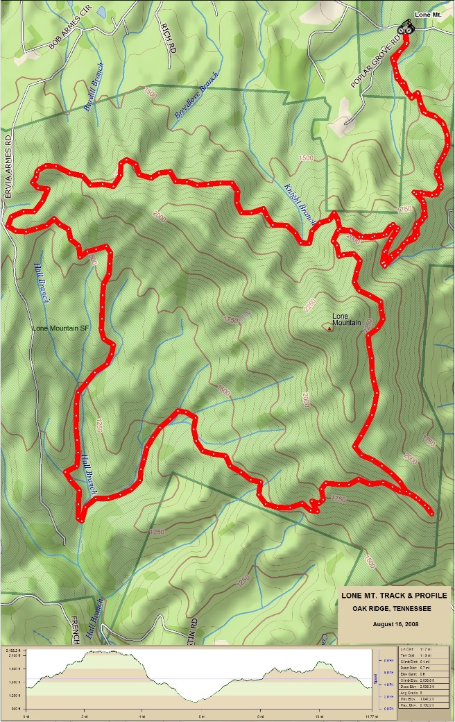
Mountain Biking In Tennessee The following is descriptions and photos of the trails Bruce has ridden in Tennessee. These trails were ridden over several (months, years) between (Year 1 and year 2). Scroll down for a complete list of rides and summaries, and use the links in the in the summaries to go to descriptions and photos for the specific trails and rides. Lone Mt.: Bruce's second-out-of state ride was at Lone Mt. Tennessee near Knoxville on August 16t, 2008. Again, he was in the area on business and had an opportunity to ride a great trail. He had his bike shipped out via FedEx. The Lone Mt. ride was 11.8 miles long with over 2,600 feet of climbing. Big South Fork: Bruce has a mountain biking trip through the lower Appalachian Mountains planed for the near future. The trip will include IMBA EPIC trails in Tennessee, North Carolina, Georgia and Alabama, starting with the The Big South Fork IMBA EPIC trail system near Oneida, Tennessee. It will also include Tanasi, Bent Cr., and Du Pont in North Carolina, Bull Mt., GA and Oak Mt., Alabama. The placeholder for Big South Fork is to collect information on the ride at that location. (Introduction to the trail and ride including any other riders or group with you.) Lone Mt. is located in eastern Tennessee, just west of Oak Ridge and Knoxville. It is shown by the green star in the map below. According to his GPS receiver, he did 14 miles of trail with a cumulative climbing distance of 1,960 feet. Lone_Mt_Location.jpg
The statistics for the (Trail Name) ride are provided below along
with a map showing the track and profile and statistics. The track
and profile is for the clockwise direction. Reverse it for a
counter-clockwise ride.
Right click on the GPX link above to download a GPX file for this ride. The GPX file may want to save as an XML file, so if it does, change the extension to gpx before you save it. The file is a high-resolution track with points are every 10' created on the Delorme PN-60W GPS. You can right-click on the image below and use the "Save Target As" option to down-load a 1MB 11x17" PDF version of the map that can be printed. You can also click on the image to open it in a new window and zoom up to 200% for a detailed view.
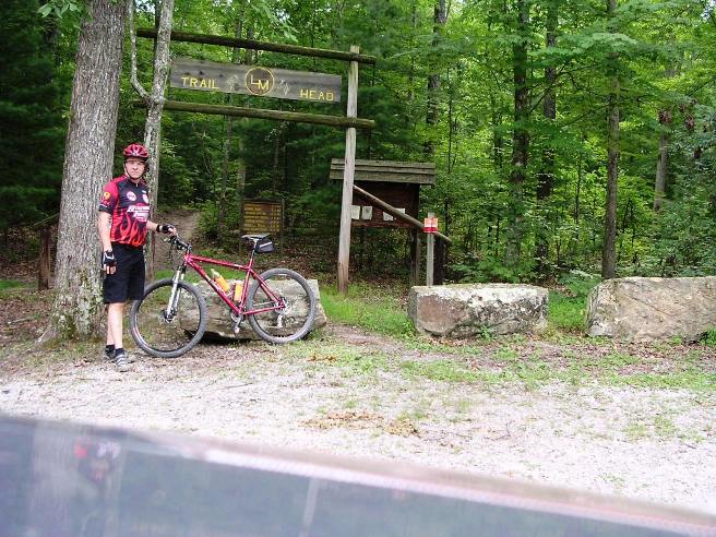
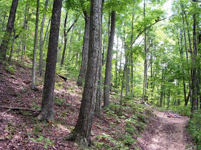
This is the kind of trail on which you will use all your gears, and spend a lot of time in 1-1. The grades are not impossibly steep, but go on for some distance, making it necessary to slow down to a sustainable climbing pace. The Lone Mt. trailhead is shown in the photo below. Note the original frame is in the bike. He broke it a month later and had to get it replaced. He also ended up replacing the disk brakes too. They really got a heavy duty workout on the way down off the trail.
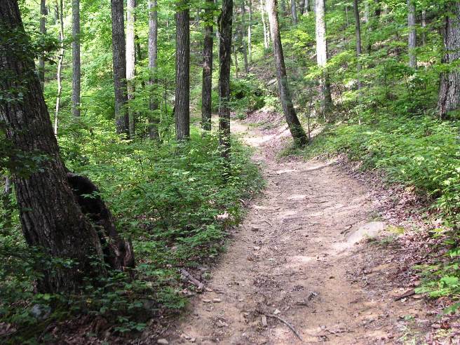
Lone Mt. is either up or down. There isn't much flat. The shot below shows one of the initial climbs. They wouldn't be so bad except the steep sections go on for 500' to 1,000' at a time. The trails are not narrow single track like the ones in Texas, but are designed to accommodate ATVs.
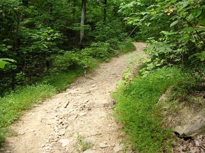
In places the trail is steep and rocky too, making it hard to get traction on the way up. They also make for some real interesting braking on the way down.
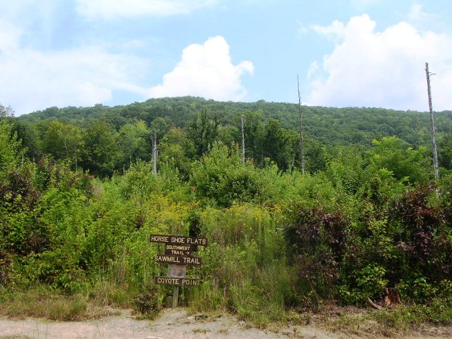
This is Horse Shoe Flats up on the mountain. As you can see, it's not too far below the peak.
The next photo shows a typical turn and climb. The grade is easily 40% and goes on for hundreds of feet. I rode it as far as I could in my "granny-gear" and then walked the rest.
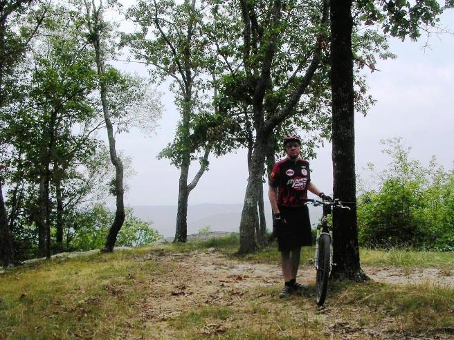
This is Bruce at the top. At this point he is 1,000' above the trailhead.
The purpose of this part is to collect information on the ride at Big South Fork. This is an IMBA EPIC and the link to the MTB site can be found here.
The statistics for the Big South Fork ride are provided below along
with a map showing the track and profile and statistics. The track
and profile is for the clockwise direction. Reverse it for a
counter-clockwise ride.
Right click on the GPX link above to download a GPX file for this ride. The GPX file may want to save as an XML file, so if it does, change the extension to gpx before you save it. The file is a high-resolution track with points are every 10' created on the Delorme PN-60W GPS. You can right-click on the image below and use the "Save Target As" option to down-load a 1MB 11x17" PDF version of the map that can be printed. You can also click on the image to open it in a new window and zoom up to 200% for a detailed view. (Insert Track-Profile map with link to tabloid-sized PDF) This is the kind of trail on which you will use all your gears, and spend a lot of time in 1-1. The grades are not impossibly steep, but go on for some distance, making it necessary to slow down to a sustainable climbing pace. The photo below shows (description). (Place-holder for photo) Description of following photo. (Place-holder for photo) Wrap up
|
|
Version 0.1, December 31, 2016 |