|
|
|
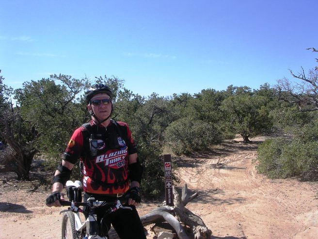
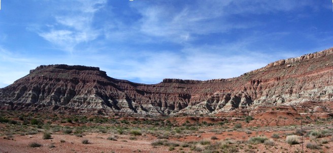
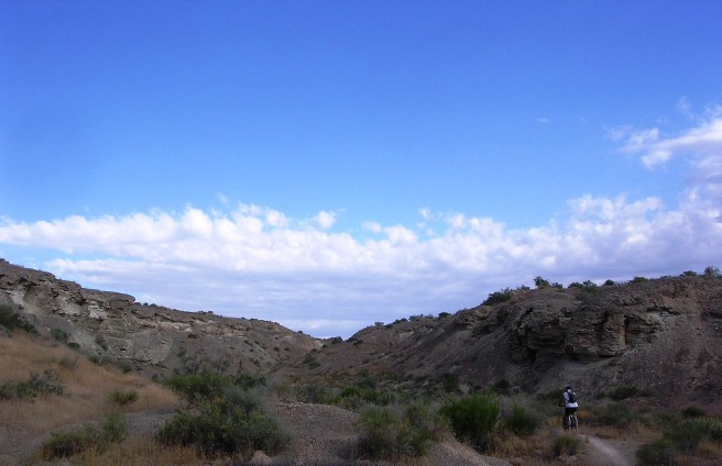
Mountain Biking In UTAH The following is descriptions and photos of the trails Bruce has ridden in Utah. These trails were ridden during 2011 while working in Las Vegas. Scroll down for a complete list of rides and summaries, and use the links in the in the summaries to go to descriptions and photos for the specific trails and rides. Brian Head, Cedar City, UT - Bunker Creek Trail: The Brian Head trails are down hill from near the peak of Brian Head mountain near Cedar City, Utah. Brian Head is a bit over 11,300 feet high. Bruce rode two of the trails at Brian Head, Bunker Creek and Blow Hard Mt., on October 1, 2011. Bunker Creek is a fast, flowy downhill run dropping 3,567' in 11.9 miles. The elevation at the end of the ride was 8,352'. This was a group ride organized by the Southern Nevada Mountain Biking Association (SNMBA). These two rides were done as a "day trip" up from Las Vegas where he was working on a radio system project. Brian Head, Cedar City, UT - Blowhard Mountain Trail: The Blow Hard Mountain ride was the second ride done on October 1, 2011 on the trip up from Las Vegas with the SNMBA. This trail is a short, fast and technical downhill run at high altitude. Some of the technical sections are difficult for all but the best riders. Several required dismounting to negotiate. Good tires and brakes are essential when riding this trail. Blow Hard Mt. drops 14' per 100' on average, double that of Bunker Creek. The total descent was 4,080' in 7.1 miles. The maximum elevation was 10,624'. The elevation at the end of the ride was 7,634'. Gooseberry Mesa, Hurricane, UT - South Rim Trail: On April 16th and 17th of 2011, while working in Nevada, Bruce joined the SNMBA for a two-day adventure on Gooseberry Mesa east of Hurricane, UT. He followed the two-day April trip up with day trip in October. The trail system is on a mesa 1,000' above the valley floor, and is just south of Zion National Park and Virgin, Utah, the home of the Red Bull Rampage. The trails cross vast expanses of slick-rock and hug the edge of the mesa in many places. Gooseberry Mesa, Hurricane, UT - Hidden Canyon Trail: While the South Rim Trail is the most spectacular, the trip back to the trail head followed the Hidden Canyon Trail. This trail winds through some very spectacular rock formations. The track, profile and statistics are included in the data for the South Rim ride. y Gooseberry Mesa, Hurricane, UT - Gander Trail: For the day-two of the April, 2011 ride, Bruce and his friends rode the Gander Trail. The Gander Trail is on the north-east side of the mesa facing towards Zion National Park, and offers more spectacular views. This trail is rather typical of "normal" mountain bike trails in that its surface composition is mostly dirt with a normal amount of rock in places. However, the views are much more spectacular than those on the South Rim since it faces towards Zion National Park. St. George, UT - Bearclaw Poppy Trail: On June 18, 2011, Bruce rode the Bear-claw Poppy trail in St. George, Utah with his friend Steve. This is a "lollypop" trail with its trail head off Navajo Dr. in a subdivision in the southwest part of St. George, UT. Hurricane, UT - Virgin Rim, Hurricane Rim, Gould's & J.E.M Trails: The Hurricane Rim Trail is single track running from the cliffs above Hurricane along the edge of the Virgin River Gorge. Gould's Rim Trail is single track running along Gould's Wash. It links to top of J.E.M. trail for option of long loop using Hurricane Rim Trail. It involves light climbing, and some narrow twisting undulating single track makes this upper-intermediate tech. It links to lower end of J.E.M. trail. Moderate climbing and rough rock makes this upper-intermediate technical trail. It climbs to the northern edge of Gooseberry Mesa near the town of Virgin, then descends to the Virgin River on single track. The Hurricane, Virgin, Gould's and J.E.M. trail system has only a few technical spots. For the most part it is open, flowy single track. Brian Head, Cedar City, UT - Bunker Creek Trail
In October of 2011, while working in Nevada, Bruce joined a group of
local riders from the Southern Nevada Mountain Biking Association (SNMBA)
for a one-day adventure to Brian Head Mt., UT. They spent the day
riding the Bunker Creek Trail, and then went onto the Blow Hard Mt.
Trail. This section describes the Bunker Creek ride, and the
following section the Blowhard Mt. ride.
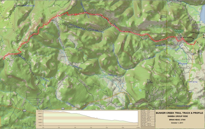
Right click on the GPX link above to download a GPX file for this ride. The GPX file may want to save as an XML file, so if it does, change the extension to GPX before you save it. The file is a high-resolution track with points are every 10' created on the Delorme PN-60W GPS. You can right-click on the image below and use the "Save Target As" option to down-load a 1MB 11x17" PDF version of the map that can be printed. You can also click on the image to open it in a new window and zoom up to 200% for a detailed view.
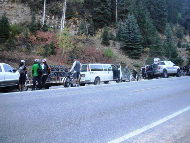
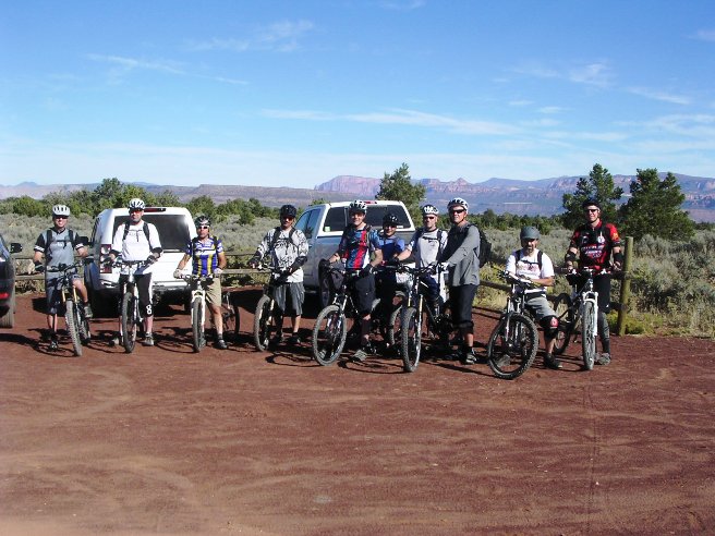
This trail is a long, fast and flowing downhill run at high altitude. Technical sections are few, and not too difficult to negotiate, but good tires and brakes are essential. The group convoyed up from Vegas and met the shuttles in a parking area at the end of the Blow Hard Mt. Trail. There were 28 riders and they filled up both shuttle vans.
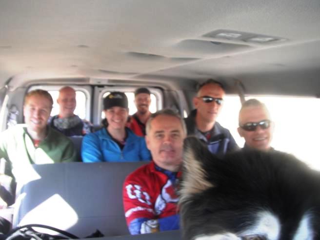
Lots of smiling faces in the first shuttle getting ready for the trip up to the top of Brian Head and the ride down the Bunker Creek Trail.
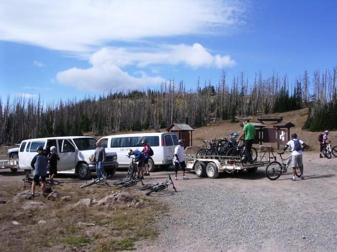
The unloading operation took place in a parking lot up at the trailhead and near the summit of Brian Head Peak. The altitude at this point was exactly 11,000'.
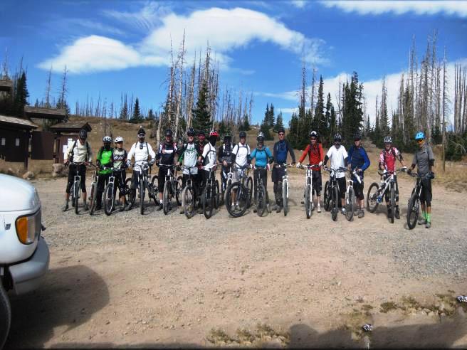
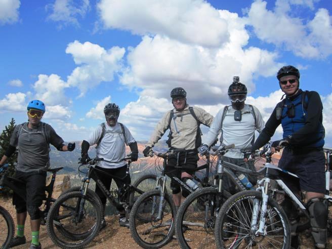
The customary group photo of most of riders at the beginning of the ride.
From the parking lot, it is a short ride climbing 60' vertically to the top. Climbing at 11,000' was more difficult than anticipated. As you can see in the distance, the fall colors were beginning at this altitude. Below is Christian at our first stop.
Another rest stop up top near the junction of the Dark Hollow Trail with a photo below of Bruce with crazy Carlos.
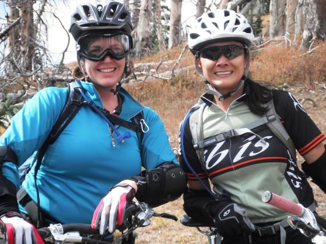
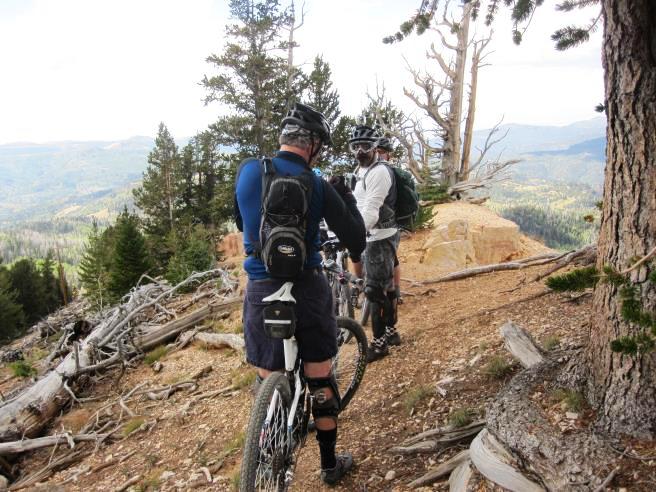
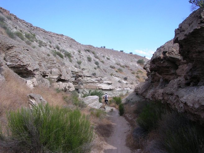
They even had a couple of ladies along for the ride. Here is Chere and Sherry. Bunker Creek is an "intermediate" level trail, and is suitable for anyone with good XC skills.
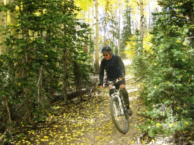
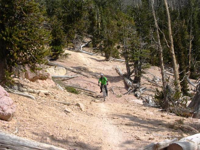
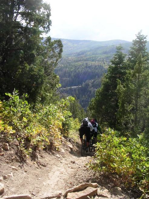
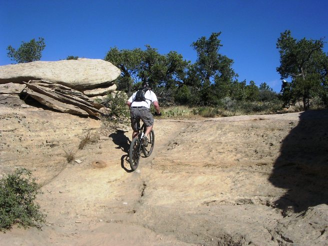
Below is a photo of Bruce coming through a group of pines on a smooth section of trail. About one-third of the trail is a smooth ride in the woods.
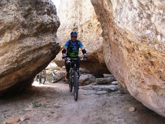
Not all of the trail was so friendly. Below is a photo of Bruce coming through a rougher section of trail. This is pretty typical of the rougher sections, although were several rougher sections along the way.
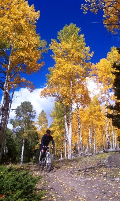
Below is a photo of Bruce coming through a grove of Aspens near the end of the trail.
The Aspen Grove made for a nice spot to stop and regroup.
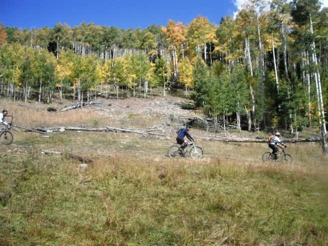
After regrouping, we made the final run through some open meadows to the end of the trail. The Bunker Creek Trail was nearly all down-hill and fast.
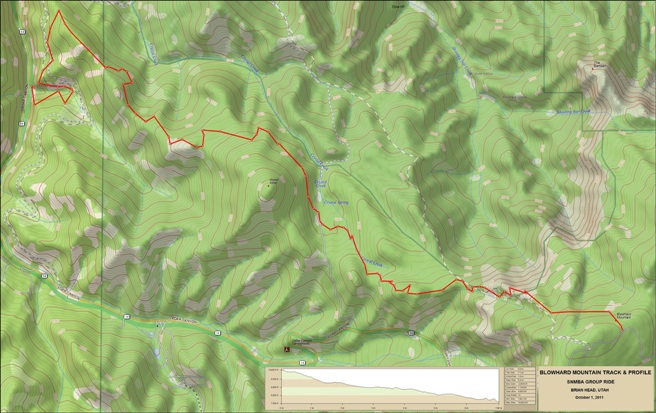
Bunker Creek drops 7' per 100' on average. Total descent was 3,567' in 11.9 miles. Maximum elevation was 11,060'. The elevation at the end of the ride was 8,352'. Even though Bunker Creek was not too difficult, being nearly all downhill made it was a blast. Now it was on to Blow Hard Mt. which was going to raise the difficulty bar considerably. Brian Head, Cedar City, UT - Blow Hard Mountain Trail: The Blow Hard Mountain ride was the second ride done on October 1, 2011 on the trip up from Las Vegas with the SNMBA. This trail is a short, fast and technical downhill run at high altitude. Some of the technical sections are difficult for all but the best riders. Several required dismounting to negotiate. Good tires and brakes are essential when riding this trail. Blow Hard Mt. drops 14' per 100' on average, double that of Bunker Creek.
The statistics for the Blow Hard Mountain Trail ride are provided
below along with a map showing the track and profile and statistics.
This trail is a short, fast and technical downhill run at high
altitude.
Right click on the GPX link above to download a GPX file for this ride. The GPX file may want to save as an XML file, so if it does, change the extension to GPX before you save it. The file is a high-resolution track with points are every 10' created on the Delorme PN-60W GPS. You can right-click on the image below and use the "Save Target As" option to down-load a 1MB 11x17" PDF version of the map that can be printed. You can also click on the image to open it in a new window and zoom up to 200% for a detailed view.
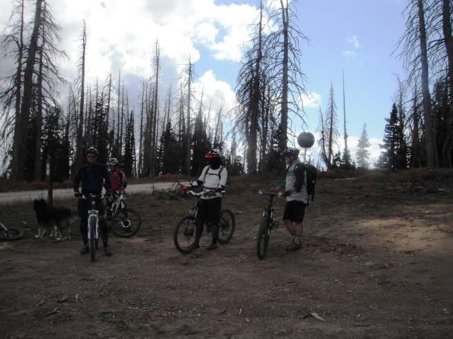
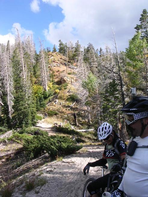
This trail is a short, fast and technical downhill run at high altitude. The technical sections are difficult for all but the best riders. Several required dismounting to negotiate. Good tires and brakes are essential when riding this trail. The Bunker Creek Trail ended at Panguitch Lake where we met the shuttle. After loading up the bikes and riders, it was on to Blow Hard Mt. to ride that trail. Here they are at the Blow Hard Mt. trail head.
The riders at a regrouping stop on Blow Hard.
Below is another regrouping stop just before a steep, treacherous descent down the side of the mountain.
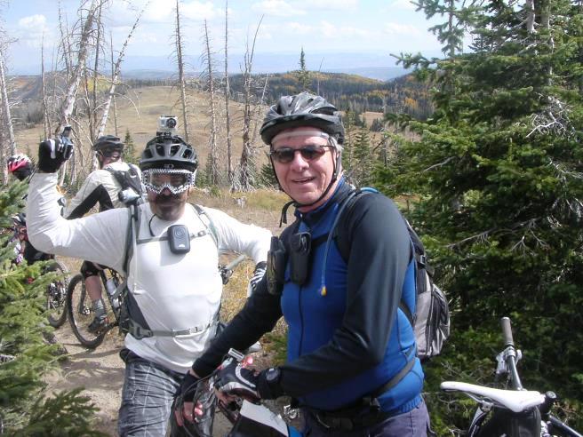
Another shot at the regrouping stop with Bruce and Carlos.
Below is a group photo at the regrouping stop.
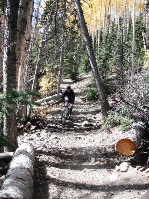
Below is a shot of the start of the first descent.
Looking back part way down the first descent.
Below is a shot of Ed near the bottom of the first descent. This section of the trail was very loose and hard to maintain control on. Constant braking on loose gravel made for an "interesting" descent.
The shot below shows the first descent from a distance. The run down included several switch-backs. You can see how loose the conditions were from the soil in the photo below.
Not all of Blow Hard was a steep down-hill run. The photo below shows a more "sedate" section of the trail.
After a section of fairly level riding, it was time for the final descent to the valley floor. Below is a shot of two of the riders on the initial phase of the two-stage descent.
After the initial descent, there is a picturesque ride along a rim above the valley leading to the end of the trail. The trail does a "u-turn" behind the camera position and drops into the valley on the left of the photo. This is another good example of the descents on this trail.
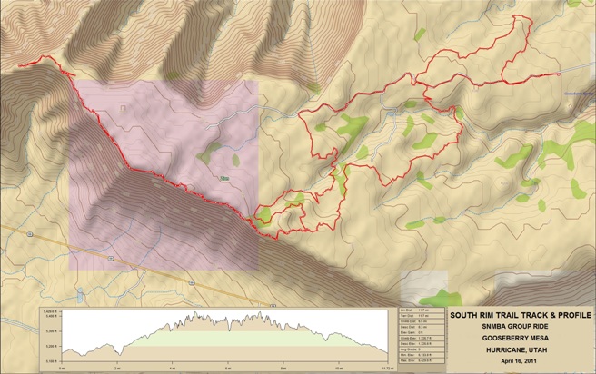
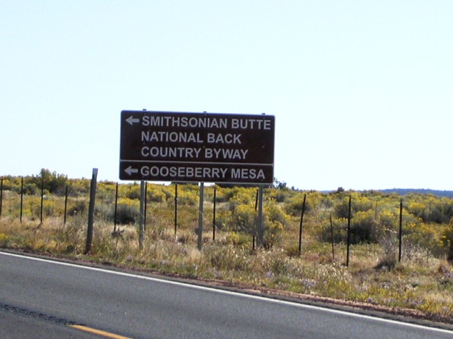
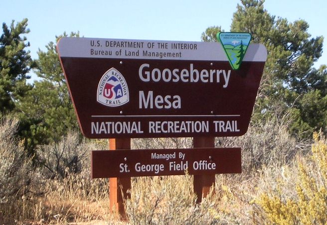
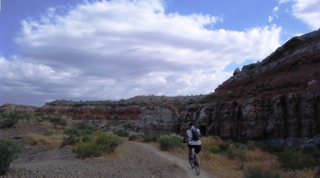
Blow Hard Mt. drops 14' per 100' on average, double that of Bunker Creek. Total descent was 4,080' in 7.1 miles. Maximum elevation was 10,624'. The elevation at the end of the ride was 7,634'. Gooseberry Mesa, Hurricane, UT - South Rim Trail On April 16th and 17th of 2011, while Bruce was working in Nevada, he joined the SNMBA for a two-day adventure on Gooseberry Mesa just outside Hurricane, UT. The trail system is built on a mesa about 1,000' above the valley floor. It is just south of Zion National Park and Virgin, Utah where they hold the Red Bull Rampage each year. He spent two days riding on the mesa and felt it was the greatest two days of mountain biking up to this point in his life. He followed the two-day April trip up with day trip in October.
The statistics for the South Rim Trail are provided below along with
a map showing the track and profile and statistics. The track and
profile is for the clockwise direction. Reverse it for a
counter-clockwise ride.
Right click on the GPX link above to download a GPX file for this ride. The GPX file may want to save as an XML file, so if it does, change the extension to GPX before you save it. The file is a high-resolution track with points are every 10' created on the Delorme PN-60W GPS. You can right-click on the image below and use the "Save Target As" option to down-load a 1MB 11x17" PDF version of the map that can be printed. You can also click on the image to open it in a new window and zoom up to 200% for a detailed view.
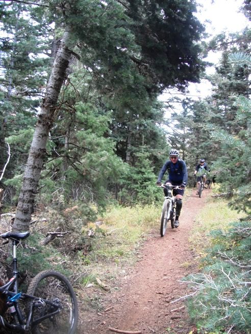
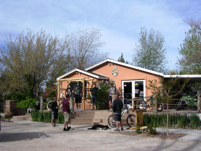
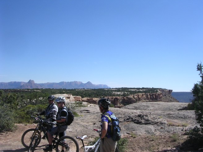
This is the kind of trail on which you will use all your gears, but you will spend most of your time in the middle gears. Most of the grades are not too steep, but there are some climbs that seem like they are nearly straight up. Bruce drove up from Vegas with some other folks from Vegas on day 1 of the trip. The photo below shows the early arrivers from SNMBA at Over The Edge Sports in Hurricane. Ultimately, 24 riders participated in the ride, breaking up into three groups.
From the bike shop in Hurricane, the cut-off to the mesa is about 14 miles east out Utah State Road 59. The first thing you come to is the Apple Valley General store at about 12 miles, then two miles further east the sign for the access road to the mesa. Total driving time from Las Vegas to the parking lot on the Mesa is about 2 1/2 hours.
Travel 3-4 miles out the dirt road off SR-9 and turn left on the dirt road marked by the Gooseberry Mesa sign. About 2 miles up that dirt road, you will see a sign saying you are in entering the park.
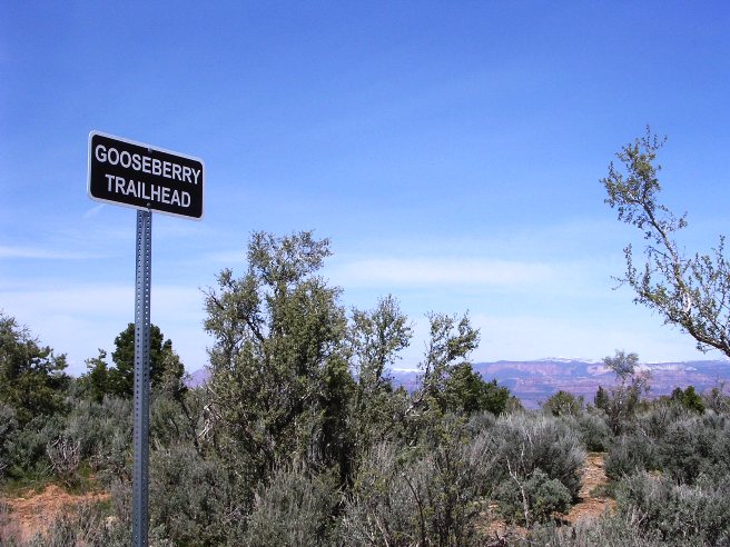
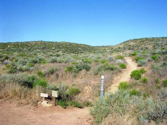
Continue along the access road until you come to the trail head sign shown below. Bear to the left and proceed to the White trailhead.
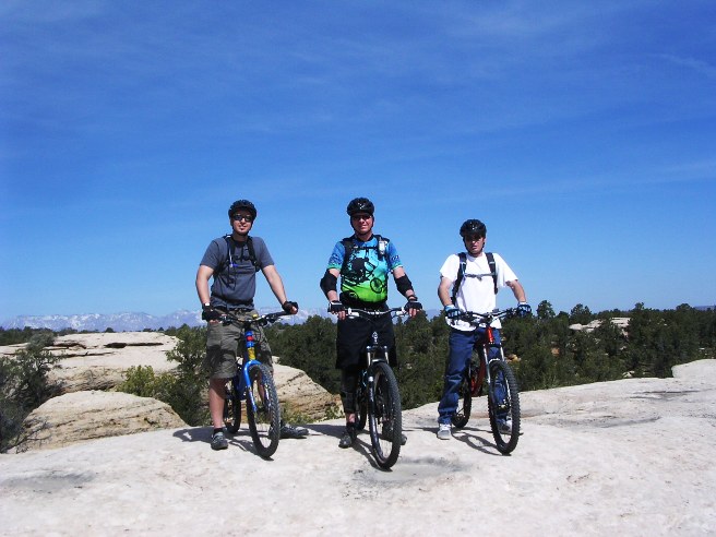
The photo below shows Jeff, Bruce and Jason at the slick rock practice section. The practice section was very useful in preparing them to ride the "real" stuff, and Bruce highly recommends it for first-timers. The practice area gives you a good feel for handling the unique features of the terrain without being too challenging.
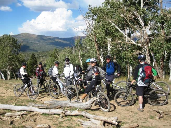
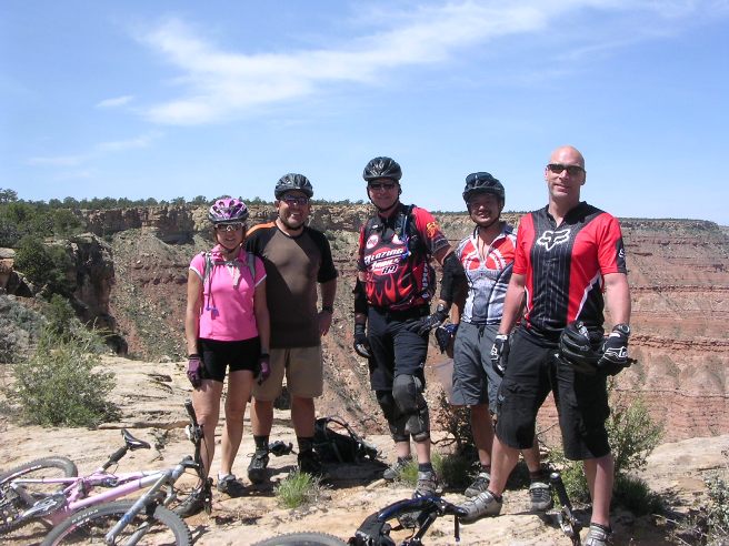
The riders in SNMBA like "Goose" as they say, and organized a day trip on October 15, 2011. The ride started out following the same route as the April 15th ride, but instead of returning via Hidden Canyon, took the White and North Rim trails. Below is a group photo of the SNMBA riders at the start. Bruce is on the right.
Below is a photo of Bruce from the October 15th ride at the beginning of the South Rim Trail in the parking lot.
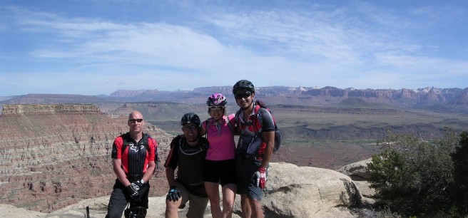
On the way out to the South Rim, they passed "Wedding Rocks". It is called Wedding Rocks because a local couple recently got married at this location. Their reasoning was that if your wedding starts out on the rocks, it can't get any worse. The rider on the left is Ed, our leader. Jason is in the middle and Debbie is on the right.
The following photo shows one of many climbs along the trail out to trail head for the South Rim. This was one of the easiest.
Below is a photo from the October 15th ride of Christian on one of the many slick rock climbs on the Mesa.
The following photo from the October 15 ride shows of the riders negotiating the trail through the slick rock on the way out to the South Rim.
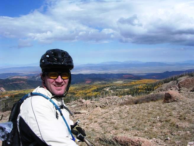
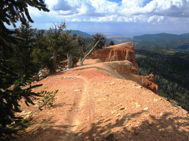
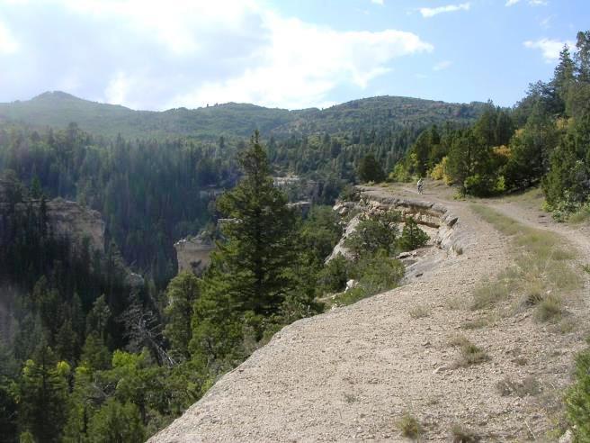
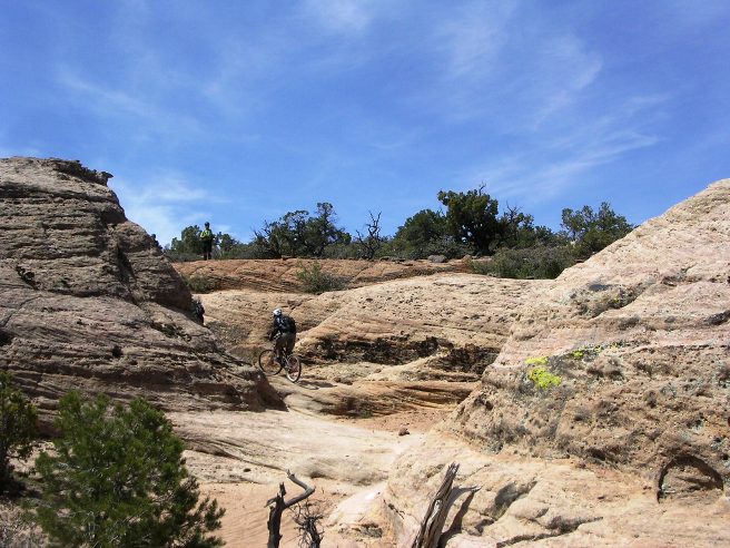
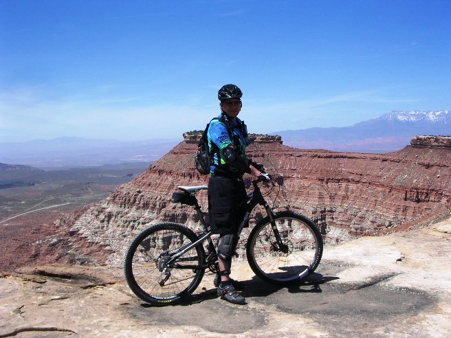
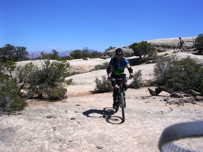
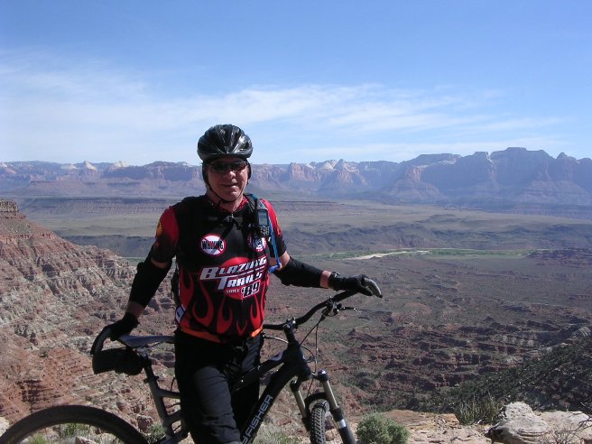
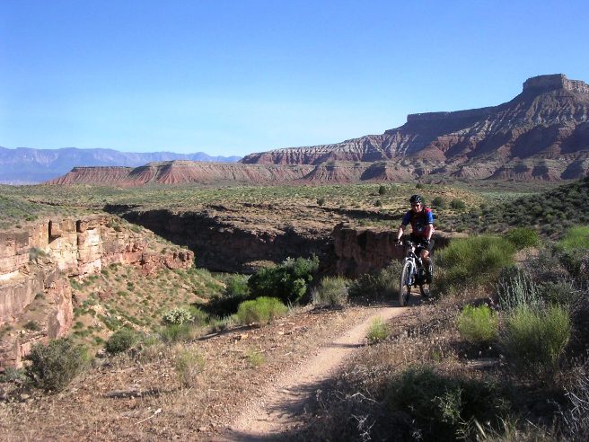
Next is Bruce on the South Rim Trail. From here, the trail follows the edge of the Mesa to the "Point". The GPS track on the topographic map shows how the trail hugs the edge of the mesa and is about 1,200' high.
Bruce, Jeff and Jason below on the South Rim Trail at the edge of the mesa.
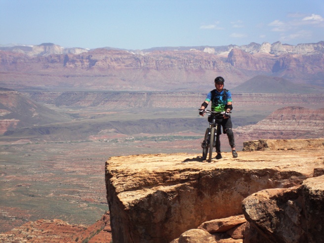
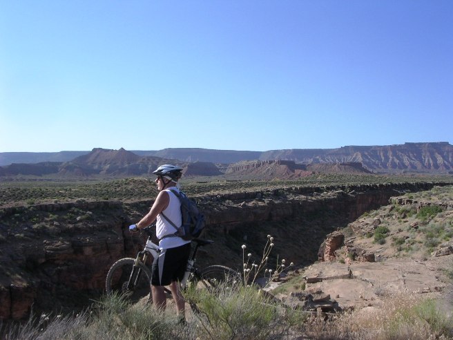
Below is a photo of Bruce nearly out the the "Point". This is the point of rock ledge on the right-hand side of the photo. That is as far as you can ride, or even walk for that matter.
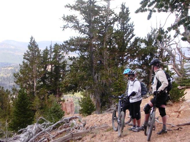
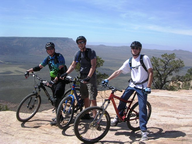
Here are some of the guys from the October 15th ride on the South Rim Trail out near The Point. The photo gives a good perspective of the rim and the trail along it.
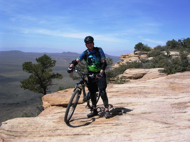
The photo below shows Bruce on the north side of the "Point". Zion National Park is in the mountains in the background.
The photo below gives a ground-level view of the "Point", the high spot near the center of the photo. The trail follows the edge of the mesa from the right-hand side of the photo to the "Point". This ride offers some spectacular views as well as some "white-knuckled" trail sections within a few feet of the edge of the mesa.
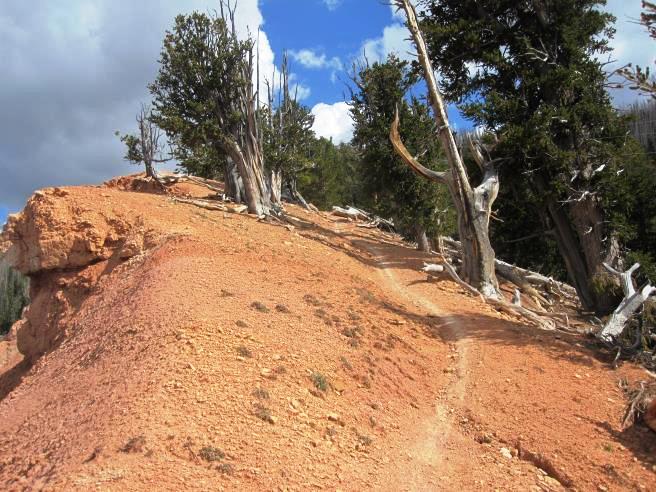
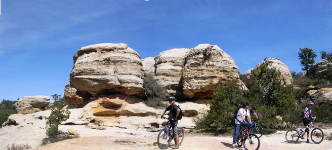
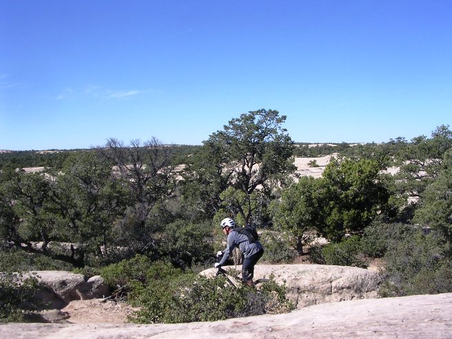
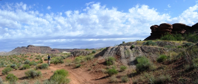
Gooseberry Mesa is a very interesting place. On several occasions, Bruce suggested a trip to Moab, but the SNMBA group said they would rather do Gooseberry since it was only half the distance and had everything Moab had, but in less than half the space. Gooseberry Mesa, Hurricane, UT - Hidden Canyon Trail While the South Rim Trail is the most spectacular, the trip back to the trail head followed the Hidden Canyon Trail. This trail winds through some very spectacular rock formations. The track, profile and statistics are included in the data for the South Rim ride. This is the kind of trail on which you will use all your gears, and spend a lot of time in 1-1. Many of the climbs are short and steep. Below is a photo is Bruce coming through some rocks on the Hidden Canyon Trail.
The photo below shows Bruce on a bit more slick-rock with Debbie in the distance.
While there is a lot of slick rock up on the mesa, everything up there is slick-rock. The photo below shows Bruce on a "normal" trail section towards the interior of the mesa.
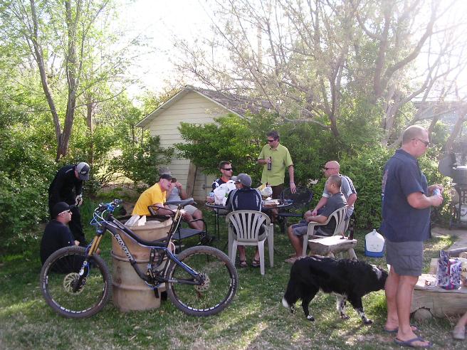
After the ride, Quinton of Over The Edge Sports treated the SNMBA riders to snacks and brats. OTE was a great host and served as convenient base of operations.
The first day was a blast, even if it was very difficult, and they still had day two ahead of them. Gooseberry Mesa, Hurricane, UT - Gander Trail For the day-two of the April ride, Bruce and his friends rode the Gander Trail. The Gander Trail is on the north-east side of the mesa facing towards Zion National Park, and offers more spectacular views. This trail is rather typical of "normal" mountain bike trails in that its surface composition is mostly dirt with a normal amount of rock in places. However, the views are much more spectacular than those on the South Rim since it faces towards Zion National Park.
The statistics for the Gander Trail ride are provided below along
with a map showing the track and profile and statistics. The track
and profile is for the clockwise direction.
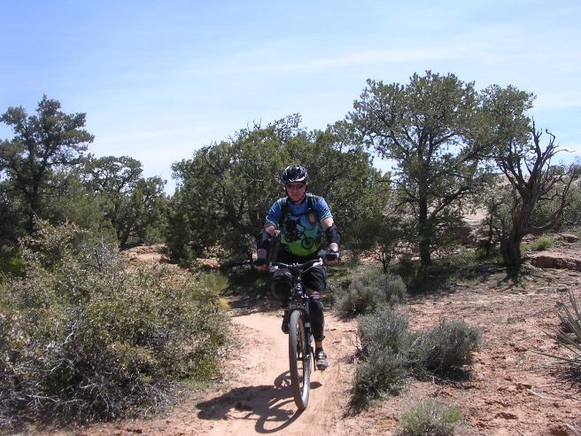
Right click on the GPX link above to download a GPX file for this ride. The GPX file may want to save as an XML file, so if it does, change the extension to GPX before you save it. The file is a high-resolution track with points are every 10' created on the Delorme PN-60W GPS. You can right-click on the image below and use the "Save Target As" option to down-load a 1MB 11x17" PDF version of the map that can be printed. You can also click on the image to open it in a new window and zoom up to 200% for a detailed view. (Insert Track-Profile map with link to tabloid-sized PDF) This is the kind of trail on which you will use all your gears, and spend a lot of time in 1-1. The grades are not impossibly steep, but go on for some distance, making it necessary to slow down to a sustainable climbing pace. Below is a photo of Bruce near the beginning of the Gander Trail.
Below is Rich, Monty, Bonnie and Tae, part of the group riding Gander.
Another photo of the group with Bonnie, Monty, Bruce, Alexandra and Rich.
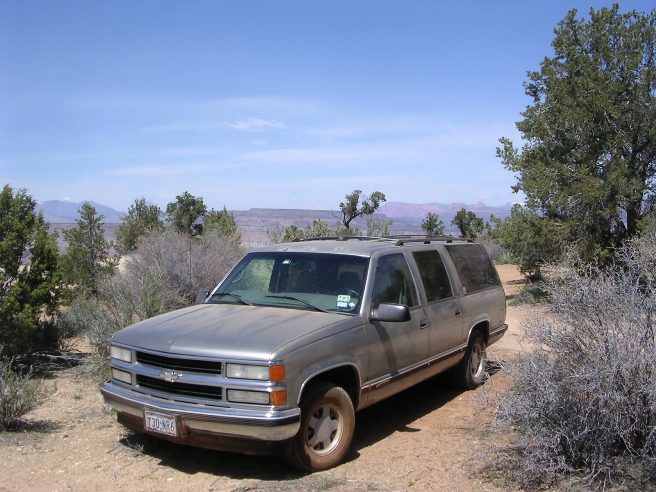
It can get windy and dusty up on the mesa. By the end of the second day of riding, everything needed a good cleaning, including Bruce's truck.
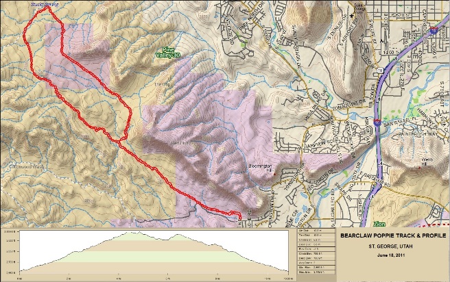
While working in Vegas, Bruce several times suggested going on up to Moab. The folks from SNMBA were not very interested, saying Gooseberry had about everything Moab had, but in a much smaller foot-print. That, and Gooseberry could be done as a day trip from Vegas. St. George, UT - Bear-claw Poppy Trail On June 18, 2011, Bruce rode the Bear-claw Poppy trail in St. George, Utah with his friend Steve. This is a "lollypop" trail with its trail head off Navajo Dr. in a subdivision in the southwest part of St. George, UT.
The statistics for the Bear-claw Poppy Trail ride are provided below along
with a map showing the track and profile and statistics. The track
and profile is for the counter-clockwise direction around the
lollipop.
Right click on the GPX link above to download a GPX file for this ride. The GPX file may want to save as an XML file, so if it does, change the extension to GPX before you save it. The file is a high-resolution track with points are every 10' created on the Delorme PN-60W GPS. You can right-click on the image below and use the "Save Target As" option to down-load a 1MB 11x17" PDF version of the map that can be printed. You can also click on the image to open it in a new window and zoom up to 200% for a detailed view.
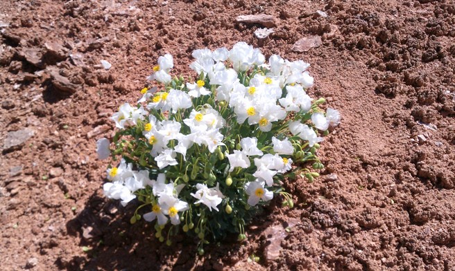
This is the kind of trail on which you will use most your gears and spend most of your time in your middle ring. The grades are not steep, but go on for some distance, making it necessary to slow down to a sustainable climbing pace. The run down the northeast side of the loop is fast and fun, and you will be using your big ring a lot. This trail is at the southwest corner of town and is named for the rare and endangered Bear-claw Poppies that grow there. The flower is endemic to Washington County, Utah, and is an endangered species. It is limited to barren, heavily gypsiferous soils in the immediate vicinity of St. George. Only a half-dozen populations are known to exist, several of which are adjacent to or even within the urbanized area. The photo below was taken by Steve in April of 2013.
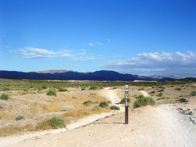
The photo below shows the trailhead for the Bear-claw Poppy trail.
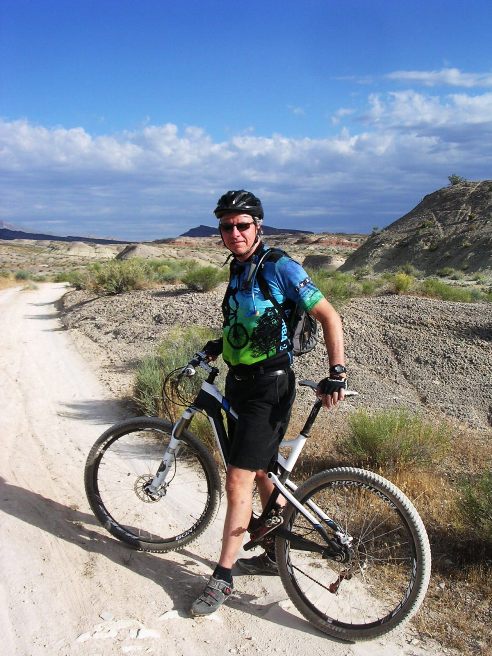
Bruce is shown on the trail a little further out.
Eventually, the trail gets up into the hills and follows some canyons up to the higher ground. Below is Steve headed up one of the canyons.
Below is a photo of Steve further up the canyon in a narrow section.
Towards the top of the loop, the canyon widens out giving more spectacular scenery.
The trail climbs nearly 600', then it is all downhill. Below is Bruce coming down the trail through some beautiful scenery on the return leg.
Next, is a photo of Bruce with a permanent smile etched into his face.
The photo below is Bruce continuing on bombing down the trail leaving a cloud of dust.
The photo below shows Steve heading down to a series of steep drops.
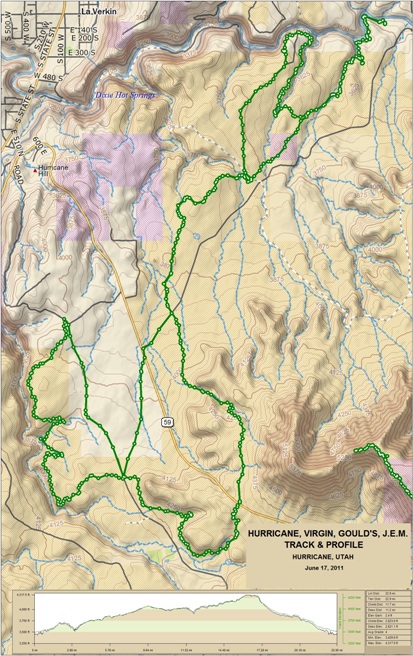
Bear-claw Poppy is about as much fun as you can have on a non-technical trail. There is one section called the Roller Coaster with some 50'-70' rollers you can take with awesome speed. Hurricane, UT - Virgin Rim, Hurricane Rim, Gould's & J.E.M Trails The Hurricane Rim Trail is single track running from the cliffs above Hurricane along the edge of the Virgin River Gorge. Gould's Rim Trail is single track running along Gould's Wash. It links to top of J.E.M. trail for option of long loop using Hurricane Rim Trail. It involves light climbing, and some narrow twisting undulating single track makes this upper-intermediate tech. It links to lower end of J.E.M. trail. Moderate climbing and rough rock makes this upper-intermediate technical trail. It climbs to the northern edge of Gooseberry Mesa near the town of Virgin, then descends to the Virgin River on single track. The Hurricane, Virgin, Gould's and J.E.M. trail system has only a few technical spots. For the most part it is open, flowy single track.
The Virgin, Hurricane, Gould's, J.E.M. Trail system ride statistics
are provided below along with a map showing the track and profile
and statistics. The track and profile is for the counter-clockwise
direction.
Right click on the GPX link above to download a GPX file for this ride. The GPX file may want to save as an XML file, so if it does, change the extension to GPX before you save it. The file is a high-resolution track with points are every 10' created on the Delorme PN-60W GPS. You can right-click on the image below and use the "Save Target As" option to down-load a 1MB 11x17" PDF version of the map that can be printed. You can also click on the image to open it in a new window and zoom up to 200% for a detailed view.
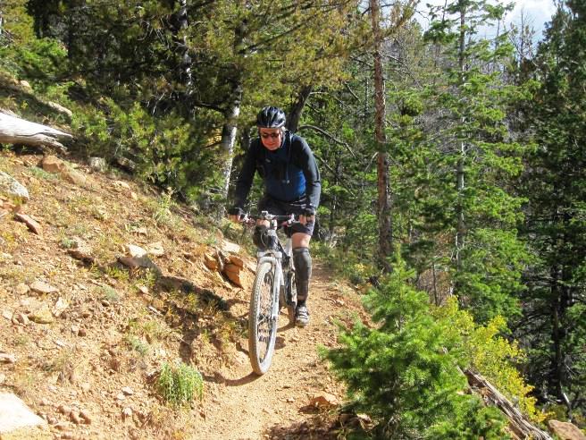
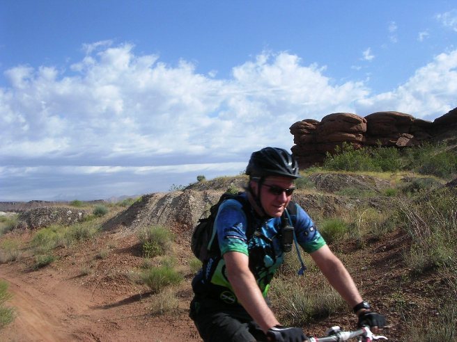
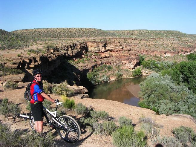
This is the kind of trail on which you will use all your gears, and spend a lot of time in 1-1. The grades are not impossibly steep, but go on for some distance, making it necessary to slow down to a sustainable climbing pace. The photo below shows Bruce at a stop along the Virgin River on the Virgin Rim Trail outside Hurricane.
Below is a photo of Bruce coming up the Virgin Rim Trail along the river.
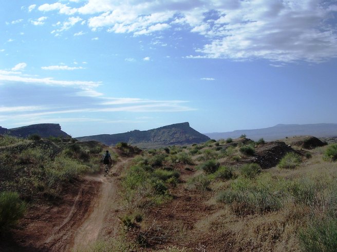
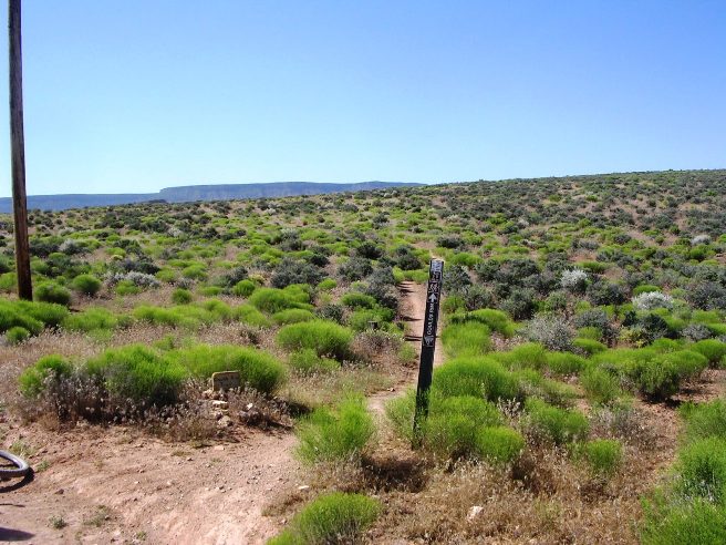
Below is a photo of the entrance to the Hurricane Rim Trail.
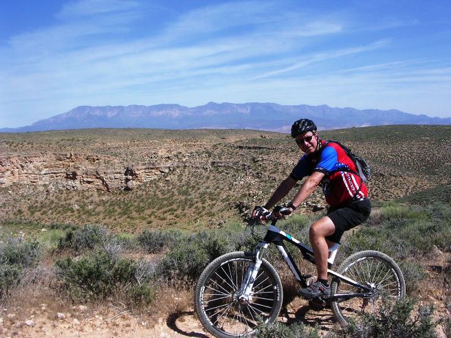
Below is a photo of Steve at a rest stop along the Hurricane Rim Trail. Gooseberry Mesa is in the distance.
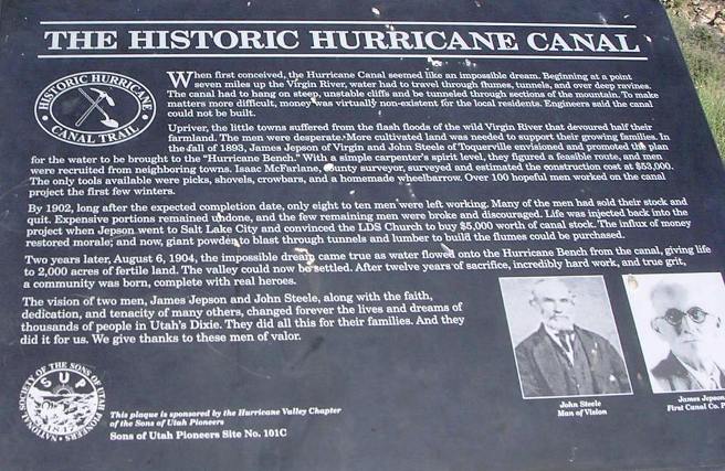
A photo of plaque describing the historic Hurricane Canal
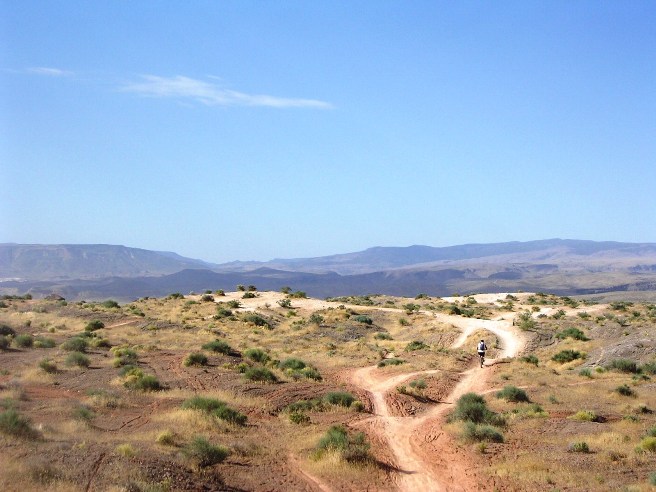
Below is the entrance to the Gould's Rim Trail.
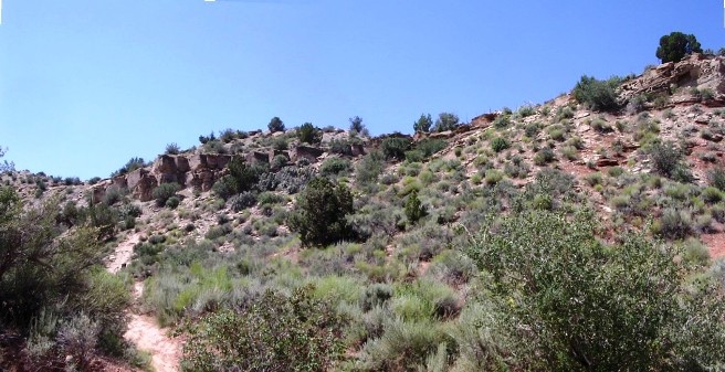
Steve on a long descent on the Gould Trail.
Bruce stopping for a photo op along the Gould Rim Trail.
Bruce getting ready for a steep descent on the J.E.M. Trail.
Below is a steep, rocky descent on the J.E.M. trail. It's a whole lot worse in person than it looks in the photo.
The Virgin, Hurricane, Gould's and J.E.M trails are great fun. They are not too technical, but the scenery is great!
|
|
Version 0.1, October 27, 2015 |