|
|
|
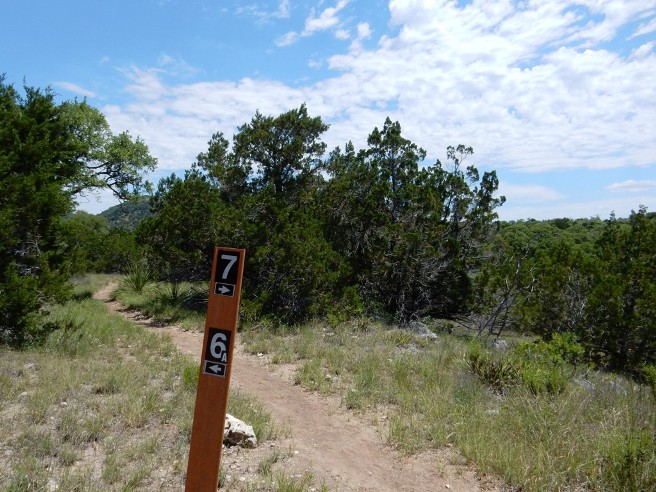
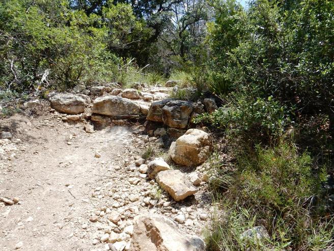
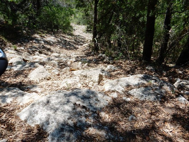
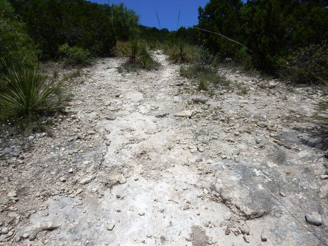
Mountain Biking In TEXAS Texas is Bruce's home and one incredible place to ride. Below are descriptions and photos of the D/FW trails he rides on a regular basis as well as the trails outside the D/FW area he has ridden. D/FW, Big Cedar Wilderness Trails: Big Cedar Wilderness Trails, BCWT or BC for short, is a local Dallas trail system on the south side of the Metroplex at Cedar Hill Bruce occasionally rides. (Page incomplete) D/FW, Boulder Park: Boulder Park is a local Dallas area trail system on the south side of the Metroplex near the Executive Airport. It's not one of his favorites, but Bruce does ride it several times a year. (Page incomplete) D/FW, Dinosaur Valley SP: Dinosaur Valley State Park is southwest of Ft. Worth near Glen Rose and has a nice trail system with quite a few technical features. Bruce rode this system for the first time on September 7, 2015. D/FW, Johnson Branch SP: Johnson Branch State Park is north of the Metroplex near Denton and has a nice trail system with quite a few technical features. Bruce last rode Johnson Branch on May 18, 2008. (incomplete) D/FW, Oak Cliff: Oak Cliff is a local Dallas area trail located on the south side of the Metroplex in the City of Dallas. Bruce rides this trail several times a year. (Page incomplete) D/FW, Rowlett Creek Preserve: Rowlett Creek Preserve or RCP is a local Dallas area trail located on the east side of the Metroplex in the City of Garland. Bruce lives nearby and rides this trail several times a week. East Texas, Tyler SP: March, 2018. Austin, Walnut Creek: On April 21, 2013, Bruce rode the Walnut Creek trail system on the north side of Austin. This ride was done in conjunction with a business trip to San Antonio. (Page incomplete) High Plateau, Palo Duro Canyon SP: Palo Duro Canyon State Park out near Amarillo is known as the "Grand Canyon of Texas" and has a very nice trail system. Bruce rode Palo Duro on May 10, 2008 Hill Country, Flat Rock Ranch - West Loop: On April 20, 2013, Bruce rode the trails at Flat Rock Ranch down near Comfort. The trials are cut into the limestone of central Texas and were the first "Hill Country" trails Bruce rode. This ride was done in conjunction with a business trip to San Antonio. Hill Country, Flat Rock Ranch - TMBRA Race: The weekend of March 14-15, 2020, Bruce raced in the 21st Annual Hill Country MTB Challenge sponsored by the South Texas Off Road Mountain-Biking Association (STORM). He competed in the Master's Men Open 70+ category. Hill Country, Lake Georgetown - Goodwater Loop: On October 4, 2019, Bruce rode the IMBA EPIC Goodwater Loop around Lake Georgetown. This is a 27 mile intermediate to expert level loop, with at least half of it being in the expert category. Hill Country, Pedernales Falls SP - Trammel Crossing Trail: Pedernales Falls SP in the Texas Hill country in one of the premier state parks in Texas. It has several nice trails. Bruce rode the Trammel Crossing Trail on August 8, 2015 and again on June 21, 2019. Hill Country, Pedernales Falls SP - Wolf Mt. & Juniper Ridge Trails: Pedernales Falls SP in the Texas Hill country in one of the premier state parks in Texas. It has several nice trails. Bruce rode the Madrone, Juniper Ridge and Wolf Mt. Trails on June 4, 2016 and again on June 22, 2019. Hill Country, Pedernales Falls SP - Wolf Mt. Trail: Pedernales Falls SP in the Texas Hill country in one of the premier state parks in Texas. It has several nice trails. Bruce rode the Madrone, Juniper Ridge and Wolf Mt. Trails on June 10, 2016 and again on June 22, 2019. Hill Country, Pedernales Falls SP - Madrone & Wolf Mt. Trails: Pedernales Falls SP in the Texas Hill country in one of the premier state parks in Texas. It has several nice trails. Bruce rode the Madrone and Wolf Mt. Trails on June 11, 2016 and again on June 22, 2019. Hill Country, Reveille Peak Ranch: Reveille Peak Ranch is west of Burnet. This is a ranch that has been developed into a sports facility for XTERRA, running and mountain biking events. Bruce rode Reveille on April 21, 2013. Hill Country, Rocky Hill Ranch - TMBRA Race:
Hill Country, Hill Country State Natural Area: Bruce rode the Hill Country SNA is west of San Antonio and south of Bandera on May 7, 2016 while working in Houston. This land was originally the 5,370 acre Bar-O ranch. There are approximately 40 miles of trails, with a 50/50 mix of single and double track. Most of the double track is ATV trail, although motorized vehicles are not permitted on the trails. San Antonio, TX - North Salado Creek Trail: Bruce was in San Antonio on a business trip and rode the Salado Creek Trail after wrapping up business Friday afternoon, April 19, 2013. South Texas, Columbus, Hanna-Stillman Ranch: Bruce met another rider, Russ Hanna, while working in the Houston area. Russ is an avid mountain biker and Cat-1 racer, so it was only natural he build a trail on the family ranch. Russ invited the Houston Dirty SOBs (Seniors on Bikes) to ride the private trail on the Hanna - Stillman Ranch on July 17, 2017. Russ himself is an older rider, having recently retired from work and mountain bike racing. South Texas, Galveston, Jack Brooks: Bruce rode the Jack Brooks Trails throughout 2017 and 2018 while working in the Houston area. This trail system is built in the low, flat terrain of South Texas a few miles north of the Gulf of Mexico. There are approximately 6.6 miles of the rootyist trails and steepest climbs Bruce ever encountered. The trail system gets it features from the dredging done there years ago to drain the land. There are numerous "spoil" piles from the dredging that have become overgrown with trees, and this is what gives the trail "ups and downs". South Texas, Houston, Anthills:
South Texas, Houston, Cypress Creek: Bruce rode the Cypress Creek Trail on following dates while working at NASA in the Houston area. March 5, July 24, September 25, November 5 in 2016, and January 7, 2018. Since the was one of the most popular local trails in the Houston area, there were numerous rides in 2017, but these were not documented. There are approximately 9.2 miles of trails, mostly single track. The trail is mostly flat through the woods, although there are several deep and wide creek crossings that are challenging and thrilling. South Texas, Houston, Cypress Wood: 20
South Texas, Houston, Sugarland, Brazos: 21
South Texas, Houston, Sugarland, New Territory: 22
South Texas, Houston, Sugarland, Oyster Creek: 23
South Texas, Huntsville, Double Lake: 24
South Texas, Huntsville State Park: 25
West Texas, Buck Cr., Abilene - TMBRA Race: 26
Scroll on down or use the links above to go to the descriptions and photos for these trails and rides. D/FW, Big Cedar Wilderness Trails Introduction to the trail and ride including any other riders or group with you.
The statistics for the (Trail Name) ride are provided below along
with a map showing the track and profile and statistics. The track
and profile is for the clockwise direction. Reverse it for a
counter-clockwise ride.
Right click on the GPX link above to download a GPX file for this ride. The GPX file may want to save as an XML file, so if it does, change the extension to gpx before you save it. The file is a high-resolution track with points are every 10' created on the Delorme PN-60W GPS. You can right-click on the image below and use the "Save Target As" option to down-load a 1MB 11x17" PDF version of the map that can be printed. You can also click on the image to open it in a new window and zoom up to 200% for a detailed view. (Insert Track-Profile map with link to tabloid-sized PDF) This is the kind of trail on which you will use all your gears, and spend a lot of time in 1-1. The grades are not impossibly steep, but go on for some distance, making it necessary to slow down to a sustainable climbing pace. The photo below shows (description). (Place-holder for photo) Description of following photo. (Place-holder for photo) Wrap up Introduction to the trail and ride including any other riders or group with you.
The statistics for the (Trail Name) ride are provided below along
with a map showing the track and profile and statistics. The track
and profile is for the clockwise direction. Reverse it for a
counter-clockwise ride.
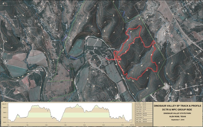
Right click on the GPX link above to download a GPX file for this ride. The GPX file may want to save as an XML file, so if it does, change the extension to gpx before you save it. The file is a high-resolution track with points are every 10' created on the Delorme PN-60W GPS. You can right-click on the image below and use the "Save Target As" option to down-load a 1MB 11x17" PDF version of the map that can be printed. You can also click on the image to open it in a new window and zoom up to 200% for a detailed view. (Insert Track-Profile map with link to tabloid-sized PDF) This is the kind of trail on which you will use all your gears, and spend a lot of time in 1-1. The grades are not impossibly steep, but go on for some distance, making it necessary to slow down to a sustainable climbing pace. The photo below shows (description). (Place-holder for photo) Description of following photo. (Place-holder for photo) Wrap up D/FW, Dinosaur Valley State Park Dinosaur Valley State Park is southwest of Ft. Worth near Glen Rose and has a nice trail system with quite a few technical features. Bruce rode this system for the first time on September 7, 2015. This is a rugged trail system in the hills along the Paluxy River at Glen Rose southwest of Ft. Worth. The area gets it name from many dinosaur foot-prints in the pathways in the cretaceous limestone of the riverbed.
The statistics for the Dinosaur Valley ride are provided below along
with a map showing the track and profile and statistics. The track
and statistics are interim since this was Bruce's first time riding
the trail system and he did not ride it as intended and did some
trails twice. A better track and map will be posted after the next
ride.
Right click on the GPX link above to download a GPX file for this ride. The GPX file may want to save as an XML file, so if it does, change the extension to gpx before you save it. The file is a high-resolution track with points are every 10' created on the Delorme PN-60W GPS. You can right-click on the image below and use the "Save Target As" option to down-load a 1MB 11x17" PDF version of the map that can be printed. You can also click on the image to open it in a new window and zoom up to 200% for a detailed view.
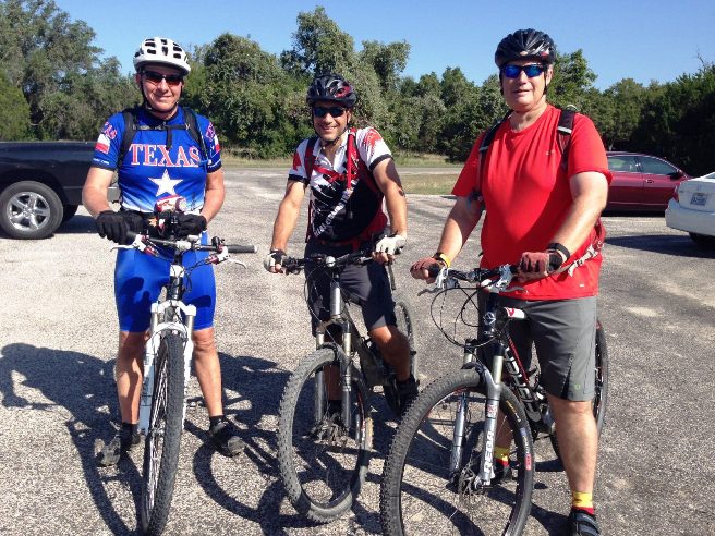
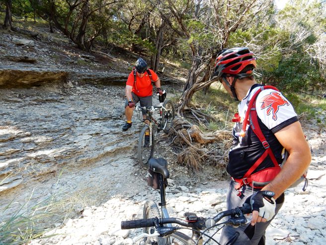
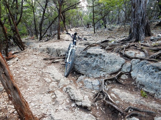
This is the kind of trail on which you will use all your gears, and spend a lot of time in 1-1 grinding up the loose rocky climbs. The grades are not impossibly steep, but some go for a ways by Texas standards making it necessary to slow down to a sustainable climbing pace. There are also some exciting loose, rocky switch-back descents. The photo below shows Bruce, Greg and Tim at the start of the ride.
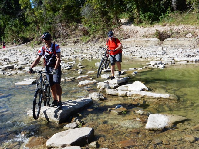
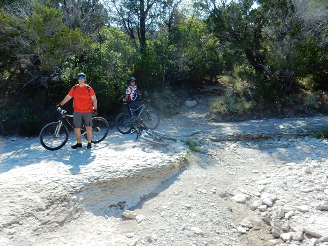
They came to the Paluxy river a short way down the trail. The river was too rocky to ride across so the bikes were carried across. Below is Greg and Tim carrying their bikes across the river.
This was Tim's first real mountain biking experience. Below is a photo of him walking the bike up a rocky climb.
A bit further on, they came to a creek crossing. Since it was it their first time crossing it, everyone opted to walk it.
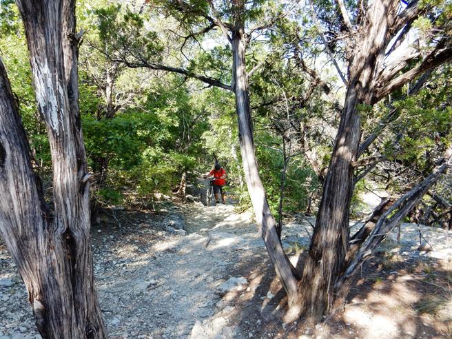
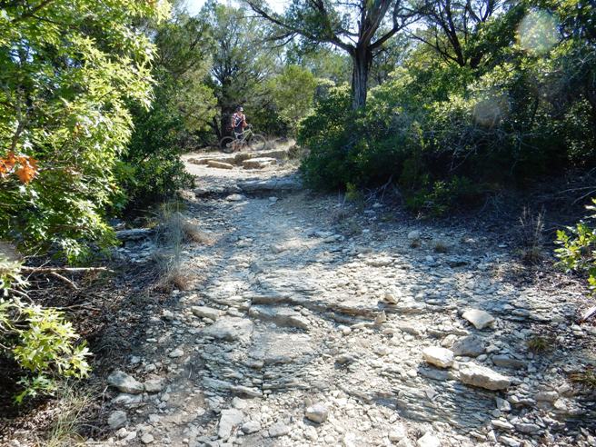
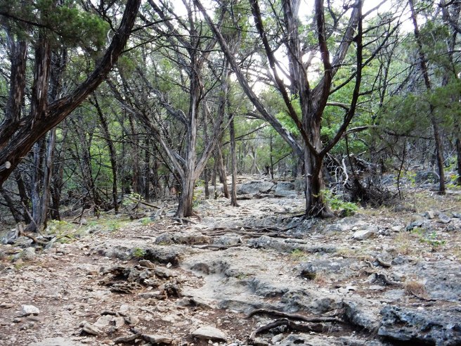
Below is a photo of Tim and Greg further down the trail where it turned from a creek bed up into the woods. This gives you a pretty good of what the limestone trails are like in places.
Below is Greg at the top of another climb. This gives you an idea of the terrain you have to contend with in places.
Not all the trails are loose, rocky climbs or descents. Below is a photo of Bruce on one of the more normal sections of trail.
Below is Bruce and Greg at an observation point overlooking the river.
After the ride, they hit the showers and headed over to the picnic area for lunch. Most of the state parks in Texas have showers in the restrooms in the campgrounds, and being able to shower after a 2 hour ride in 102F temperatures was quite enjoyable.
The ride was intended to be a reconnaissance ride for a campout planned the following March. The information gathered will help plan that event. The trail is more difficult than anticipate, so riders will need intermediate skills. They also noted the best campsites so they will have a preferred list when they check in. Introduction to the trail and ride including any other riders or group with you.
The statistics for the (Trail Name) ride are provided below along
with a map showing the track and profile and statistics. The track
and profile is for the clockwise direction. Reverse it for a
counter-clockwise ride.
Right click on the GPX link above to download a GPX file for this ride. The GPX file may want to save as an XML file, so if it does, change the extension to gpx before you save it. The file is a high-resolution track with points are every 10' created on the Delorme PN-60W GPS. You can right-click on the image below and use the "Save Target As" option to down-load a 1MB 11x17" PDF version of the map that can be printed. You can also click on the image to open it in a new window and zoom up to 200% for a detailed view. (Insert Track-Profile map with link to tabloid-sized PDF) This is the kind of trail on which you will use all your gears, and spend a lot of time in 1-1. The grades are not impossibly steep, but go on for some distance, making it necessary to slow down to a sustainable climbing pace. The photo below shows (description). (Place-holder for photo) Description of following photo. (Place-holder for photo) Wrap up Oak Cliff is a local Dallas area trail located on the south side of the Metroplex in the City of Dallas. Bruce rides this trail several times a year.
The statistics for the (Trail Name) ride are provided below along
with a map showing the track and profile and statistics. The track
and profile is for the clockwise direction. Reverse it for a
counter-clockwise ride.
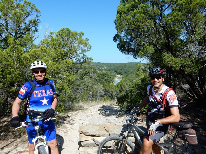
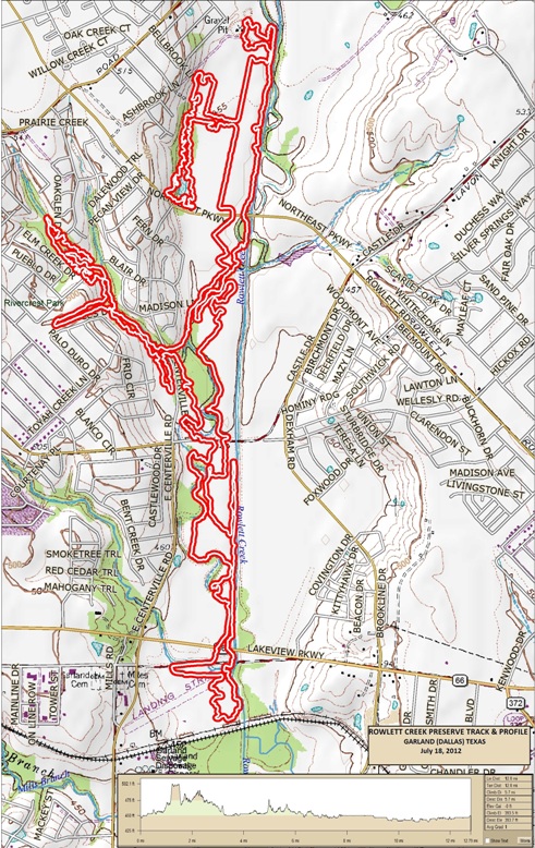
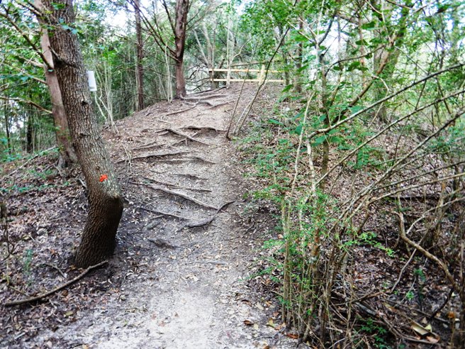
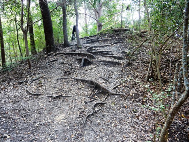
Right click on the GPX link above to download a GPX file for this ride. The GPX file may want to save as an XML file, so if it does, change the extension to gpx before you save it. The file is a high-resolution track with points are every 10' created on the Delorme PN-60W GPS. You can right-click on the image below and use the "Save Target As" option to down-load a 1MB 11x17" PDF version of the map that can be printed. You can also click on the image to open it in a new window and zoom up to 200% for a detailed view. (Insert Track-Profile map with link to tabloid-sized PDF) This is the kind of trail on which you will use all your gears, and spend a lot of time in 1-1. The grades are not impossibly steep, but go on for some distance, making it necessary to slow down to a sustainable climbing pace. The photo below shows (description). (Place-holder for photo) Description of following photo. (Place-holder for photo) Wrap up Rowlett Creek Preserve or RCP is a local Dallas area trail located on the east side of the D/FW Metroplex in the City of Garland. Bruce lives nearby, and since it is only 20 minutes from home, he sometimes rides this trail several times a week. The trail is nearly 16 miles of beginner to intermediate level loops built in a flood plain. He rides RCP primarily for conditioning and to keep his basic skills sharp. It has a few climbs and creek crossings, but is not very technical unless you ride it fast, which is what he normally does. He also tends to do two laps which gives him over 32 miles of cross-country riding. It is one of the most popular "urban" trails in the Dallas area and he usually finds several of his riding buddies out there at any given time. It is not unusual to find several hundred people there on the weekends, but they are usually spread out over the whole system, so it is not too crowded.
The statistics for the RCP Trail System are provided below along
with a map showing the track and profile and statistics. The track
and profile is for the clockwise direction. This is a directional
trail system, and almost always runs in a clockwise direction.
Occasionally, the system is reversed and run counterclockwise, but
is always posted when it is.
Right click on the GPX link above to download a GPX file for this ride. The GPX file may want to save as an XML file, so if it does, change the extension to gpx before you save it. The file is a high-resolution track with points are every 10' created on the Delorme PN-60W GPS. You can right-click on the image below and use the "Save Target As" option to down-load a 1MB 11x17" PDF version of the map that can be printed. You can also click on the image to open it in a new window and zoom up to 200% for a detailed view.
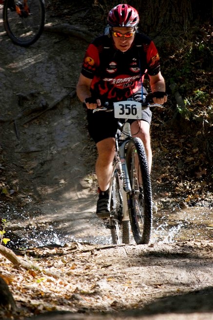
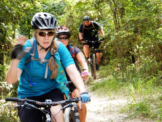
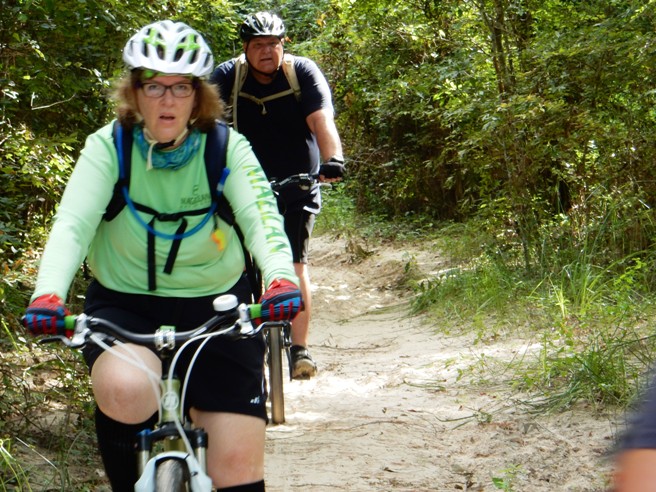
This trail is fairly flat and can be done in one chain ring. There are a few climbing sections that require your lower gears, but most of it does not. The system is popular with single speeders. The track, profile and statistics do not include Loop 6 at the south end because that section was closed for light rail construction. Loop 6 is flat river delta and only adds about 3.7 miles to the ride. The photo below shows Bruce crossing the creek at the beginning of Loop 1a in 2008 during a local club race.
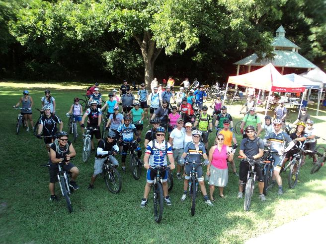
The following photo shows the participants in DORBA Dirt Days on July 21, 2013. Bruce is in the middle of the pack on the left, about 4 people in. He is wearing the white helmet and black jersey with white sleeves.
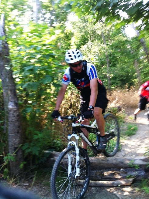
The next photo shows Bruce crossing a small log pile on Loop 5 during the DORBA Dirt Days on July 21, 2013.
On April 21, 2013, Bruce rode the Walnut Creek trail system on the north side of Austin. This ride was done in conjunction with a business trip to San Antonio.
The statistics for the (Trail Name) ride are provided below along
with a map showing the track and profile and statistics. The track
and profile is for the clockwise direction. Reverse it for a
counter-clockwise ride.
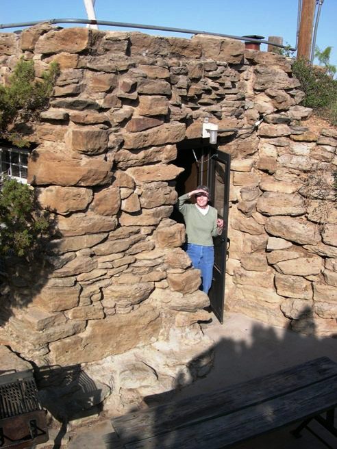
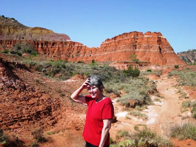
Right click on the GPX link above to download a GPX file for this ride. The GPX file may want to save as an XML file, so if it does, change the extension to gpx before you save it. The file is a high-resolution track with points are every 10' created on the Delorme PN-60W GPS. You can right-click on the image below and use the "Save Target As" option to down-load a 1MB 11x17" PDF version of the map that can be printed. You can also click on the image to open it in a new window and zoom up to 200% for a detailed view. (Insert Track-Profile map with link to tabloid-sized PDF) This is the kind of trail on which you will use all your gears, and spend a lot of time in 1-1. The grades are not impossibly steep, but go on for some distance, making it necessary to slow down to a sustainable climbing pace. The photo below shows (description). (Place-holder for photo) Description of following photo. (Place-holder for photo) Wrap up High Plateau, Palo Duro Canyon SP Palo Duro Canyon State Park out near Amarillo is known as the "Grand Canyon of Texas" and has a very nice trail system. The weekend of May 9-11, 2008, Bruce and Betsy took a long weekend out to Palo Duro Canyon in the Texas Panhandle. Palo Duro is a smaller version of the Grand Canyon, being much wider at the bottom. It is so wide that there is a state park there with campsites and cabins. It is a great place and Bruce can't wait to ride it again. The weather was perfect and the bugs were minimal. The driving time from Dallas was 6 hours. They found a great family restaurant in Childress named Dawson's and highly recommend it if you enjoy good, down-home family cooking. It's on the south side of US-287. There are three stone cabins built by the Civilian Conservation Corps back in the 1930's as part of a WPA project that created the park on the rim near the entrance to the canyon. They were able to get one of them. Betsy, AKA Mrs. Gator, has had enough tent camping for one life-time, so now "camping" must include hot showers, clean sheets, air-conditioning and room service. It met all her requirements, except they didn't need the AC. Bruce provided room service. The photo below shows Betsy standing in the doorway of one of the cabins they rented.
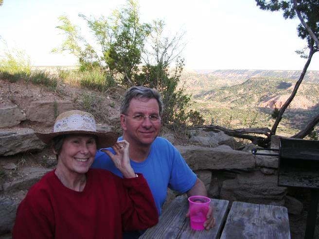
The "cabins" are made of native stone, have two sleeping areas, each with its own fireplace, and a bathroom with shower. With night-time temps around 50 and day-temps in the low 80's, the "adobe effect" made it so that they didn't need either heat or air. All rooms, including the bathroom, have a view of the canyon, as did the patio. The photo below shows the view from the patio. Each cabin has one with a picnic table and grill.
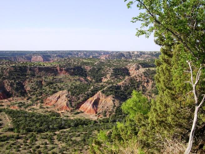
The photo below gives a telephoto view of the canyon from the patio.
There
currently are no statistics for the Palo Duro Trail ride since Bruce
was not recording GPS files at that time.
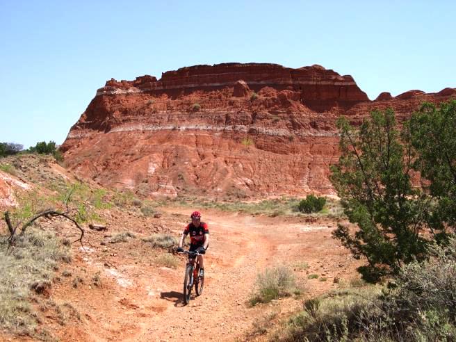
There is no ride map, track or statistics because this ride was done before Bruce started making GPS logs. This is the kind of trail on which you will use all your gears. There are some moderately steep climbs and some nice down-hill runs. Most of the trail is relatively flat and open. They went on out Lighthouse trail to the "Lighthouse", the most famous geological formation in the park. Below is a shot of Betsy on the trail out to the Lighthouse and shows some of the formations in the canyon.
Below is a shot of Bruce on the way out to the Lighthouse.
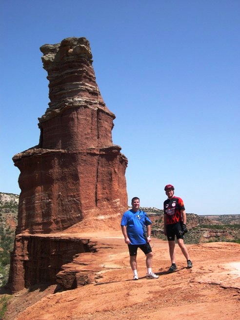
The climb up to the Lighthouse was a bit much for Betsy, so she stayed at the base while Tim and Bruce went up.
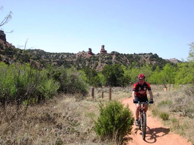
The photo below was taken on Lighthouse trail as Bruce was riding back. The Lighthouse can be seen in the distance. You have to climb up to the plateau it sits on, then climb up to formation itself.
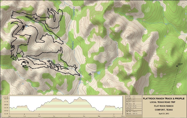
Capitol Peak and Givens, Spicer, Lowry Trails Bruce also rode the Capitol Peak, and the Givens, Spicer, Lowry Trails. Betsy and Tim are not really off-roaders, so he rode these trails alone and didn't take any photos. He did learn that if you do them all at once, you are going to get a workout. The GSL is fairly technical in spots and will work you out. He recommends parking at the trail-head for the Lighthouse trail and taking the Paseo Del Rio to the GSL trail-head as a warm-up. Ride the GSL to Little Fox Canyon Trail and use the Little Fox for recovery before moving on to the Lighthouse and Capitol Peak trails. Take the Capitol Peak Trail off of Lighthouse and stay to the right to ride along the peak. This trail is fun and moderately challenging. Ultimately, Capitol Peak will bring you back to a parking area near the Lighthouse trail head. Go left and on the Juniper Trail and you will end up back at the Lighthouse trailhead in less than a mile. Next time Bruce will plan for more than three days. By the time they arrived late Friday afternoon and got unloaded, there wasn't any time available to ride before getting dinner started. Saturday was a full ride day, and he got a couple of hours in Sunday morning before packing up and heading back to Dallas. He could have used another day or two. If you are going to use the gas to get there, you might as well make it worth while. He may even consider renting a travel trailer and staying in the Hackberry Camp area for 4-5 days. Hill Country, Flat Rock Ranch - West Loop On April 20, 2013, Bruce rode the trails at Flat Rock Ranch down near Comfort. The trials are cut into the limestone of central Texas and were the first "Hill Country" trails Bruce rode. Flat Rock Ranch is one of the top trails in Texas. It is ranked #2 on the list of Top 10 Trails Worth the Drive by MountainBikeTx.com. Since this trail was on the way back to Dallas from San Antonio, and since it had the reputation it did, it only made sense to ride it. There are two principle loops at Flat Rock: the 15 mile lower loop and 10 mile upper loop. The upper loop is the more technical of the two.
Statistics for the Lower Loop ride from the MTBProject.com site are provided below along
with a map showing the track and profile and statistics. The track
and profile is for the clockwise direction, which is the way it is
intended to be ridden. Bruce did not have his GPS set to record
during the ride, so he does not have a high-resolution track. He
will be sure to get one next time.
Right click on the GPX link above to download a GPX file for this ride. The GPX file may want to save as an XML file, so if it does, change the extension to gpx before you save it. The file is a high-resolution track with points are every 10' created on the Delorme PN-60W GPS. You can right-click on the image below and use the "Save Target As" option to down-load a 1MB 11x17" PDF version of the map that can be printed. You can also click on the image to open it in a new window and zoom up to 200% for a detailed view.
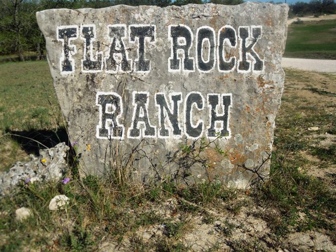
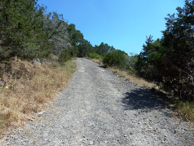
This is the kind of trail on which you will use all your gears, and spend a lot of time in 1-1. The grades are not impossibly steep, but do go on for some distance, making it necessary to slow down to a sustainable climbing pace. The photo below shows the sign at the entrance to the Ranch.
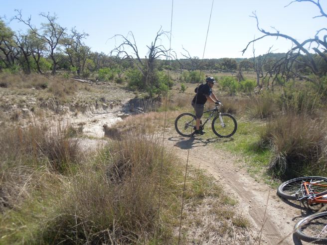
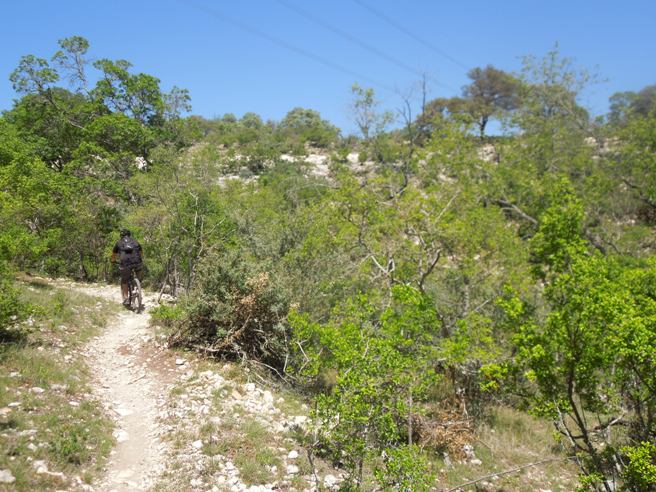
The trail is best suited for intermediate to advanced riders. Bruce met up with Robert and Carlos at the trailhead and joined them for the ride. Below is a photo of Marc after crossing a dry wash.
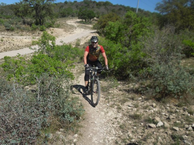
Further up the trail, they ran into Doug, one of the builders of the trail.
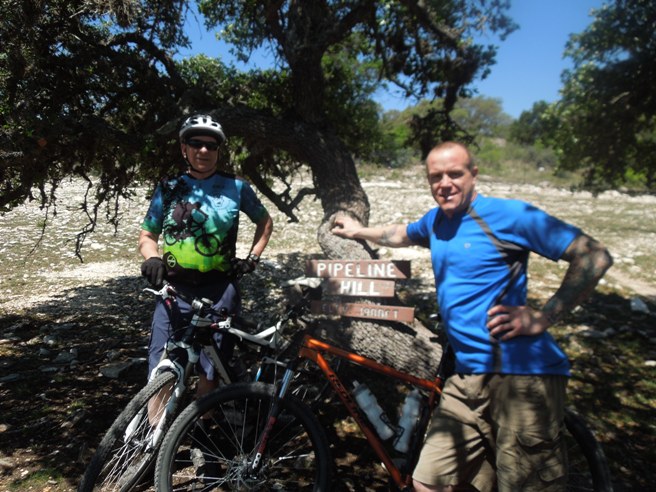
Further out the trail, you climb to Pipeline Hill. Below is Marc on the trail leading out to Pipeline. The hill is the bluff in the distance.
Below is a photo of Bruce and Robert on Pipeline Hill.
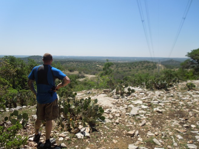
The view from Pipeline is quite spectacular. The photo below shows Robert taking in the view.
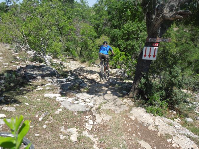
After leaving Pipeline hill, it is on to a rather technical down-hill section called "The Evil Worm."
After a few more miles of down-hill switch-backs, you come to "Hospital Hill." This section of trail gets its name from the four-foot ledge about 100 yards down the trail.
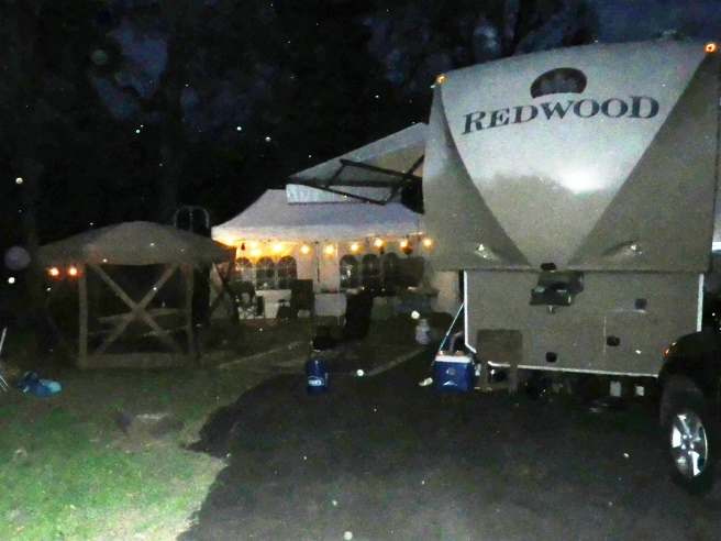
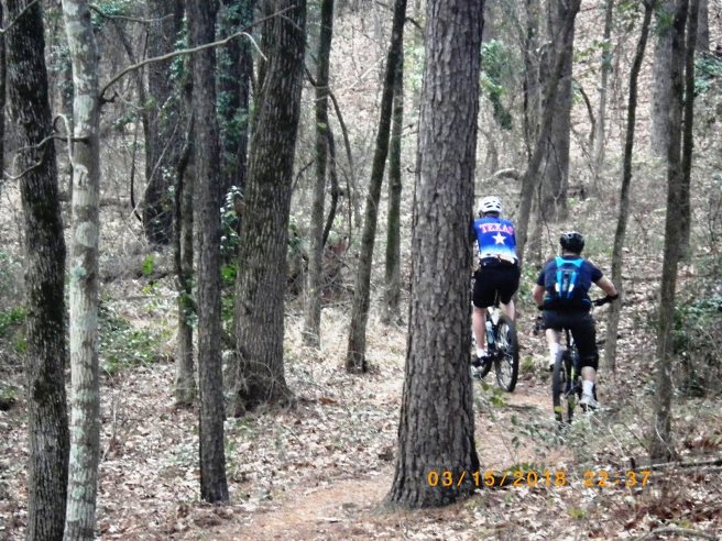
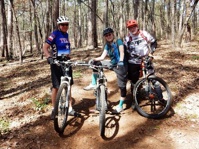
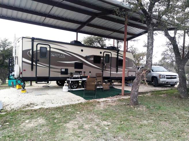
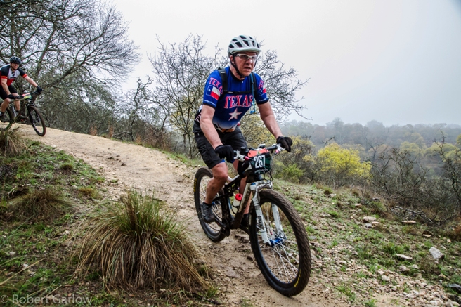
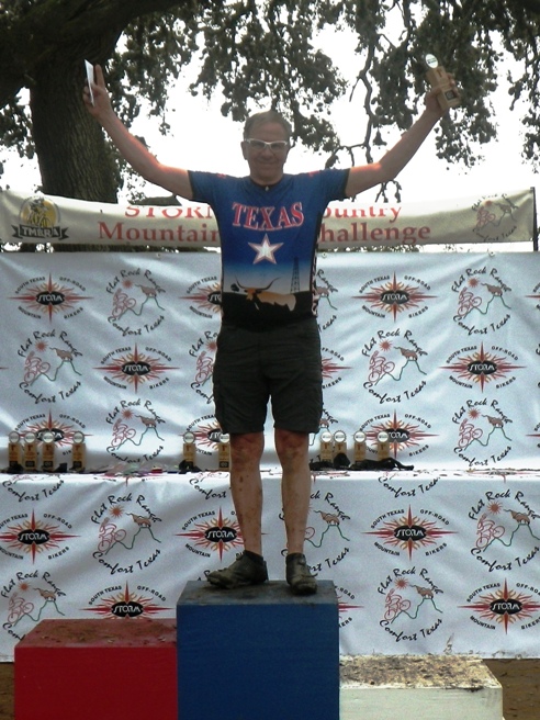
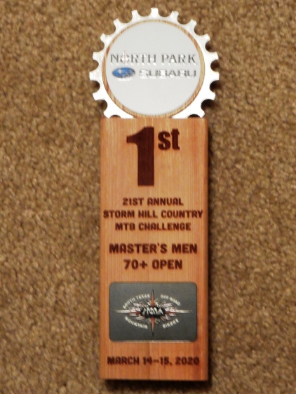
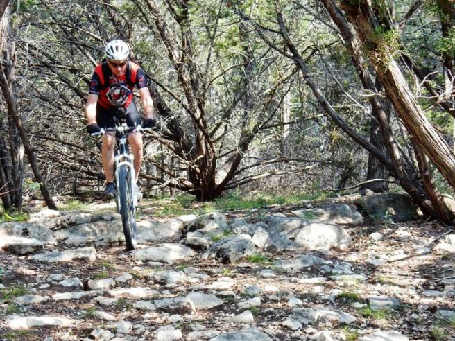
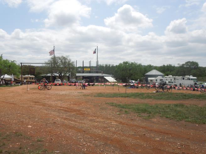
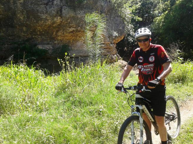
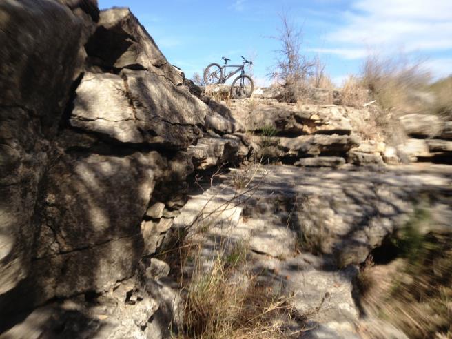
The Flat Rock Ranch trail is great ride, and Bruce plans to ride it again the next time he is in the area. Hill Country, Flat Rock Ranch - TMBRA/STORM Race Bruce rode the trails at Flat Rock Ranch on Friday, March 13th prior to a Texas Mountain Biking Racing Association (TMBRA) race on Sunday, March 15th, 2020. The race was organized by the South Texas Off Road Mountain-biking Association (STORM). Flat Rock has over 30 miles of trails on 1300 acres of land. It is still a working ranch where they raise cattle and Angora goats. The trails are mostly single track, although there are sections of double track used by ATVs for ranch operations. Motorized vehicles are not permitted on the trails other than those used for ranch operations. Jimmy Dreiss, the owner of the ranch, has a limited amount of RV spaces, and since he was full and his was out for repair, rented Bruce the shed where he normally stores his trailer.
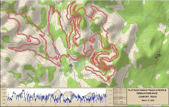
Flat Rock Ranch is ranked number and the #4 trail in Texas by MTB Project. This trail is considered difficult or a black diamond trail system by normal standards. The statistics for the Flat Rock Ranch race are similar to those provided below along with a map showing the track and profile and statistics of the pre-ride on March 13th. The race was on March 14th.
Right click on the GPX link above to download a GPX file for this ride. The GPX file may want to save as an XML file, so if it does, change the extension to gpx before you save it. The file is a high-resolution track with points are every 10' created on the Delorme PN-60W GPS. You can right-click on the image below and use the "Save Target As" option to down-load a 1MB 11x17" PDF version of the map that can be printed. You can also click on the image to open it in a new window and zoom up to 200% for a detailed view.
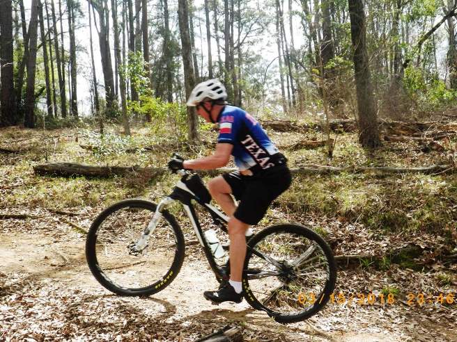
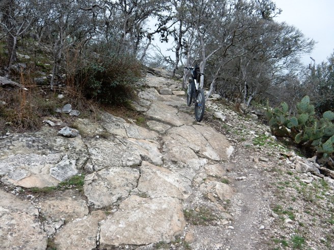
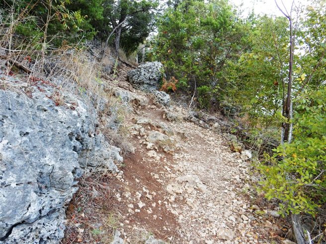
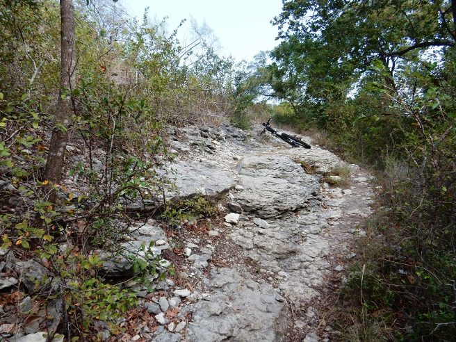
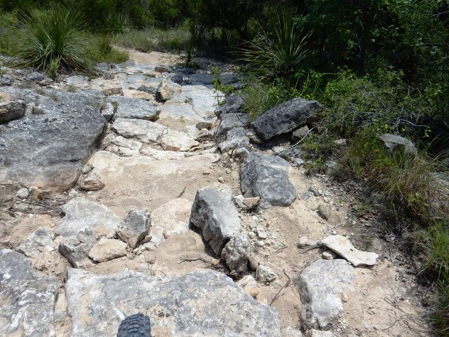
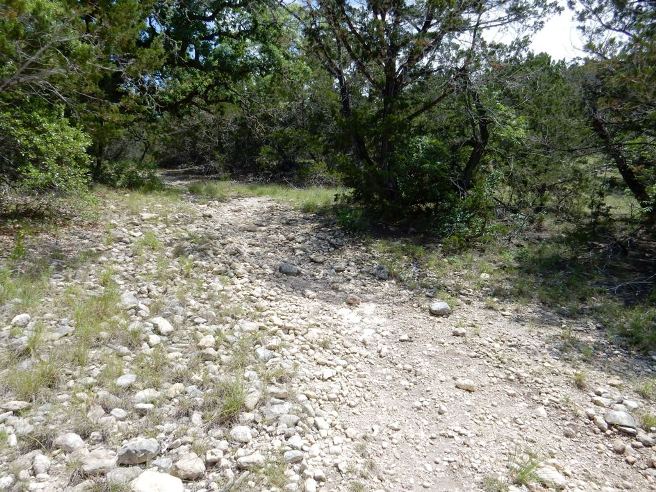
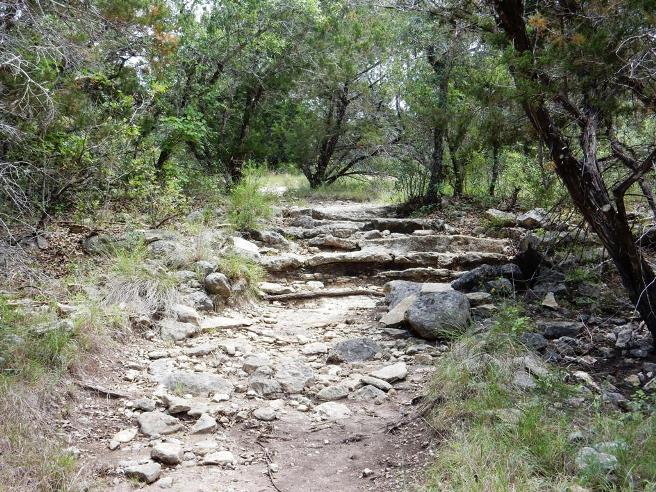
This is the kind of trail on which you will use all your lower gears. Some of the grades are very steep and there is a lot of lime-stone rock, making sections very difficult to climb. The photo below shows one of several climbs on the course. The lime-stone slabs transition to smaller broken stones at the top of the trail. This was steep and difficult to climb dry, and impossible wet during the race.
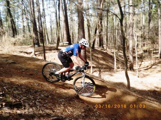
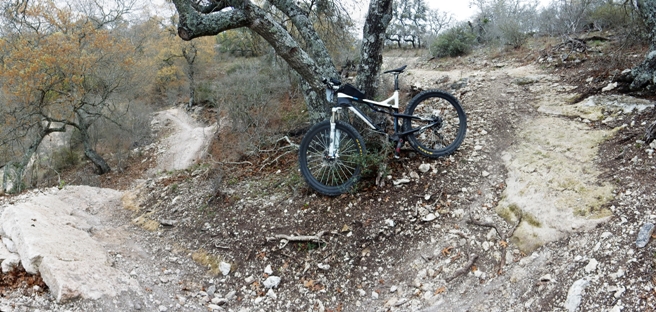
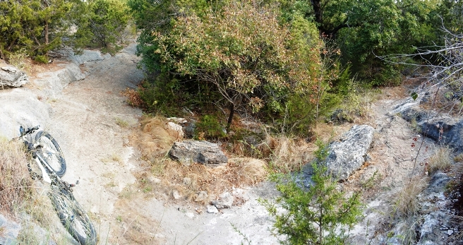
One of the more technical descents on the trail. The photo does not show how deep and steep the first drop is. This was one of several planned dismount areas for Bruce.
Below is a photo Robert Garlow of Rocket Race Photos made of Bruce coming down Mad Bomber.
It rained the morning of the race and the results can be seen on Susie packed up for the trip home.
Bruce was un-opposed for the Master's Men 70+ Open category, so he got first by finishing.
He received the trophy below plus a cash prize of $49 for his efforts.
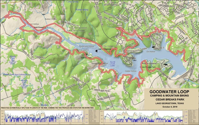
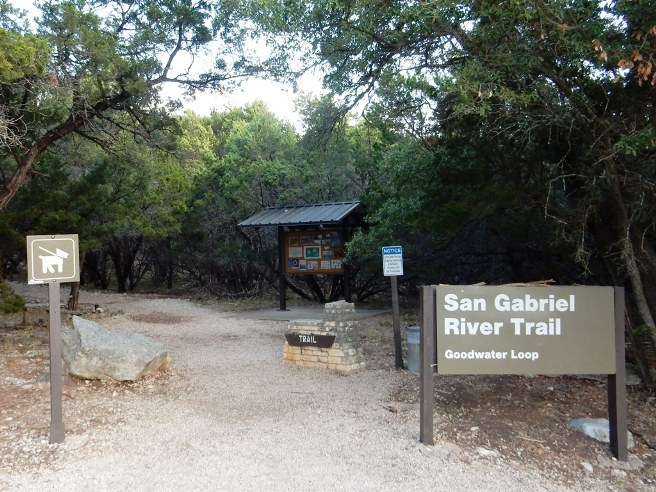
Hill Country, Cedar Breaks Lake Georgetown - Goodwater Loop
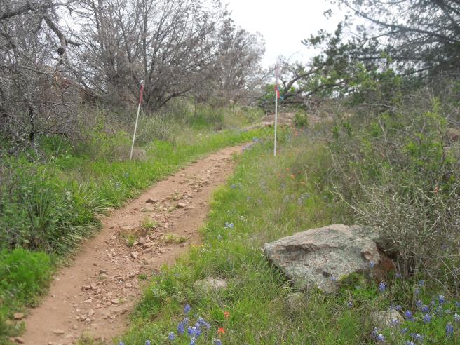
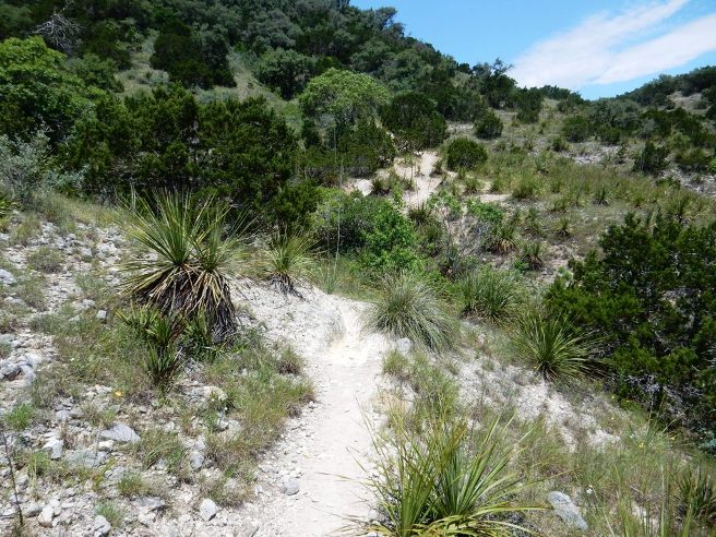
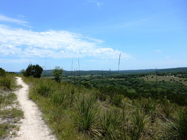
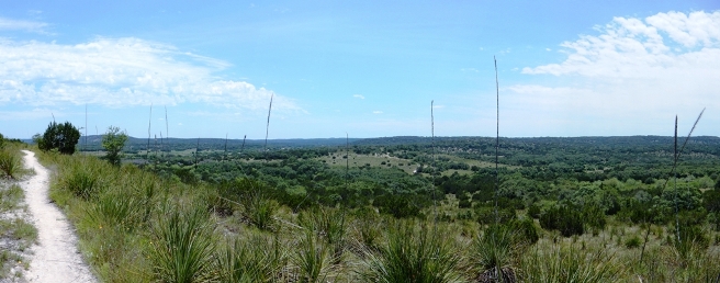
The reviews and ratings for the IMBA EPIC Goodwater Loop indicate it is a difficult to very difficult trail: Blue Square with a Black Diamond in it. One reviewer said the limestone sections of the trail had a lot of similarity to Porcupine Rim in Moab. Bruce feels more than 50% of this trail is "expert" level and easily qualifies for black diamond status since it traverses a lot of "Cheese Grater" limestone which will take your rock riding skills up a couple of levels. The remainder of the trail is conventional single track with a small portion of double track. If you plan to do the entire loop, make sure both you and your bike are in "excellent" condition. This trail will put you both to the test. The statistics for the Goodwater Loop are provided below along with a map showing the track, profile and statistics. The track and profile is for the clockwise direction from the October 4, 2019 ride. This is an extremely demanding trail, and Bruce recommends both the rider and equipment be in excellent shape. He also recommends taking a 3-liter hydration pack and enough powdered hydration mix to refill it twice along the way during the summer. The first opportunity will be at the Tejas Park Campground about 11 miles from the Cedar Breaks Trailhead. The next opportunity for water is at Jim Hogg Park at 21 miles into the loop.
The track and profile end at the Overlook TH. From there, Bruce took
Cedar Breaks Road across the dam back to the campground.
Right click on the GPX link above to download a GPX file for this ride. The GPX file may want to save as an XML file, so if it does, change the extension to gpx before you save it. The file is a high-resolution track with points are every 10' created on the Delorme PN-60W GPS. You can right-click on the image below and use the "Save Target As" option to down-load a 1MB 11x17" PDF version of the map that can be printed. You can also click on the image to open it in a new window and zoom up to 200% for a detailed view.
The Trailhead gives no clue as to what you are about to come up against.
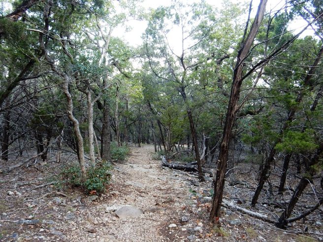
Starts out easy enough.
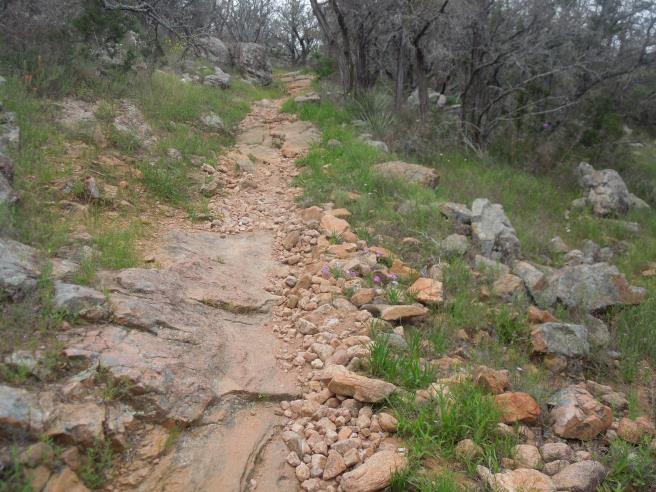
Doesn't stay easy for long. Roots and rocks are plentiful.
Looking back at the ledge. Getting reacquainted with riding in rock.
Below is another rocky descent.
Finally, some normal trail!
However, the normal trail didn't last for long.
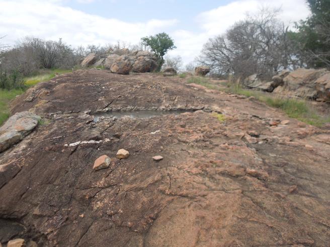
Below is a closer look at the "Cheese Grater" limestone near the top of the climb. That stuff could do some damage.
More "Cheese Grater" limestone further down the trail. At this point, he is not even 2 miles into the 27 mile loop.
Need he say more? By now, Bruce was getting very good at riding the rock on this trail.
Why not even more to hone his rock riding skills?
Nice natural berm out towards Crocket Farm.
Back into some "normal" section trail, but only for a little while.
That "Normal" section of trail didn't last too long, and then it was down a rocky descent.
At about 7 miles in, you encounter the cutoff to Sawyer Camp.
At about 8 miles, you encounter some more "Normal" trail.
That section of normal trail did not last, and it was back into "Cheese Grater" limestone at the 15 mile point for the 6 mile trek to Jim Hogg.
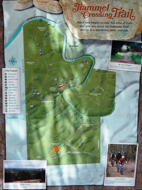
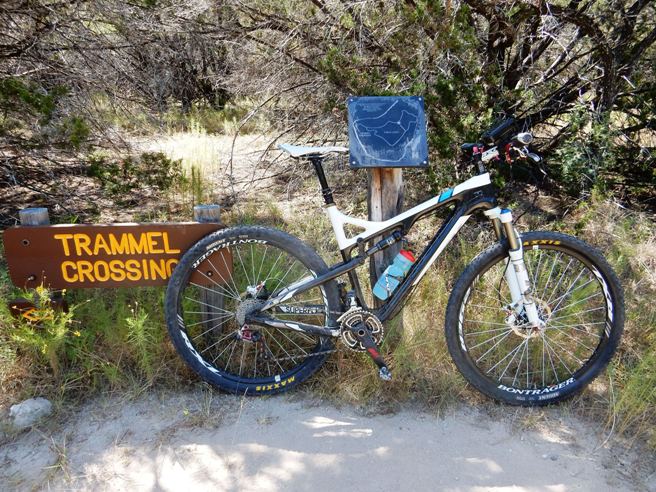
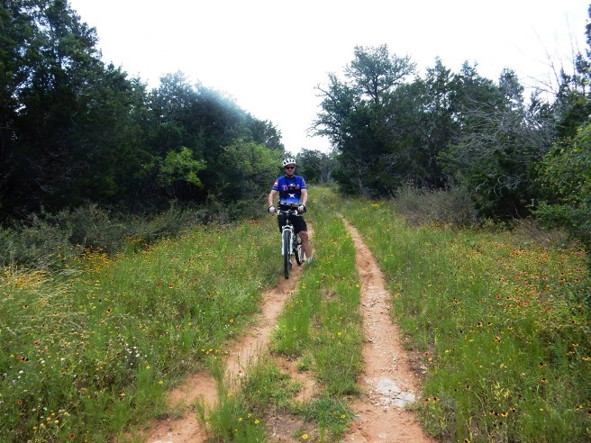
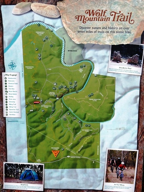
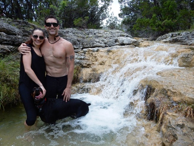
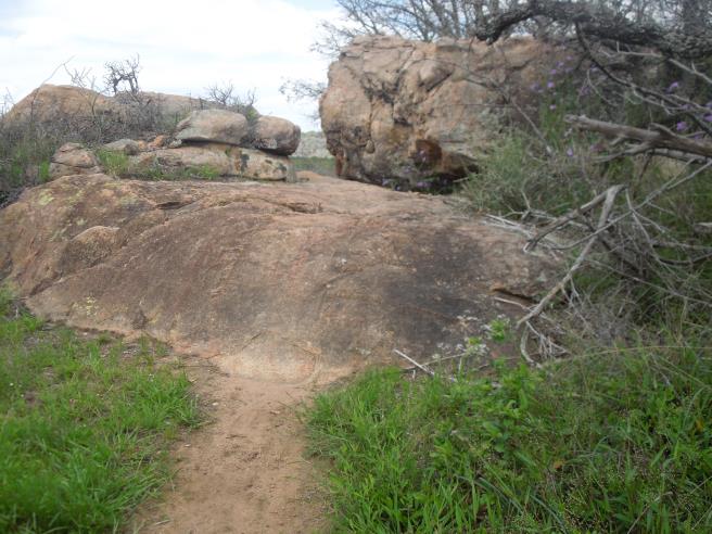
Hill Country, Pedernales Falls SP - Trammel Crossing Trail Pedernales Falls SP in the Texas Hill country in one of the premier state parks in Texas, and the most beautiful park in the Texas Hill Country. It has several nice trails. Bruce rode the Trammel Crossing Trail on August 8, 2015, and June 21, 2019. There are four principal trails at Pedernales: the Trammel Crossing, Wolf Mt., Madrone and Juniper Ridge. On the August 2015 trip, Bruce only had time to ride the Trammel Crossing, and only only made it out to the Observation Point, location A on the map below, due to the 109F to 112F temperatures on the trail. On the June 2019 trip he rode the entire Trammel Crossing Trail.
The statistics for the Trammel Crossing ride are provided below
along with a map showing the track and profile and statistics. The
track and profile is for the counter-clockwise direction from the
June 2019 ride. Bruce recommends you ride this trail in the
clockwise direction. That turns a steep, rocky climb along the
boundary at the north-east corner into a sketchy descent.
Right click on the GPX link above to download a GPX file for this ride. The GPX file may want to save as an XML file, so if it does, change the extension to gpx before you save it. The file is a high-resolution track with points are every 10' created on the Delorme PN-60W GPS. You can right-click on the image below and use the "Save Target As" option to down-load a 1MB 11x17" PDF version of the map that can be printed. You can also click on the image to open it in a new window and zoom up to 200% for a detailed view.
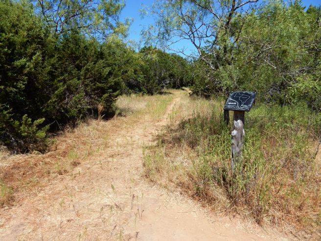
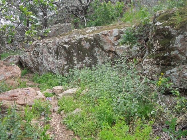
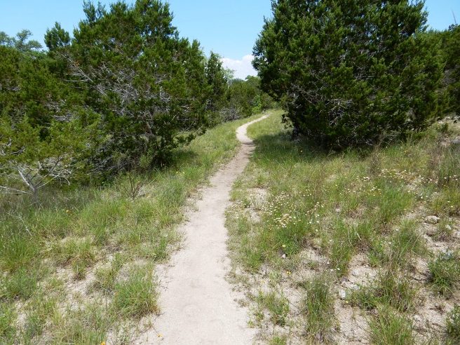
The Trammel Crossing Trail is an intermediate-level trail. The surface conditions are smooth to moderately rocky. The climbs are not too steep, but some do go on for a good ways. The climb out of the river on the way out has a lot of soft sand followed by an area of lose river rocks. The ride starts out in the camping area between campsites 33 and 34. This is shown by the small red arrow near the center of the map. There is a small parking lot and sign at the trailhead.
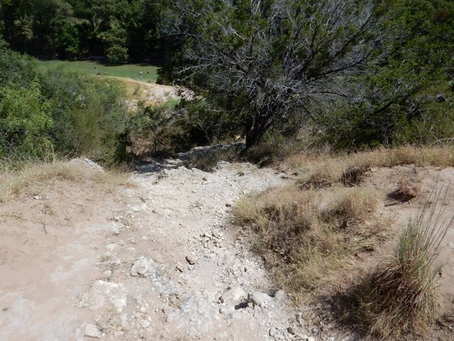
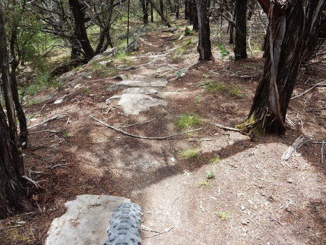
The trail from the parking lot is crushed lime stone. About a quarter-mile down, you come to a fork in the trail. Straight ahead is a very gnarly rocky descent shown in the photo below.
Taking the right fork is longer, but much smoother.
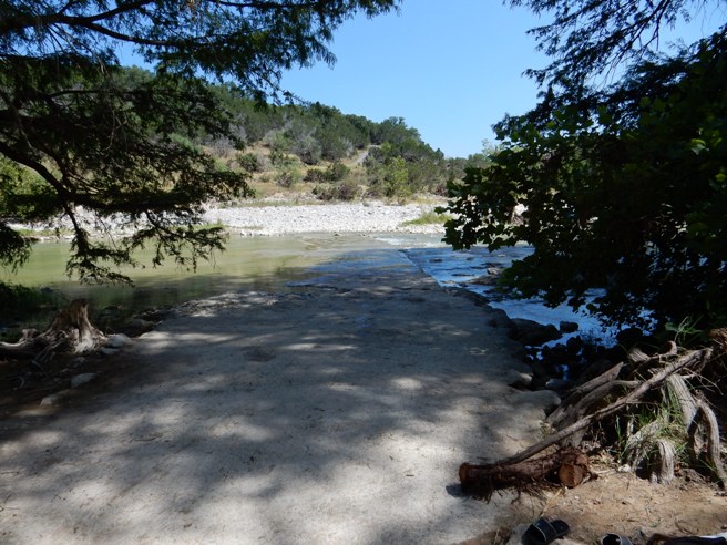
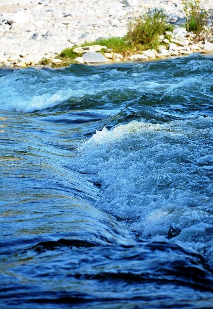
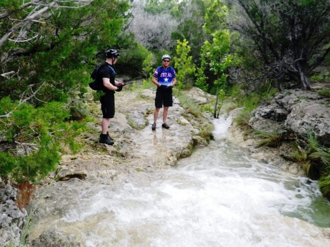
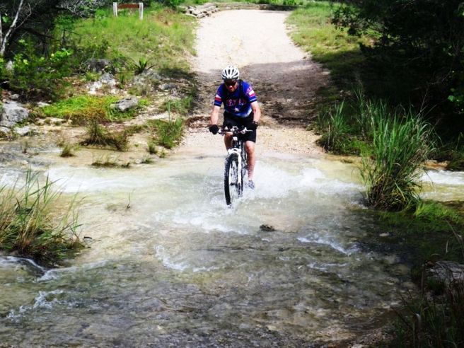
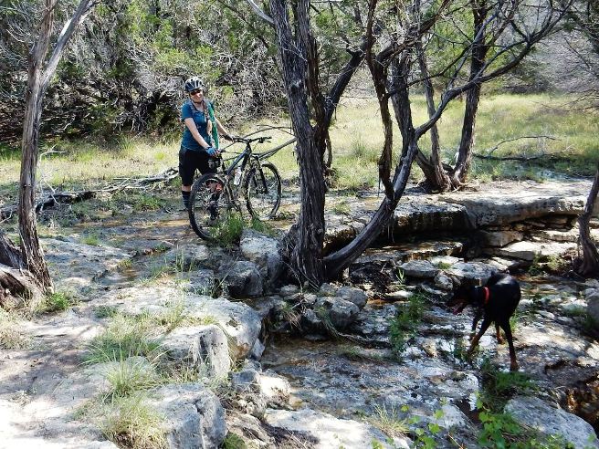
At the bottom of the access trail, you will have to negotiate some soft sand to get up onto river crossing. The crossing is a smooth feature providing good footing even though most of it will be underwater. The depth of the water during the August, 2015 ride was typically 3 inches, although there was a deeper pool on the far side that was about 8" deep. The whole crossing was easy to ride. The rock field seen on the far river bank are a bit of a challenge, but can be ridden across if you have enough momentum.
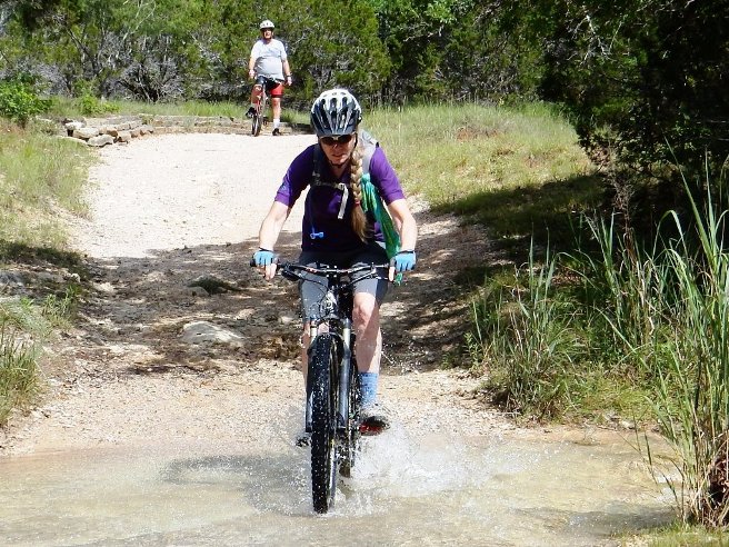
Things were not quite so serene on the crossing for the June 2019 Ride. The fast-moving water meant Bruce and David had to remove their shoes and carry the bikes across.
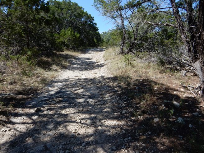
Once across the river and rocky river bank, you are presented with the long climb on the gravel road shown below.
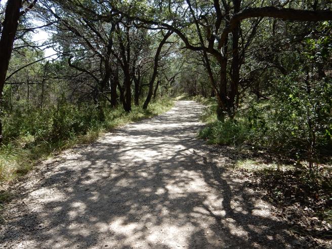
At the top of the climb, the trail turns to the left and becomes a natural surface of sand, rock and gravel shown below.
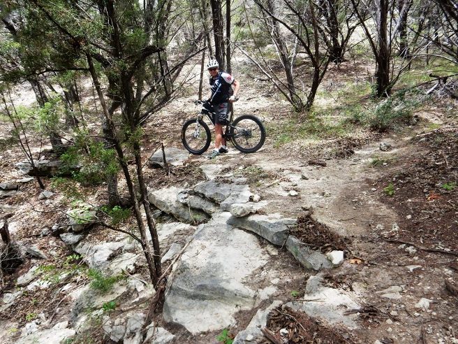
A short distance up the trail, you come to a fork and a trail marker. David is at the split just after crossing the river and climbing up the other bank during the June 2019 ride. The loop begins here and the location is shown by the star on the trail map on the trail marker. The trail is a loop with a short-cut about 2/3 the way out. Bruce recommends you go left at this point and ride the loop clockwise since there is a steep, rocky hill on the backside which is much easier to descend than climb. The descent is still sketchy, but at least you are not climbing.
Judging from the trail conditions on the August 2015 ride, it seemed the preferred direction around the loop was clockwise, so Bruce took the left fork. The photo below shows the trail conditions of the left-fork at the junction.
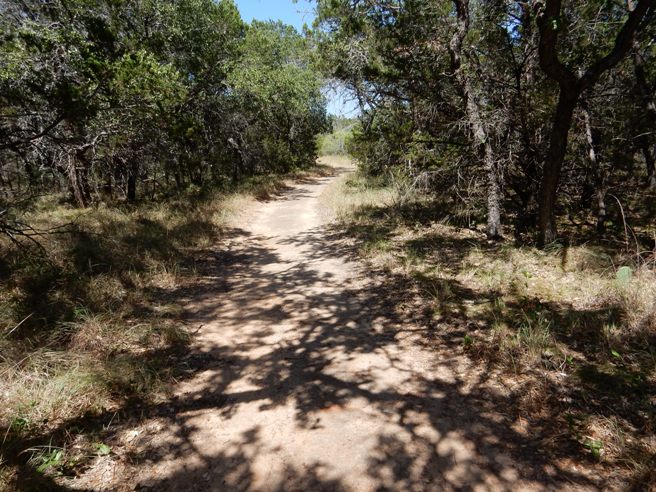
The trail was not very technical, although there were a few rocky and sandy areas to break up the monotony. Past the initial climb up from the river, the rest of the trail was mostly a long, gradual climb. The photo below is from the August 2015 ride.
At about 2 miles in, you come to another intersection and marker. This is a connector bisecting the main loop. The location is shown by the star on the trail map on the marker in the photo below. Staying on the left keeps you onto the main loop and takes you out to the overlook. The photo below is from the August 2015 ride.
Past the intersection, the trail climbs a bit more on rock and gravel. The photo below is from the August 2015 ride.
Around the bend seen in the distance of the photo above, the trail levels off and opens up. The park has done a good job marking the trail at intersections. The photo below is from the August 2015 ride.
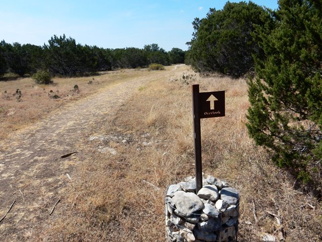
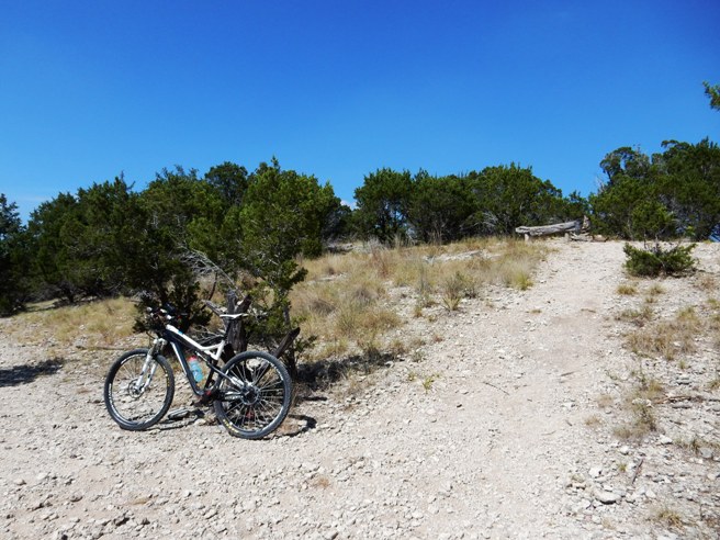
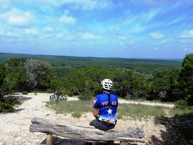
Heading down the trail and around to the right, you come to the Overlook. This is location A on the map above. Here, there is a path up to a log bench and stone monument as it was on the August 2015 ride.
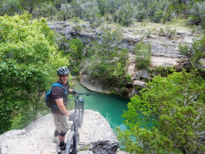
There is quite a nice view from the overlook. Below is a photo of the view from the June 2019 ride, including the bikes down on the main trail.
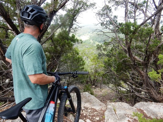
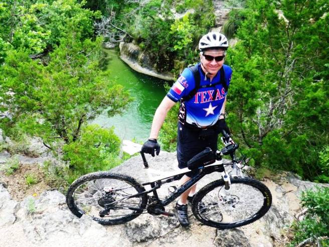
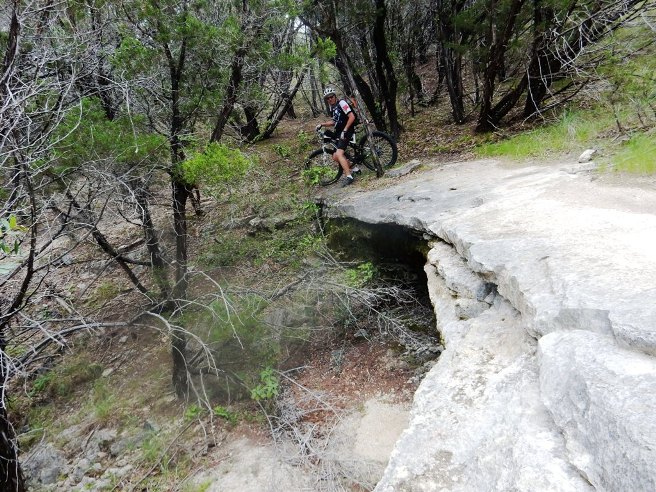
On leaving the overlook on the June 2019 ride, David and Bruce explored a trail not on the map. This trail led to the edge of a cliff overlooking the river and having an impressive view. This is location B on the map above.
Parts of the trail were still blooming on the June 2019 ride. Below is a photo of Bruce along a section of trail with Indian Paintbrush in bloom.
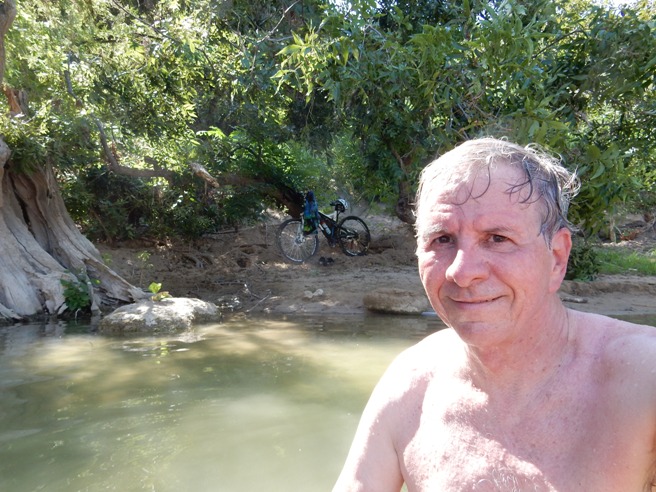
Bruce had planned to ride the entire loop in August 2015, but the temperatures on the trail were running between 109F and 112F in the sun. He was feeling heat stress, so he decided the wise thing to do was to head back. Once back at the crossing, he decided to cool off in the river near the crossing.
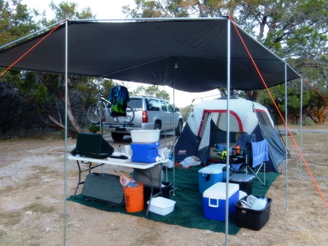
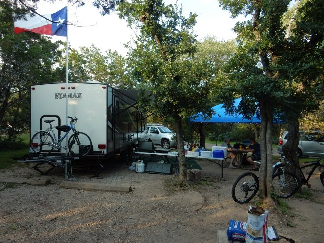
The ride was part of weekend camping trip. The photo below shows Campsite 27 that weekend. It has a high awning for good ventilation and a piece of green indoor-outdoor carpet he calls their "artificial lawn." This was Bruce and Betsy's last tent camping trip since they decided to get an air-conditioned travel trailer the following month.
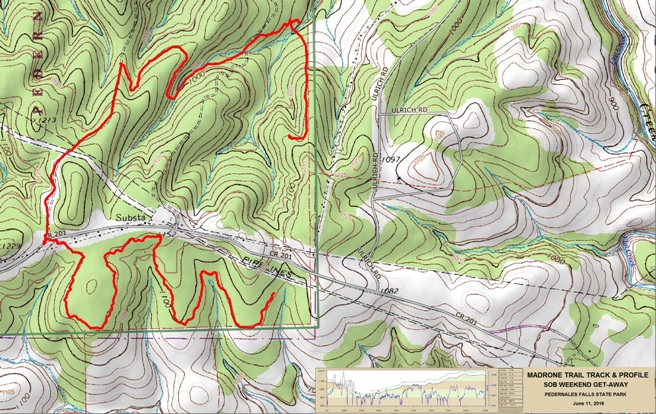
The trip was too hot and too short. Bruce planned to go back when it is cooler and stay longer so he can ride all of the trails. Two subsequent trips were made in June 2016, one as a reconnaissance trip on June 4th and another multi-day camping and riding trip a week later. The June 2019 trip was the fourth trip to Pedernales. All subsequent trips utilized a trailer. Hill Country, Pedernales Falls SP - Wolf Mt. and Juniper Ridge Trails Pedernales Falls SP in the Texas Hill country in one of the premier state parks in Texas. It has several nice trails. Bruce rode the Wolf Mt. and Juniper Ridge Trails on June 4, 2016. He also rode Madrone, Juniper Ridge and Wolf Mt. with David on June 22. 2019.
The statistics for the Trammel Crossing ride are provided below
along with a map showing the track and profile and statistics. The
track and profile is for the clockwise direction. , but as
indicated, it became an out-and-back to the observation point due to
the heat.
Right click on the GPX link above to download a GPX file for this ride. The GPX file may want to save as an XML file, so if it does, change the extension to gpx before you save it. The file is a high-resolution track with points are every 10' created on the Delorme PN-60W GPS. You can right-click on the image below and use the "Save Target As" option to down-load a 1MB 11x17" PDF version of the map that can be printed. You can also click on the image to open it in a new window and zoom up to 200% for a detailed view. Insert track-profile This looks innocent enough. Rode Wolf Mt., Madrone and Juniper Ridge. Juniper was about 8 miles of rock garden and is best left to the experienced riders. Ride time was 3 hours and 40 minutes for 20.3 miles.
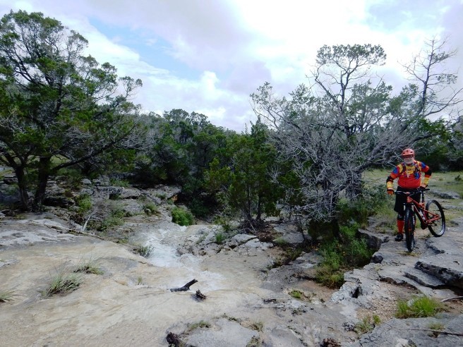
There were a lot of nice water features along the way during the June 4, 2016 ride. The heavy rains had everything flowing, yet the limestone trails were very easy to ride.
The bluff overlooking the river in the primitive camping area during the June 4, 2016 ride.
David on the bluff during the June, 2019 ride.
One of many creek crossing along the way during the June 4, 2016 ride.
Many nice cataracts too during the June 4, 2016 ride.
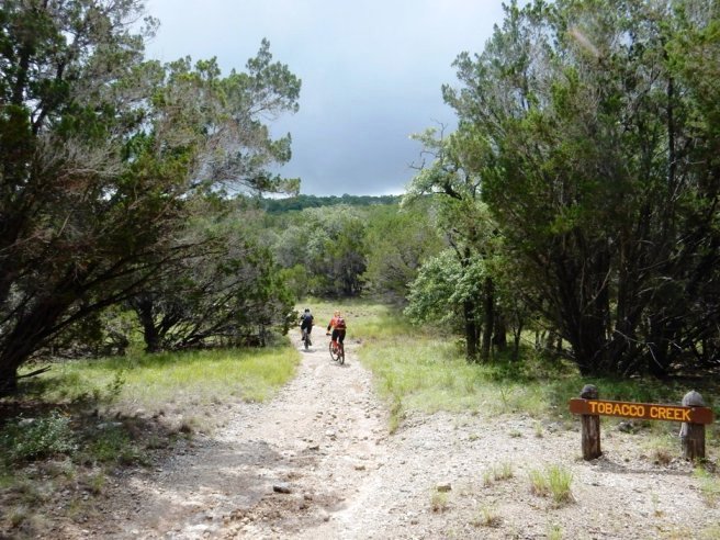
JJ and Darwin crossing Tobacco Creek during the June 4, 2016 ride.
JJ and Bruce at Jones Spring during the June 4, 2016 ride.
Darwin clearing a climb up out of another creek crossing during the June 4, 2016 ride.
JJ at the remains of a settler cabin in the park during the June 4, 2016 ride.
JJ crossing a sandy creek during the June 4, 2016 ride.
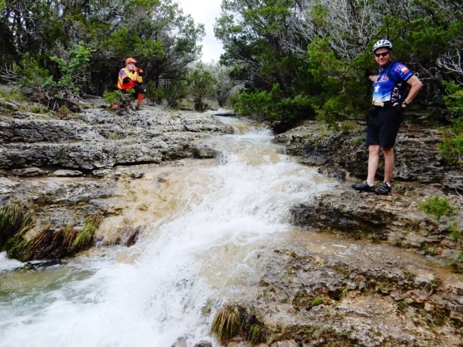
Bruce & JJ at a waterfall at a creek crossing during the June 4, 2016 ride. The trail crosses the top of the waterfall and turns back to the left.
Darwin negotiation a rocky creek crossing during the June 4, 2016 ride.
Typical trail conditions on Juniper Ridge from the June 22, 2019 ride below.
More of the Juniper Ridge Trail from the June 22, 2019 ride.
Bruce on a nice ledge they encountered on the Juniper Ridge Trail during the June 22, 2019 ride
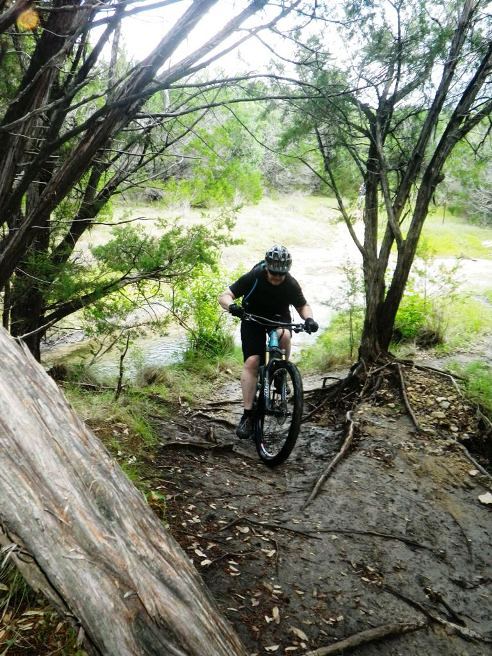
Finally, a photo of David crossing Bee Creek on the June 22, 2019 ride.
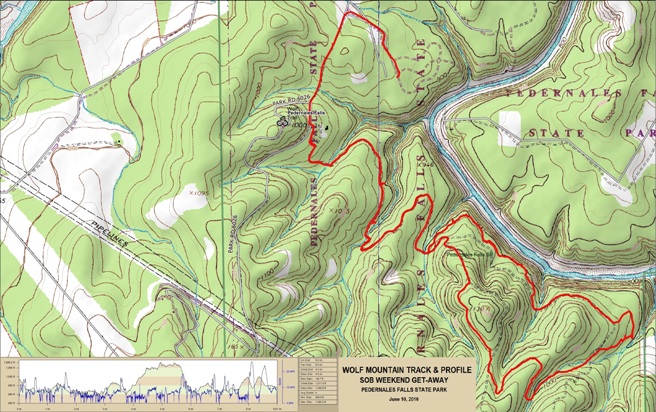
Hill Country, Pedernales Falls SP - Wolf Mt. Trail Pedernales Falls SP in the Texas Hill country in one of the premier state parks in Texas. It has several nice trails. Bruce rode the Wolf Mt. Trail on June 10, 2016.
The statistics for the Wolf Mountain ride are provided below
along with a map showing the track and profile and statistics. The
track and profile is for a lollipop ride from the campground.
Right click on the GPX link above to download a GPX file for this ride. The GPX file may want to save as an XML file, so if it does, change the extension to gpx before you save it. The file is a high-resolution track with points are every 10' created on the Delorme PN-60W GPS. You can right-click on the image below and use the "Save Target As" option to down-load a 1MB 11x17" PDF version of the map that can be printed. You can also click on the image to open it in a new window and zoom up to 200% for a detailed view.
The campsite with the trailer set, dining awning up, and Texas flag waving.
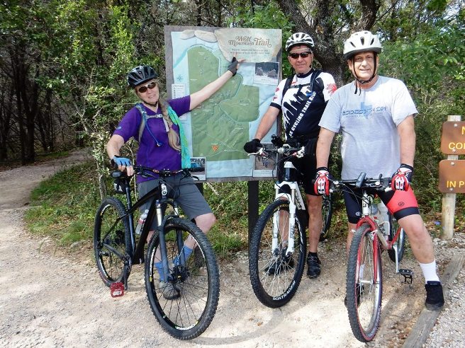
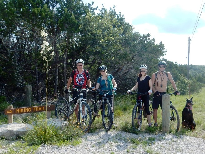
Below is the obligatory "group photo" at the start of the ride.
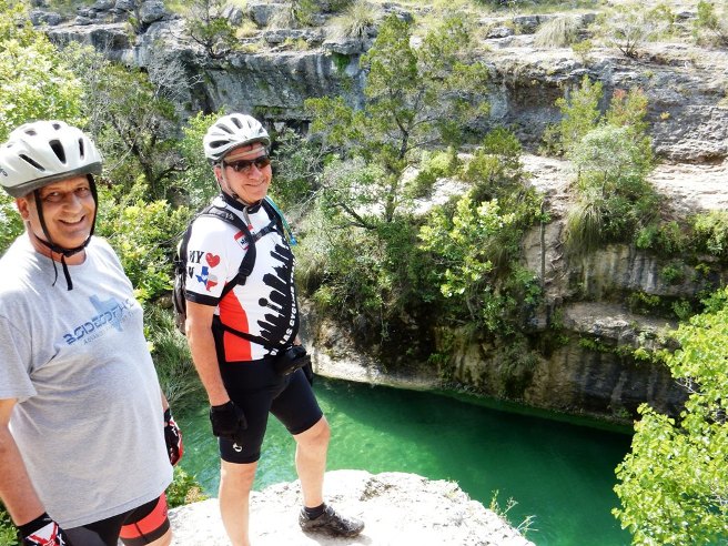
If you take the trail to the primitive camping area off the Wolf Mt. Trail, you encounter some spectacular views of the limestone bluffs the river has carved over eons.
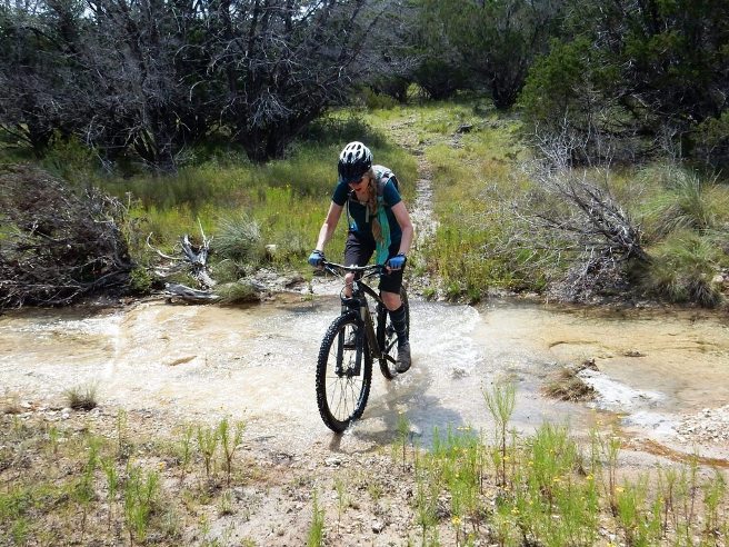
There are also plenty of fun creek crossings to splash through.
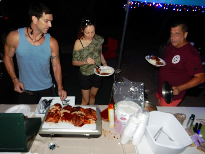
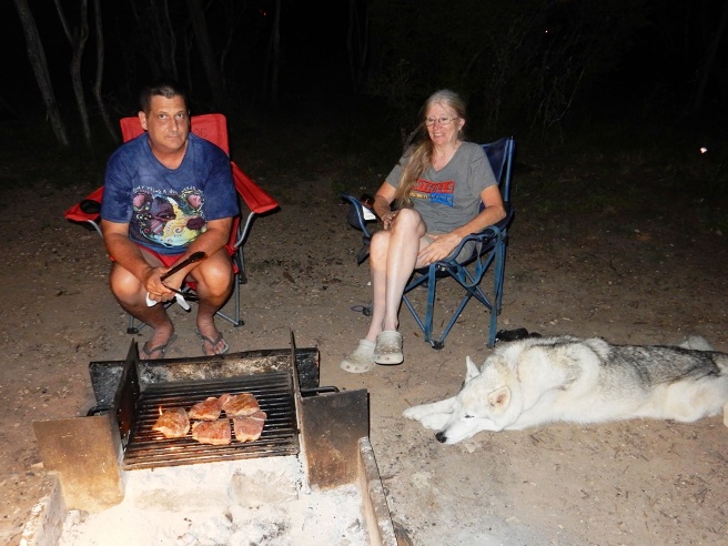
Dinner on Friday night was ribs, baked beans and coleslaw. Below is Matt, Victoria and Joel filling their plates.
Hill Country, Pedernales Falls SP - Madrone and Windmill Rd. Trails Pedernales Falls SP in the Texas Hill country in one of the premier state parks in Texas. It has several nice trails. Bruce rode the Madrone and Wolf Mt. Trails on June 11, 2016.
The statistics for the Madrone and Wolf Mt. ride are provided below
along with a map showing the track and profile and statistics. The
track and profile is for the clockwise direction. , but as
indicated, it became an out-and-back to the observation point due to
the heat.
Right click on the GPX link above to download a GPX file for this ride. The GPX file may want to save as an XML file, so if it does, change the extension to gpx before you save it. The file is a high-resolution track with points are every 10' created on the Delorme PN-60W GPS. You can right-click on the image below and use the "Save Target As" option to down-load a 1MB 11x17" PDF version of the map that can be printed. You can also click on the image to open it in a new window and zoom up to 200% for a detailed view.
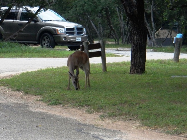
The deer at the campgrounds are fairly friendly. Here is one across the street from the campsite having breakfast.
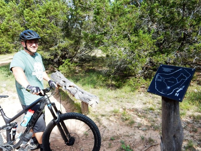
At the trail head, the group arranged for some hikers to snap the obligatory group photo at the start of the ride.
The Madrone is mostly flat and wooded, with plenty of shade. Below is Matt coming down the trail with Machi.
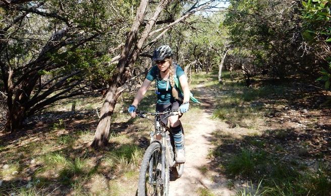
Next up was Lu Anne.
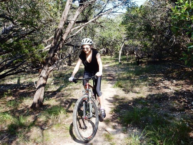
And last, but not least, is Victoria on the Madrone Trail near the parking lot on CR-201
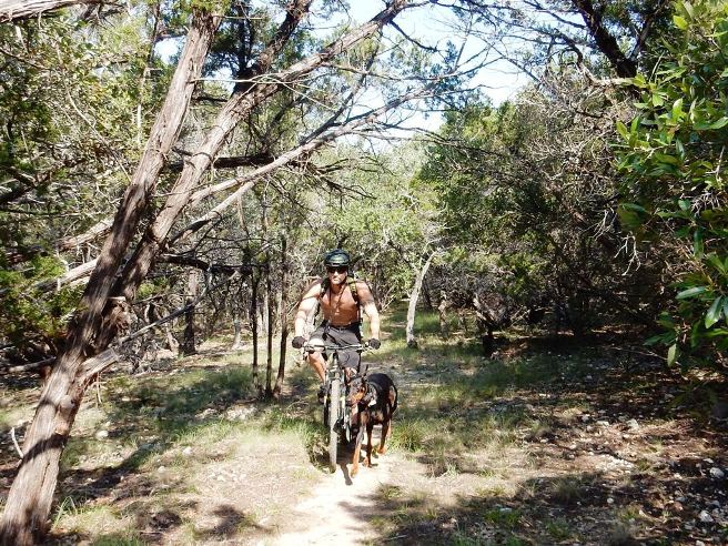
Machi was a great trail dog, leading the way for most of the ride.
Below is Bruce on a rocky descent on Madrone.
Just before Madrone crossed CR-201, the trail crossed a ledge and waterfall. The trails at Pedernales have several of these types of crossings.
After the long, fun descent, it was across another stream. Below in another photo of Lu Anne crossing a stream.
Just past the creek crossing, the group came to Jones' Spring. Below is Victoria and Matt, along with Machi cooling off in the crisp mountain water.
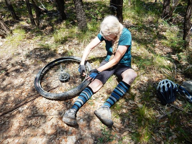
After leaving Jones' Spring, Lu Anne damaged a sidewall on a rock out cropping. Here she is doing a field conversion from tubeless to tube. She is a very competent rider and can maintain her own bike.
Lu Anne's bike is not set up for long climbs, and as a result, she ended up walking the last little bit of one hill on Windmill Hill Road. The vantage point provides a spectacular view of the Texas Hill Country.
Later that evening, it was time for dinner. Saturday night was "steak night". Below is Joel and Lu Anne watching the rib-eyes sizzle over a charcoal fire.
Off on the other side of the fire, Victoria and Matt were relaxing.
Below is Joel, Matt, Victoria and Lu Anne enjoying a rib-eye steak dinner with baked potato and corn on the cob.
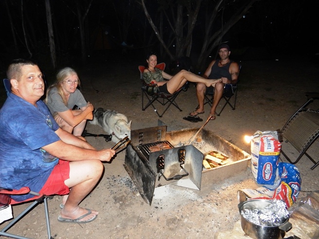
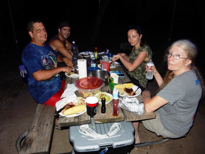
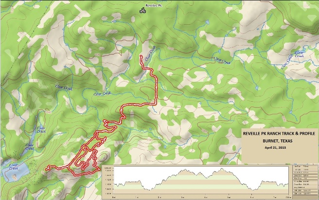
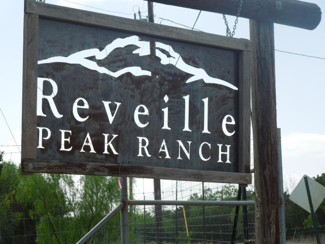
Pedernales Falls is a great place to camp and ride. The trails are beginner to intermediate level except for Juniper Ridge, which Bruce considers to be a single black diamond because of the rocks and roots. There are the Falls and river, which are very nice in the summer. Hill Country, Reveille Peak Ranch Reveille Peak Ranch is west of Burnet. This is a ranch that has been developed into a sports facility for XTERRA, running and mountain biking events. On April 21, 2013, Bruce rode Reveille Peak Ranch, one of the top trail systems in Texas. It is ranked #3 on the list of Ten Trails Worth the Drive by MountainBikeTx.com. The Ranch is reached by taking SR-29 3.4 miles west from Burnet and turning right on CR-2341. Follow CR-2341 for 4.5 miles and fork left on CR-114. The entrance to the Ranch will be about 400' on you left just after you turn.
The statistics for the Reveille Peak Trail ride are provided below along
with a map showing the track and profile and statistics. The track
and profile is for the clockwise direction. Reverse it for a
counter-clockwise ride.
Right click on the GPX link above to download a GPX file for this ride. The GPX file may want to save as an XML file, so if it does, change the extension to gpx before you save it. The file is a high-resolution track with points are every 10' created on the Delorme PN-60W GPS. You can right-click on the image below and use the "Save Target As" option to down-load a 1MB 11x17" PDF version of the map that can be printed. You can also click on the image to open it in a new window and zoom up to 200% for a detailed view.
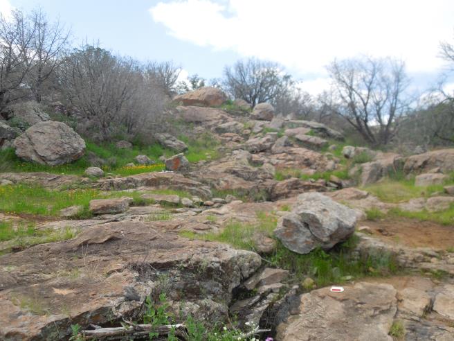
This is the kind of trail on which you will use all your gears due to the tight, twisty and rocky terrain. Some of the climbs are steep, but are short. The 2 hr., 34 min. ride time also includes time to stop and read the map and take photos. Reveille Peak Ranch is 60 miles west of Austin near Lake Buchanan.
Below is a photo of the Pavilion and staging area for a Terra Firma X-Terra race that was just winding down.
The trail looked rather tame at first.
The further in you go, the rougher and rockier it gets.
Eventually, the trail on the Reveille Peak Loop turned to mostly rock. At this point it was reminding Bruce of the slick rock in Utah. It even had hole with water.
Below is a steep climb up a BIG rock and a "squeeze" between some substantial rocks on top.
In other places you had to squeeze through. The trail shown below goes to the left through the gap in the rocks.
There are several open rock gardens with relatively ridable sections of single track. In the one below, the trail turns back to the right behind the two boulders in the middle of the photo. Then it was back to slick rock seen on the right side of the photo.
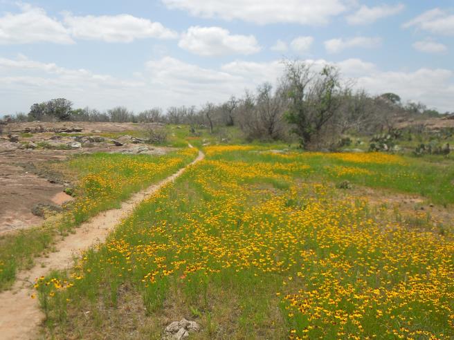
The ride took place in April, and the wild-flowers were were in full bloom in several places.
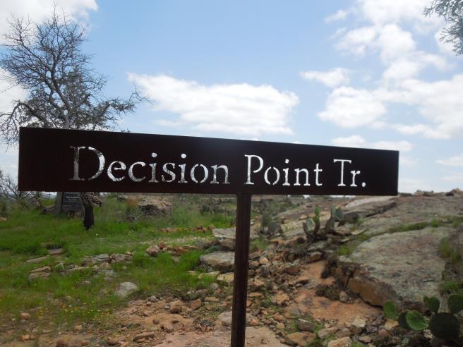
The trails alternate between nice (above) and gnarly (below). Further on there is more rocky trail to test your skills and fitness. The trail below goes to the right of the highway reflector on the rock, around the rock in the foreground and ends up on top of the rock pile via a switchback.
Finally, you reach the top and Decision Pt.
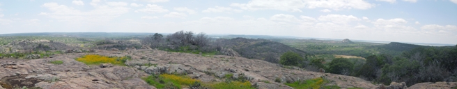
Below is a panorama from Decision Pt.
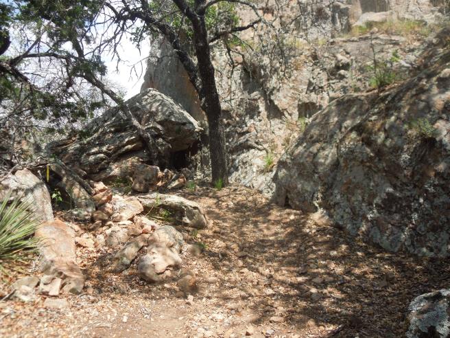
Then it was back down, weaving your way through some pretty good sized rocks.
In one place, the trail followed a cliff by a rock wall.
This was a great ride. The trails were fun, although, they could have been better marked. Hill Country, Rocky Hill Ranch
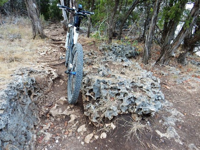
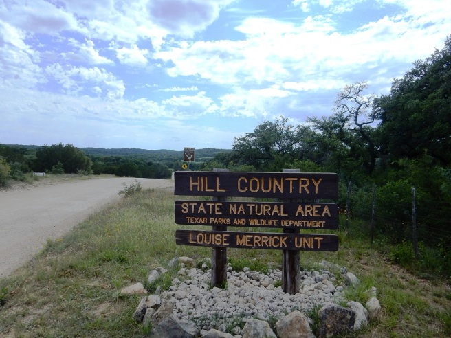
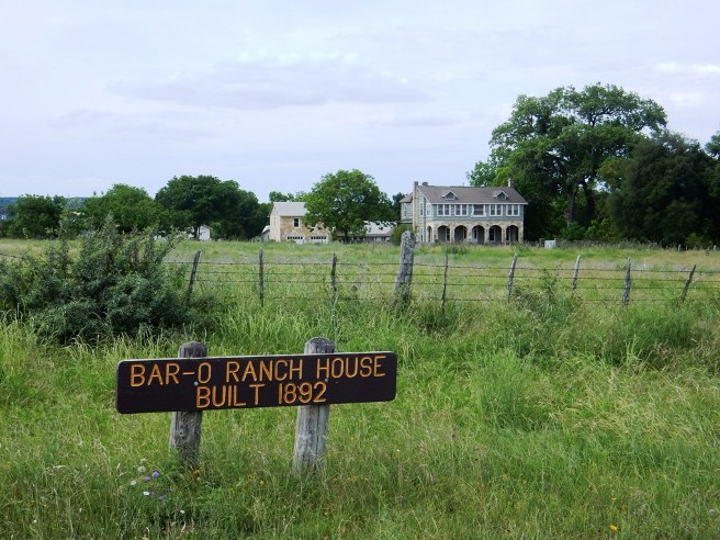
Hill Country, Hill Country State Natural Area Bruce rode the Hill Country SNA is west of San Antonio and south of Bandera on May 7, 2016 while working in Houston. This land was originally the 5,370 acre Bar-O ranch. There are approximately 40 miles of trails, with a 50/50 mix of single and double track. Most of the double track is ATV trail, although motorized vehicles are not permitted on the trails. HCSNA is ranked number 10 by MountainBikeTx.com as the Top 10 trail systems in Texas most worth the drive. This is a multi-use trail system heavily used by horse riders. You can avoid most of the equestrian traffic by sticking to the narrower, rockier trails.
The statistics for the HC SNA Trail ride are not available since
Bruce forgot his GPS.
Right click on the GPX link above to download a GPX file for this ride. The GPX file may want to save as an XML file, so if it does, change the extension to gpx before you save it. The file is a high-resolution track with points are every 10' created on the Delorme PN-60W GPS. You can right-click on the image below and use the "Save Target As" option to down-load a 1MB 11x17" PDF version of the map that can be printed. You can also click on the image to open it in a new window and zoom up to 200% for a detailed view. (Insert Track-Profile map with link to tabloid-sized PDF) This is the kind of trail on which you will use all your gears, and spend a lot of time in 1-1. The grades are not impossibly steep, but go on for some distance, making it necessary to slow down to a sustainable climbing pace. You have arrived!
The HC SNA used to be the Bar-O Ranch and this is the original ranch house.
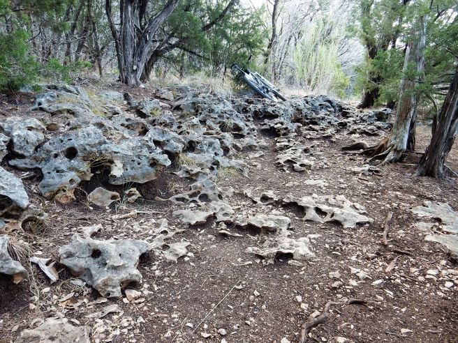
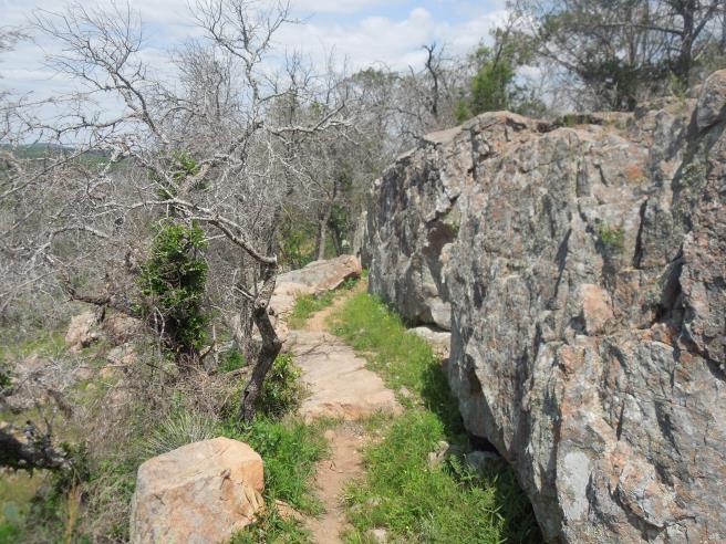
Welcome to the rocky trails of the Hill Country.
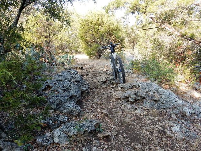
Not all the trails are rocky and all the intersections are well marked.
Then there is stuff like this. In my prime I could have cleared this. As a senior, I walked it.
Not farther on was a nice rocky down-hill run. Dropped the seat post and let it rip!
There were also some long, rocky climbs. The small ring and OneUp 42T rear cog came in really handy here.
All in all, the trails were challenging, but fun.
Many parts of the trail system offered great views.
A panoramic of the previous photo. The Texas Hill Country is a great place to relax.
Another rocky down-hill. The best line is to the right.
And another typical rocky climb.
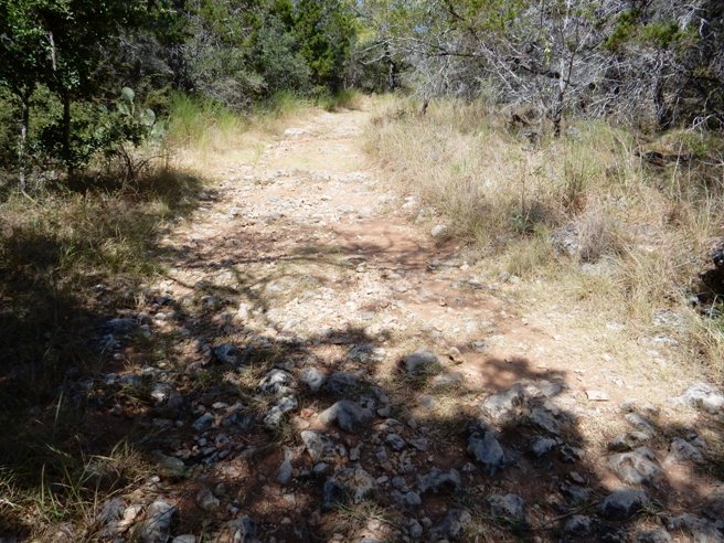
Not everything is rocky. There are a lot of sections of smooth trail too.
Then there is this! Unfortunately I left my superpowers in the truck and had to walk this one too. There is a line to the right used by super heroes.
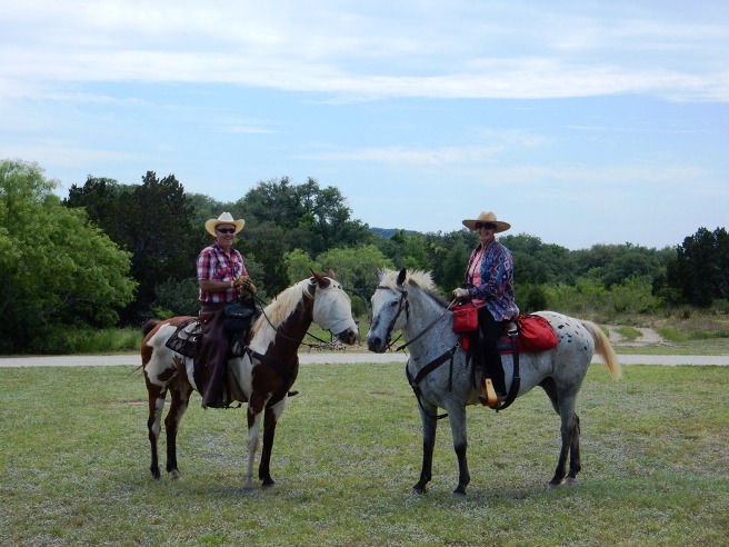
A couple of riders I met at the trail-head at the end of the ride. The Pinto is wearing a sun-shield.
San Antonio, North Salado Creek Trail Bruce was in San Antonio on business and rode the North Salado Creek Trail after wrapping up business Friday afternoon, April 19, 2013.
There is no track, profile or statistics for this ride as Bruce
didn't have the GPS recording at the time. A track, profile and
statistics will be added after the next ride.
This is a typical urban trail with narrow, twisty sections and some rough climbs and descents. The photo below shows Peter, a local rider I met at the trail head who offered to give me a tour of the trail system.
Description of following photo.
Below is a photo of Peter's bike up on the bluffs out at the end of the trail.
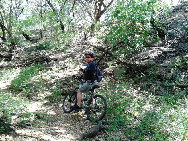
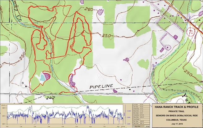
South Texas, Columbus, Hanna-Stillman Ranch Bruce met another rider, Russ Hana, while working in the Houston area. Russ is an avid mountain biker and Cat-1 racer, so it was only natural he build a trail on the family ranch. Russ invited the Houston Dirty SOBs (Seniors on Bikes) to ride the private trail on the Hanna - Stillman Ranch on July 17, 2017. Russ himself is an older rider, having recently retired from work and mountain bike racing.
The statistics for the Hanna - Stillman Ranch Trail ride are provided below along
with a map showing the track and profile and statistics.
Right click on the GPX link above to download a GPX file for this ride. The GPX file may want to save as an XML file, so if it does, change the extension to gpx before you save it. The file is a high-resolution track with points are every 10' created on the Delorme PN-60W GPS. You can right-click on the image below and use the "Save Target As" option to down-load a 1MB 11x17" PDF version of the map that can be printed. You can also click on the image to open it in a new window and zoom up to 200% for a detailed view.
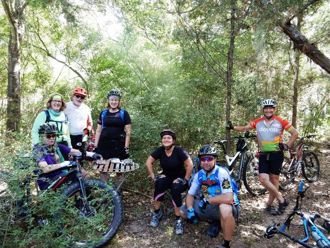
This is a tight, twisty trail through the scrub trees of South Texas. The photo below shows the riders in the group. Russ is on the right holding up a tree.
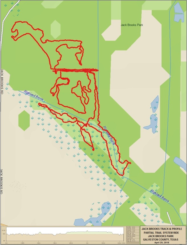
This is a fun little trail and great for social rides, especially in the summer since most of it is shaded. South Texas, Galveston, Jack Brooks Bruce rode the Jack Brooks Trails throughout 2017 and 2018 while working in the Houston area. This trail system is built in the low, flat terrain of South Texas a few miles north of the Gulf of Mexico. There are approximately 6.6 miles of the rootyist trails and steepest climbs Bruce ever encountered. The trail system gets it features from the dredging done there years ago to drain the land. There are numerous "spoil" piles from the dredging that have become overgrown with trees, and this is what gives the trail "ups and downs". Dragon's Back is a prime example. Picture a trail down a series of dirt piles twenty or more feet high and you get the idea.
The statistics for the Jack Brooks Trail ride are provided below along with a map showing
the track and profile and statistics.
Right click on the GPX link above to download a GPX file for this ride. The GPX file may want to save as an XML file, so if it does, change the extension to gpx before you save it. The file is a high-resolution track with points are every 10' created on the Delorme PN-60W GPS. You can right-click on the image below and use the "Save Target As" option to down-load a 1MB 8-1/2 x 11" PDF version of the map that can be printed. You can also click on the image to open it in a new window and zoom up to 200% for a detailed view.
This is the kind of trail on which you will use all your gears, and spend a lot of time in 1-1. There are a number of short, steep climbs that challenge even the best riders. In addition to being steep, most are full of exposed roots adding to the challenge. Jack Brooks is the "Rootyist" trail Bruce has ever ridden, and was sure glad he was riding a full suspension bike. Bugs are another feature of the Jack Books Park trail system. The locals call themselves the Spider Riders since the park is home to the Golden Orb spider. These spiders get the size of your hand, so you definitely do not want to be the first rider in the morning.
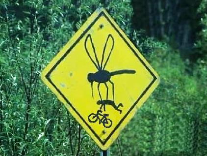
In addition to spiders, the park has one of the best mosquito populations in South Texas. If you are not fully covered in Repel MAX, they will carry you off. If you want to ride these trails, plan on a mid-day ride at a drier time of year when the mosquitoes are not so bad.
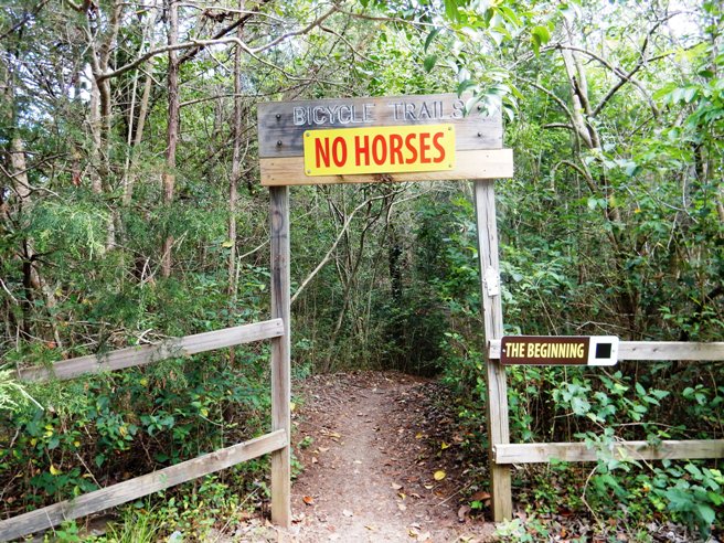
There are 18 trails in the trail system, beginning at the parking lot. The first trail is appropriately named The Beginning.
Between the entrance and Crossroads, you encounter about six rooty climbs and one really nice bridge. The steward uses roofing paper for traction when the wood is wet.
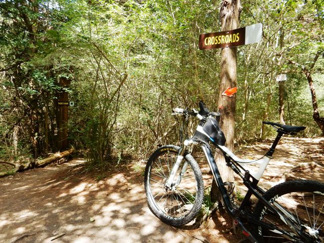
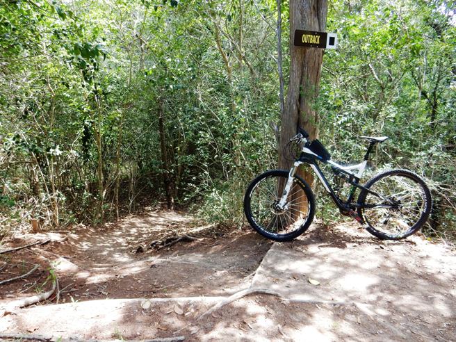
After the rooty climbs and bridge, you arrive at Crossroads. This is a major junction in the trail system with three trails either entering or leaving this point. They include: The Beginning, There's More, Outback and the approach to Hell I across the Golden Gate Bridge. The bike in the photo below is pointed down the There's More trail which eventually joins with the Hobo Camp Trail. This part of the trail system is flat and only moderately rooty.
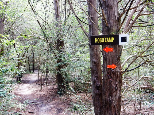
The Hobo Camp loop branches off to the left at its intersection with There's More.
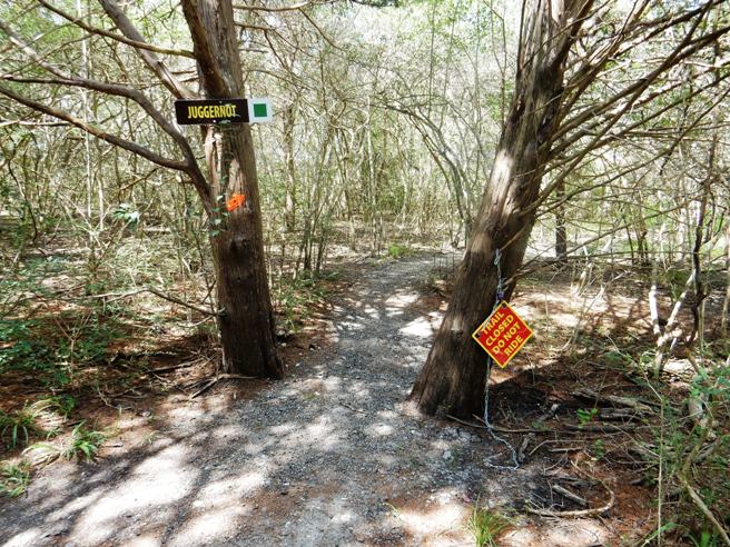
Hobo Camp eventually rejoins There's More and a bit further down you take a right onto Juggernot.
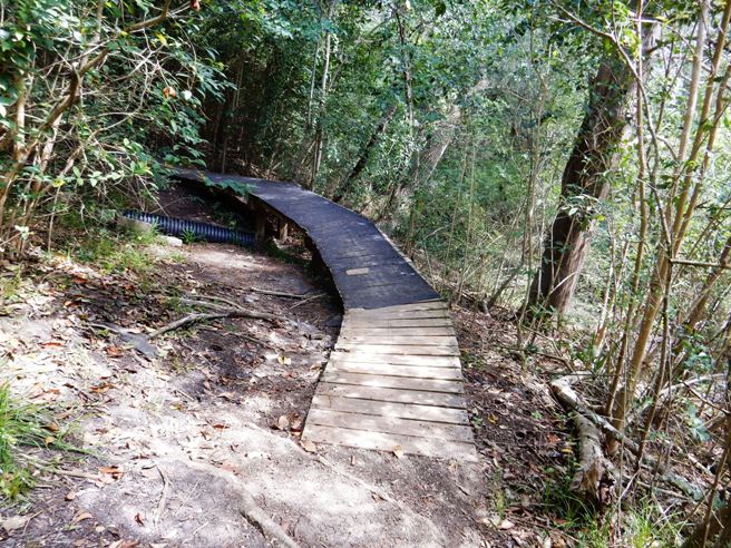
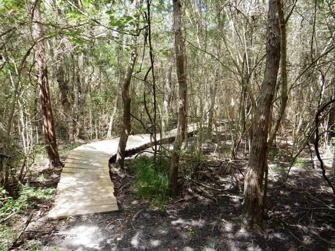
Since the park and trail system is in Galveston County, parts of it are low, so board walks have been constructed through areas that do not dry out very quickly.
At the end of Juggernot, you come to the big slide. This is a creek crossing followed by a very steep climb, hard right turn at the top and a steep rooty drop.
Once you have negotiated the Big Slide, it is on to Outback. This is a twisty trail with another half dozen rooty climbs.
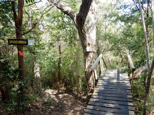
Outback takes you back to Crossroads. From there, it across the Golden Gate, down Hell I and down the Spider Bridge. This is a steep man-made technical trail feature that gives you a real adrenalin rush. The trail name describes the ride experience quite well.
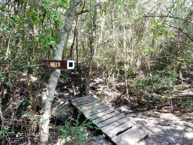
Hell I connects to Dragon's Back, another appropriately named trail with lots of rooty ups and downs. Part way through Dragon's Back, you take a diversion onto a flat trail named Hermit's Run and then back to Dragon's Back. From there, it is on to Hell II. The warm-up on Hell I gets you ready for Hell II.
From Hell II, it is on to The Autobahn, By-Pass, Brickyard, The Never Ending Trail, back onto Autobahn and then finishing up on Home Stretch. There has been a lot said about the rooty climbs on this trail system. The photo below shows one of the dozens of climbs at Jack Brooks.
Here is another example of the rooty climbs to expect on this trail system.
South Texas, Houston, Anthills Bruce rode the (Name) Trail on Month day, 201x while working in the Houston area. (Background on the trail system) There are approximately xx miles of trails, with a 50/50 mix of single and double track. Most of the double track is ATV trail, although motorized vehicles are not permitted on the trails. (Trail Name) is ranked number xx by MountainBikeTx.com as the Top 10 trail systems in Texas most worth the drive. This is a multi-use trail system heavily used by horse riders.
The statistics for the (Name) Trail ride are provided below along with a map showing
the track and profile and statistics.
Right click on the GPX link above to download a GPX file for this ride. The GPX file may want to save as an XML file, so if it does, change the extension to gpx before you save it. The file is a high-resolution track with points are every 10' created on the Delorme PN-60W GPS. You can right-click on the image below and use the "Save Target As" option to down-load a 1MB 11x17" PDF version of the map that can be printed. You can also click on the image to open it in a new window and zoom up to 200% for a detailed view. (Insert Track-Profile map with link to tabloid-sized PDF) This is the kind of trail on which you will use all your gears, and spend a lot of time in 1-1. The grades are not impossibly steep, but go on for some distance, making it necessary to slow down to a sustainable climbing pace.
TX_20160709_104542_Anthills
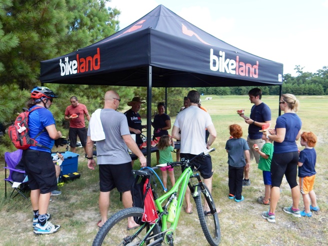
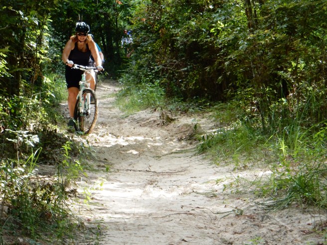
South Texas, Houston, Cypress Creek Bruce rode the Cypress Creek Trail on following dates while working at NASA in the Houston area. March 5, July 24, September 25, November 5 in 2016, and January 7, 2018. Since the was one of the most popular local trails in the Houston area, there were numerous rides in 2017, but these were not documented. There are approximately 9.2 miles of trails, mostly single track. The trail is mostly flat through the woods, although there are several deep and wide creek crossings that are challenging and thrilling. Cypress Creek is ranked as the number 1 trail in Texas by MTBProject although Bruce believes the ranking is highly overrated. This is a multi-use trail system occasionally used by horse riders.
The statistics for the Cypress Creek Trail ride are provided below along with a map showing
the track and profile and statistics.
Right click on the GPX link above to download a GPX file for this ride. The GPX file may want to save as an XML file, so if it does, change the extension to gpx before you save it. The file is a high-resolution track with points are every 10' created on the Delorme PN-60W GPS. You can right-click on the image below and use the "Save Target As" option to down-load a 1MB 11x17" PDF version of the map that can be printed. You can also click on the image to open it in a new window and zoom up to 200% for a detailed view.
This is the kind of trail on which you will stay in your middle gears. Most of the trail flat to undulating with a few creek crossings that will require your climbing gears. Most of the rides were organized by Bikeland who also provide refreshments.
Below is Sarah and Debi on the January 7, 2018 ride, a couple of Bruce's friends from Switzerland, along with Candice from the Houston area.
Some of the trails can get a bit sandy in places.
The ladies like this trail system since it is not too technical. Below is Lu Anne on the July 24, 2016 ride.
Shelly was not far behind Lu Anne.
Debi climbing out of one of the creek crossings on the January 7, 2018 ride.
A local rider on climbing out of a creek crossing on the November 5, 2016 ride.
Sarah on one of the many technical trail features at Cypress Creek during the January 7, 2018 ride.
Bruce on one of the technical trail features at Cypress Creek during the September 25, 2016 ride.
Bruce on another one of the technical trail features at Cypress Creek during the January 7, 2018 ride.
South Texas, Houston, Cypress Wood: Bruce rode the (Name) Trail on Month day, 201x while working in the Houston area. (Background on the trail system) There are approximately xx miles of trails, with a 50/50 mix of single and double track. Most of the double track is ATV trail, although motorized vehicles are not permitted on the trails. (Trail Name) is ranked number xx by MountainBikeTx.com as the Top 10 trail systems in Texas most worth the drive. This is a multi-use trail system heavily used by horse riders.
The statistics for the (Name) Trail ride are provided below along with a map showing
the track and profile and statistics.
Right click on the GPX link above to download a GPX file for this ride. The GPX file may want to save as an XML file, so if it does, change the extension to gpx before you save it. The file is a high-resolution track with points are every 10' created on the Delorme PN-60W GPS. You can right-click on the image below and use the "Save Target As" option to down-load a 1MB 11x17" PDF version of the map that can be printed. You can also click on the image to open it in a new window and zoom up to 200% for a detailed view. (Insert Track-Profile map with link to tabloid-sized PDF) This is the kind of trail on which you will use all your gears, and spend a lot of time in 1-1. The grades are not impossibly steep, but go on for some distance, making it necessary to slow down to a sustainable climbing pace.
TX_20180218_01_Cypresswood TX_20180908_081016_Cypresswood
South Texas, Houston, Sugarland, Brazos: 21 Bruce rode the (Name) Trail on Month day, 201x while working in the Houston area. (Background on the trail system) There are approximately xx miles of trails, with a 50/50 mix of single and double track. Most of the double track is ATV trail, although motorized vehicles are not permitted on the trails. (Trail Name) is ranked number xx by MountainBikeTx.com as the Top 10 trail systems in Texas most worth the drive. This is a multi-use trail system heavily used by horse riders.
The statistics for the (Name) Trail ride are provided below along with a map showing
the track and profile and statistics.
Right click on the GPX link above to download a GPX file for this ride. The GPX file may want to save as an XML file, so if it does, change the extension to gpx before you save it. The file is a high-resolution track with points are every 10' created on the Delorme PN-60W GPS. You can right-click on the image below and use the "Save Target As" option to down-load a 1MB 11x17" PDF version of the map that can be printed. You can also click on the image to open it in a new window and zoom up to 200% for a detailed view. (Insert Track-Profile map with link to tabloid-sized PDF) This is the kind of trail on which you will use all your gears, and spend a lot of time in 1-1. The grades are not impossibly steep, but go on for some distance, making it necessary to slow down to a sustainable climbing pace.
TX_20170721_085723_cc_Sugarland_Brazos
South Texas, Houston, Sugarland, New Territory: 22 Bruce rode the (Name) Trail on Month day, 201x while working in the Houston area. (Background on the trail system) There are approximately xx miles of trails, with a 50/50 mix of single and double track. Most of the double track is ATV trail, although motorized vehicles are not permitted on the trails. (Trail Name) is ranked number xx by MountainBikeTx.com as the Top 10 trail systems in Texas most worth the drive. This is a multi-use trail system heavily used by horse riders.
The statistics for the (Name) Trail ride are provided below along with a map showing
the track and profile and statistics.
Right click on the GPX link above to download a GPX file for this ride. The GPX file may want to save as an XML file, so if it does, change the extension to gpx before you save it. The file is a high-resolution track with points are every 10' created on the Delorme PN-60W GPS. You can right-click on the image below and use the "Save Target As" option to down-load a 1MB 11x17" PDF version of the map that can be printed. You can also click on the image to open it in a new window and zoom up to 200% for a detailed view. (Insert Track-Profile map with link to tabloid-sized PDF) This is the kind of trail on which you will use all your gears, and spend a lot of time in 1-1. The grades are not impossibly steep, but go on for some distance, making it necessary to slow down to a sustainable climbing pace.
TX_20170812_00_New_Terr_Ride TX_20170819_01_New_Terr_Ride
South Texas, Houston, Sugarland, Oyster Creek: 23 Bruce rode the (Name) Trail on Month day, 201x while working in the Houston area. (Background on the trail system) There are approximately xx miles of trails, with a 50/50 mix of single and double track. Most of the double track is ATV trail, although motorized vehicles are not permitted on the trails. (Trail Name) is ranked number xx by MountainBikeTx.com as the Top 10 trail systems in Texas most worth the drive. This is a multi-use trail system heavily used by horse riders.
The statistics for the (Name) Trail ride are provided below along with a map showing
the track and profile and statistics.
Right click on the GPX link above to download a GPX file for this ride. The GPX file may want to save as an XML file, so if it does, change the extension to gpx before you save it. The file is a high-resolution track with points are every 10' created on the Delorme PN-60W GPS. You can right-click on the image below and use the "Save Target As" option to down-load a 1MB 11x17" PDF version of the map that can be printed. You can also click on the image to open it in a new window and zoom up to 200% for a detailed view. (Insert Track-Profile map with link to tabloid-sized PDF) This is the kind of trail on which you will use all your gears, and spend a lot of time in 1-1. The grades are not impossibly steep, but go on for some distance, making it necessary to slow down to a sustainable climbing pace. TX_20170422_01_mr_Sugarland_Oyster_Cr
South Texas, Huntsville, Double Lake: 24 Bruce rode the (Name) Trail on Month day, 201x while working in the Houston area. (Background on the trail system) There are approximately xx miles of trails, with a 50/50 mix of single and double track. Most of the double track is ATV trail, although motorized vehicles are not permitted on the trails. (Trail Name) is ranked number xx by MountainBikeTx.com as the Top 10 trail systems in Texas most worth the drive. This is a multi-use trail system heavily used by horse riders.
The statistics for the (Name) Trail ride are provided below along with a map showing
the track and profile and statistics.
Right click on the GPX link above to download a GPX file for this ride. The GPX file may want to save as an XML file, so if it does, change the extension to gpx before you save it. The file is a high-resolution track with points are every 10' created on the Delorme PN-60W GPS. You can right-click on the image below and use the "Save Target As" option to down-load a 1MB 11x17" PDF version of the map that can be printed. You can also click on the image to open it in a new window and zoom up to 200% for a detailed view. (Insert Track-Profile map with link to tabloid-sized PDF) This is the kind of trail on which you will use all your gears, and spend a lot of time in 1-1. The grades are not impossibly steep, but go on for some distance, making it necessary to slow down to a sustainable climbing pace.
TX_20160618_01_DoubleLake TX_20180121_111425_Double_Lake_JJ TX_20180223_171018_Double_Lake_GHORBA-TMBRA_BRC TX_20180225_135952_Double_Lake_GHORBA-TMBRA_BRC
South Texas, Huntsville State Park: 25 The trail system at Huntsville State Park is one of the more popular trail systems in South Texas, and Bruce rode it numerous times while working in the Houston area. Huntsville is a very popular camping destination, son many times these rides were part of a 3-4 dey camping trip. (Background on the trail system) The trails is approximately xx miles of trails in the park, and the typical ride loop consists of the (Name trails) The trails are predominately single track with some sections of double track. Huntsville trail system is ranked number xx by MountainBikeTx.com as the Top 10 trail systems in Texas most worth the drive. This is a multi-use trail system also heavily used by hikers.
The statistics for the (Name) Trail ride are provided below along with a map showing
the track and profile and statistics.
Right click on the GPX link above to download a GPX file for this ride. The GPX file may want to save as an XML file, so if it does, change the extension to gpx before you save it. The file is a high-resolution track with points are every 10' created on the Delorme PN-60W GPS. You can right-click on the image below and use the "Save Target As" option to down-load a 1MB 11x17" PDF version of the map that can be printed. You can also click on the image to open it in a new window and zoom up to 200% for a detailed view. (Insert Track-Profile map with link to tabloid-sized PDF) This is the kind of trail on which you will use most, but not all your gears. The grades are gradual for the most part, and a few go on for some distance. Parts of the trail system have loose sand for an additional challenge. There are also a number of bridges and board-walks crossing creeks and low areas.
TX_20160915_01_Huntsville_SP TX_20160916_01_Huntsville_SP TX_20160917_01_Huntsville_SP TX_20161113_01_Huntsville_SP_Bileland
West Texas, Buck Cr., Abilene: 26 Bruce rode the Buck Creek Trail system in Abilene while competing in the Bent Wheel Bash. The Bent Wheel Bash is a Texas Mountain Bike Racing Association (TMBRA) race. While working for NASA in Houston, Bruce would ride with Scott Schaefer, the President of TMBRA. Scott asked Bruce if he raced and he said not since he turned 65 in 2012 citing the difficulty of competing against the 60 year old riders. Scott indicated TMBRA had 70+ men's open class, so Bruce decided to give it a go. The other riders normally competing in the 70+ class did not show for this race, to Bruce raced the course and took 1st place. The race course was 11 miles long, and Bruce's class raced 2 laps. The race course was predominately single track with a section of double track at the start.
The statistics for the Buck Creek Trail ride are provided below along with a map showing
the track and profile and statistics.
Right click on the GPX link above to download a GPX file for this ride. The GPX file may want to save as an XML file, so if it does, change the extension to gpx before you save it. The file is a high-resolution track with points are every 10' created on the Delorme PN-60W GPS. You can right-click on the image below and use the "Save Target As" option to down-load a 1MB 11x17" PDF version of the map that can be printed. You can also click on the image to open it in a new window and zoom up to 200% for a detailed view. (Insert Track-Profile map with link to tabloid-sized PDF) This is the kind of trail on which you will use most, but not all your gears. The grades are gradual for the most part, and a few go on for some distance. Parts of the trail system have loose sand for an additional challenge. There are also a number of bridges and board-walks crossing creeks and low areas.
TX_20200301_01_Abilene_Bent_Wheel_Bash TX_20200301_02_Abilene_Bent_Wheel_Bash TX_20200301_03_Abilene_Bent_Wheel_Bash TX_20200301_04_Abilene_Bent_Wheel_Bash
|
|
Version 0.4, October 7 2019 |