|
|
|
Mountain Biking In OREGON The following is descriptions and photos of the trails Bruce has ridden in Oregon. These trails were ridden over several months in 2012 while working on the Statewide Radio System there. Scroll down for a complete list of rides and summaries, and use the links in the in the summaries to go to descriptions and photos for the specific trails and rides. Silver Falls: (date) This park and trail has several mountain bike trails, and while they are not very technical, they are pretty serious in the amount of climbing and descending involved. Trail 2 name: dates and summary Waldo Lake: (date) This trail is also an IMBA EPIC Bruce rode. It is a an intermediate-level trail system ranked No. 508 in the world. This is the trail where Bruce had his one and only riding accident landing him in the hospital. McKenzie River: Bruce was not able ride this trail on his previous visit in 2012, but finally did have an opportunity to ride it on April 16th during a business trip in 2016. (summary) In the Fall of 2012, Bruce was working in Oregon and rode a few trails out there. The first was Silver Falls State Park east of Salem, and was ridden as a group ride with the Salem Oregon Mountain Biking Association (SOMBA).
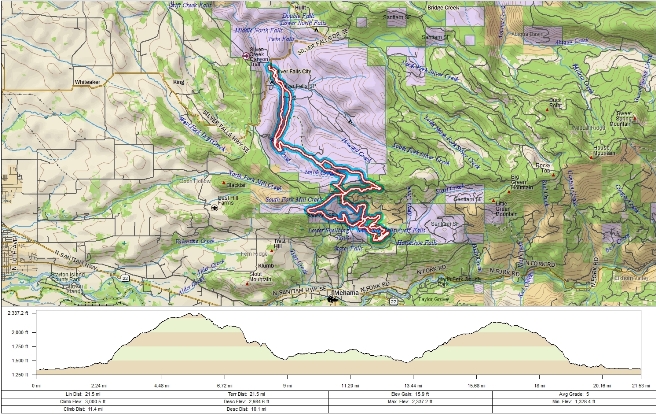
The statistics for the Silver Falls Trail ride are provided below along
with a map showing the track and profile and statistics. The track
and profile is for the clockwise direction. Reverse it for a
counter-clockwise ride.
Right click on the GPX link above to download a GPX file for this ride. The GPX file may want to save as an XML file, so if it does, change the extension to gpx before you save it. The file is a high-resolution track with points are every 10' created on the Delorme PN-60W GPS. You can right-click on the image below and use the "Save Target As" option to down-load a 1MB 11x17" PDF version of the map that can be printed. You can also click on the image to open it in a new window and zoom up to 200% for a detailed view.
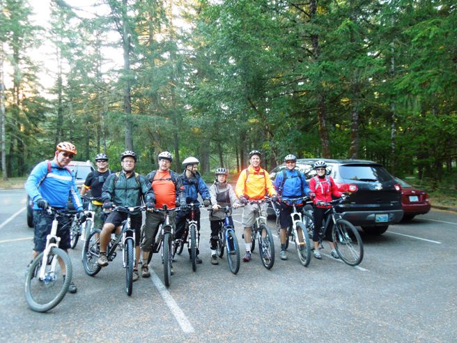
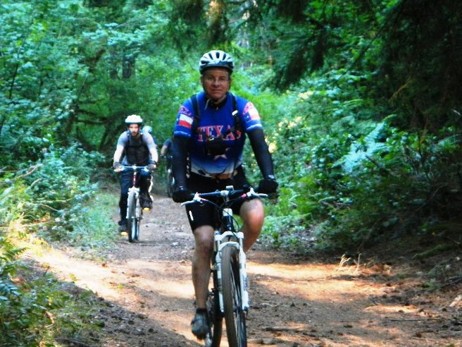
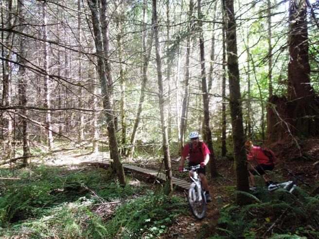
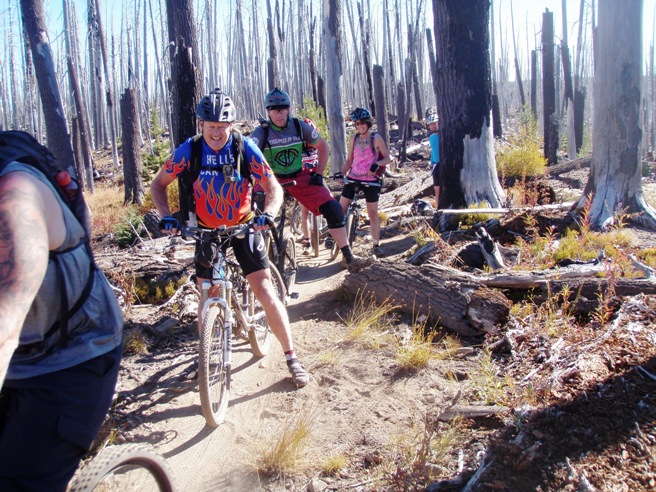
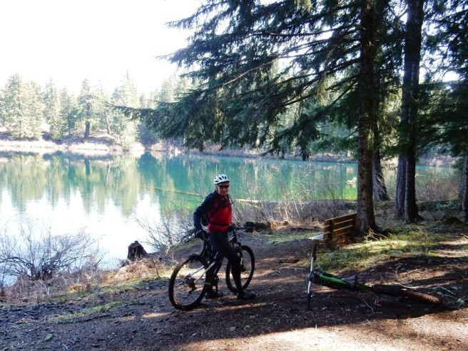
The trail system at Silver Falls can be pretty much anything you want it to be. The ride on Labor Day weekend, 2012, combined several trails for a total of 21.5 miles and 3,000' of climbing. The trails parallel each other and are like an "out and back" but only one section is ridden both ways. The initial climb on this route is a continuous climb four miles in length. Bruce refers to this as the "four-mile trial". Below is the group from the Salem Oregon Mountain Bike Association (SOMBA) at the beginning of the ride.
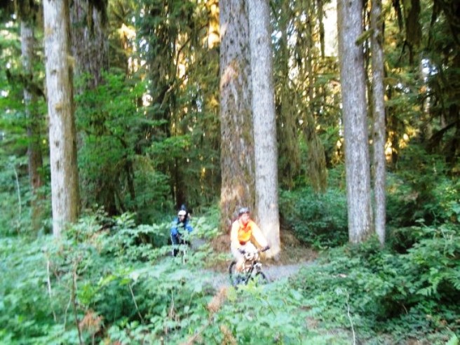
One of the first things you discover is that the trees are very tall.
The trees are also very big. Clearing a downed tree is a real chore in Oregon.
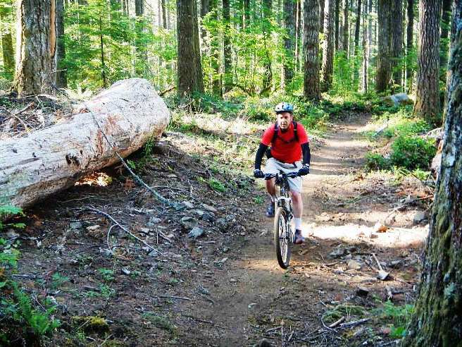
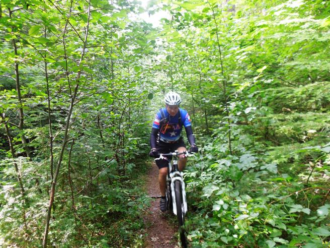
For the most part, the trails are wide and smooth. Below is Bruce cruising along.
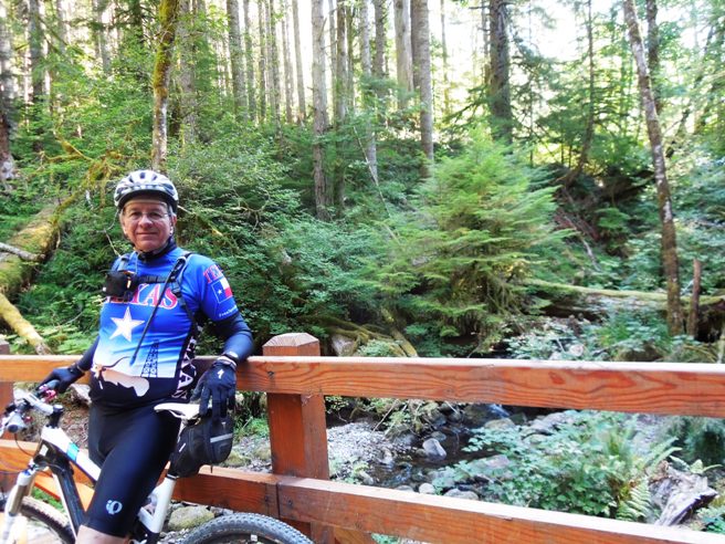
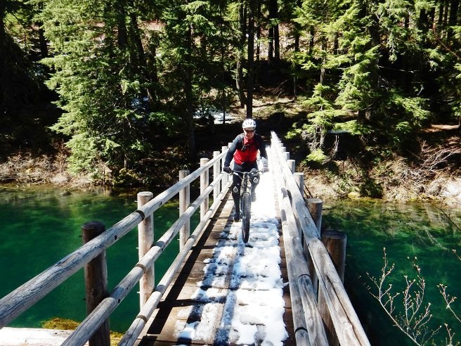
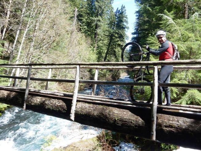
Below is Bruce stopping for a "photo-op" on one of the many bridges.
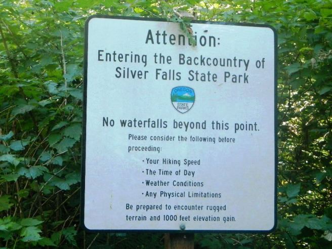
The other thing Bruce learned riding in Oregon is that the rides are long. Below is a warning sign for hikers that the trail ahead is rugged with a lot of climbing.
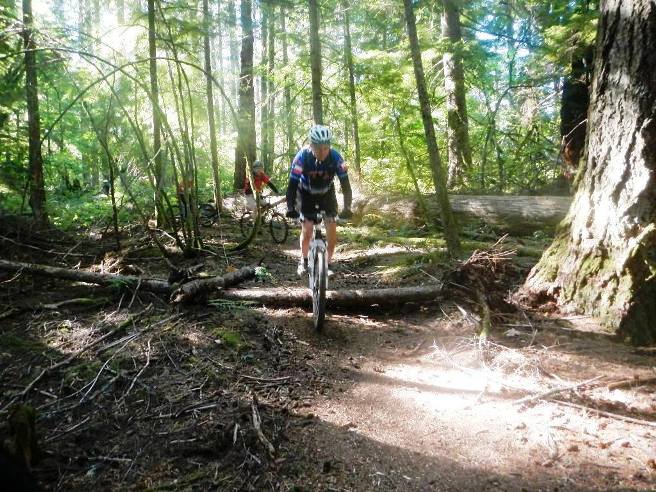
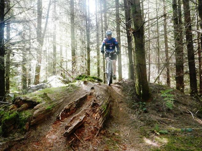
The climbs and descents are not terribly steep, but they do go on for miles in some instances. Below is Bruce on a descent crossing an erosion control log.
SOMBA has done a lot of work on some of the trails. Below is one of the bridges they built. Since this part of Oregon gets lots of rain, there are numerous creeks and bridges over them.
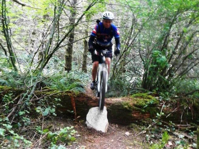
Bruce coming up over a rise and down along a rotting fallen tree.
Next, it was down the hill and across a fallen tree.
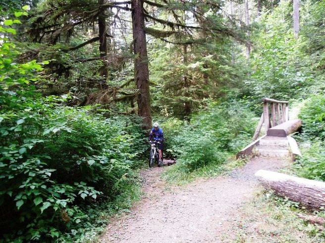
Another creek and bridge. This one is a felled tree flattened off to become a foot-bridge. The handrail and steps aren't "bike friendly", so riders take the bypass through the creek.
Not all the trails are wide and open. Here is a section of trail that is a "tree tunnel".
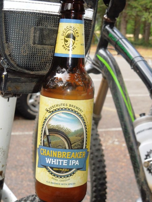
At the end of the ride, Bruce was introduced to a local brew from the Deschutes Brewery just over the hill.
Oregon has a lot of microbreweries, and Deschutes is one of the larger. Introduction to the trail and ride including any other riders or group with you.
The statistics for the (Trail Name) ride are provided below along
with a map showing the track and profile and statistics. The track
and profile is for the clockwise direction. Reverse it for a
counter-clockwise ride.
Right click on the GPX link above to download a GPX file for this ride. The GPX file may want to save as an XML file, so if it does, change the extension to gpx before you save it. The file is a high-resolution track with points are every 10' created on the Delorme PN-60W GPS. You can right-click on the image below and use the "Save Target As" option to down-load a 1MB 11x17" PDF version of the map that can be printed. You can also click on the image to open it in a new window and zoom up to 200% for a detailed view. (Insert Track-Profile map with link to tabloid-sized PDF) The trail system at Silver Falls can be pretty much anything you want it to be. The ride on Labor Day weekend, 2012, combined several trails for a total of 21.5 miles and 3,000' of climbing. This is the kind of trail on which you will use all your gears, and spend a lot of time in 1-1. The grades are not impossibly steep, but go on for some distance, making it necessary to slow down to a sustainable climbing pace. The trails parallel each other and are like an "out and back" but only one section is ridden both ways. The initial climb on this route is a continuous climb four miles in length. Bruce refers to this as the "four-mile trial". The photo below shows (description). (Place-holder for photo) Description of following photo. (Place-holder for photo) Wrap up In the Fall of 2012, Bruce was working in Oregon and rode a few trails out there. This is an account of the Waldo Lake trail ride. Waldo Lake is an IMBA EPIC trail east of Eugene and north of Crater Lake. This was a group ride with the Disciples of Dirt from Eugene, Oregon.
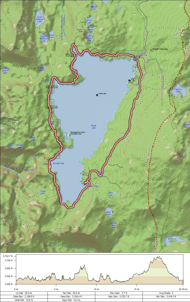
The statistics for the Waldo Lake Trail ride are provided below along
with a map showing the track and profile and statistics. The track
and profile is for the counter-clockwise direction. Reverse it for a clockwise ride.
Right click on the GPX link above to download a GPX file for this ride. The GPX file may want to save as an XML file, so if it does, change the extension to gpx before you save it. The file is a high-resolution track with points are every 10' created on the Delorme PN-60W GPS. You can right-click on the image below and use the "Save Target As" option to down-load a 1MB 11x17" PDF version of the map that can be printed. You can also click on the image to open it in a new window and zoom up to 200% for a detailed view.
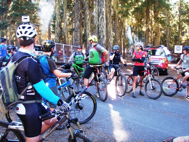
Bruce started riding the trail in a counter-clockwise direction from the campground. The clockwise direction is preferred in that going in that direction allows the technical sections to be ridden at the beginning of the ride. Below is the
group from the Disciples Of Dirt (DoD) of Eugene, and the Salem
Oregon Mountain Bike Association (SOMBA) in the parking lot at the
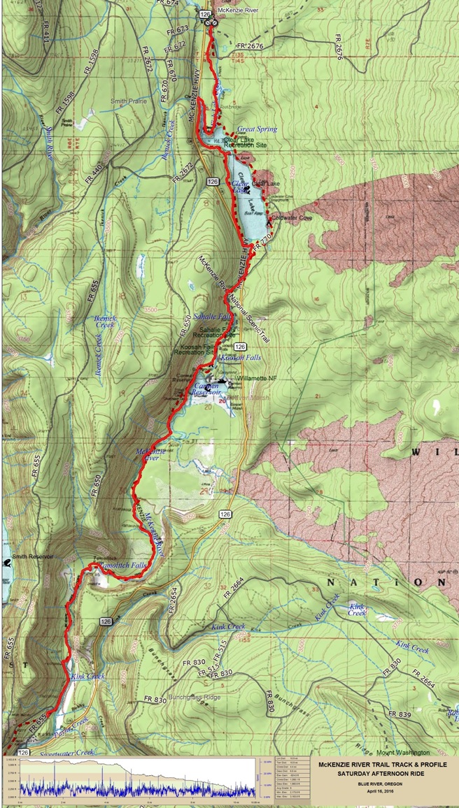
Waldo Lake Campground at the beginning of the ride. The McKenzie River Trail is rated the #1 trail in the United States, so it was obviously on Bruce's bucket list of trails to ride. The trail is normally ridden one way from the top at FR 2676 to the end some 26 miles down-stream. Bruce rode the MRT for the first time on April 16, 2016 with his friend James Ellertson of the Salem Oregon Mountain Biking Association (SOMBA). Bruce stayed at the McKinzie River Mt. Resort with James, Jennifer and Chris, a couple of James friends. This is a quaint resort that used to be a Forest Service ranger station. The resort rents bikes and has a shuttle to the trail head.
The statistics for the McKenzie River trail ride are provided below
along with a map showing the track and profile and statistics.
Right click on the GPX link above to download a GPX file for this ride. The GPX file may want to save as an XML file, so if it does, change the extension to gpx before you save it. The file is a high-resolution track with points are every 10' created on the Delorme PN-60W GPS. You can right-click on the image below and use the "Save Target As" option to down-load a 1MB 11x17" PDF version of the map that can be printed. You can also click on the image to open it in a new window and zoom up to 200% for a detailed view.
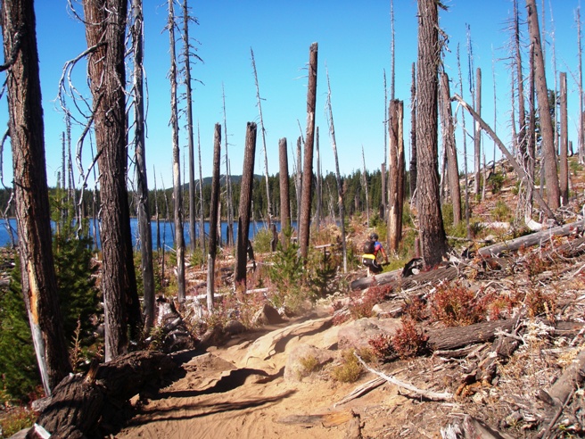
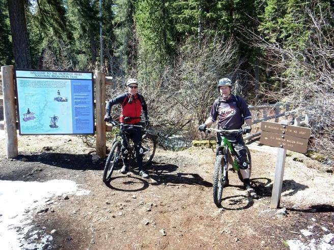
This trail is diabolical. It is mostly down-hill with a significant amount of climbing mixed in. The terrain range from smooth, flowing single track to long stretches of rugged rock gardens. The rocky sections between Clear Lake and Tamalitch Pool were at times double black diamond. Unless you are an advanced rider, you will be walking parts of the rock gardens on the upper part of the trail. The photo below shows Bruce and James at the trailhead at the start of the ride. The ride was in April, so there was still some snow around on the upper part of the trail.
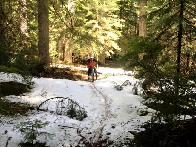
The photo below shows Bruce coming through one of the snowy areas on the trail. Since it was late season snow, it was wet, heavy and very hard to ride through.
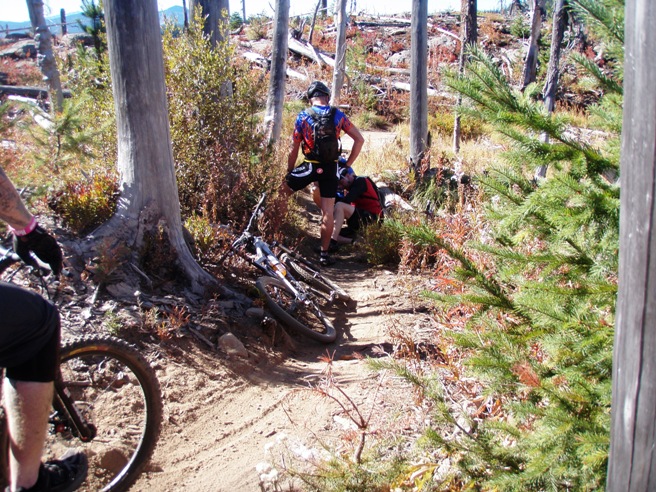
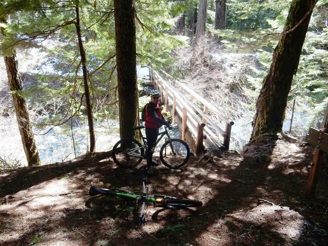
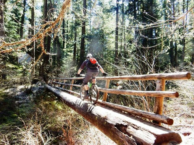
Further down they came to the first bridge. Most of the bridges were too narrow to ride across, and the hand-rails interfered with the handlebars, so they ended up walking most of the bridges. Below is Bruce about to walk the bike across the first bridge.
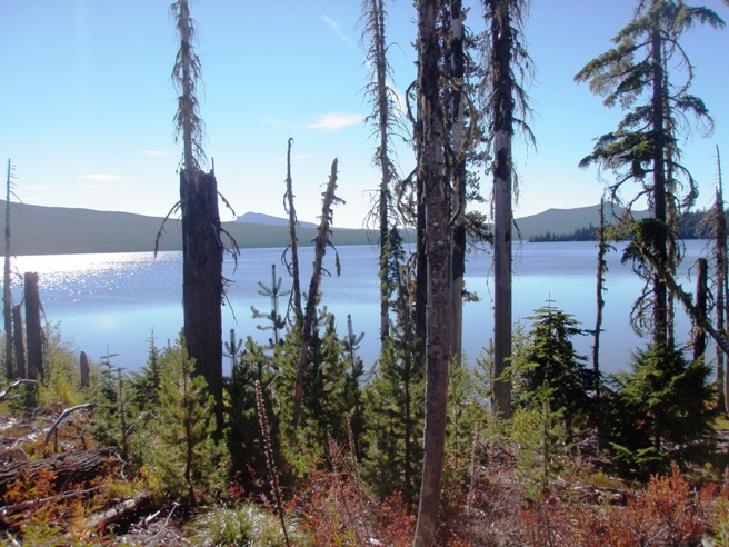
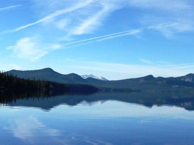
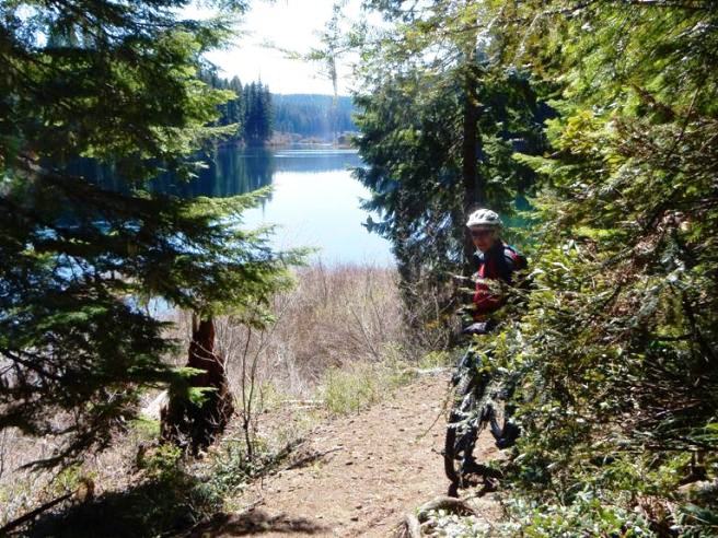
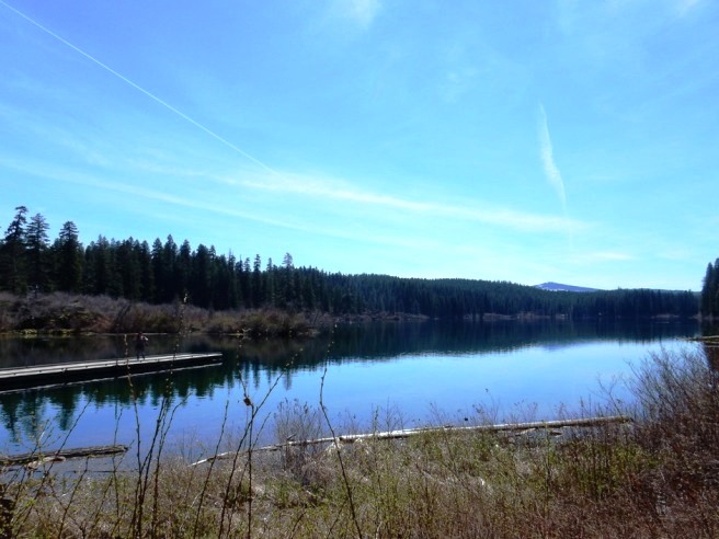
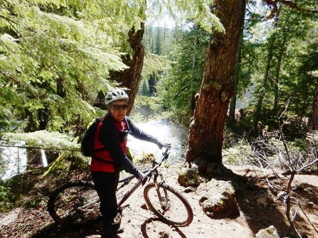
About 3.5 miles into the ride, they came to Clear Lake. The water in the river and lakes is a beautiful shade of blue due to the cold temperature. This is the same effect you see with blue ice in glaciers.
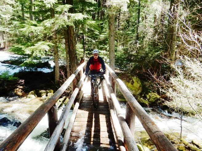
The trail crosses the river several times. Below is Bruce riding across one of the wider bridges.
Further down, they came to the Clear Lake Resort. Below is Bruce by the lake near the general store.
The photo below was taken from behind the general store near the dock and canoe rental area.
After Clear Lake, it was back onto the trail and more bridges. Below is Bruce riding across one of the wider bridges with a light covering of snow still on it. Notice the clarity of the water on the far bank.
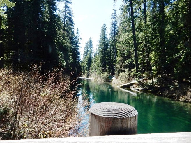
As Bruce was about to leave the bridge, he made the photo below looking down-stream.
As indicated earlier, most of the bridges were narrow, made from felled trees with hand rails attached. The bikes had to be walked across on the rear wheel because the handrails were too narrow for the handle bars. Below is Bruce crossing one of these "log" bridges.
There were numerous falls and rapids along the river. Below is Bruce near one of these spots along the trail.
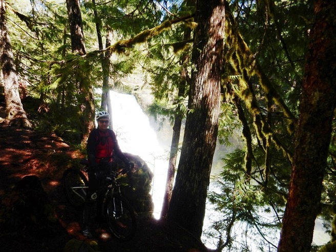
The most spectacular falls on the river along the trail were Sahalie Falls. Below is Bruce at the falls. .
There was a lot of water in the river, and the falls were quite impressive. Follow this link for a short video made at the falls. Further down, James and Bruce came to another log bridge. James rode across it balancing with his right hand. Bruce walked this one.
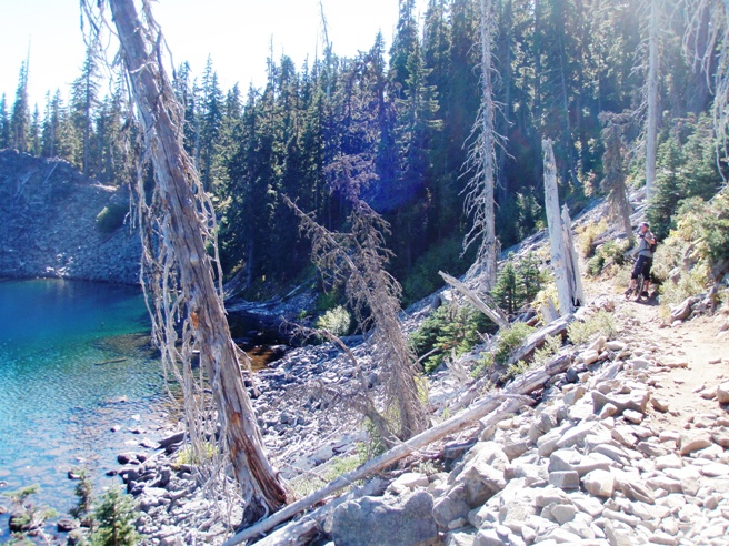
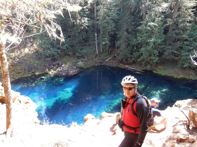
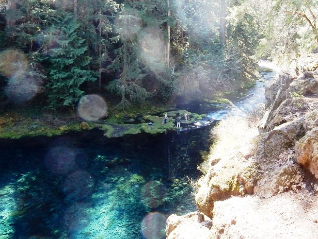
Next was Tamolitch Lake or Blue Pool. The blue color of the water is to it's temperature just above freezing.
The photo below shows the river exiting the lake and folks on the rocks below.
The ride was awesome for a number of reasons. The scenic beauty is obvious. The second was the level of difficulty in riding this trail. The photos and videos on the Internet do not show much of the rock gardens, but they are plentiful and very rugged in places. You need to be an accomplished mountain biker to ride this trail, otherwise you will be doing a lot of walking.
|
|
Version 0.1, April 24, 2016 |