|
|
|
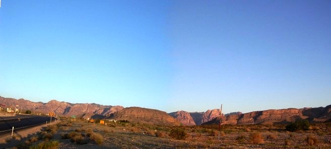
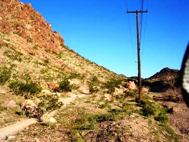
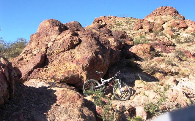
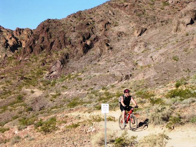
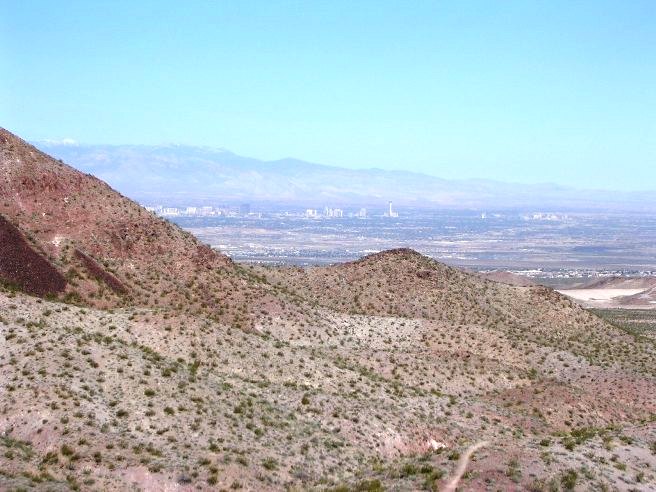
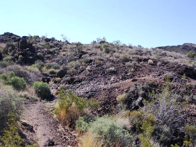
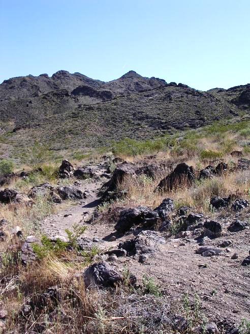
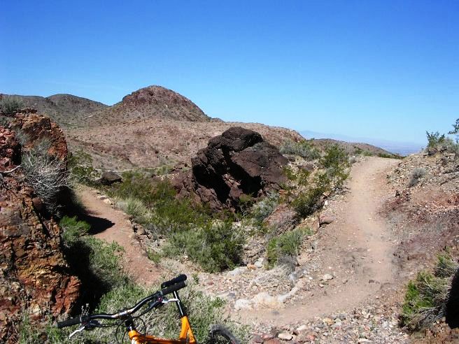
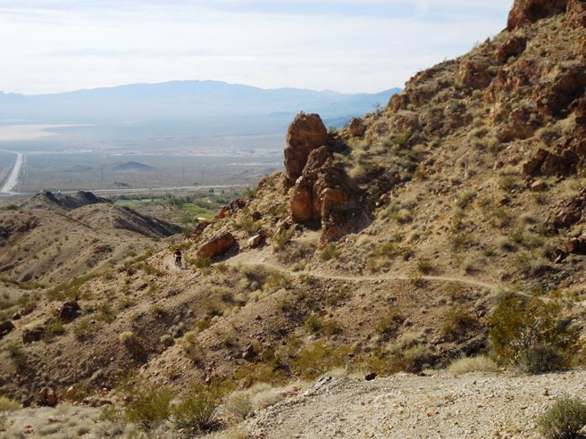
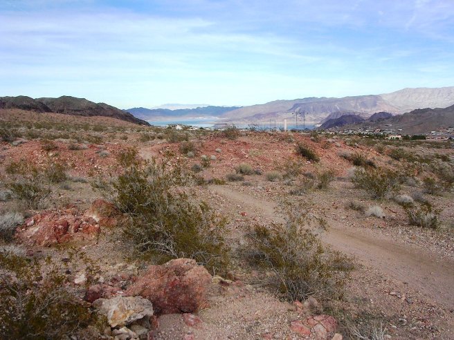
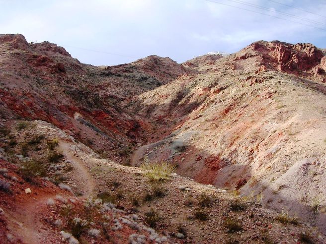
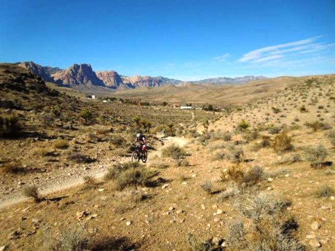
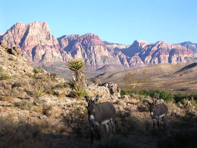
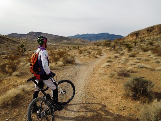
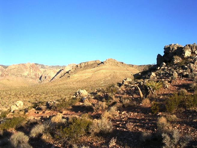
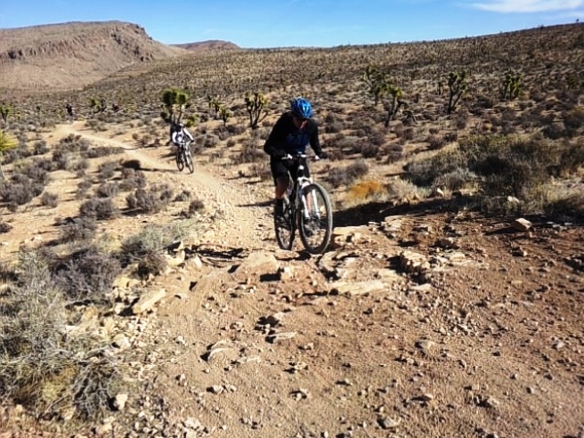
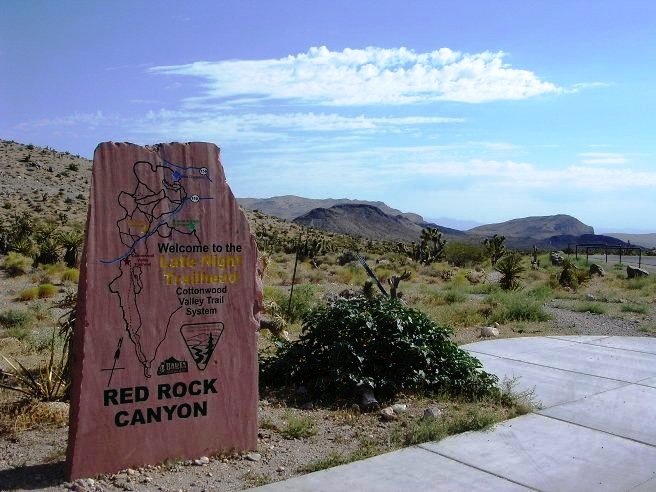
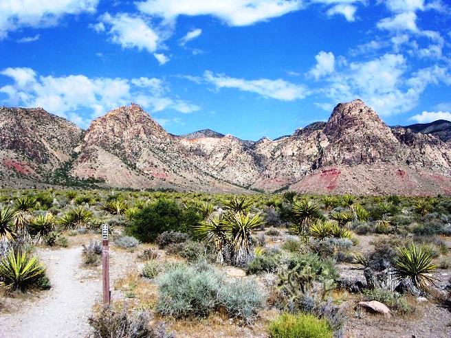
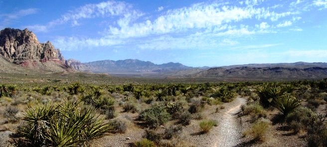
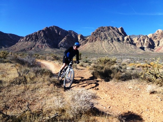
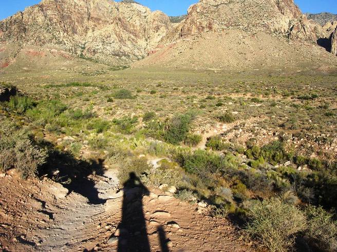
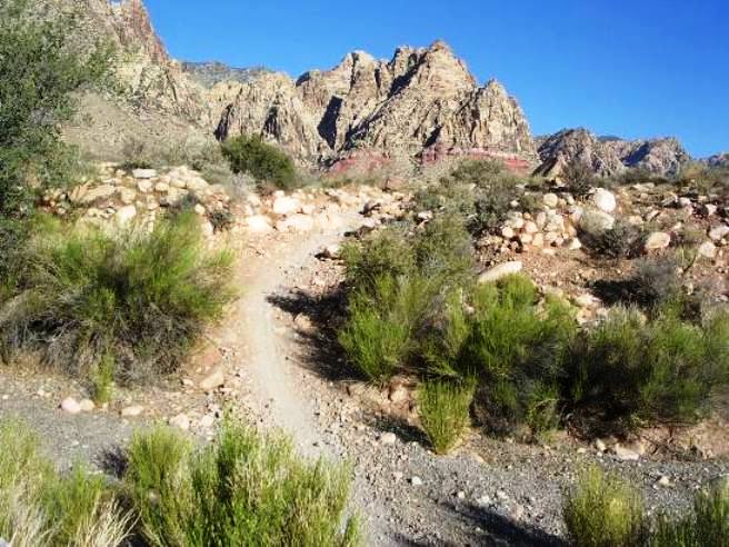
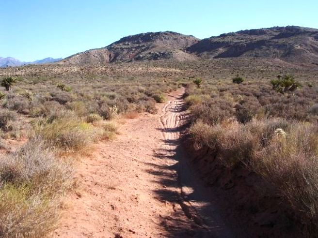
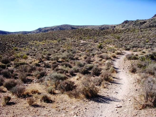
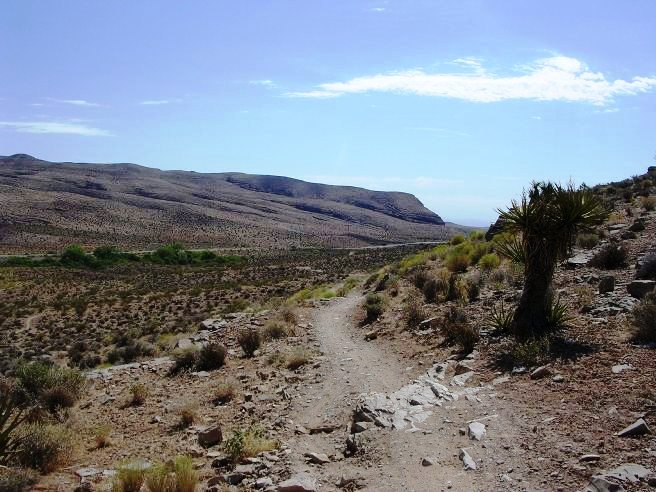
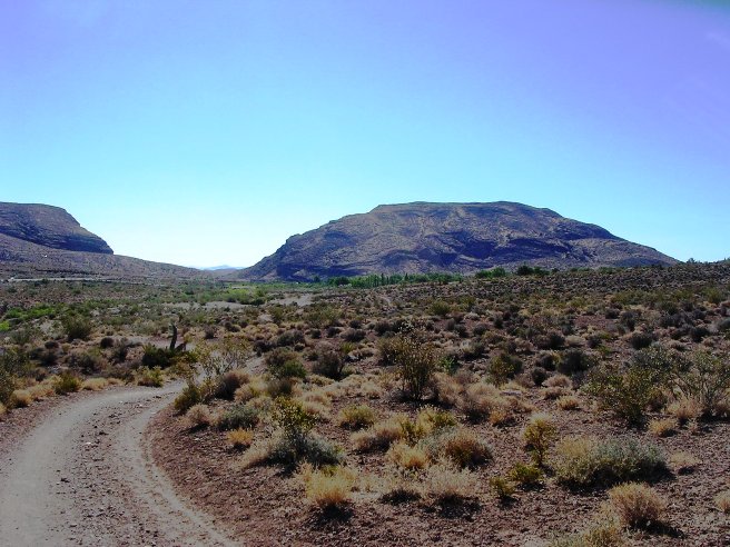
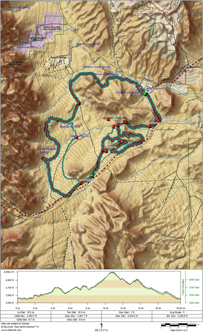
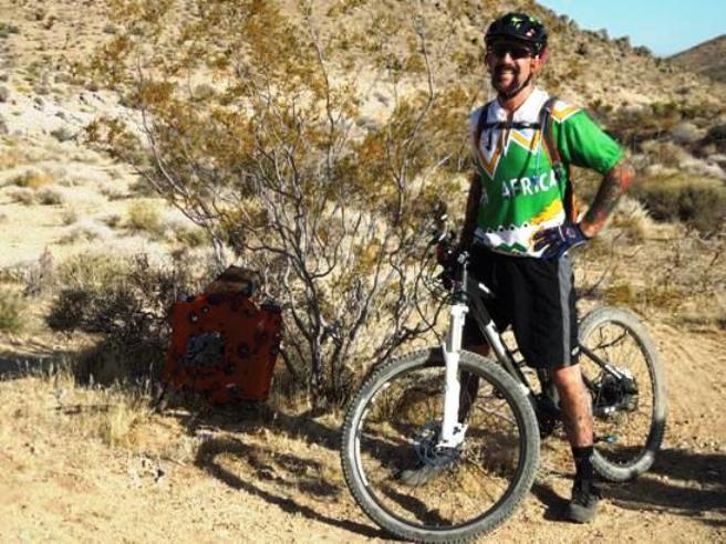
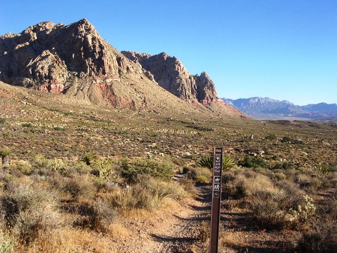
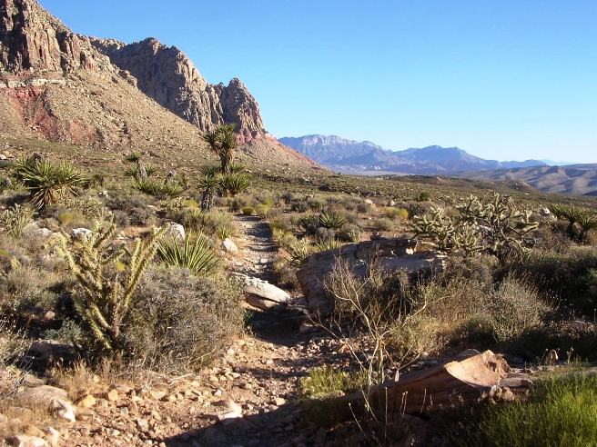
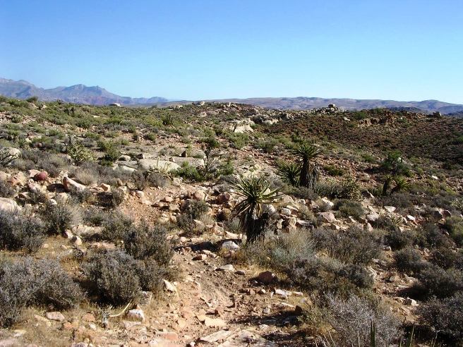
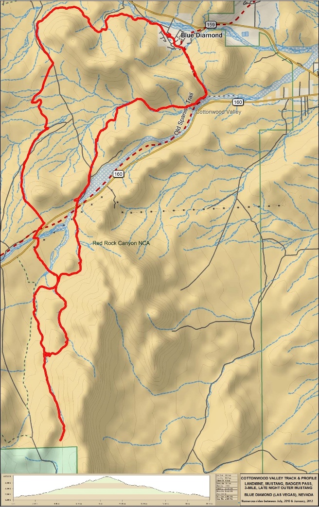
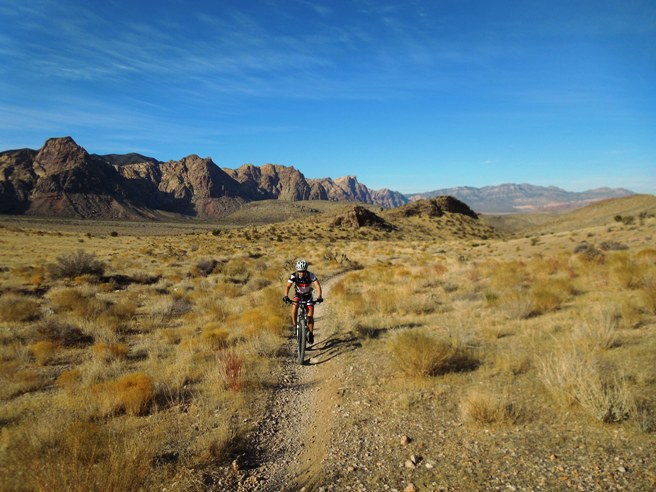
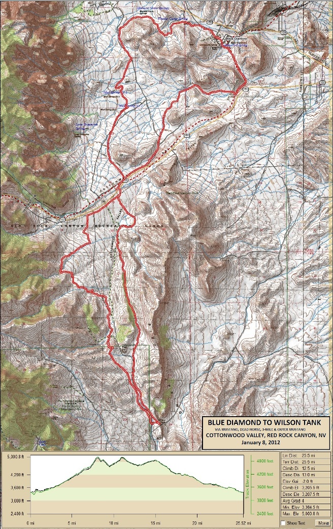
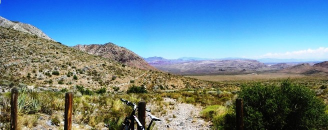
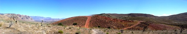
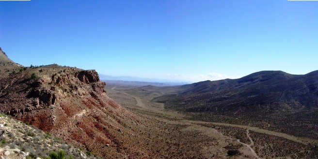
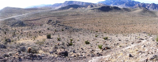
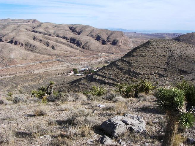
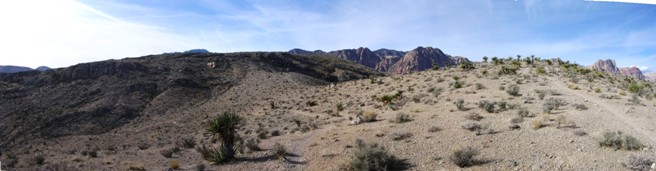
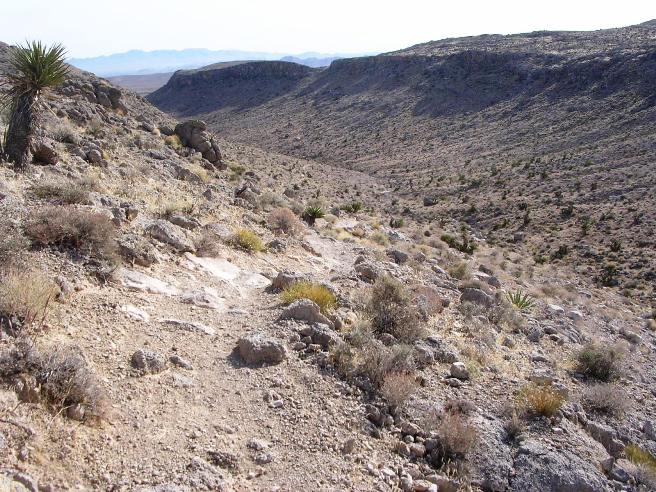
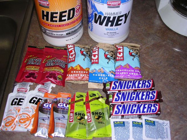
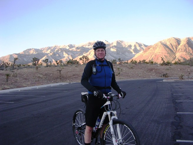
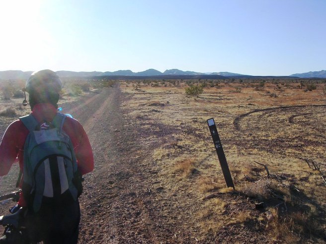
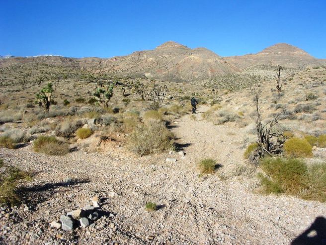
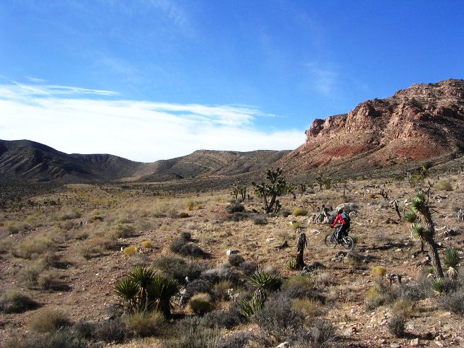
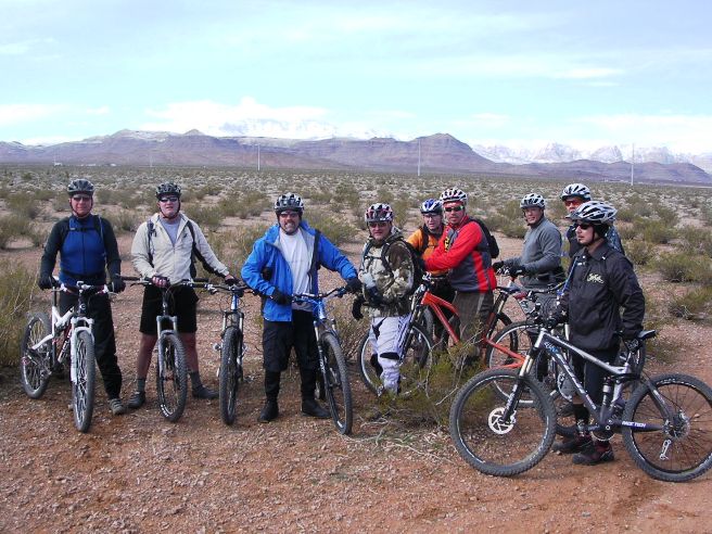
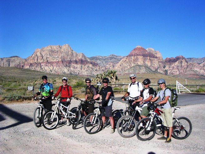
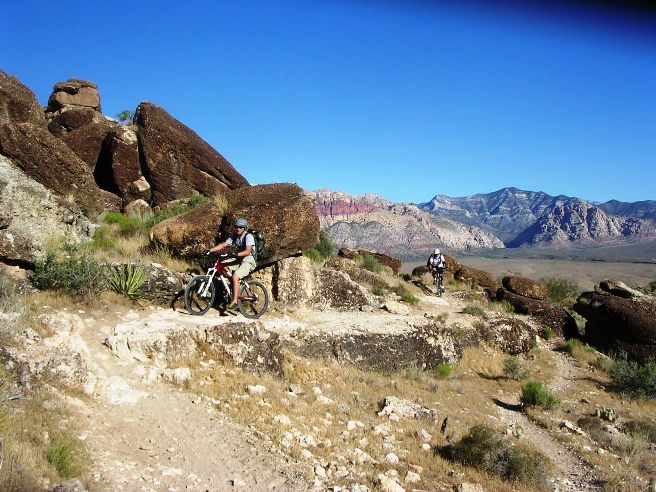
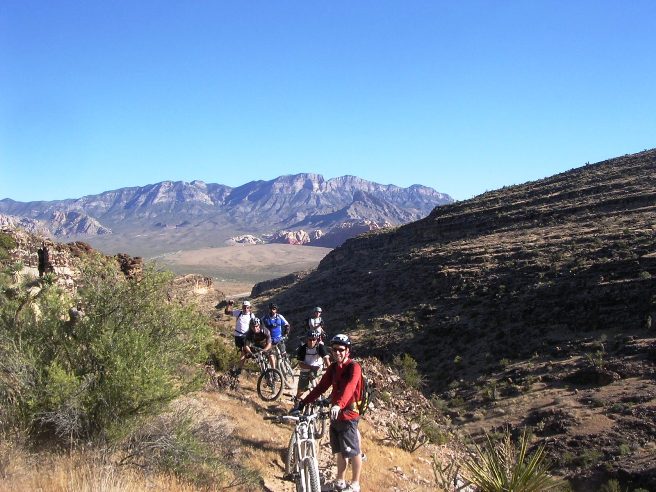
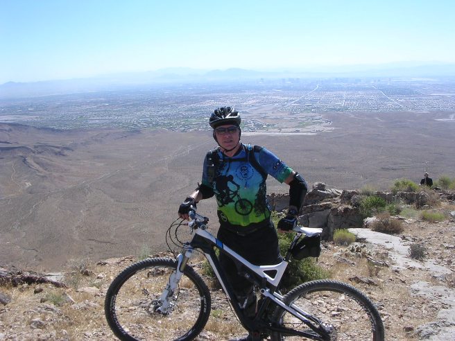
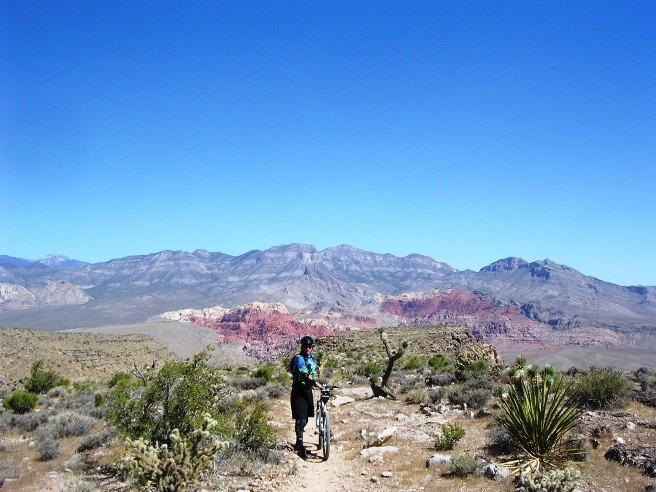
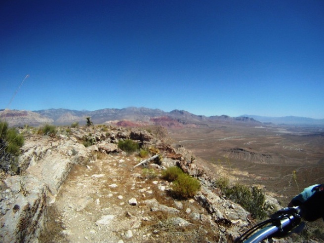
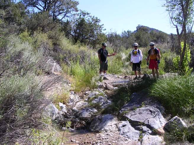
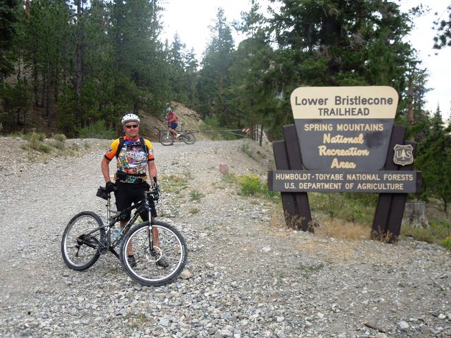
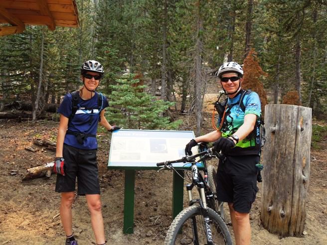
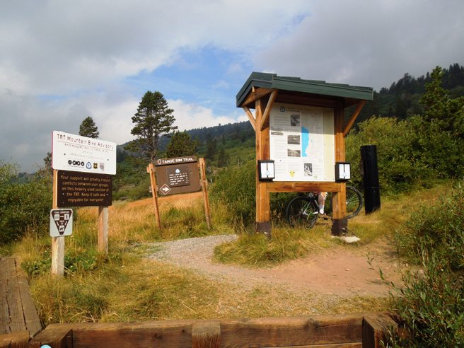
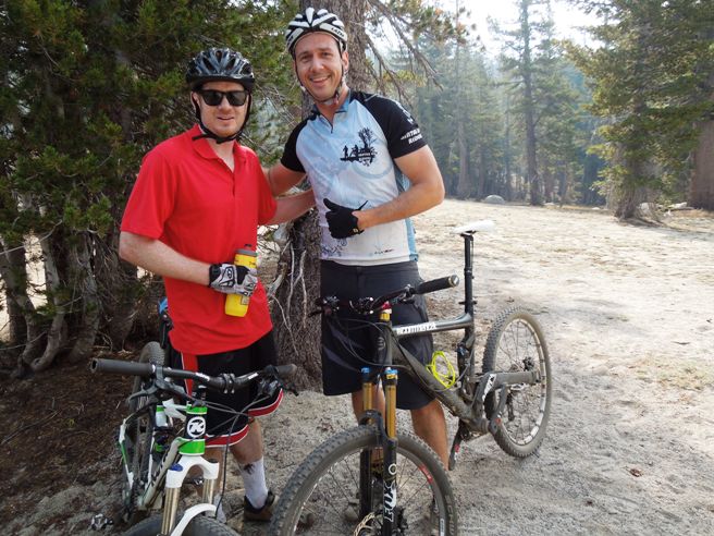
Mountain Biking In NEVADA Bruce has spent a lot of time in the Las Vegas area and has ridden most of the trails in the vicinity. He was in Vegas on business in March of 2007, and took that opportunity to rent a bike and ride Bootleg Canyon in Boulder City. This was his first out-of-state ride and his first IMBA EPIC trail ride. It was the hardest ride he had done to that point in his cycling career. The first time out, he rented a Specialized full suspension from All Mountain Cyclery who also gave him advice on which trails to ride. He rode three of the trails: Girl Scout, Caldera and West Loop. If you are headed that way, check out the canyon and the great folks at All Mountain Cyclery. In 2010, 2011 and 2012, he was on an engineering project in Nevada and had numerous opportunities to ride Bootleg and well as a bunch of other trails in and around Las Vegas. This included Cottonwood Valley and the Cowboy Trails in Red Rock Canyon National Conservation Area, Mt. Charleston, Union trails and Twilight Zone. This time he had his own bike, a TREK Superfly 100 Elite full suspension. In addition to riding in the Vegas area, he made it out Reno on subsequent trips out that way. Bootleg Canyon Originally a Native American trail, Bootleg Canyon, also called the Hooch Highway, was a backdoor into into Boulder City and the Hoover Dam construction site during prohibition. Bootleggers brewed illegal alcohol in stills in hidden draws and arroyos, then moved it through the canyon into the dry community of Boulder City and down the Colorado River. Later, trails in the area were improved by the Civilian Conversation Corps, and the area was used for public picnics and gatherings. Today, Bootleg Canyon is the site of many hiking and mountain biking trails. Red Rock Canyon While working in Vegas, Bruce rode the Red Rock Canyon trails extensively since they were only 20 minutes away from his condo. Visitors call this area Red Rock Canyon, but locals refer to it as Cottonwood Valley which is part of the Red Rock Canyon National Conservation Area. The panorama shows the approach to Red Rock Canyon from SH-160 near where SH-159 cuts off to Blue Diamond. He rode most of the area from the Blue Diamond trail head since this provided longer rides.
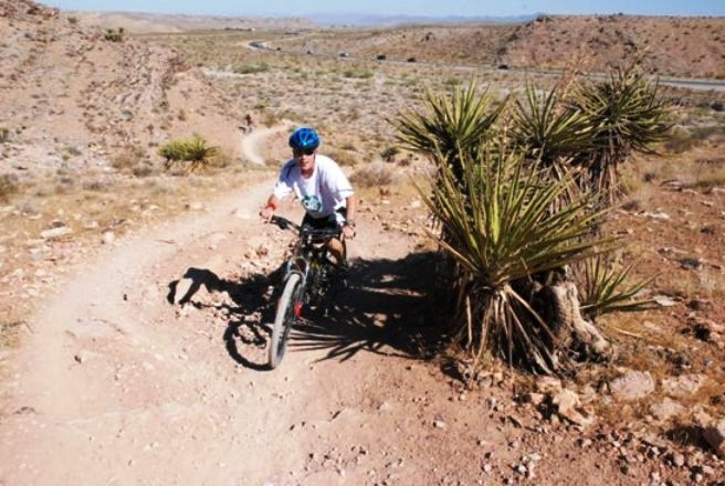
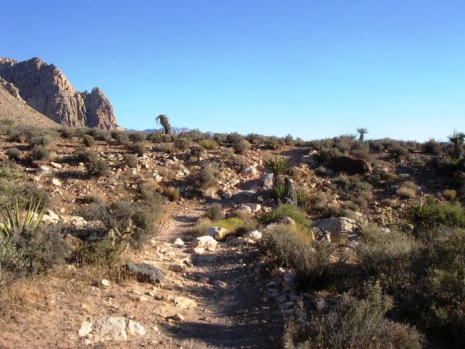
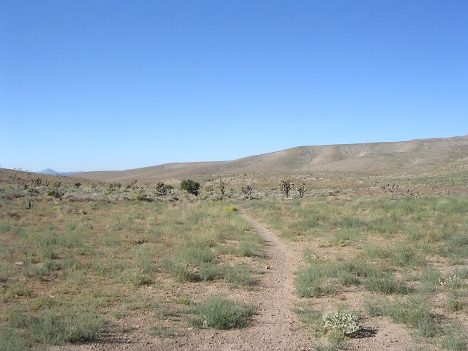
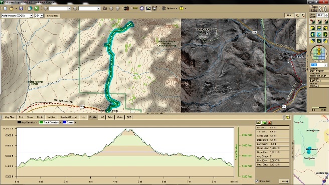
One of the nicest things about Cottonwood Valley in Red Rock Canyon is that there is a bike shop at the trail head. [McGhie's Bike Outpost] in Blue Diamond is just 2 blocks from the trail head. Chris Tuma, the shop manager has a good fleet of Trek, Cannondale and Fisher bikes set up to ride there. You can drive out to Blue Diamond, get fitted and be on the trail in 30 minutes. There is over 200 miles of single track in the valley. The difficulty ranges from beginner to single black diamond expert trails. The most difficult is the Hurl. The average ride is about 12-20 miles with 1,200' to 2,400' of ascent. Some of the longer rides reach 40 miles with over 4,000' of ascent. Boulder City, NV - Bootleg Canyon, Girl Scout Loop: Bruce was in Vegas on business in March of 2007, and used that opportunity to ride Bootleg Canyon in Boulder City. At that time he rode Girl Scout, Caldera and West Leg. Girl Scout is considered a "beginner level" trail by Bootleg standards. While working in Vegas in 2010 through 2012, he rode these trails several more times. Boulder City, NV - Bootleg Canyon, Caldera Loop: Bruce was in Vegas on business in March of 2007, and used that opportunity to ride Bootleg Canyon in Boulder City. At that time he rode Girl Scout, Caldera and West Leg. Caldera is considered an "intermediate level" trail by Bootleg standards. While working in Vegas in 2010 through 2012, he rode these trails several more times. Boulder City, NV - Bootleg Canyon, West Leg Loop: Bruce was in Vegas on business in March of 2007, and used that opportunity to ride Bootleg Canyon in Boulder City. At that time he rode Girl Scout, Caldera and West Leg. West Leg is considered an "intermediate level" trail by Bootleg standards. While working in Vegas in 2010 through 2012, he rode these trails several more times. Boulder City, NV - Bootleg Canyon, Ernie's Epic Trail: During 2011, Bruce had an opportunity to ride Ernie's Epic on two occasions: once in May and once in November. He also rode it with his friend Paul "Tait" Hakes in January of 2012 when Tate came out for CES. Ernie's is a 15 mile "intermediate level" loop that takes about 3 1/2 hours to complete. Boulder City, NV - Booteg Canyon, The Boy Scout Trail: dates and summary Boulder City, NV - Booteg Canyon, The Lakeview Trail: The Lakeview trail system is actually three separate trails that interconnect. They are the Lower Lakeview, the Middle Lakeview and the Upper Lakeview. The Lower and Upper Lakeview trails make for a 4.2 mile loop with a fair amount of terrain variation. The Middle Lakeview bisects this loop and is flatter. Bruce rode the Lower and Upper Lakeview Trails on January 16, 2011. Las Vegas, NV - Cottonwood Red Rock, Landmine - Mustang Trails: While working in Vegas, Bruce rode the Red Rock Canyon trails extensively on various weekends from July, 2010 , through January, 2012. These were his trails of choice since they were only 20 minutes from his condo. Visitors call this area Red Rock Canyon, but locals refer to it as Cottonwood Valley which is part of the Red Rock Canyon National Conservation Area. The panorama shows the approach to Red Rock Canyon from SH-160 near where SH-159 cuts off to Blue Diamond. He rode most of the area from the Blue Diamond trail head since this provided longer rides. Las Vegas, NV - Cottonwood Red Rock, Landmine-Wounded Knee-Late Night-Black Velvet Trails: This ride is an intermediate to expert variation to the Landmine-Mustang loop described above. It is done by including the Wounded Knee, Lawn Mower, Late Night and Black Velvet trails. Bruce rode the Red Rock Canyon trails extensively on various weekends from July, 2010 , through January, 2012, and often included this variation. Las Vegas, NV - Cottonwood Red Rock, Badger Pass & 3 Mile Smile Trails: After riding Landmine and Mustang and becoming familiar with the trail features, Bruce decided to try the south side of Cottonwood Valley. Badger Pass and 3-Mile Smile are the primary trails on the south side, along with Dead Horse. Badger is an intermediate-level trail which is a long, arduous climb of 640' in 3.4 miles. The 3-Mile Smile trail is another 3 mile climb, but this time along a dry wash. While the climbing was a chore, the descents were awesome. Once he became familiar with these trails, he rode them about once a month from August, 2010 through August, 2012. Las Vegas, NV - Cottonwood Red Rock, Dead Horse & 3-Mile Smile Trails: After riding Badger Pass and 3-Mile, Bruce decided to really up his game by riding the Dead Horse and 3-Mile Smile trails from Blue Diamond. This took his ride from 21 miles and about 1,000 feet of climbing to over 25 miles and 3,200 feet of climbing. Parts of Dead Horse are have some demanding climbs and is rather technical features in other places, so it is considered an expert-level trail. Las Vegas, NV - Cottonwood Red Rock, The Hurl Trail: The Hurl is one of the most technical trails in the Cottonwood Valley section of Red Rock Canyon. It is a short trail at 6.2 miles, but has nearly 1,200 ft of climbing. The average grade is a 7, compared to a 4 for most of the rest of the trails at Cottonwood. Some parts of the trail have a 25% grade. Bruce rode The Hurl various weekends from July, 2010 , through January, 2012. Las Vegas, NV - Cottonwood Red Rock, The Bonnie & Clyde Trail: Bruce rode the Bonnie & Clyde trail on November 5, 2011. Riding Bonnie & Clyde from from Blue Diamond is a challenge. The loop is just over 35 miles in length and has 3,830' of ascent. Las Vegas, NV - The Union Trail: The Union Trail is a trail system on the south side of Las Vegas near the Union Pacific railroad tracks. Bruce rode these trails twice while working in Vegas, once on November 13, 2010 and again on February 20, 2011. These trails are rather normal for the area, and provide a nice change of pace from the other more popular trails. Las Vegas, NV - Red Rock, The Cowboy Trails: The Cowboy Trails are in the Red Rock National Conservation Area north of Cottonwood Valley up at the equestrian area. These are some of the most technical trails in the area, and are considered "Advanced" or "Expert" trails. There are three segments to the Cowboy Trails: Bomb Voyage, Bob Gnarly and Bone Shaker. Bruce rode the Bomb Voyage segment on July 15, 2011. Las Vegas, NV - The Twilight Zone Trail: About 5 miles out Kyle Canyon Road from US-95, there is a gravel parking lot on the right side of the road that is the trail head for the Twilight Zone Trail. Bruce rode this short, brutal trail on June 4, 2011. The origin of the trail's name in unclear, but after riding it, Bruce is convinced that it comes from off-camber bench-cuts, loose conditions and deceptive climbs and descents. It just doesn't ride like any other trail in the area. Climbs and lines are difficult to judge, making you feel like you are in a land of substance and shadows, another dimension, or the Twilight Zone. Las Vegas, NV - Red Rock, The Mt. Springs Trail: The Mountain Spring Trail is not on any "official" trail maps, and was "discovered" by local knowledge. Bruce rode this trail 4 times: January 29, 2011, March 13, 2011, and July 22, 2011. The overall ride is 4.4 miles long, but the first 3 miles are on a jeep road with some impressive climbs and drops. The last mile and a half is single-track and has the most climbing. This trail takes you to the top of the cliffs on the west side of Cottonwood Valley. Las Vegas, NV - Mt. Charleston, Bristlecone Pine Trail: On August 4, 2012, Bruce rode the Bristlecone Pine Trail with Chris and Dave. This trail is often ridden in the summer because its temperatures tend to be 40F cooler than the deserts below. The only drawback is that you are riding at over 9,000 feet above sea level. The Bristlecone Pine only grows in a few places in the world and can live 4,000 years. Some of the trees they rode past were there before the time of Christ, and that was truly awesome. Lake Tahoe, NV - The Flume Trail: In September of 2013, Bruce had some work near Reno, so he took advantage of the business trip to arrange a ride of the Flume and Tahoe Rim Trails in the Lake Tahoe area. A friend he used to ride with in the Vegas and southern Utah areas, Debbie Wood, had recently moved to Reno and offered to be his riding partner for the Flume. The first day, he rented a Specialized Stumpjumper for the Flume. This is a shuttle ride. The shuttle takes you from Incline Village to Spooner Lake. The ride from Spooner Lake is 14.3 miles long and has a cumulative elevation gain of 2,718'. The trail starts out at 7,000', rises to 8,177' in the first 4.7 miles, and ends back at Incline Village at 6,322' above sea level. If Bruce were ever to ride the Flume and Tahoe Rim Trails again, he would start at the Tahoe Meadows location, ride the Tahoe Rim Trail south to Marlette Lake, and then ride the Flume back to the bike shop. This would make for a 24 mile (38.6 km) ride and about 5,000' (1,524 m) of climbing, but would be, in his opinion, the best way to do it. This version of the ride would take 4 to 6 hours to complete, Lake Tahoe, NV - The Tahoe Rim Trail: In September of 2013, Bruce had some work near Reno, so he took advantage of the business trip to arrange a ride of the Flume and Tahoe Rim Trails in the Lake Tahoe area. He rode the Flume the first day, September 1st, and the Tahoe Rim Trail (TRT) the second day. Bruce rented a 2013 Kona Hei Hei 29er for the Tahoe Rim Trail ride. He met Alex and Michael at the shop, and since Alex knew the trail and Michael and Bruce didn't, Alex offered to lead. The TRT is an IMBA EPIC Trail, so Bruce was happy to cross this one off his list. The TRT encompasses 165 miles along the ridge tops of the Lake Tahoe Basin, crossing six counties, and two states. It is an intermediate-level trail ranked No. 90 in the world. Boulder City, NV - Bootleg Canyon, Girl Scout Loop Introduction to the trail and ride including any other riders or group with you. The statistics for the (Trail Name) ride are provided below along
with a map showing the track and profile and statistics. The track and profile is for the clockwise
direction. Reverse it for a counter-clockwise ride.
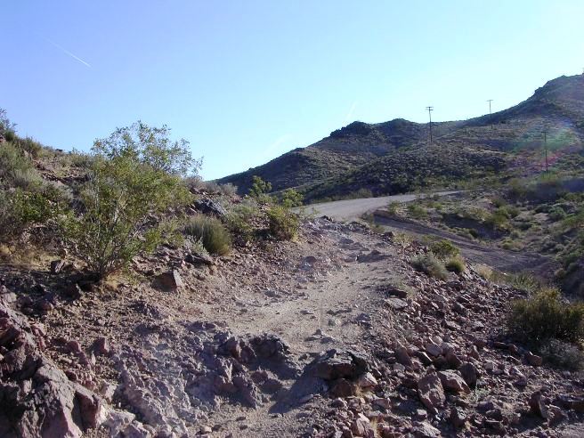
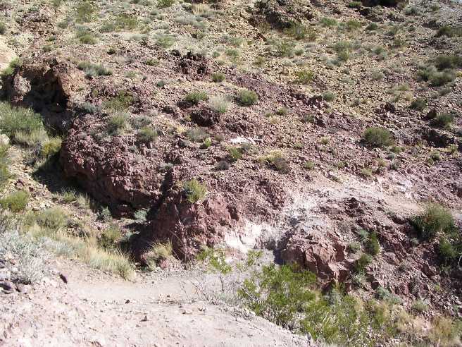
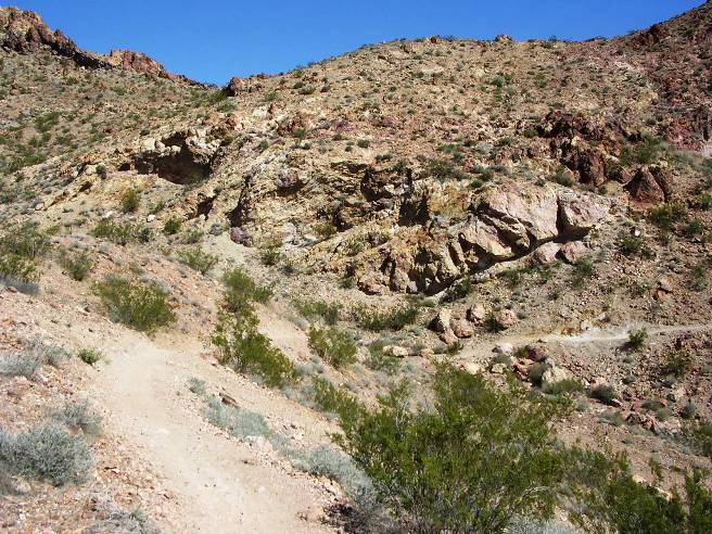
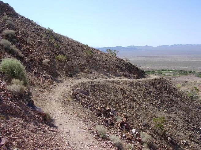
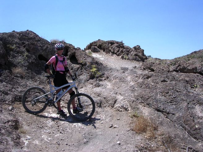
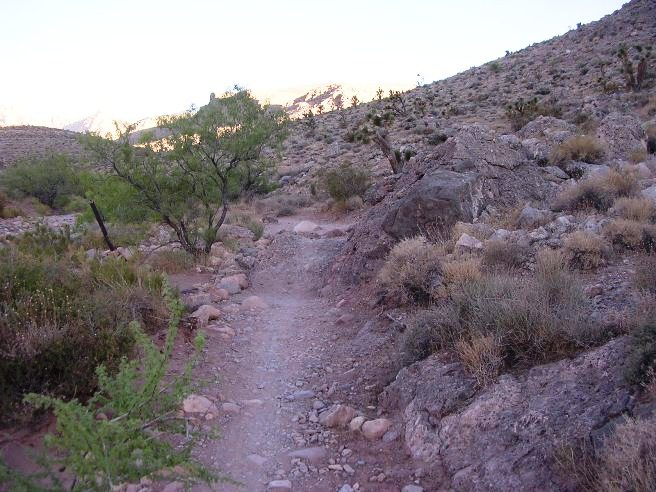
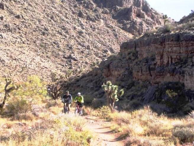
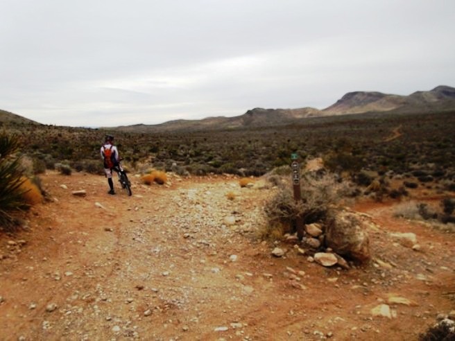
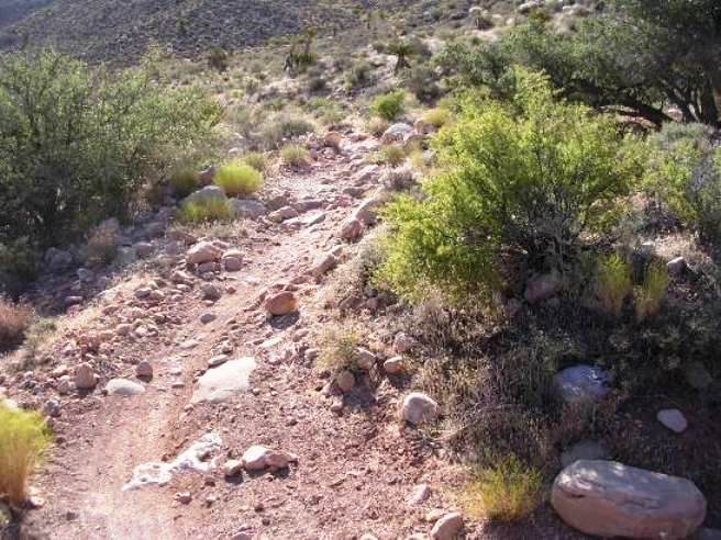
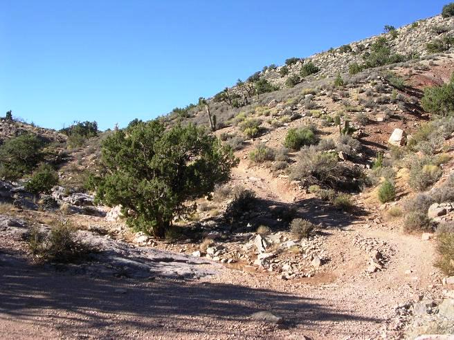
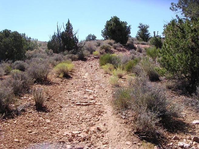
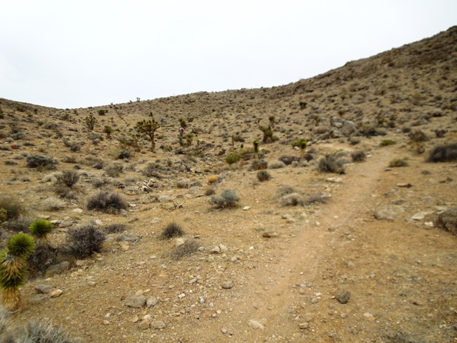
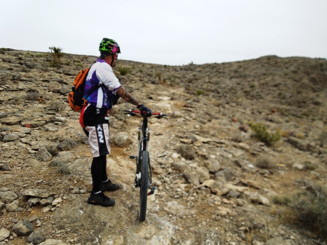
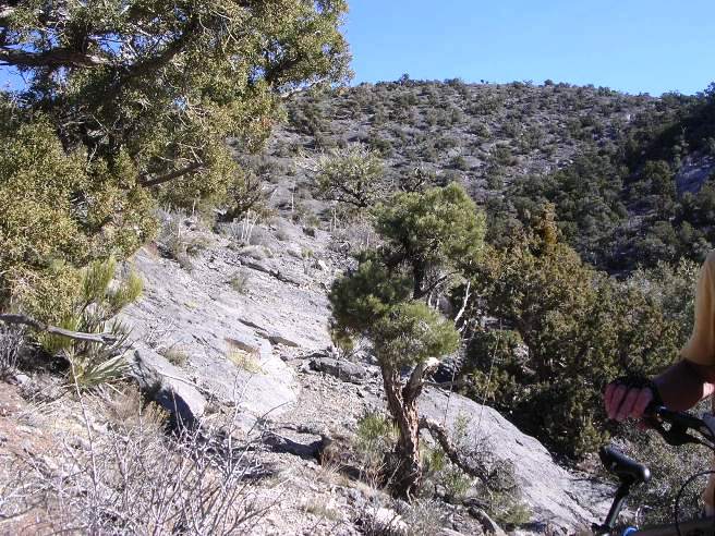
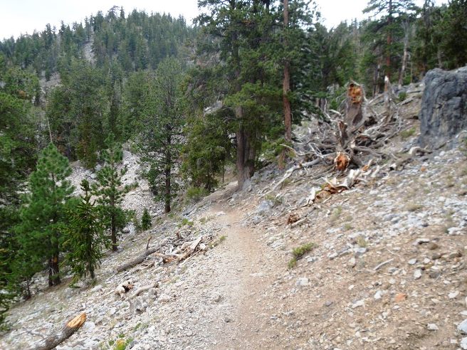
Right click on the GPX link above to download a GPX file for this ride. The GPX file may want to save as an XML file, so if it does, change the extension to gpx before you save it. The file is a high-resolution track with points are every 10' created on the Delorme PN-60W GPS. You can right-click on the image below and use the "Save Target As" option to down-load a 1MB 11x17" PDF version of the map that can be printed. You can also click on the image to open it in a new window and zoom up to 200% for a detailed view. (Insert Track-Profile map with link to tabloid-sized PDF) This is the kind of trail on which you will use all your gears, and spend a lot of time in 1-1. The grades are not impossibly steep, but go on for some distance, making it necessary to slow down to a sustainable climbing pace. The photo below shows the south end of the Girl Scout trail near the main parking lot.
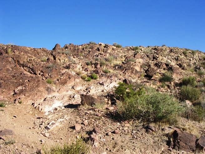
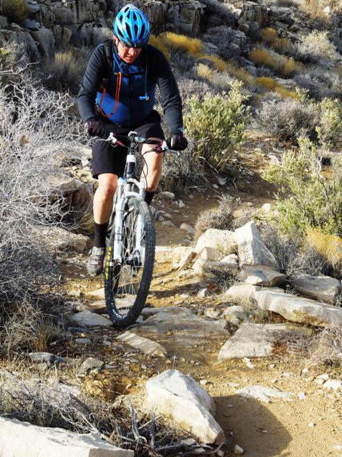
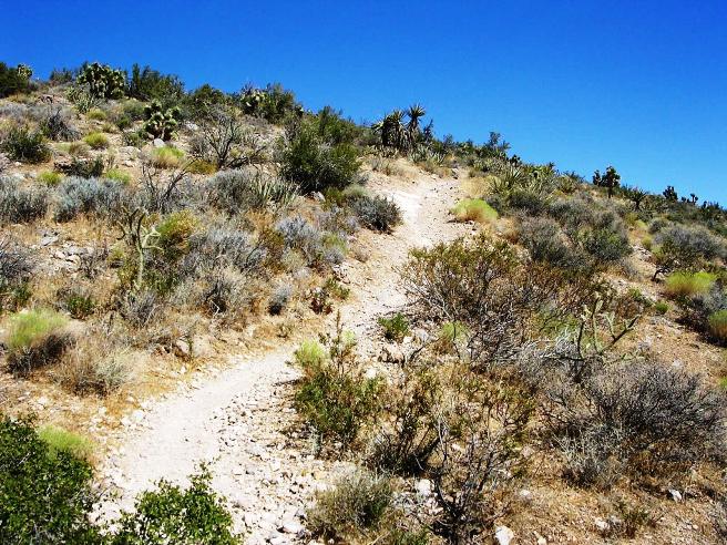
While most of the trail is fairly easy, it does has some technical sections as shown below.
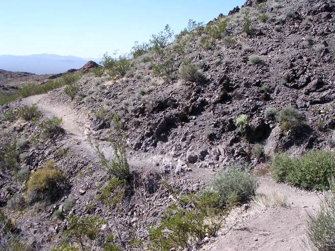
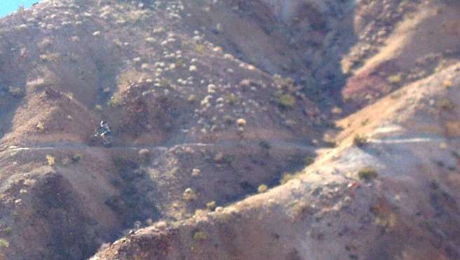
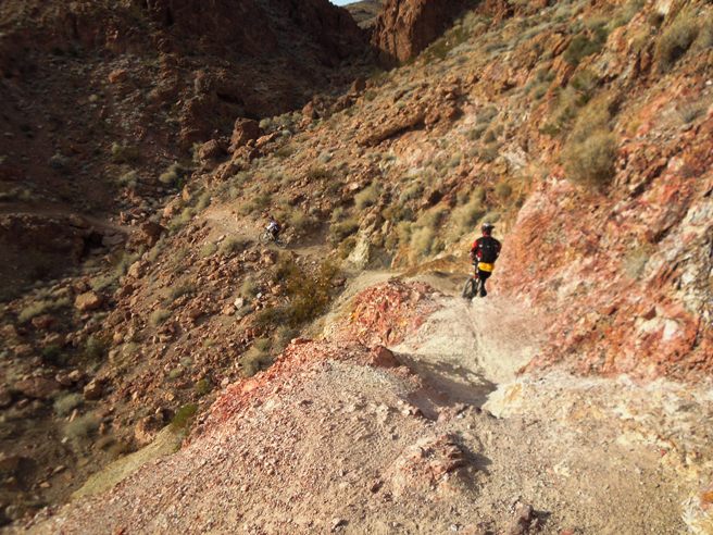
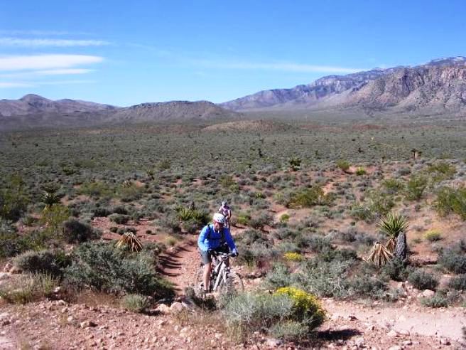
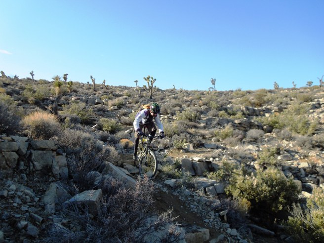
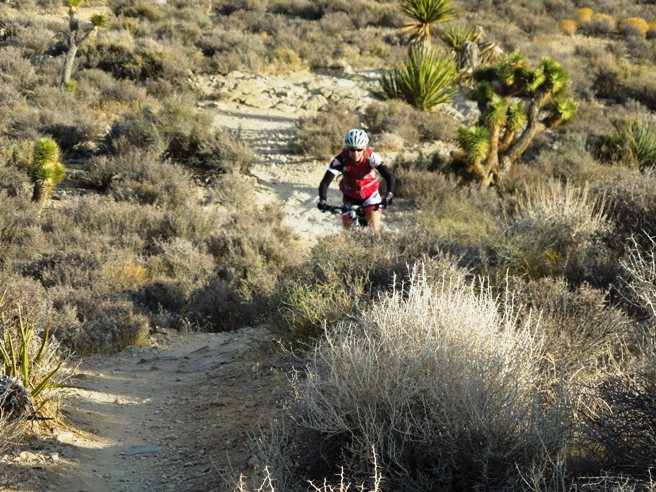
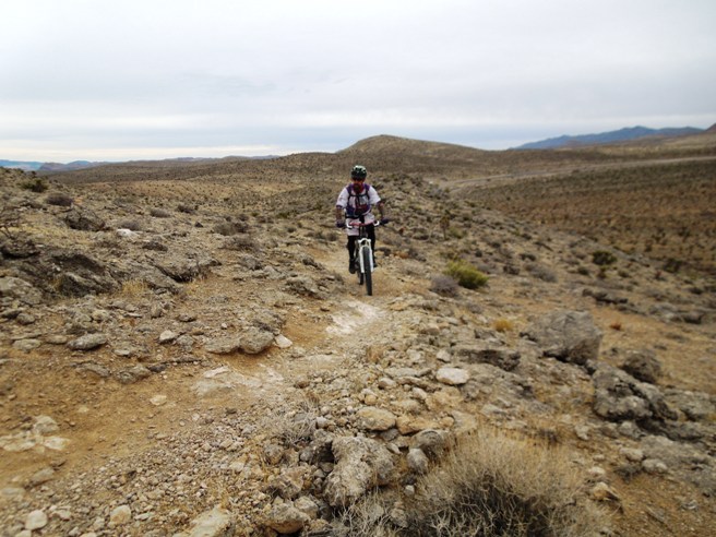
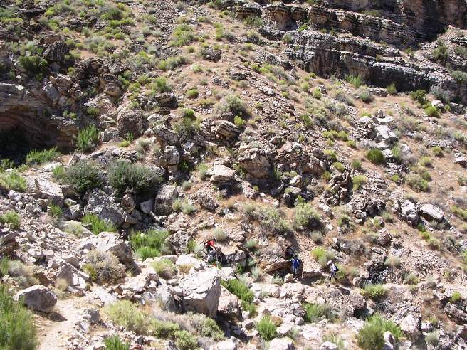
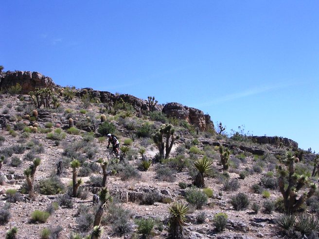
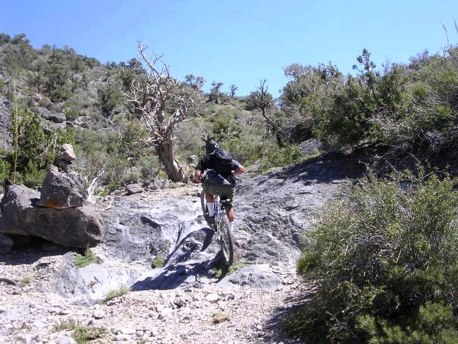
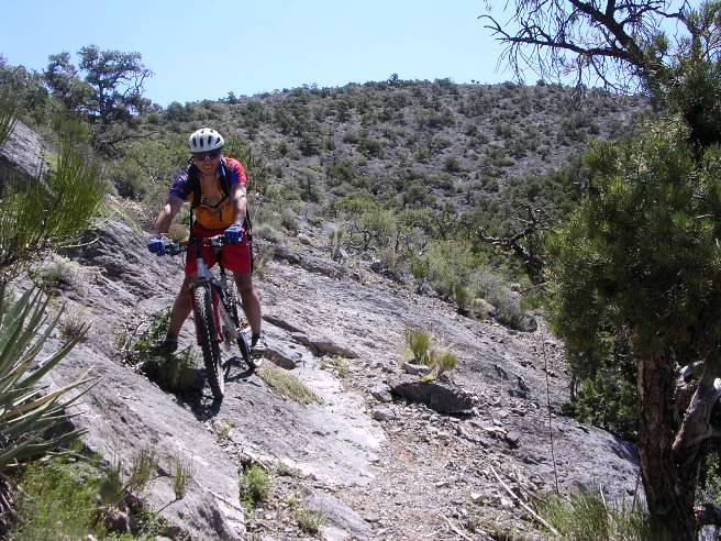
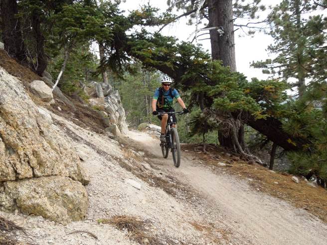
The photo below shows a local rider near the north end of the climb up Girl Scout.
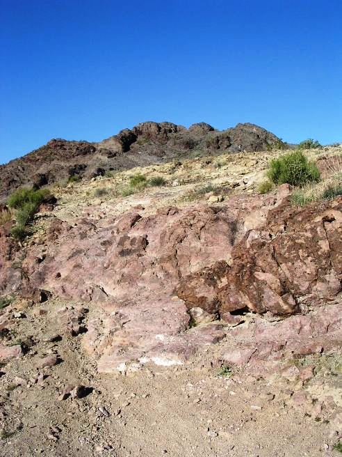
Girl Scout was definitely a climb with a few twists and turns, not to mention several rocky areas like the one shown below. This was at the top or north end of Girl Scout.
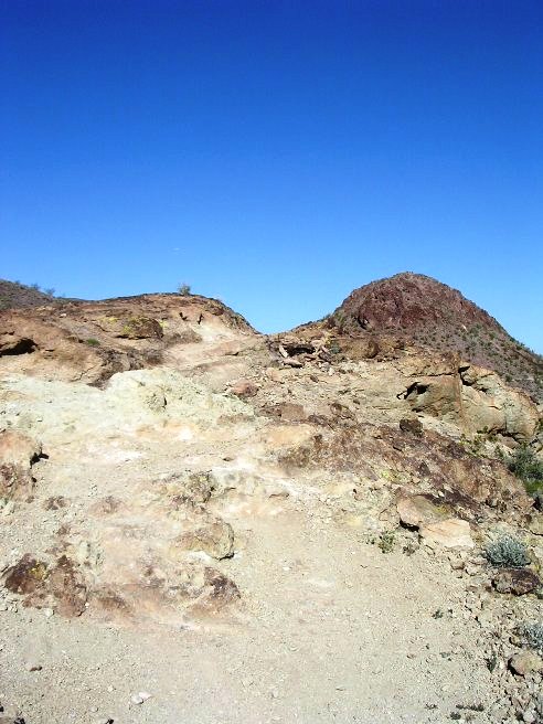
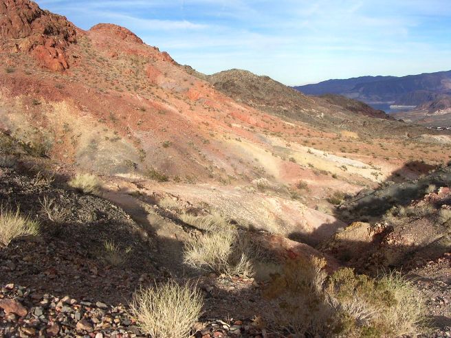
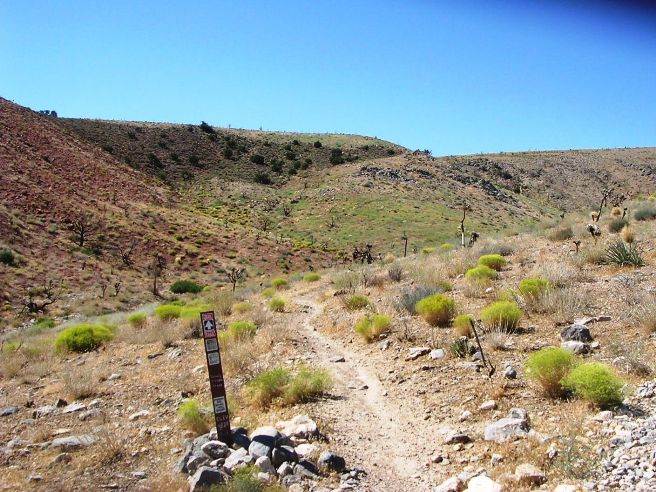
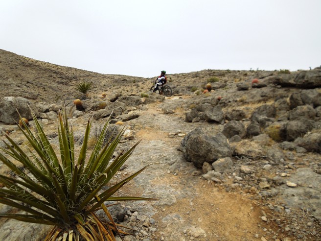
Boulder City, NV - Bootleg Canyon, Caldera Loop The top or north end of Girl Scout is close to the west entrance of the Caldera Loop. This trail gets its name from the rim of the ancient volcanic caldera it follows. Bruce first rode the Caldera Loop while in Las Vegas on business in 2007 and several more times will working in Vegas from 2010 to 2012.
The statistics for the Caldera Trail ride are provided below along
with a map showing the track and profile and statistics. The track
and profile is for the clockwise direction. Reverse it for a
counter-clockwise ride.
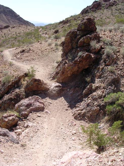
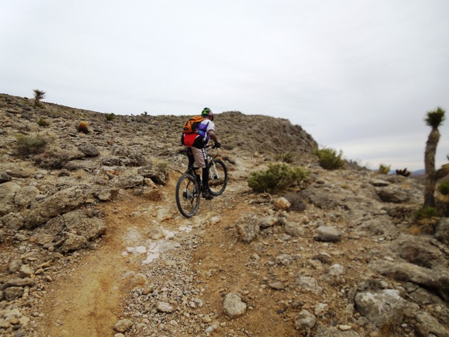
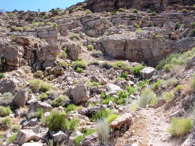
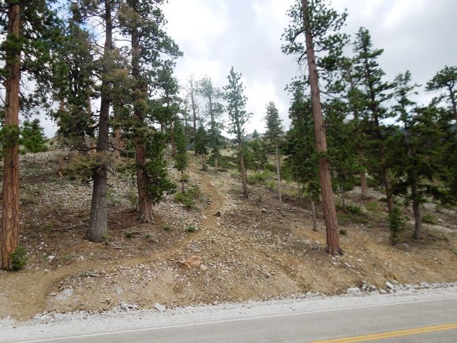
Right click on the GPX link above to download a GPX file for this ride. The GPX file may want to save as an XML file, so if it does, change the extension to gpx before you save it. The file is a high-resolution track with points are every 10' created on the Delorme PN-60W GPS. You can right-click on the image below and use the "Save Target As" option to down-load a 1MB 11x17" PDF version of the map that can be printed. You can also click on the image to open it in a new window and zoom up to 200% for a detailed view. (Insert Track-Profile map with link to tabloid-sized PDF) This is the kind of trail on which you will use all your gears, and spend a lot of time in 1-1. The grades are not impossibly steep, but go on for some distance, making it necessary to slow down to a sustainable climbing pace. The photo below shows the entrance to Caldera. Yes there is a trail there. It turns right to enter the rocky area and then turns left to go up and over the top..
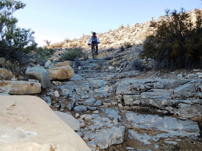
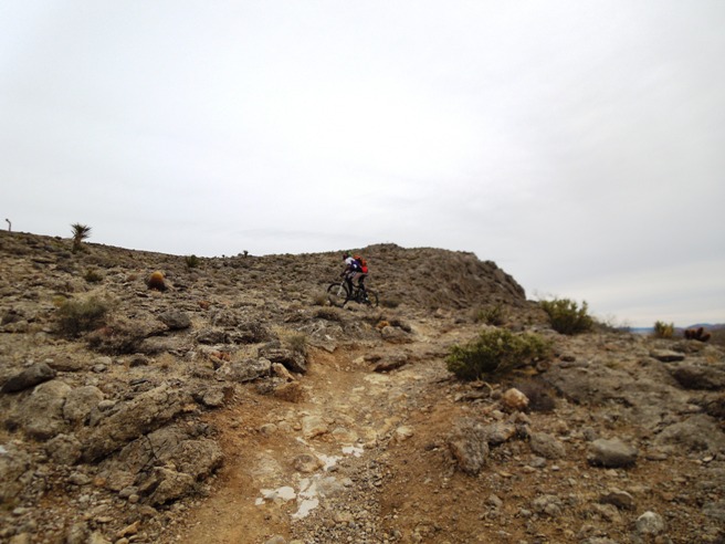
The second rocky climb on Caldera. The photo below really doesn't show the height and steepness.
The photo below shows the third climb on Caldera. All three climbs are in the first half mile.
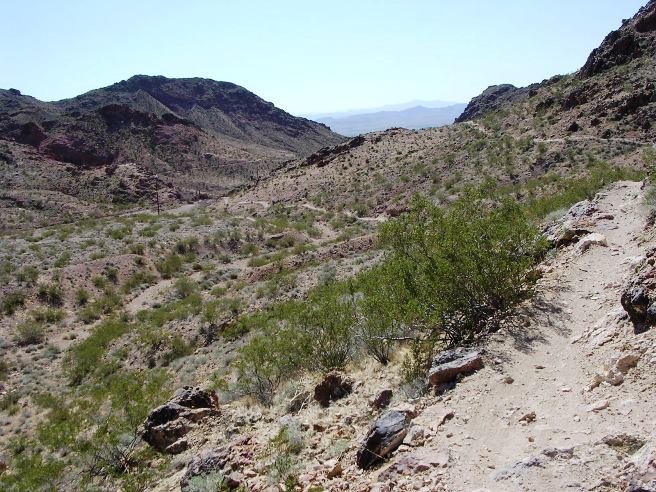
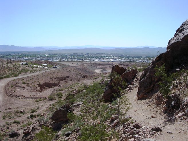
Once up top, you get a spectacular view of the desert and Las Vegas in the distance.
After circling around through the desert to the east side, you start back into the mountains. Below is a photo of one of several dry wash crossings on Caldera.
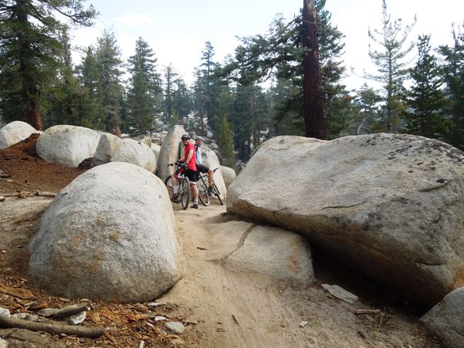
There are a number of rock gardens similar to the one shown below.
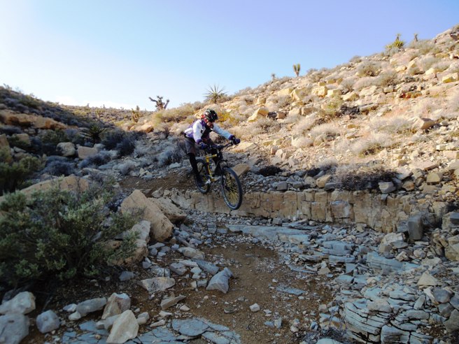
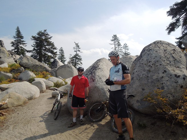
There is a nice drop and turn near the end of Caldera. To keep things in perspective, the rock in the center of the photo below is 8 to 10 feet high.
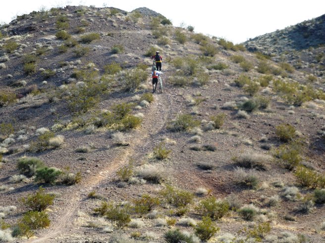
Boulder City, NV - Bootleg Canyon, West Leg Loop The Caldera Loop circles back to its beginning and the end of Girl Scout. One of the ends of West Leg also appears at that location. From Caldera, Bruce took West Leg back to the parking lot at the main trail head. Bruce first rode the West Leg Trail while in Las Vegas on business in 2007 and many more times will working in Vegas from 2010 to 2012. The statistics for the (Trail Name) ride are provided
below along with a map showing the track and profile and statistics. The track and profile
is for the clockwise direction. Reverse it for a counter-clockwise ride.
Right click on the GPX link above to download a GPX file for this ride. The GPX file may want to save as an XML file, so if it does, change the extension to gpx before you save it. The file is a high-resolution track with points are every 10' created on the Delorme PN-60W GPS. You can right-click on the image below and use the "Save Target As" option to down-load a 1MB 11x17" PDF version of the map that can be printed. You can also click on the image to open it in a new window and zoom up to 200% for a detailed view. (Insert Track-Profile map with link to tabloid-sized PDF) This is the kind of trail on which you will use all your gears, and spend a lot of time in 1-1. The grades are not impossibly steep, but go on for some distance, making it necessary to slow down to a sustainable climbing pace. The photo below shows Looking back on one of the drops and climbs near the beginning of West Leg.
The photo below shows a rock crossing with a bit of a drop-off on West Leg.
More climbing on West Loop.
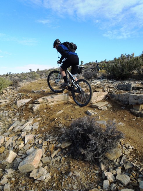
The Bootleg equivalent of "no-brakes" below, but with a higher penalty for failure.
Looking back on another wash crossing on West Loop.
Getting around the rock outcropping below is important. Otherwise you can count on some rocks "breaking" your fall.
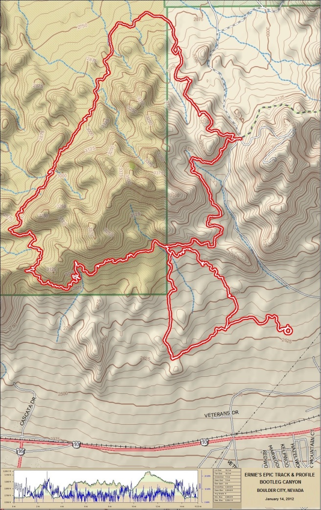
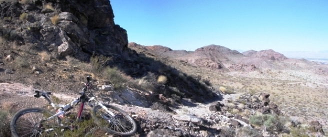
Boulder City, NV - Bootleg Canyon, Ernie's Epic Trail During 2011, Bruce had an opportunity to ride Ernie's Epic on two occasions: once in May and once in November. He also rode it January of 2012 with one of his Vegas friends, Preston Hooton, and Paul "Tait" Hakes from Dallas when Tate came out to Vegas for CES. Ernie's is a 15.2 mile "intermediate level" loop covering a variety of terrain that takes about 3 1/2 hours of ride time to complete. It starts at the circle parking lot southwest of the main lot, and circles back around to Caldera and West Leg. The statistics for the Ernie's Epic ride are provided
below along with a map showing the track and profile and statistics. The track and profile
is for the clockwise direction. Reverse it for a counter-clockwise ride.
Right click on the GPX link above to download a GPX file for this ride. The GPX file may want to save as an XML file, so if it does, change the extension to gpx before you save it. The file is a high-resolution track with points are every 10' created on the Delorme PN-60W GPS. You can right-click on the image below and use the "Save Target As" option to down-load a 1MB 11x17" PDF version of the map that can be printed. You can also click on the image to open it in a new window and zoom up to 200% for a detailed view.
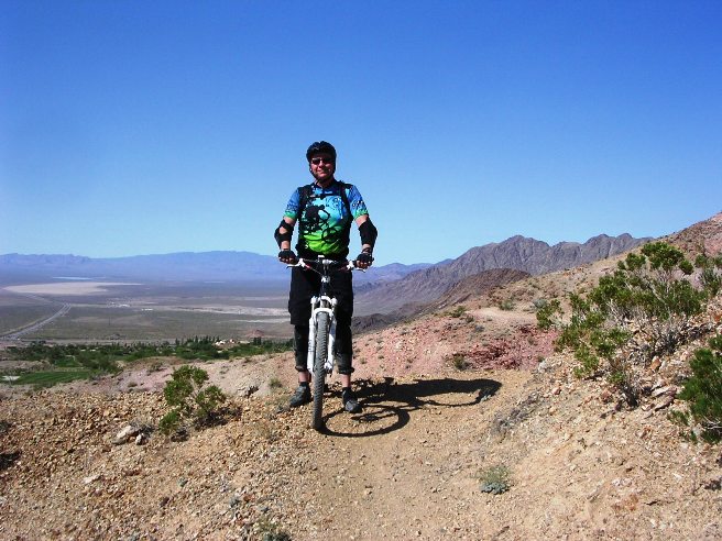
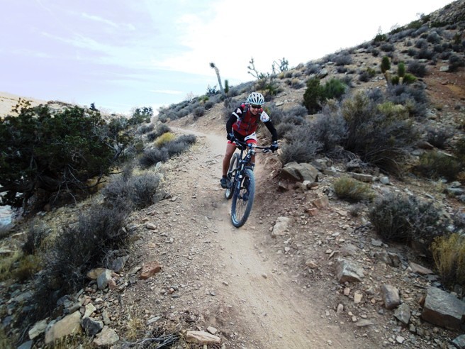
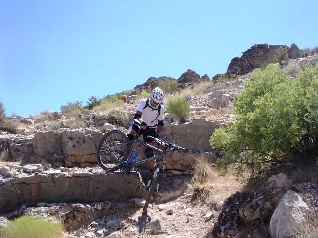
This is the kind of trail on which you will use all your gears, and spend a lot of time in 1-1. Some of the grades are very steep and had to be hiked. Others go on for some distance, making it necessary to gear down to a sustainable climbing pace. The photo below shows Bruce at the start of the May 30, 2011 ride fresh, set and ready to go.
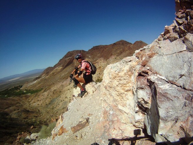
Much of the trail is bench-cut into the side of the mountains as can be seen below. You have to stay on your toes because the penalty for failure is fairly steep.
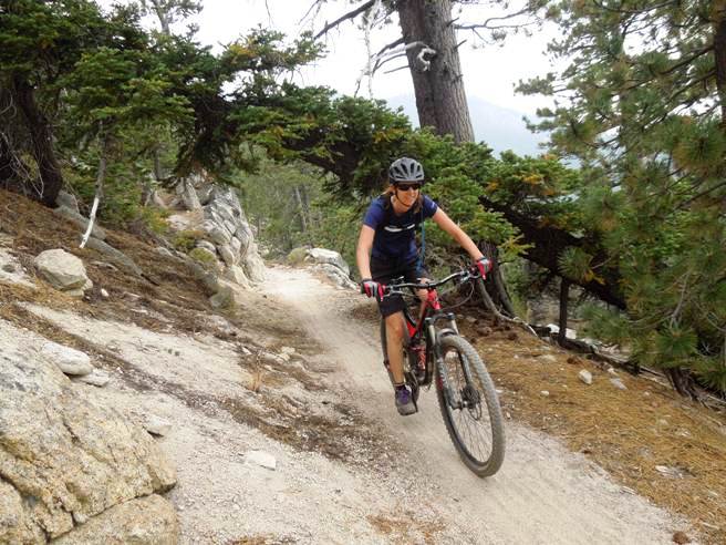
Below is a shot of Bruce's friend Debbie taking a break during the May 30, 2011 ride. He met Debbie at Bootleg in 2010 and she showed him the various trails out there. The section of trail shown below goes between Debbie and the rock face, and demands careful attention to your line and gearing.
At the top of the first ridge, you get an impression of what this trail is all about. This is the first of three mountain ridges to cross. The second can be seen in the background. If you look carefully, you can see the trail in the hills just to the right of the handle bars. There is one more beyond that one.
Below is a shot of Debbie climbing a switch-back near the end of Ernie's during the May 2011 ride.
This is a rock wall near the end of Ernie's. The photo from the May 2011 ride doesn't do it justice. The wall is nearly 5' high with a climbing angle of over 45 degrees.
Below is a photo of the group that turned out for the Southern Nevada Mountain Bike Association (SNMBA) ride in November of 2011.
The photo below shows one of the ladies on the southwest section of the trail during the November 2011 ride.
Next photo is a wide angle shot of the southwest section of the trail near the start of the ride and shows just how exciting this part of the bench-cut can be. The trail cuts across the middle of the photo below.
The telephoto shot below shows a rider on the southwest section of Ernie's.
The photo below shows Paul Hakes starting out on the southwest bench-cut section of Ernie's during a ride in January of 2012.
The photo below shows Tate with Bruce's friend Preston from Vegas at the top of the first of three ridges they had to cross. The second ridge can be seen in the background. You can just barely make out the trail at the foot of the ridge.
The photo below shows Tate and Preston pausing for a break on the second ridge during the January 2012 ride.
The photo below shows why Preston and Tait paused. They wanted to check out the trail before descending the back side of the second ridge.
Below is a photo of Tait and Preston "climbing" up the third and final ridge on Ernie's during the January 2012 ride.
Boulder City, NV - Bootleg Canyon, The Boy Scout Trail Introduction to the trail and ride including any other riders or group with you. The statistics for the (Trail Name) ride are provided below along with a map showing the track and profile and statistics. The track and profile is for the clockwise direction. Reverse it for a counter-clockwise ride.
Right click on the GPX link above to download a GPX file for this ride. The GPX file may want to save as an XML file, so if it does, change the extension to gpx before you save it. The file is a high-resolution track with points are every 10' created on the Delorme PN-60W GPS. You can right-click on the image below and use the "Save Target As" option to down-load a 1MB 11x17" PDF version of the map that can be printed. You can also click on the image to open it in a new window and zoom up to 200% for a detailed view. (Insert Track-Profile map with link to tabloid-sized PDF) This is the kind of trail on which you will use all your gears, and spend a lot of time in 1-1. The grades are not impossibly steep, but go on for some distance, making it necessary to slow down to a sustainable climbing pace. The photo below shows (description).
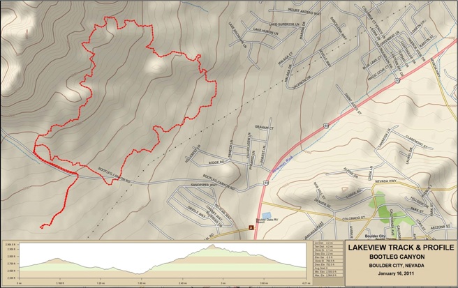
Boulder City, NV - Bootleg Canyon, The Lakeview Trail The Lakeview trail system is actually three separate trails that interconnect. They are the Lower Lakeview, the Middle Lakeview and the Upper Lakeview. The Lower and Upper Lakeview trails make for a 4.2 mile loop with a fair amount of terrain variation. The Middle Lakeview bisects this loop and is flatter. Bruce rode the Lower and Upper Lakeview Trails on January 16, 2011. The statistics for the Lakeview Trail ride are provided below along with a map showing the track and profile and statistics. The track and profile is for the clockwise direction. Reverse it for a counter-clockwise ride.
Right click on the GPX link above to download a GPX file for this ride. The GPX file may want to save as an XML file, so if it does, change the extension to gpx before you save it. The file is a high-resolution track with points are every 10' created on the Delorme PN-60W GPS. You can right-click on the image below and use the "Save Target As" option to down-load a 1MB 11x17" PDF version of the map that can be printed. You can also click on the image to open it in a new window and zoom up to 200% for a detailed view.
This is the kind of trail on which you will use all your gears. Some of he grades are steep, making it necessary to slow down to a sustainable climbing pace. Starting out on the Lower Lakeview with a view of Lake Mead in the distance. The Lower Lakeview is a beginner to intermediate level trail.
Further out, the Lower Lakeview Trail gets a bit more technical.
The Lower Lakeview joins the Upper Lakeview and now things get harder.
The switchback descent above transitions into a switchback climb below that gives you a real workout.
The photo below looks back at the switchbacks and gives a good view of the challenge this section offers.
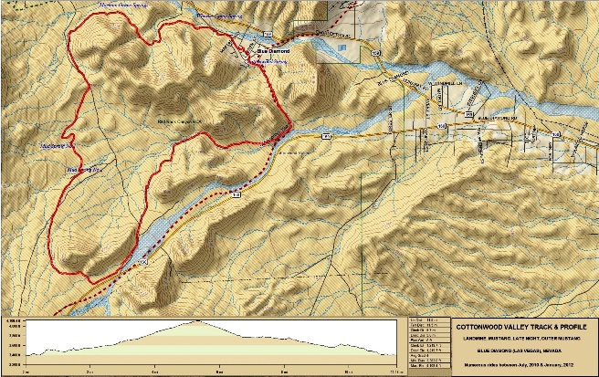
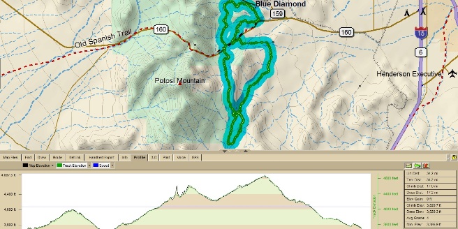
Las Vegas, NV - Cottonwood Red Rock, Landmine - Mustang Trails The first set of trails Bruce rode were north of Nevada SR-160 and included the Landmine, Mustang, and Late Night and Outer Mustang Trails. The Land Mine - Mustang loop is very popular and the loop most renters ride. The loop is normally ridden clockwise from the trail head near McGhie's Bike Outpost in Blue Diamond.
The statistics for the for the Landmine, Mustang, and Late Night and
Outer Mustang loop ride are provided below along
with a map showing the track and profile and statistics. The track
and profile is for the clockwise direction. Reverse it for a
counter-clockwise ride.
Right click on the link to the GPX file above to download a GPX file for this ride. The GPX file may want to save as an XML file, so if it does, change the extension to gpx before you save it. The file is a high-resolution track with points are every 10' created on the Delorme PN-60W GPS. The track and profile for this ride are shown in the image below. The two green dots are the Blue Diamond Trail Head (BD TH) and Late Night Trail Head (LN TH). Right-click on the image below and use the "Save Target As " option to down-load a 1MB 8.5x11" JPG version of this map. You can also click on the image and zoom to 200% for a detailed view in a separate window. [Right click here to down load the GPX file.] The file will want to save as an XML file, so change the extension to gpx before you save it. The file is a high-resolution track created on the Delorme PN-60W GPS. Right-click on the image below and use the "Save Target As" option to down-load a 1MB 11x17" PDF version of the map that can be printed. You can also click on the image to open it in a new window and zoom up to 200% for a detailed view.
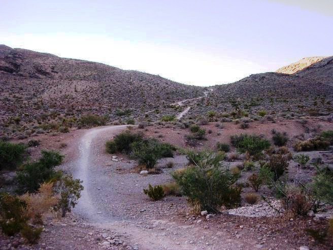
This is the kind of trail on which you will use all your gears. The grades are not impossibly steep, but some go on for some distance, making it necessary to slow down to a sustainable climbing pace. The length of this loop is just under 12 miles and it has about 1,240' of cumulative ascent. The elevation at Blue Diamond is 3,385', and it hits a maximum elevation of 4,108' just west of the Late Night trail head. The average grade is 4%. The initial climb from the trailhead is 200' in 0.4 miles, giving you a good "warm-up." The maximum grade on this climb is 22%, meaning you climb 22' for every 100' traveled. The photo below shows the climb from the Blue Diamond trail head. The maximum grade is near the top. This trail is called the "Welcome to Nevada" climb for first timers as it is the first good climb encountered, and it happens within sight of the trail head.
Below is a shot of Bonnie, a rider from the Dallas area, near the top of the climb. The community of Blue Diamond is in the distance.
On many rides, Bruce would across wild burros. Here are a couple at the top of the climb. The Burros are escapees from the mining days a century ago and are common in the Conservation Area. The photo below is of the burros along the trail and of the magnificent vistas afforded from the trail.
Down the trail, you come to a split where you see Preston below. The right fork takes you up a climb and over the hill. The left fork takes you around the hill and down a drop. The hill is an aerobic challenge and the drop is a technical skills challange. Both forks end up at the same junction beyond the hill.
Down the right fork you come to one of the most demanding climbs on the "intermediate" section of the trail. Below is a photo made from the bottom of the climb.
The photo below shows Debi from Basel, Switzerland, coming up the climb. Bruce can be seen down below waiting his turn to attempt the climb.
The climb is tough, but once at the top, you are rewarded with a magnificent view and then a fun descent.
After the descent, you ride some fairly flat, routine single track until you come to the BFR. The "B" stands for Big and the "R" stands for Rock. Chris calls it the Big Friendly Rock, but others use a different word for the middle initial. The photo below shows the approach to BFR, which is much steeper than it appears in the photo.
The BFR is a moderate challenge for intermediate level riders. Below is a photo of Bruce climbing up and over the rock.
After the BFR, it's a cruise down a canyon and around some hills before beginning the climb to the parking lot and Late Night trail head on Nevada SR-160.
You pass through some canyons further down the trail. Below is Juan and Jon coming out of one of them.
From this point, follow the trail to the second junction and stay left. Past the junction, you climb three small hills Bruce refers to as the Three Sisters. Below is Bruce at the top of the first hill. The canyon in the previous photo can be seen in the distance.
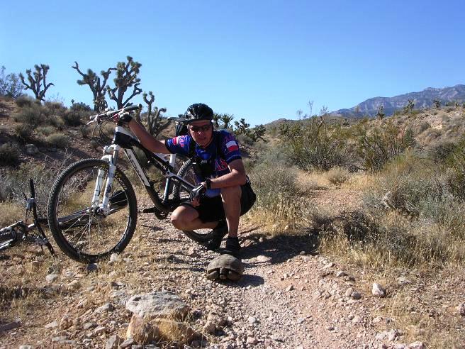
Past Three Sisters, it down through a wash and on up to the Late Night trail head. Along the way you can encounter protected wildlife. Below is Bruce with an endangered desert tortoise he came across on the trail. As protected wildlife in a conservation are, the tortoise is strictly "hands off".
Finally, it is a long, gradual 2-mile climb with 380 ft. elevation gain to the Late Night trail head.
At the end of the climb you arrive at the Late Night trail head where there is the parking lot, restrooms and a nice trail map stone carving. This is almost the half-way point of the loop, and nearly all of the climbing is done,
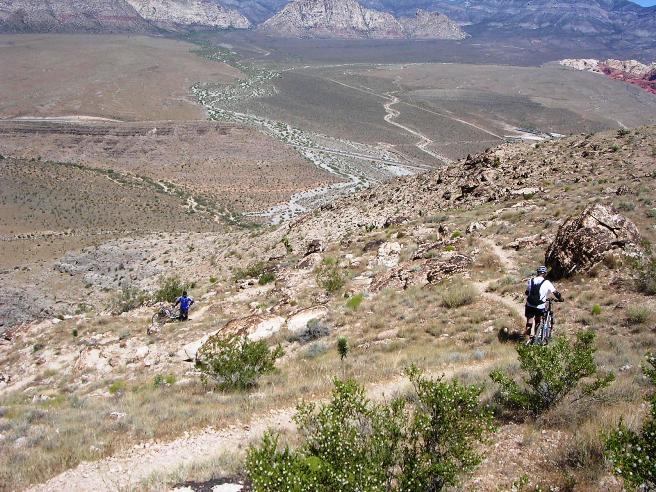
Next, you travel west from the parking up the Mustang/Late Night Trail. About a half-mile up, you reach the junction where the Mustang Trail branches off to the right (north).
Shortly after entering the Mustang Trail, you begin a 2-mile, 400' descent to the valley floor. It is quite a ride, much like a bobsled run on a mountain bike. The locals call this long descent into the valley "Viagra" saying if this doesn't get you excited, nothing will.
Here is Bruce coming down Viagra on a "Top Gear" run. When conditions are good, you can get into your top gear an hit 30+ MPH in the dirt, if your top gear will allow you to go that fast.
At the end of Viagra you come to a three-way junction. The options are to take right fork back to the Light Night trail head on the Mustang Loop, continue straight and take the cutoff back to BFR, or go left down through the wash to the Outer Mustang Loop. Below is Preston at the junction heading towards Outer Mustang.
The trip down into the wash at the start of Outer Mustang is a bit loose and requires the right line. It also requires as much speed as you can get to be able to clear the the rocky climb out of the wash.
While the trip down is loose gravel, the climb out is rocky, especially near the top.
Beyond the wash, you come to a trail section known as "Little Daytona". This is a straight, smooth, downhill section that is another top gear run. The trail is the most fun after rain when it is packed down firm. Here it is in its normal, dry, loose state. Even in this condition, it is possible to hit 30+ MPH in the dirt.
At the end of "Little Daytona" you encounter a small climb, kiosk and trail intersection. Below is a couple of riders finishing up a run down "Little Daytona" and climbing up to the kiosk. It also gives a good view of therun down Viagra and "Little Daytona".
Here is the kiosk at the top of the hill.
Following the trail to the right takes you back to BFR, and left takes you down Outer Mustang to Blue Diamond. Here is a rider taking a break before another fast descent.
At the bottom of this run, you encounter a sandy stretch and rock garden. This is a hard, tricky ride because it starts out loose and sandy, with poor traction.
The trail then transitions to rocks that tend to steer you, making for an additional skills challenge.
After the rock gardens, there is a bit more rocky climbing.
The final leg into Blue Diamond and the finish are just around the corner and across a couple of washes. The washes are a blast, like a roller coaster ride on a mountain bike.
Ahead, Blue Diamond sits like a green oasis in the desert, and the ride is just about complete.
Even though this is a 12 mile loop, the climbs and rocks make it a 1.5 hour ordeal for the average rider on what the locals consider an "easy" trail. Las Vegas, NV - Cottonwood Red Rock - Landmine - Wounded Knee - Late Night - Black Velvet Trails An intermediate to expert variation to the Landmine-Mustang loop can be done by including the Wounded Knee, Lawn Mower, Late Night and Black Velvet trails. The track and profile for this variation is shown in the image below, overlaying the normal Landmine-Mustang-Outer Mustang described above. The Wounded Knee and Lawn Mower sections are the loop to the south-east, and the Late Night and Black Velvet sections are up against the mountains west of the Mustang Trail. Being up against the mountains results much more rugged terrain, making these two trails much tougher than most of the other trails in the valley. All four of these sections are advanced intermediate to expert level trails, and are definitely not recommended for beginners. The statistics for the Landmine-Mustang-Outer Mustang-Wounded Knee-Lawn Mower loop are provided below along with a map showing the track and profile and statistics. The track and profile is for the clockwise direction. Reverse it for a counter-clockwise ride.
Right click on the GPX link above to download a GPX file for this ride. The GPX file may want to save as an XML file, so if it does, change the extension to gpx before you save it. The file is a high-resolution track with points are every 10' created on the Delorme PN-60W GPS. You can right-click on the image below and use the "Save Target As" option to down-load a 1MB 11x17" PDF version of the map that can be printed. You can also click on the image to open it in a new window and zoom up to 200% for a detailed view.
This is the kind of trail on which you will use all your gears, and spend a lot of time in 1-1. The grades are not impossibly steep, but go on for some distance, making it necessary to slow down to a sustainable climbing pace. For folks renting bikes, this route is also normally ridden from the trail head near McGhie's Bike Outpost in Blue Diamond. The two green dots are the Blue Diamond Trail Head (BD TH) and Late Night Trail Head (LN TH). Right-click on the image above and use the "Save Target As " option to down-load a 2MB 11x17" JPG version of this map. You can also click on the image and zoom to 200% for a detailed view in a separate window. The length of this loop is just under 20 miles and it has about 2,465' of ascent. The elevation at Blue Diamond is 3,385', and this ride hits a maximum elevation of 4,254' compared to 4,108' for the Landmine-Mustang loop. The high spot is in the southwest corner of the map where the GPS track comes up against the foot of the mountain near its crossing with the Jeep road. The average grade on this loop is 5% compared to 4% for the Landmine-Mustang loop. The Wounded Knee, Lawn Mower, Late Night and Black Velvet sections are advanced intermediate to expert level trails, and are definitely not for beginners. This ride follows the Landmine trail across BFR and then turns left at the first intersection as you exit the canyon on to the Wounded Knee Trail. When you turn left, you enter another canyon and begin a climb to the top of hill. The trail twists and turns through the rocks. Below is a shot of Bruce on the climb up to the top of the hill.
There are a number of ledges to clear along the way. Here is Bruce climbing the last big one near the top.
The rest of the climb to the summit is fairly easy. Here is Tate and Bruce at the top.
Next, it's down the backside to the "Waterfall". Here is Preston negotiating a rocky turn and drop.
After a couple of descending switchbacks it's down the rocky descent the locals call the "Waterfall". Below is Preston dropping off the first ledge.
Next, it's down the "Waterfall".
Use this link to see a short VIDEO of Bruce descending the "Waterfall". This is a full HD video, so watch it full screen for best results. Lawnmower Trail After Wounded Knee and the "Waterfall", you follow the trail south to the Old Spanish Trail and then west to the cut-off to the Lawnmower Trail. The cut-off goes right (north) and is marked by rock marker and clearance light from a truck.
This is a long, steep switchback climb. The trail gets it's name from an old lawnmower marking the entrance to the trail. Below is a shot of Preston and the lawnmower at the entrance to the trail.
Late Night Trail The Late Night Trail starts outs looking fairly routine as you can see below.
A little further in things start to get a little rough.
The further in you go, the rougher things get. The rocks keep getting larger.
Black Velvet The Black Velvet Trail picks up where Late Night leaves off in terms of difficulty. It is several miles across rocky terrain like that shown below.
Below is a shot of Bruce and Tate next to one of the rocks along the trail. This rock came down off the cliff. Glad no one was around when it did.
Las Vegas, NV - Cottonwood Red Rock, Badger Pass, 3 Mile Smile & White Rhino Trails For the first month in the Vegas area, Bruce spent most of his time on the Landmine, Mustang, Late Night and Outer Mustang trails. The ride up through Badger Pass and up The 3-Mile Smile is one of the first he did south of NV-160. After "discovering" it, he rode it at least once a month.
The statistics for the Landmine, Mustang, Badger Pass,
3-Mile Smile, Late Night and Outer Mustang ride are provided below along
with a map showing the track and profile and statistics. The track
and profile is for the clockwise direction. Reverse it for a
counter-clockwise ride.
Right click on the GPX link above to download a GPX file for this ride. The GPX file may want to save as an XML file, so if it does, change the extension to gpx before you save it. The file is a high-resolution track with points are every 10' created on the Delorme PN-60W GPS. You can right-click on the image below and use the "Save Target As" option to down-load a 1MB 11x17" PDF version of the map that can be printed. You can also click on the image to open it in a new window and zoom up to 200% for a detailed view.
This is the kind of trail on which you will use all your gears, and spend a lot of time in 1-1. The grades are not impossibly steep, but go on for some distance, making it necessary to slow down to a sustainable climbing pace.
In December, one of Bruce's riding friends, Bonnie from DORBA in Dallas, came out to Vegas for some training. She came early Sunday and Bruce was her guide for an afternoon ride before she checked into her hotel. Below is Bonnie at McGhie's Bike Outpost with her rented Gary Fisher 29" full suspension bike.
The initial climb from the trailhead is 200' in 0.4 miles, giving you a good "warm-up." The maximum grade is 22%, meaning you climb 22' for every 100' traveled. The maximum grade is near the top. The photo below shows Bonnie on the climb from the Blue Diamond trail head. This trail is called the "Welcome to Nevada" climb for "flat landers" as it is the first good climb encountered, and it happens at the beginning of the trail head.
Since the entire area used to be mining territory, you often see wild Burros out on the trails. Below are a couple Bruce photographed on his August 14, 2010 ride.
On the way out Landmine, you quickly encounter a second climb. Below is Bonnie grinding it out on the December 11, 2011 ride.
It is on up Landmine and Mustang to the Late Night Trail head. Here you cut off to the south and pass under NV-160 through a set of culverts.
Past the culverts, it is 3 miles of steady climb to Badger Pass. The elevation gain is 640 feet. The photo below shows the look ahead.
Below is a photo looking back as Bonnie grinds it out.
Once you get to the top, there is a switchback descent dropping down off Badger Pass to 3-Mile Smile.
After a minute or two of descending, it is time to start another climb: this time up up 3-Mile. The photo below shows the start of the climb.
Below is Bruce and a group of SNMBA riders at the top of 3 Mile on a January 22, 2011 ride. Mark McMahan is on the far right.
At the top, you can either continue out to the Wilson Tank overlook or turn around and bomb back down. Below is Bonnie screaming down 3-Mile trailing a cloud of dust on the December 11, 2011 ride.
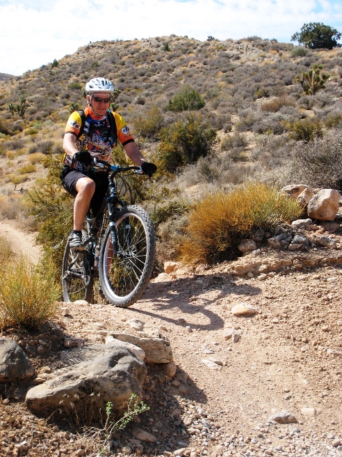
You can see a great video Bonnie made of her run down 3-Mile using this LINK. Below is Bruce at the end of 3-mile on the August 4, 2012 ride.
From 3-Mile, it is down to White Rhino. This section of trail gets its name from the white gypsum ledge you drop off of. Below is Bonnie descending White Rhino on the December 11, 2011 ride.
From here it was on down back under the highway through another set of culverts to Late Night and Viagra. You can see a great video Bonnie also made of the run down White Rhino and Viagra using this LINK. Las Vegas, NV - Cottonwood Red Rock, Landmine - Mustang - Dead Horse - 3 Mile Smile, Late Night and Outer Mustang Trails After riding Badger Pass and 3 Mile, Bruce decided to really up his game by riding the Dead Horse and 3-Mile Smile trails from Blue Diamond. This took his ride from 21 miles and about 1,000 feet of climbing to over 25 miles and 3,200 feet of climbing. Parts of Dead Horse are have some demanding climbs and is rather technical features in other places, so it is considered an expert-level trail. Once Bruce became familiar with these trails, he also rode them about once a month.
The statistics for the Landmine, Mustang, Dead Horse,
3-Mile Smile, Late Night and Outer Mustang ride are provided below along
with a map showing the track and profile and statistics. The track
and profile is for the clockwise direction. Reverse it for a
counter-clockwise ride.
Right click on the GPX link above to download a GPX file for this ride. The GPX file may want to save as an XML file, so if it does, change the extension to gpx before you save it. The file is a high-resolution track with points are every 10' created on the Delorme PN-60W GPS. You can right-click on the image below and use the "Save Target As" option to down-load a 1MB 11x17" PDF version of the map that can be printed. You can also click on the image to open it in a new window and zoom up to 200% for a detailed view.
This is the kind of trail on which you will use all your gears, and spend a lot of time in 1-1. The grades are not impossibly steep, but go on for some distance, making it necessary to slow down to a sustainable climbing pace. The photo below shows the initial climb up from the Late Night trailhead at SR-160 in the distance. The initial climb is from 3,956' to 4,790' AMSL in 3.4 miles, a gain of 834'.
The remaining trails sections on Dead Horse are undulating between 4,500' and 5,000' over the 6 miles or so. The photo below shows a descent at about 9 miles into the ride.
After each descent there is usually a climb. Below is one at about 10 miles in.
The final "challenge" is Satan's Escalator at about 11 miles into the ride. This is a steep switch-back climb of over 200' in about 1 mile. The switchbacks are very sharp, and gave the long wheel-base of his 29er XL a real challenge at times.
Over the top at Satan's Escalator, you encounter a long plateau that is mostly down-hill towards Wilson's Tank. The photo below shows the view looking back towards the Escalator which is on the left side of the photo below.
The terrain on the plateau out to Wilson's Tank has its ups and downs and is quite rocky since it is up against the mountains. Below is a view of the trail about half-way out the plateau to Wilson's Tank.
After riding two miles across the plateau, you reach Wilson Tank. The view from the 4,600' elevation is spectacular. Las Vegas can be seen in the distance on the horizon.
The return trail across the east side of the plateau to Cottonwood Valley Pass is much less rocky.
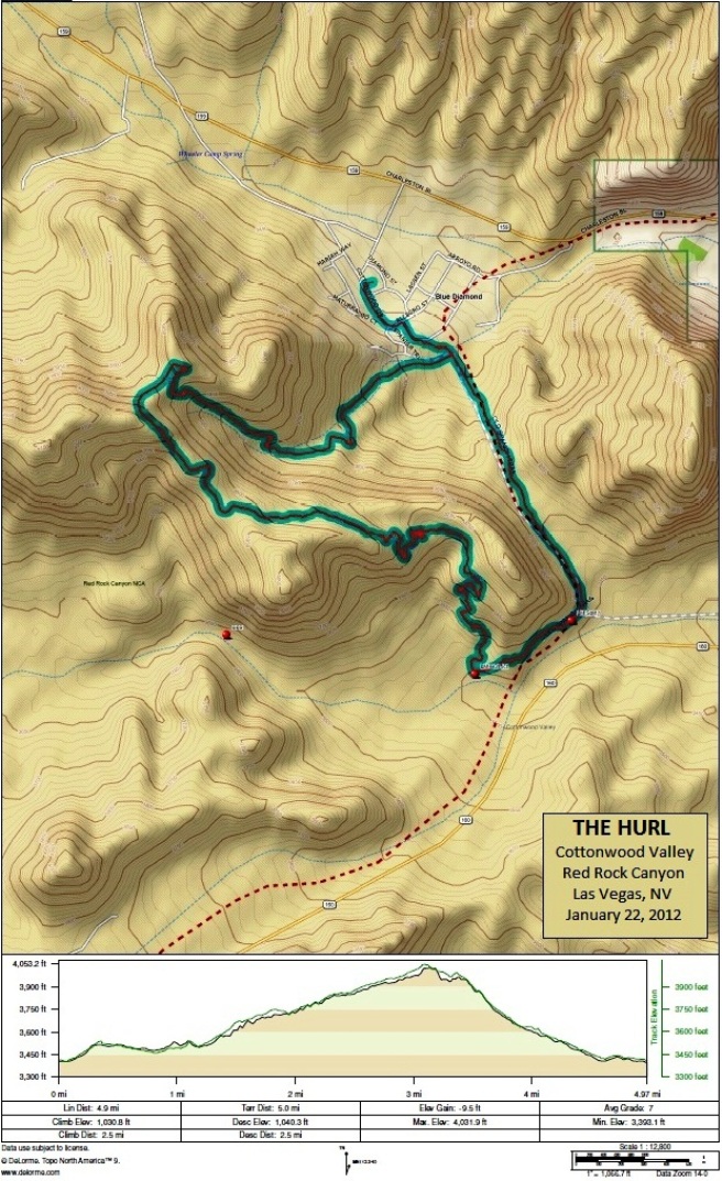
After crossing the "plateau", you come to Cottonwood Pass and the beginning of the 3-Mile Smile trail described in the previous section. Las Vegas, NV - Cottonwood Red Rock, The Hurl Trail The Hurl is one of the most technical trails in the Cottonwood Valley section of Red Rock Canyon. It is a short trail at 6.2 miles, but has nearly 1,200 ft of climbing. The average grade is a 7, compared to a 4 for most of the rest of the trails at Cottonwood. Some parts of the trail have a 25% grade. The statistics for the Hurl Trail ride are provided below along with a map showing the track and profile and statistics. The track and profile is for the clockwise direction. Reverse it for a counter-clockwise ride.
Right click on the GPX link above to download a GPX file for this ride. The GPX file may want to save as an XML file, so if it does, change the extension to gpx before you save it. The file is a high-resolution track with points are every 10' created on the Delorme PN-60W GPS. You can right-click on the image below and use the "Save Target As" option to down-load a 1MB 11x17" PDF version of the map that can be printed. You can also click on the image to open it in a new window and zoom up to 200% for a detailed view.
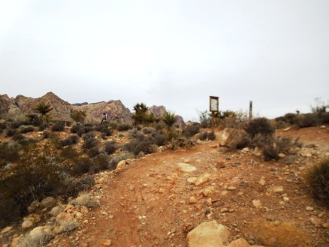
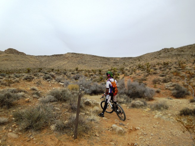
This is the kind of trail on which you will use all your gears, and spend a lot of time in 1-1. The grades are not impossibly steep, but go on for some distance, making it necessary to slow down to a sustainable climbing pace. The Hurl can be ridden in two directions. The first access point is from the Land Mine trail at the top of the climb up from Blue Diamond. The second is from the Land Mine Trail about a mile further out. This point is marked with the second red dot traveling clockwise on the loop in the map above. Riding the trail in a clockwise direction is more difficult because it means you climb rather than descend the steep rocky sections. The trail marker at the south entrance is shown in the photo below.
Initially, the trail looks innocent enough, but this is deceptive.
After some twisting and turning, you start to encounter rock.
Before long, the trail turns right, gets steeper, becomes all rock, making the climbing a bear. This climb presents itself after you have done several "normal" climbs. The photo below shows Preston on the first technical climb.
After a couple hundred feet of climbing the rock, the trail turns left and continues climbing.
Below is a shot of Preston on the third leg of the rocky, switch-back climb. The rocks momentarily interrupted his progress, but he got back on and rode it out.
Preston finally gives out near the top of this climb, taking a seat on his top tube.
The photos don't show it, but several sections on the climb are a 25% grade. That is 25' of climbing for ever 100' of trail, very rocky trail! On top, you have a spectacular view of valley. This one is looking south-west towards the Late Night trailhead.
At this point, you still haven't reached the top. There is still a bit of climbing to go as you can see below.
Once past the top, you reach an area where you can see Blue Diamond (your starting point) below.
As you start down, the scenery looking back is quite spectacular.
Now comes the scary part. The ride up tested your physical endurance. The ride down is really going to test your skills in negotiating rocky descents.
The penalty for failure here is quite "steep" as you can see on the right. In addition to being off-camber and rugged, it is also very loose. From here, it's all the way down the hillside, through the canyon and back to the starting point. At the end, you are simply grateful to have survived the experience. Las Vegas, NV - Cottonwood Red Rock, The Bonnie & Clyde Trail
The statistics for the Bonnie & Clyde ride are provided below along with a map showing the track and profile and statistics. The track and profile is for the clockwise direction. Reverse it for a counter-clockwise ride.
Right click on the GPX link above to download a GPX file for this ride. The GPX file may want to save as an XML file, so if it does, change the extension to gpx before you save it. The file is a high-resolution track with points are every 10' created on the Delorme PN-60W GPS. You can right-click on the image below and use the "Save Target As" option to down-load a 1MB 11x17" PDF version of the map that can be printed. You can also click on the image to open it in a new window and zoom up to 200% for a detailed view. (Insert Track-Profile map with link to tabloid-sized PDF) This is the kind of trail on which you will use all your gears, and spend a lot of time in 1-1. The grades are not impossibly steep, but go on for some distance, making it necessary to slow down to a sustainable climbing pace.
The ride started out at the parking lot for the Late Night trail head. The mountains got a "dusting" of snow that morning. Bruce, wanting it to be more, started at Blue Diamond, which added 12 miles and about 1200' of ascent to the "official" ride.
Parts of Bonnie & Clyde follow jeep trails or double track.
Other parts of the trail are for ATVs.
And then there is quite a bit of single track.
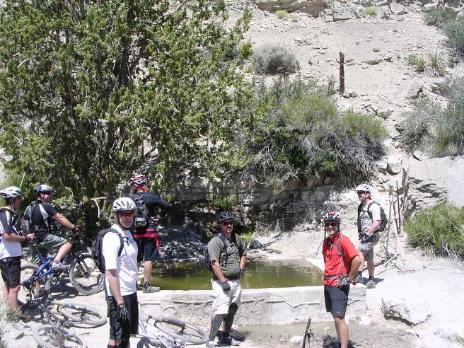
At about the 40% point, you come to Wilson's Tank. This is a pair of spring-fed covered livestock tanks.
After Wilson's Tank, it's around the end of the mountain and up on top. Below is Bruce on top. Wilson Tank is just over the edge and in the valley below.
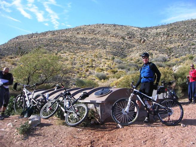
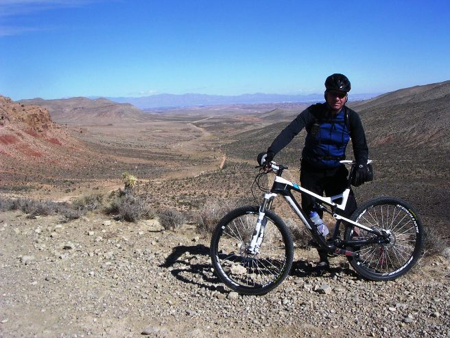
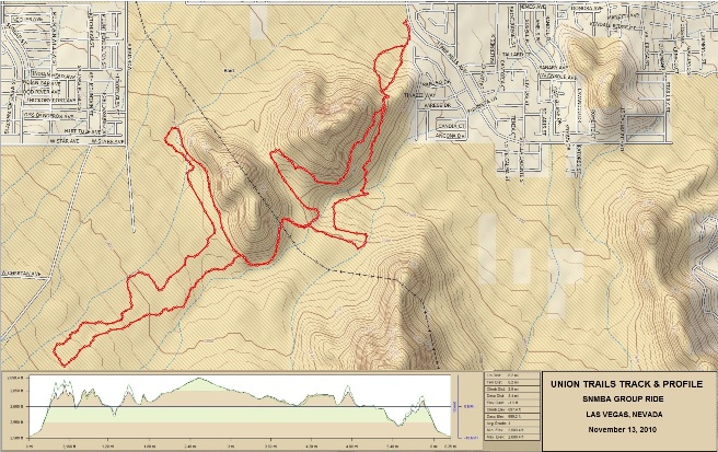
All in all, it was a very strenuous ride, one that he plans to do again. Back to the top Las Vegas, NV - The Union Trail The Union Trail is a trail system on the south side of Las Vegas near the Union Pacific railroad tracks. Bruce rode these trails twice while working in Vegas, once on November 13, 2010 and again on February 20, 2011. These trails are rather normal for the area, and provide a nice change of pace from the other more popular trails.
The statistics for the Union Trail ride are provided below along
with a map showing the track and profile and statistics. The track
and profile is for the clockwise direction. Reverse it for a
counter-clockwise ride.
Right click on the GPX link above to download a GPX file for this ride. The GPX file may want to save as an XML file, so if it does, change the extension to gpx before you save it. The file is a standard-resolution track created on the Delorme PN-60W GPS. You can right-click on the image below and use the "Save Target As" option to down-load a 1MB 11x17" PDF version of the map that can be printed. You can also click on the image to open it in a new window and zoom up to 200% for a detailed view.
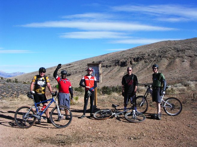
This is the kind of trail on which you will use all your gears, and even spend a bit of time in 1-1. The grades are not impossibly steep, but go on for some distance, making it necessary to slow down to a sustainable climbing pace. About half the trail is small, loose rocks. The photo below shows the Southern Nevada MTB group for the November 13, 2010 ride.
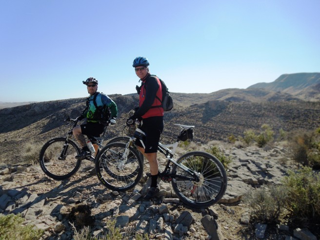
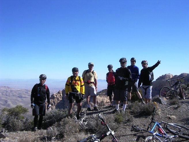
Las Vegas, NV - Red Rock, The Cowboy Trails The Cowboy Trails are in the Red Rock National Conservation Area north of Cottonwood Valley up at the equestrian area. These are some of the most technical trails in the area, and are considered "Advanced" or "Expert" trails. There are three segments to the Cowboy Trails: Bomb Voyage, Bob Gnarly and Bone Shaker. Bruce rode the Bomb Voyage segment on July 15, 2011.
The statistics for the Bomb Voyage segment ride are provided below along
with a map showing the track and profile and statistics. The track
and profile is for the clockwise direction. Reverse it for a
counter-clockwise ride.
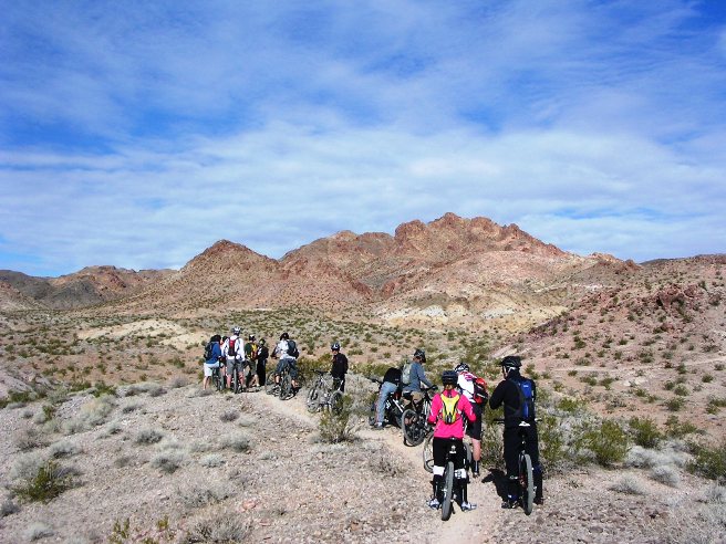
Right click on the GPX link above to download a GPX file for this ride. The GPX file may want to save as an XML file, so if it does, change the extension to gpx before you save it. The file is a high-resolution track with points are every 10' created on the Delorme PN-60W GPS. You can right-click on the image below and use the "Save Target As" option to down-load a 1MB 11x17" PDF version of the map that can be printed. You can also click on the image to open it in a new window and zoom up to 200% for a detailed view. (Insert Track-Profile map with link to tabloid-sized PDF) This is the kind of trail on which you will use all your gears, and spend a lot of time in 1-1. The grades are not impossibly steep, but go on for some distance, making it necessary to slow down to a sustainable climbing pace. The Cowboy Trails are in the Red Rock National Conservation Area north of Cottonwood Valley up at the equestrian area. These are some of the most technical trails in the area, and are considered "Advanced" or "Expert" trails. As you can see from the group photo below, most riders bring their "all mountain" bikes with the long travel suspensions for this ride, and they really need it on parts of the trail.
Like so many trails in Red Rock, it seems you go up a couple thousand feet to get to the real fun. This trail is no different. There is over 2,000' of climbing to the top.
The photo below shows the group stopping for a break about half-way up.
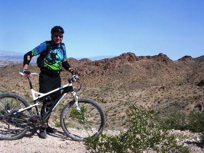
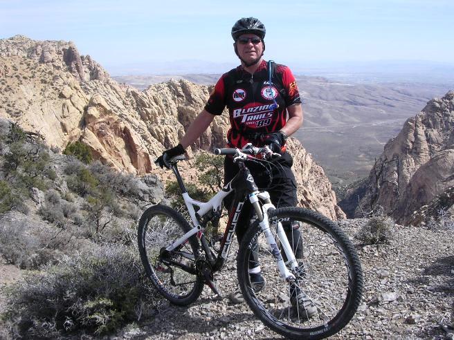
The ride up was a grind, over 2,000' of grinding to be exact. Below is a photo of Bruce on top after the initial climb with Las Vegas in the distance below.
At this point, things started getting really gnarly. It seemed to start out OK, but that didn't last long.
Before you knew it, you were hopping or dropping ledges every 50' or so. In the photo below, the trail goes up the ledge on the left.
Where there weren't ledges, it was rock. The photo below shows Mark negotiating a rocky climb up on top.
Bruce got his fill of rocky climbs this day. The photo below was taken by Steve as Bruce gave out near the top of one climb. Steve said to turn and look good regardless of the fact we were dying here. Steve's motto is "It is better to look good than to feel good."
After the rocky climbs came the rocky descents. In the bottom of the photo below you can make out Mark in red negotiating a rocky descent. If you look closely, you can see the other riders in the rocks. They are actually on the trail in the rocks.
The photo below gives a close-up of the trail Mark was on in the photo above. Some rode this section of trail, most walked.
Not everyone was able to ride this stuff. Below is Steve "negotiating" one of the turns. Some of the guys actually rode these drops. Most walked.
Once through the rocky areas, is was a long, relatively smooth and steep descent into the valley and on back to the parking lot.
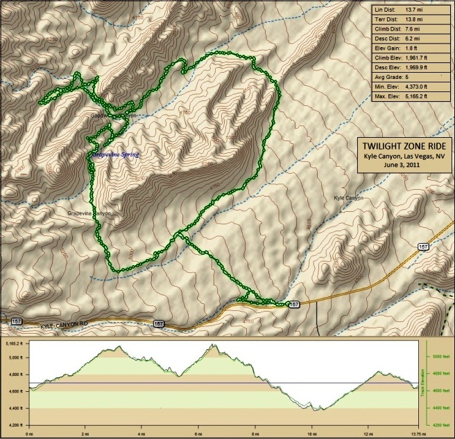
Afterwards, Steve and Bruce agreed they would not do this again, or so they said. up Las Vegas, NV - The Twilight Zone Trail About 5 miles out Kyle Canyon Road from US-95, there is a gravel parking lot on the right side of the road that is the trail head for the Twilight Zone Trail. This is a short, brutal 13.8 mile trail with 1,962' of ascent. The origin of the trail's name in unclear, but after riding it, Bruce is convinced that it comes from off-camber bench-cuts, loose conditions and deceptive climbs and descents. It just doesn't ride like any other trail in the area. Climbs and lines are difficult to judge, making you feel like you are in a land of substance and shadows, another dimension, or the Twilight Zone.
The statistics for the Twilight Trail ride are provided below along
with a map showing the track and profile and statistics. The track
and profile is for the clockwise direction. Reverse it for a
counter-clockwise ride.
Right click on the GPX link above to download a GPX file for this ride. The GPX file may want to save as an XML file, so if it does, change the extension to gpx before you save it. The file is a high-resolution track with points are every 10' created on the Delorme PN-60W GPS. You can right-click on the image below and use the "Save Target As" option to down-load a 1MB 11x17" PDF version of the map that can be printed. You can also click on the image to open it in a new window and zoom up to 200% for a detailed view.
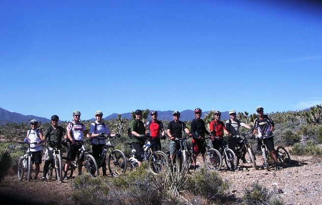
This is the kind of trail on which you will use all your gears. The grades are not impossibly steep, but go on for some distance, making it necessary to slow down to a sustainable climbing pace. It seems most trails in this area have about 2,000' of climbing. Here is a photo of the group for the June, 2011 ride minus the photographer, Bruce.
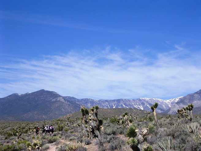
The better riders, or "hammer-heads," quickly out-paced the rest of the group. It is June and there is still snow in the mountains.
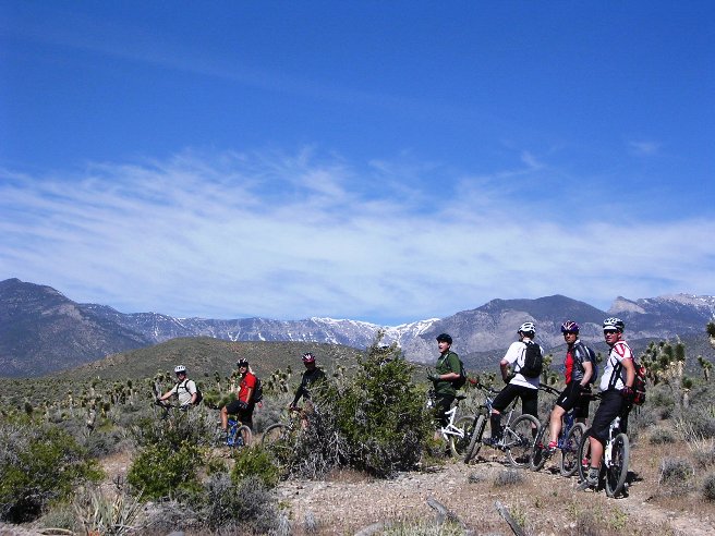
Another photo of the riders regrouping on the trail.
Below is a photo of Steve coming down across a ledge on the trail.
One of the springs coming out of the mountain awaited at the furthest point of the ride. This one had been made into a live-stock tank. From here, it was back to the parking lot.
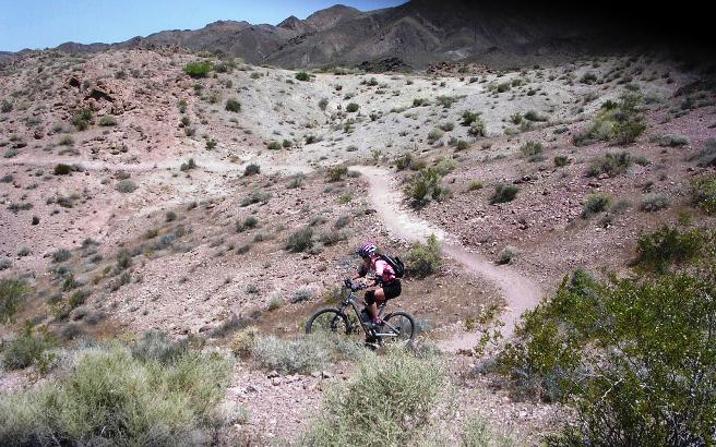
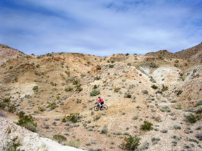
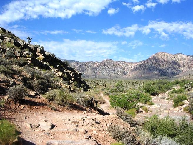
The trail demanded total and complete focus along most of the way. As a result, there were not very many photo opportunities. Las Vegas, NV - Red Rock, The Mt. Springs Trail The Mountain Spring Trail is not on any "official" trail maps, and was "discovered" by local knowledge. Bruce rode this trail 4 times: January 29, 2011, March 13, 2011, and July 22, 2011. The overall ride is 4.4 miles long, but the first 3 miles are on a jeep road with some impressive climbs and drops. The last mile and a half is single-track and has the most climbing. This trail takes you to the top of the cliffs on the west side of Cottonwood Valley.
The statistics for the Mountain Spring Trail ride are provided below
along with a map showing the track and profile and statistics.
Right click on the GPX link above to download a GPX file for this ride. The GPX file may want to save as an XML file, so if it does, change the extension to gpx before you save it. The file is a high-resolution track with points are every 10' created on the Delorme PN-60W GPS. You can right-click on the image below and use the "Save Target As" option to down-load a 1MB 11x17" PDF version of the map that can be printed. You can also click on the image to open it in a new window and zoom up to 200% for a detailed view.
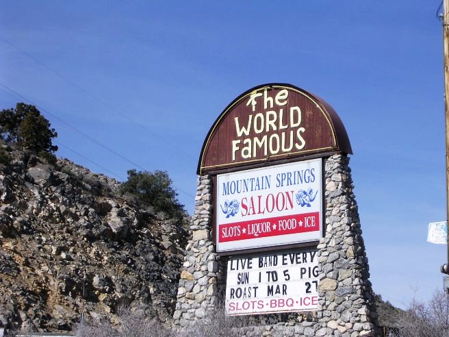
This is the kind of trail on which you will use all your gears, and spend a lot of time in 1-1. Some of the grades are short and steep, and others go on for some distance, making it necessary to slow down to a sustainable climbing pace. Leg protection is highly recommended because the last mile and a half is through Creosote brush which eats flesh. The trail starts off a jeep road leading out of Mt. Spring, but is usually ridden from the parking lot of the historic Mt. Springs Saloon. The saloon is a popular gathering point for motorcycle riders and offers everything needed: liquor, food, ice and slots.
Shortly after leaving the Jeep road, you can take a slight diversion and visit one of the springs coming out of the mountains.
From there, the climbing gets tough in places. Below is Brandon negotiating a rocky climb.
It's a haul, but eventually, you get to the top and are rewarded by a fantastic view of Cottonwood Valley. Below is the group from the January 2011 ride at the top.
Below is Bruce with his now deceased Gary Fisher Superfly 100.
The way down is the same as the way up. The photo below shows what the trail looks like near the top coming down.
The terrain looks harmless enough until you try riding down it.
The further down you go, the more boulders you have to maneuver around.
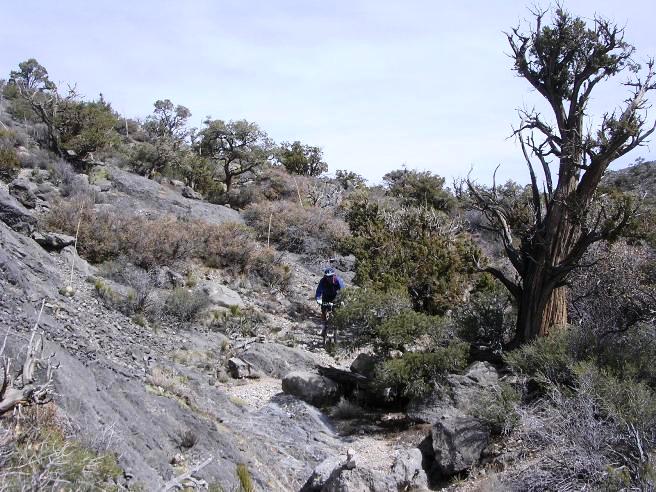
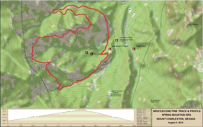
While this is a short ride, it is one of the most challenging and technical rides in the area. Las Vegas, NV - Mt. Charleston, Bristlecone Pine Trail On August 4, 2012, Bruce rode the Bristlecone Pine Trail with Chris and Dave. This trail is often ridden in the summer because its temperatures tend to be 40F cooler than the deserts below. The only drawback is that you are riding at over 9,000 feet above sea level. The Bristlecone Pine only grows in a few places in the world and can live 4,000 years. Some of the trees they rode past were there before the time of Christ, and that was truly awesome.
The statistics for the Bristlecone Pine Trail ride are provided below along
with a map showing the track and profile and statistics. The track
and profile is for the clockwise direction. Reverse it for a
counter-clockwise ride.
Right click on the GPX link above to download a GPX file for this ride. The GPX file may want to save as an XML file, so if it does, change the extension to gpx before you save it. The file is a high-resolution track with points are every 10' created on the Delorme PN-60W GPS. You can right-click on the image below and use the "Save Target As" option to down-load a 1MB 11x17" PDF version of the map that can be printed. You can also click on the image to open it in a new window and zoom up to 200% for a detailed view.
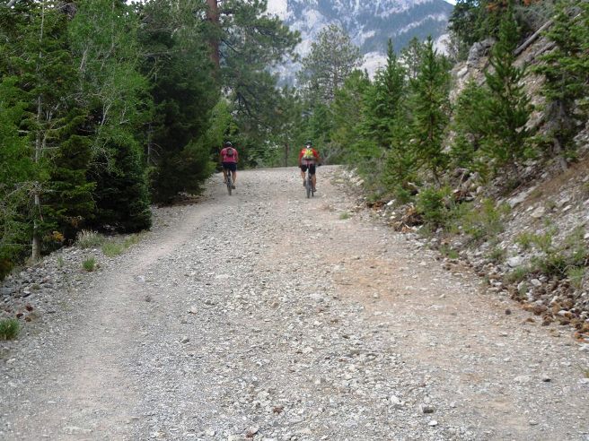
This is the kind of trail on which you will use all your gears, and spend some time in 1-1. The grades are not impossibly steep, but go on for some distance, making it necessary to slow down to a sustainable climbing pace. The photo below shows the trailhead for Bristlecone Pine.
The trail starts out as a jeep road. Below is Chris and Dave starting out.
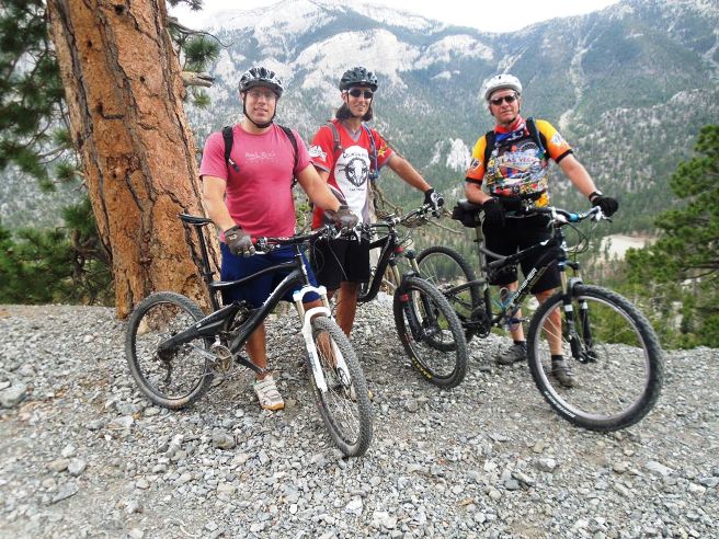
The jeep road goes up a ways. Below is Dave, Chris and Bruce taking advantage of a hiker that offered to take their photo.
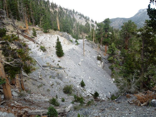
Further on, the trail transitions to single track. Below is a photo looking back on a section of trail just completed. Notice there is very little dirt, and mostly decomposed rock.
Looking forward to the next section of trail.
The ride ends with a fun descent down through the ancient Bristlecone Pine trees.
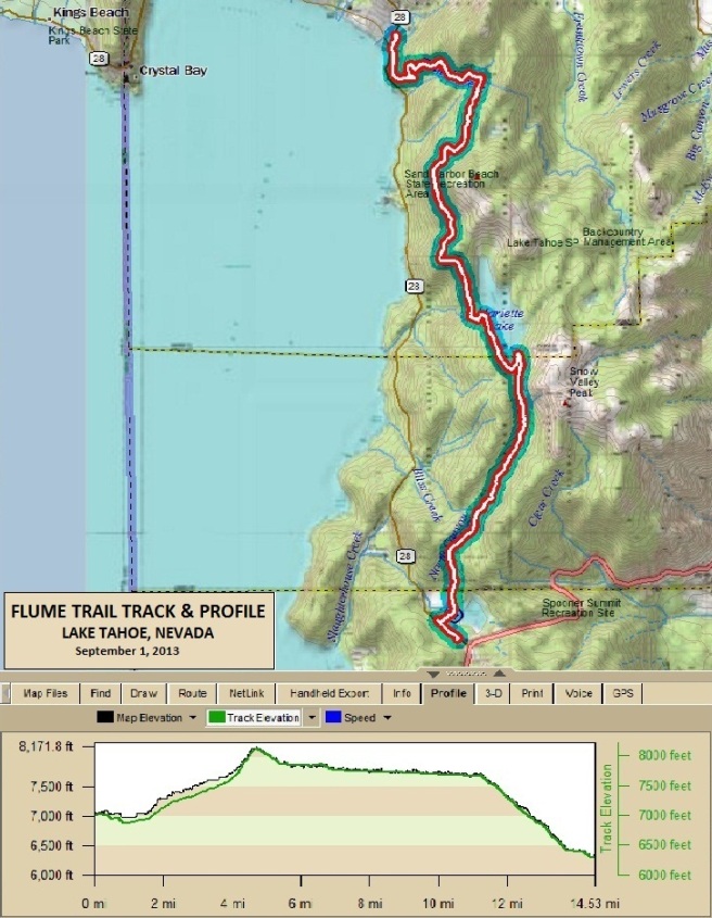
Lake Tahoe, NV - The Flume Trail Timber was required for the mines during the mining boom in the late 1800s of the nearby Comstock Lode in Virginia City. In 1873 Nevada State Controller Walter Hobart and former Nevada and California Surveyor General Seneca "Sam" Marlette were operating a small sawmill in what is now known as Incline Village. The timber around Lake Tahoe was placed on the incline railway where it was taken up 1,400 feet (430 m) up the 4,000 foot (1,219 m) long inclined railroad. After the lumber was brought up the Incline, it was dumped into a wooden V flume for the trip to Lakeview on the Virginia & Truckee Railroad. The metal plating reduced wear on the flume boards as the lumber was then dropped by a gravity flume down the eastern side of the mountains. While the Flume is not on the IMBA list of EPIC trails, it is one of most famous trails in America because of its spectacular views, and is on the list of "Must Ride Trails" for all mountain bikers. Below is the track and profile for the Flume ride.
The statistics for the Flume Trail ride are provided below along
with a map showing the track and profile and statistics. The track
and profile is for the clockwise direction. Reverse it for a
counter-clockwise ride.
Right click on the GPX link above to download a GPX file for this ride. The GPX file may want to save as an XML file, so if it does, change the extension to gpx before you save it. The file is a high-resolution track with points are every 10' created on the Delorme PN-60W GPS. You can right-click on the image below and use the "Save Target As" option to down-load a 1MB 11x17" PDF version of the map that can be printed. You can also click on the image to open it in a new window and zoom up to 200% for a detailed view.
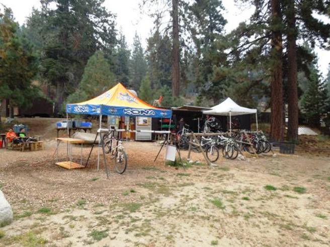
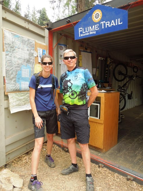
This is the kind of trail on which you will use all your gears. The grades are not impossibly steep, but go on for some distance, making it necessary to slow down to a sustainable climbing pace. The ride started with a bike rental at Flume Trail Bikes in Incline Village. For the Flume, the rental bike was a Specialized Stumpjumper FSR Comp 29. The bike rental service operates out of an intermodal container converted to a shop.
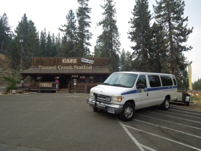
Flume Trail Mountain Bikes also operates a shuttle from the Tunnel Creek Station Cafe. The Shuttle goes to both the Spooner Lake and Tahoe Meadows trailheads on alternate runs.
Below is a photos of Debbie and Bruce just before loading up on the shuttle to the Spooner Lake trailhead.
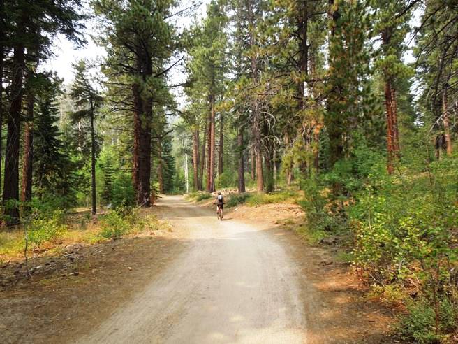
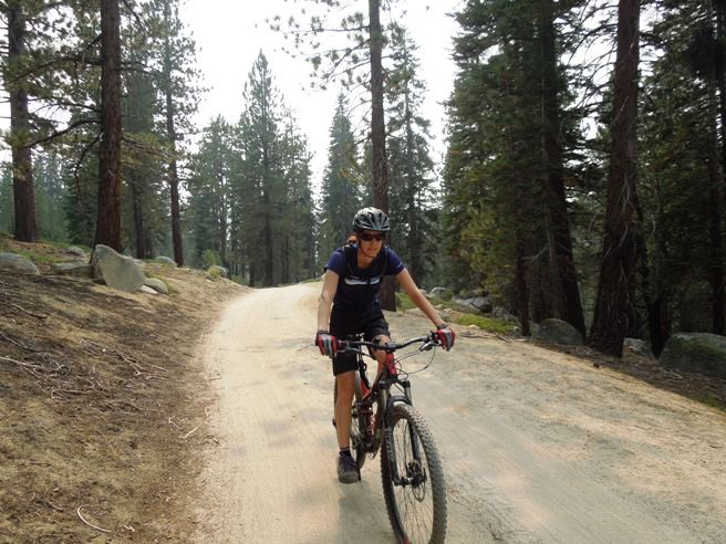
The initial climb was a killer. The photo above shows the climb in the distance. It was a 4.7 mile continuous uphill grind. The section below is typical of some of the "milder" parts of the climb. There were many sections were the grade was much steeper.
Overall, you climb from 7,000' to 8,124' in 4.7 miles. That is 1,124' of elevation gain. The average grade is 4.5%. Once at the top, it is mostly downhill.
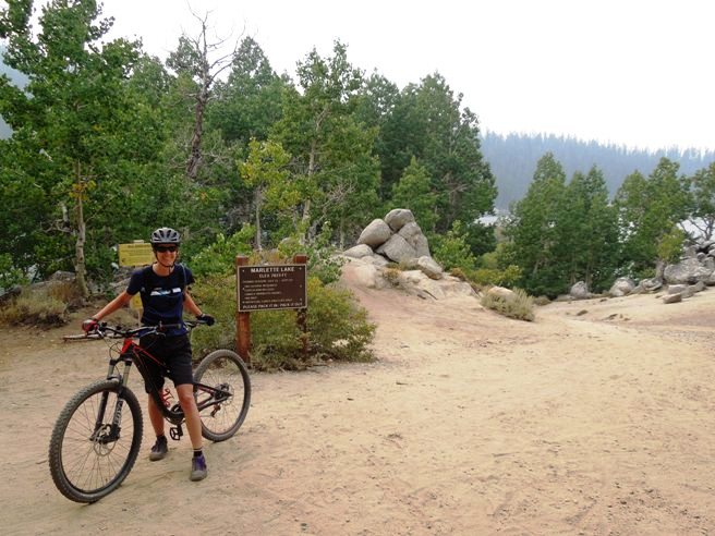
The initial climb is technically not the Flume Trail but the Marlette Trail. The Flume begins after the climb up the Forest Service road. Below is Debbie and Bruce at the plaque marking the beginning of the Flume.
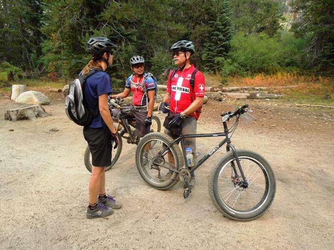
Along the way, Bruce and Debbie ran into the Tahoe Mountain Bike Patrol. Below is Debbie talking to Ray, one of the Patrol members about riding in the area. When asked about the Surly, Ray said it was perfect for the sandy trails in the Lake Tahoe area. The trail is not too sandy at this point, but further on it got to be several inches deep.
Just down the trail and around the bend, you come to Marlette Lake. The lake elevation is 7,823' above sea level.
The trail goes around the south end of the lake before continuing north. Below is Debbie on the trail by the southwest shore of the lake.
Below is a photo of Bruce at the south end of the lake. Notice the sand is getting deeper.
Bruce coming around a downed tree on the way up to Sand Point.
Debbie on the trail above Sand Point. Notice how much deeper the sand is getting.
From the Sand Point over look, it was northward. In places, the trail got a bit technical trying to maneuver around the rocks in the soft sand.
Below is Bruce coming under the still living downed tree.
Then there is the photo of Debbie coming under the tree. This is one of the most photographed spots on the Flume.
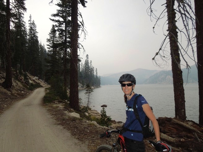
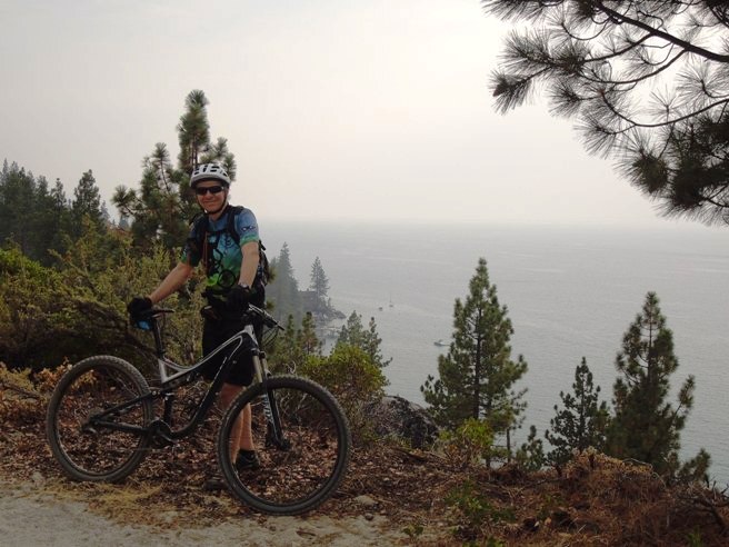
Finally, a photo of Bruce on the trail with Sand Harbor below in the background.
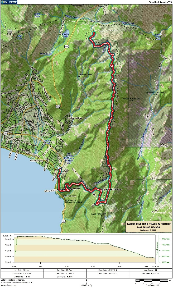
The Flume is one of those "Bucket List" trails for all serious mountain bikers, and he was very pleased to cross this one off, even if it was a bit smoky from the fire at Yosemite. Lake Tahoe, NV - The Tahoe Rim Trail The TRT is an IMBA EPIC Trail, so Bruce was happy to cross this one off his list. The entire TRT encompasses 165 miles along the ridge tops of the Lake Tahoe Basin, crossing six counties, and two states. It is an intermediate-level trail ranked No. 90 in the world. Bruce rented a 2013 Kona Hei Hei 29er for this ride. He met Alex and Michael at the shop, and since Alex knew the trail and Michael and Bruce didn't, Alex offered to lead. They rode the section of the TRT from Tahoe Meadows to Tunnel Creek Rd. The track and profile for the ride is shown below. For some reason, the GPS had trouble acquiring a usable signal at the start of the ride, so the track is about a half mile shorter than it should be. The starting point was off NV-431 near CR-340 at the top of the map.
The statistics for the Tahoe Rim Trai ride are provided below along
with a map showing the track and profile and statistics. The track
and profile is for the clockwise direction. Reverse it for a
counter-clockwise ride.
Right click on the GPX link above to download a GPX file for this ride. The GPX file may want to save as an XML file, so if it does, change the extension to gpx before you save it. The file is a high-resolution track with points are every 10' created on the Delorme PN-60W GPS. You can right-click on the image below and use the "Save Target As" option to down-load a 1MB 11x17" PDF version of the map that can be printed. You can also click on the image to open it in a new window and zoom up to 200% for a detailed view.
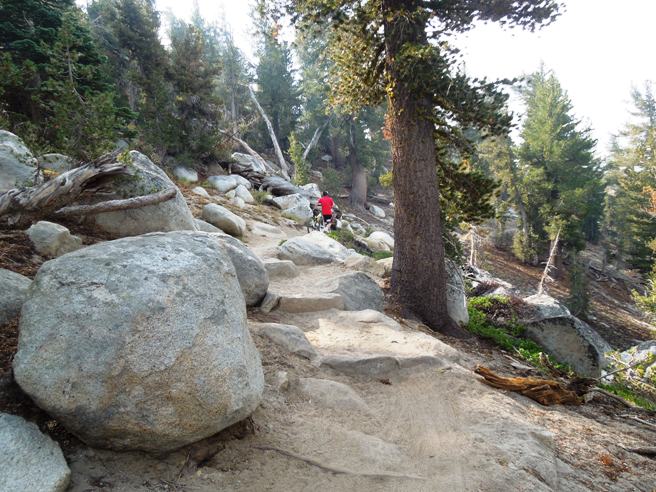
This is the kind of trail on which you will use all your gears, and there are a lot of fun descents. The grades are not impossibly steep. The ride from Tahoe Meadows was approximately 11 miles long and mostly down hill. The starting elevation was about 8,700', dropping to about 8,450' in the first half mile then climbing to 8,828' by mile two. From there it was mostly down hill to an ending elevation of 6,322'. Some of the descents were stair cased with steps far enough apart to make for a good landing before hitting the next one. The climbing elevation was 1,182' and the descending elevation was 3,509', and most of that came in the last third of the trail. The photo below shows the trail head at Tahoe Meadows.
The TRT has a lot of sand and rocks. Below is a typical section on the climb up. The descending sections were very similar, but much easier to ride going down hill.
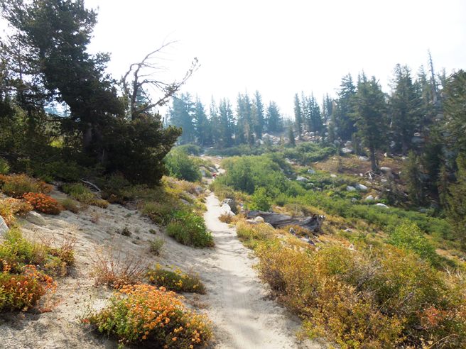
There were flat parts too. Like the Flume, the TRT also had a lot of sandy sections.
Below is Bruce catching his breath after the initial climb up from the meadow.
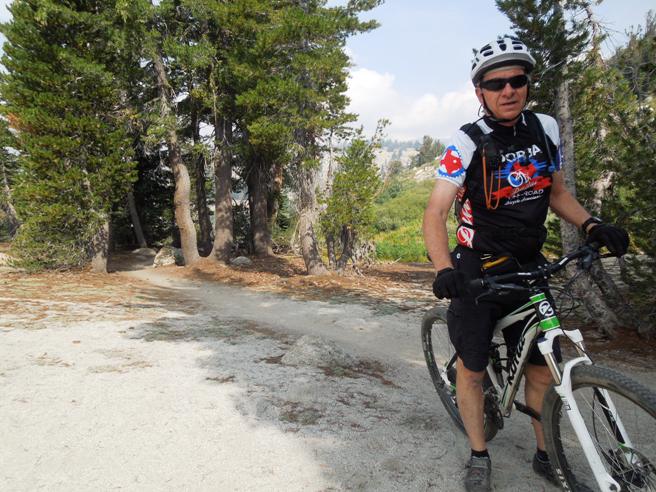
Below is Michael and Alex. Michael was also on a Kona rental bike.
There was lots of sand and rock on this trail, and a lot of the rocks were huge.
Below is a photo of Bruce at an overlook towards Reno. On a clear day, you could see Reno, but with the smoke, it wasn't possible that day.
Below is Michael and Alex at another rest stop.
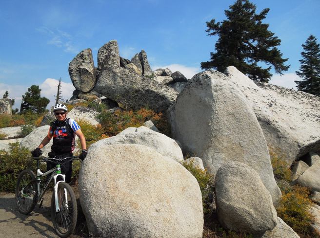
A little further down the trail, they stopped to get a photo of Bruce in a rock out-cropping.
This was a great ride. However, if he ever does it again, he plans to take the TRT to Marlette Lake and return via the Flume, doing both trails in one day.
|
|
Version 0.2, March 5, 2017 |