|
|
|
Mountain Biking In Florida The following is descriptions and photos of the trails Bruce has ridden in Florida. These trails were ridden over several years between 2008 and (year 2). Scroll down for a complete list of rides and summaries, and use the links in the in the summaries to go to descriptions and photos for the specific trails and rides. Lithia, Florida - Alafia River State Park: On a trip to Tampa in 2008, Bruce decided to check out the Alafia River State Park IMBA EPIC Trail. Florida is not known for it's mountain biking, so he was curious as to what an IMBA EPIC Trail in the Tampa Bay area would be like. He was amazed! Trail 2 name: dates and summary Trail 3 name: dates and summary Trail 4 name: dates and summary Lithia, Florida - Alafia River State Park Bruce has a sister that lives in Brandon which is a suburb of Tampa. He was going to be spending some time in Florida, so he decided to see what kind of trails he might be able to find. A web search led him to the Alafia River SP trail 15 miles from her house. This is another IMBA EPIC trail and was quite an unexpected find in Florida. Normally the area is considered to be flat, but SWAMP has converted an abandoned phosphate strip mine into a bike park. This made for a really enjoyable experience for his third out of state riding adventure. Check out this YouTube Video about the park.
The statistics for the Alafia Trail ride are provided below along
with a map showing the track and profile and statistics.
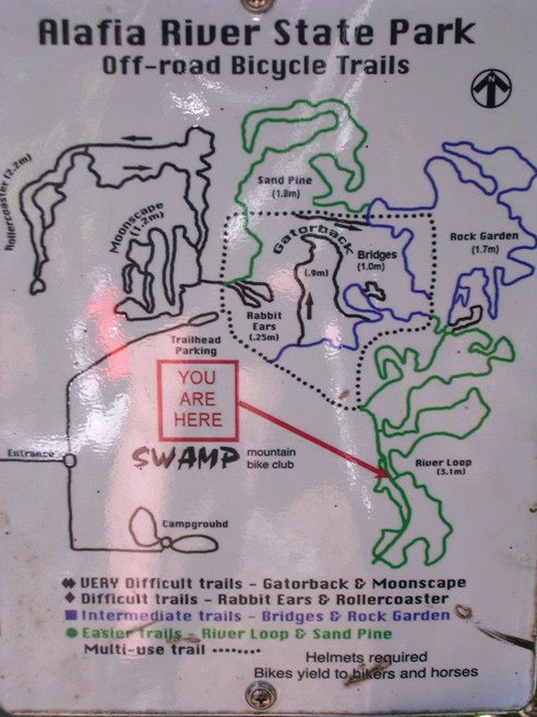
Right click on the GPX link above to download a GPX file for this ride. The GPX file may want to save as an XML file, so if it does, change the extension to gpx before you save it. The file is a high-resolution track with points are every 10' created on the Delorme PN-60W GPS. You can right-click on the image below and use the "Save Target As" option to down-load a 1MB 11x17" PDF version of the map that can be printed. You can also click on the image to open it in a new window and zoom up to 200% for a detailed view. (Insert Track-Profile map with link to tabloid-sized PDF) This is the kind of trail on which you will use all your gears, and spend a lot of time in 1-1. The grades are not impossibly steep, but go on for some distance, making it necessary to slow down to a sustainable climbing pace. The trails are diverse and well marked. Signs showing the trail system and your current location are provided throughout the park.
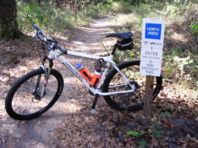
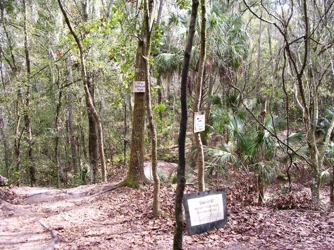
North Creek The entrance to the North Creek Loop. The signage at Alafia is terrific.
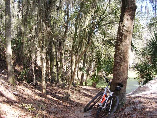
Alafia is a picturesque place. Below is a photo of one of the trails under moss-laden trees going past palmettos and a lake.
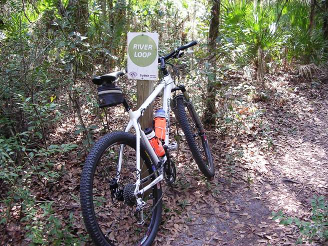
River Loop Start text here
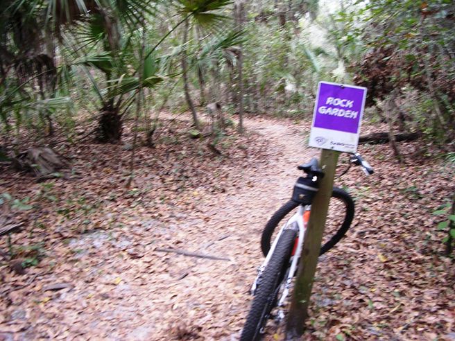
Rock Garden The entrance to Rock Garden. At this point the camera batteries were about done for, so there are not too many more photos.
Rabbit Ears The entrance to Rabbit Ears. This is marked as a double black diamond trail.
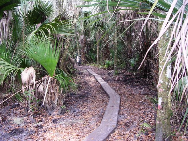
Land Bridges Some of the land bridges across the wetter parts of the trail.
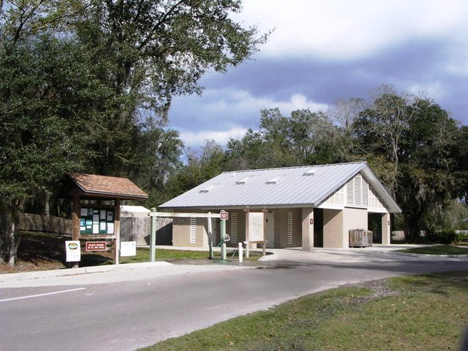
Facilities The State of Florida has done a great job with this trail. Below is a photo of the facilities at the trailhead. They include restrooms, information kiosk and bike wash. The area also has a nice parking lot, picnic tables and lots of shade.
Introduction to the trail and ride including any other riders or group with you.
The statistics for the (Trail Name) ride are provided below along
with a map showing the track and profile and statistics. The track
and profile is for the clockwise direction. Reverse it for a
counter-clockwise ride.
Right click on the GPX link above to download a GPX file for this ride. The GPX file may want to save as an XML file, so if it does, change the extension to gpx before you save it. The file is a high-resolution track with points are every 10' created on the Delorme PN-60W GPS. You can right-click on the image below and use the "Save Target As" option to down-load a 1MB 11x17" PDF version of the map that can be printed. You can also click on the image to open it in a new window and zoom up to 200% for a detailed view. (Insert Track-Profile map with link to tabloid-sized PDF) This is the kind of trail on which you will use all your gears, and spend a lot of time in 1-1. The grades are not impossibly steep, but go on for some distance, making it necessary to slow down to a sustainable climbing pace. The photo below shows (description). (Place-holder for photo) Description of following photo. (Place-holder for photo) Wrap up Introduction to the trail and ride including any other riders or group with you.
The statistics for the (Trail Name) ride are provided below along
with a map showing the track and profile and statistics. The track
and profile is for the clockwise direction. Reverse it for a
counter-clockwise ride.
Right click on the GPX link above to download a GPX file for this ride. The GPX file may want to save as an XML file, so if it does, change the extension to gpx before you save it. The file is a high-resolution track with points are every 10' created on the Delorme PN-60W GPS. You can right-click on the image below and use the "Save Target As" option to down-load a 1MB 11x17" PDF version of the map that can be printed. You can also click on the image to open it in a new window and zoom up to 200% for a detailed view. (Insert Track-Profile map with link to tabloid-sized PDF) This is the kind of trail on which you will use all your gears, and spend a lot of time in 1-1. The grades are not impossibly steep, but go on for some distance, making it necessary to slow down to a sustainable climbing pace. The photo below shows (description). (Place-holder for photo) Description of following photo. (Place-holder for photo) Wrap up
|
|
Version 0.1, October 27, 2015 |