|
|
|
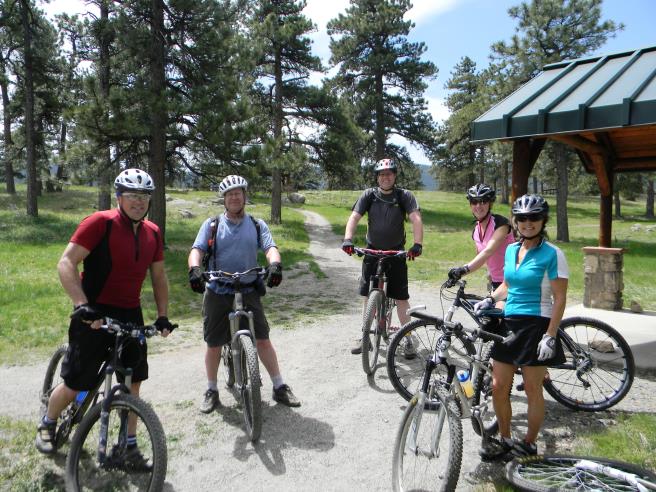
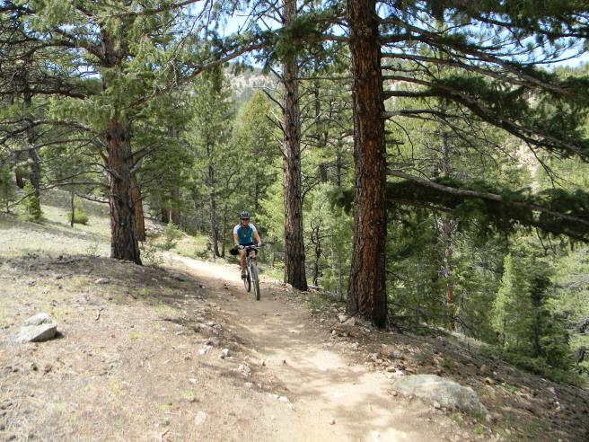
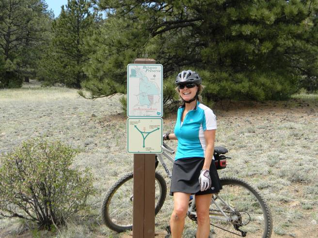
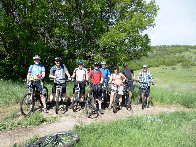
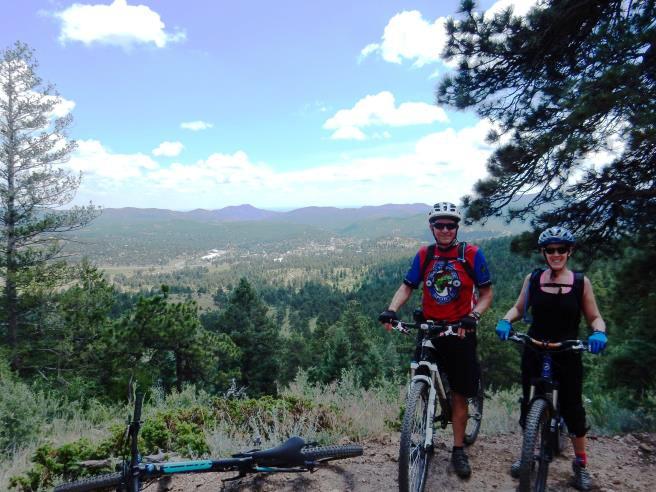
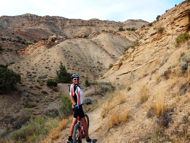
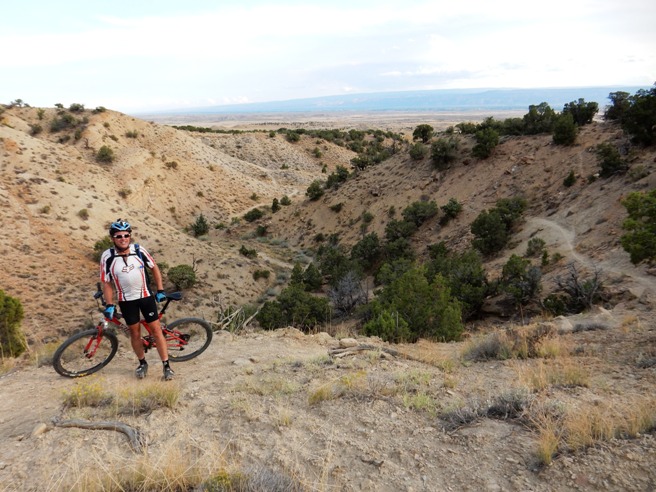
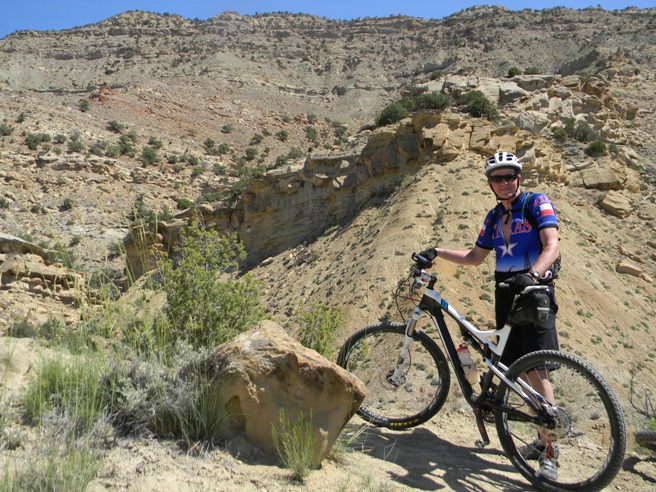
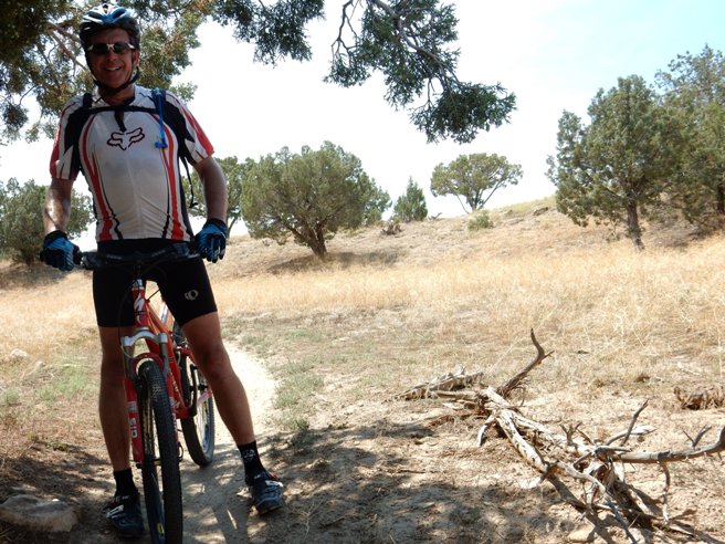
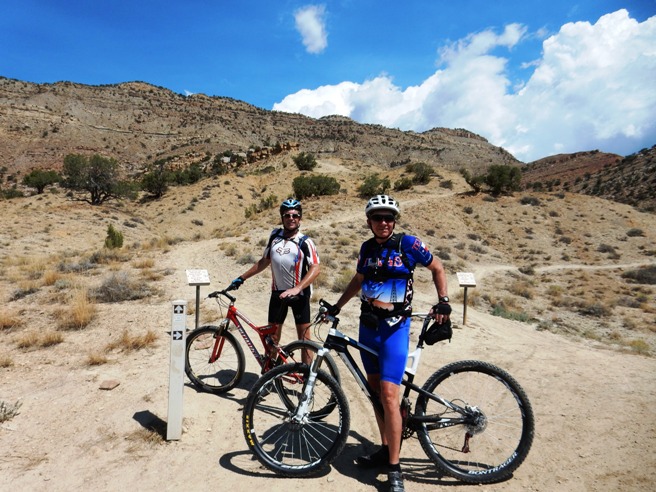
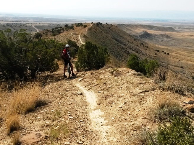
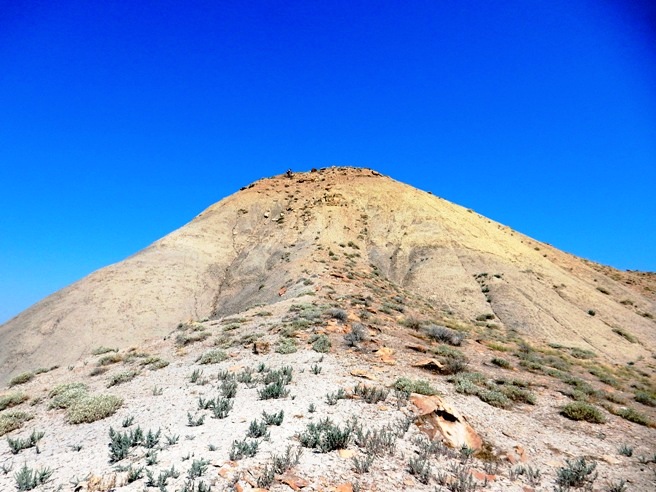
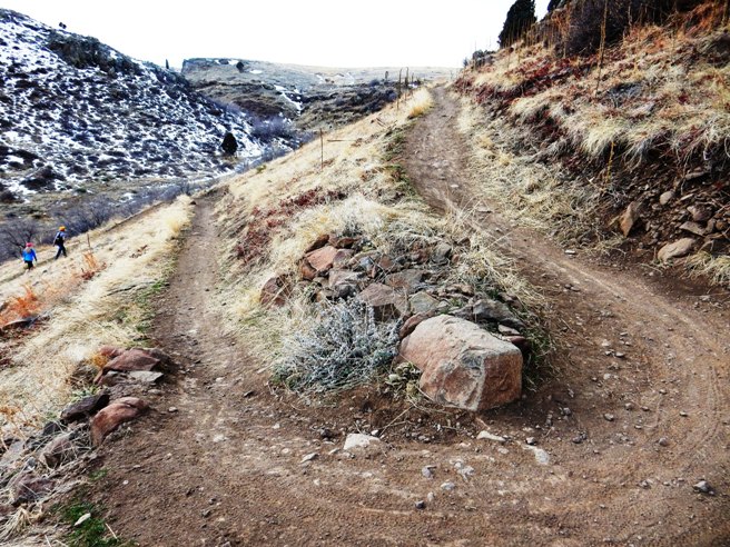
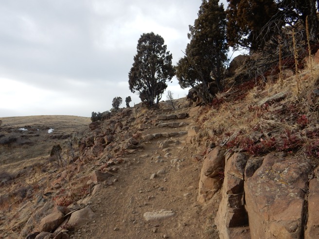
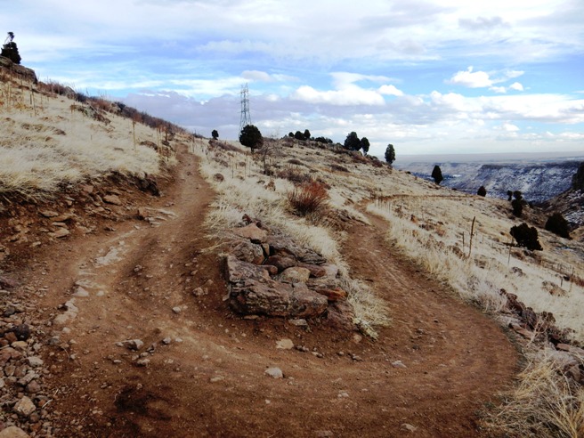
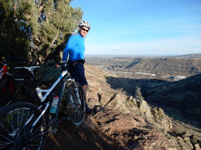
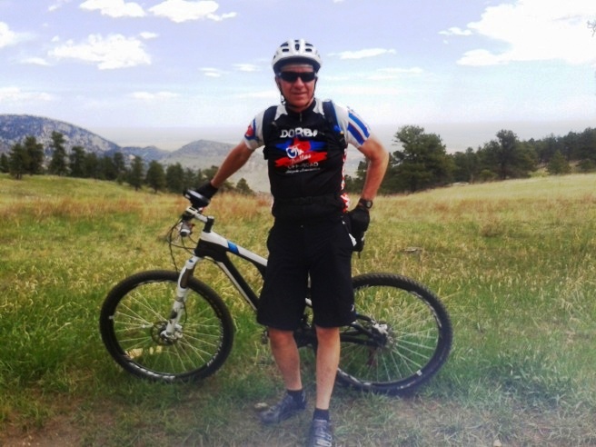
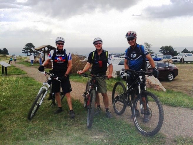
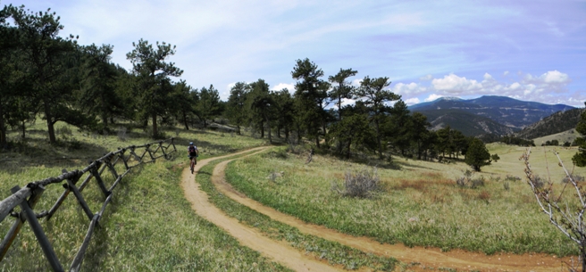
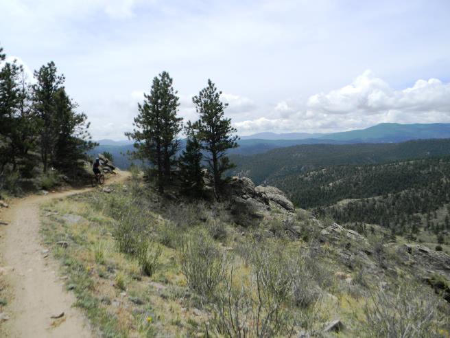
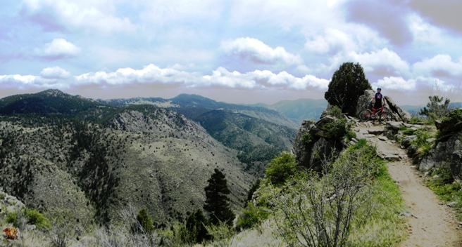
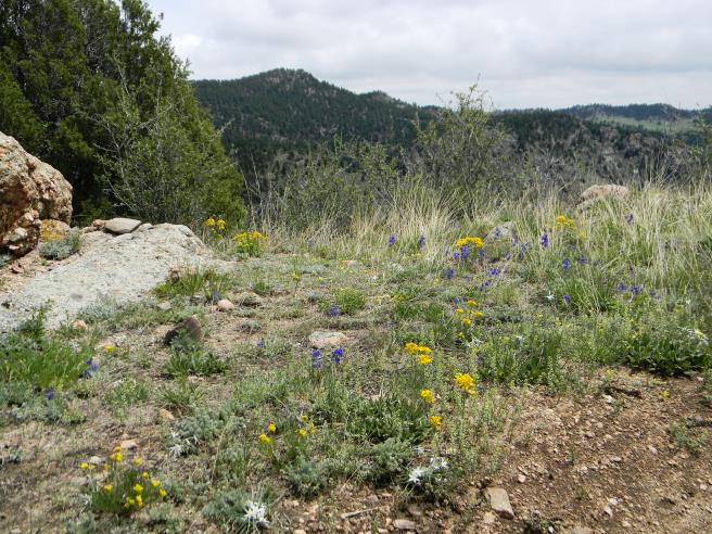
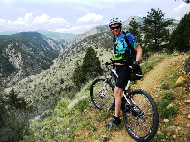
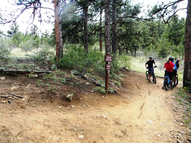
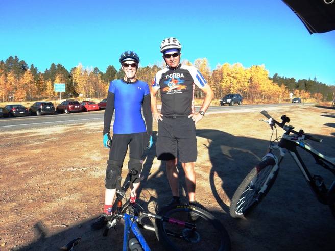
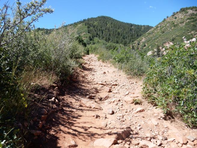
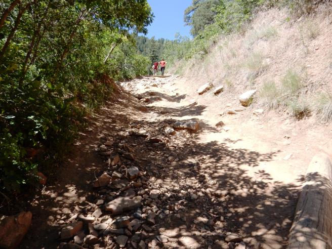
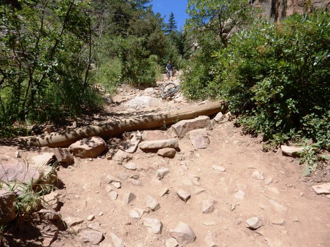
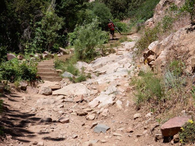
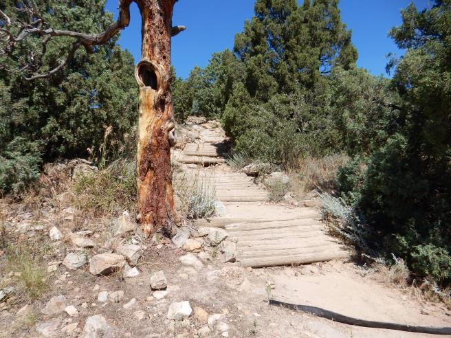
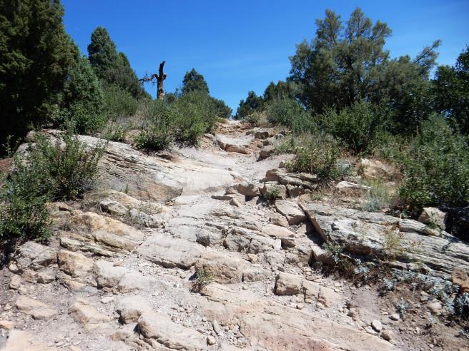
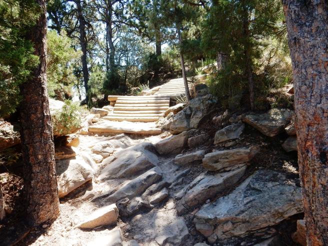
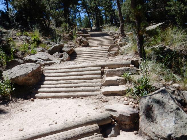
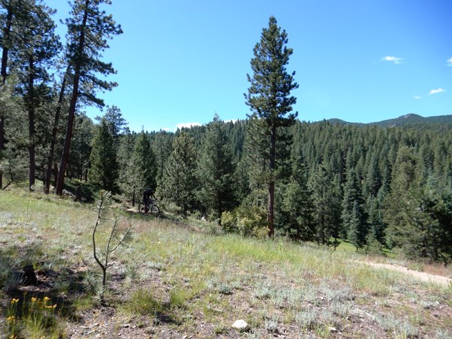
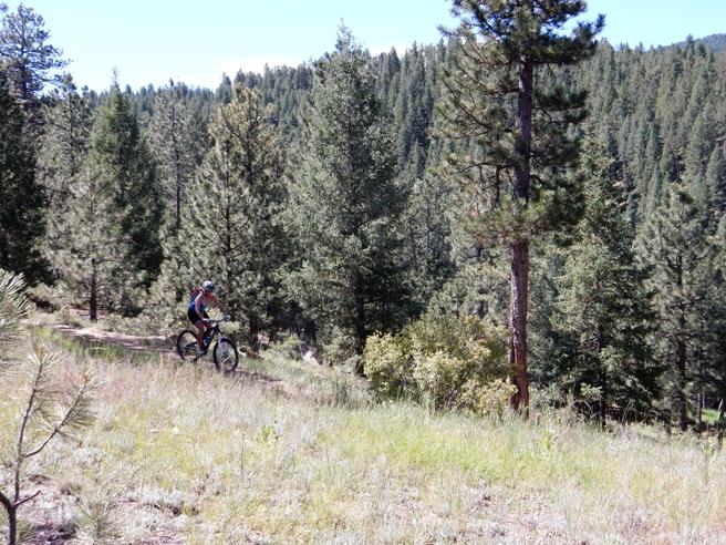
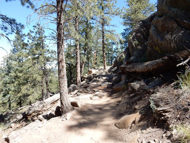
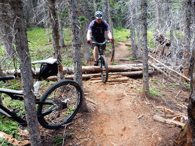
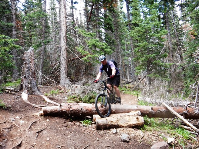
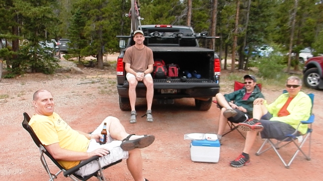
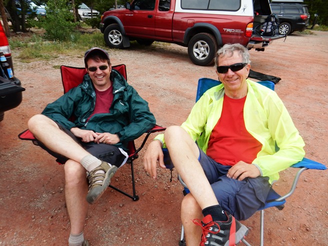
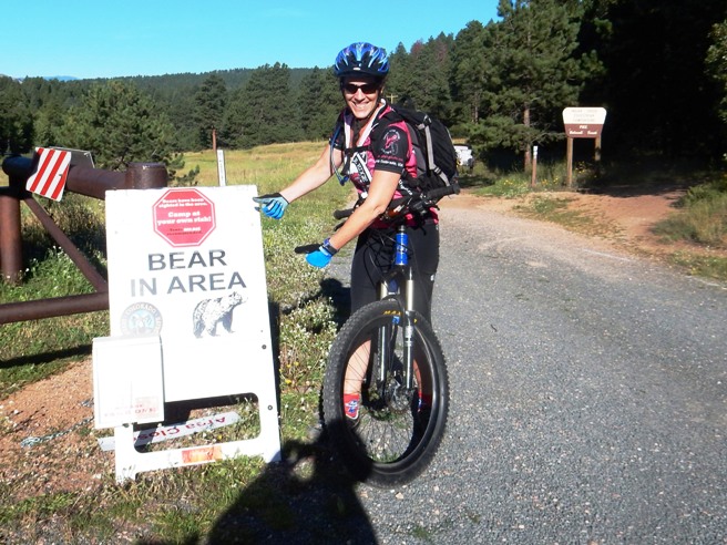
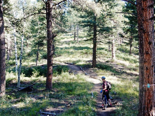
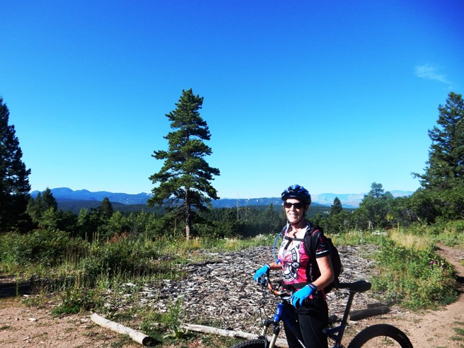
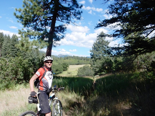
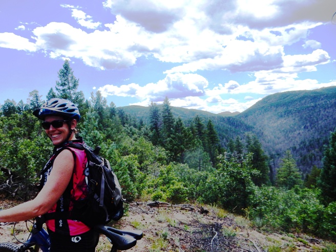
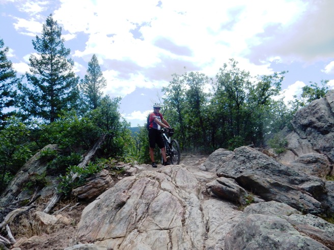
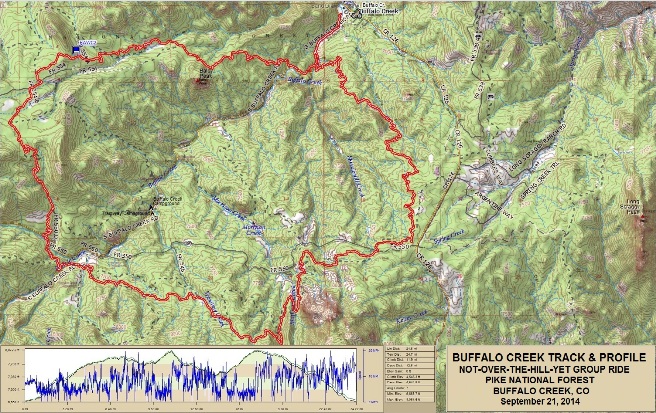
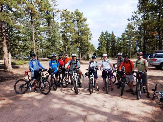
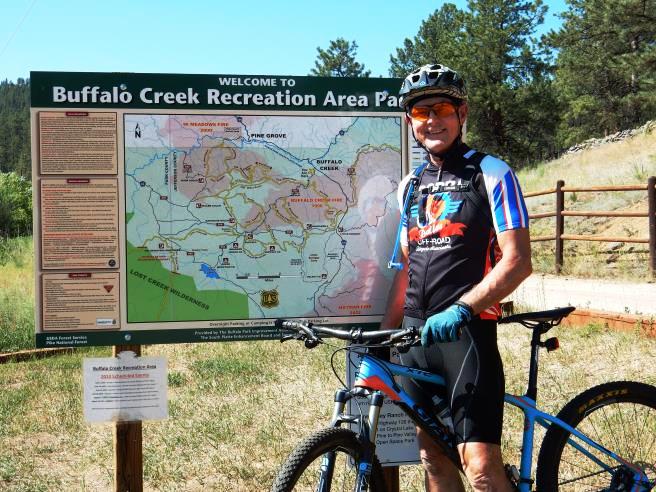
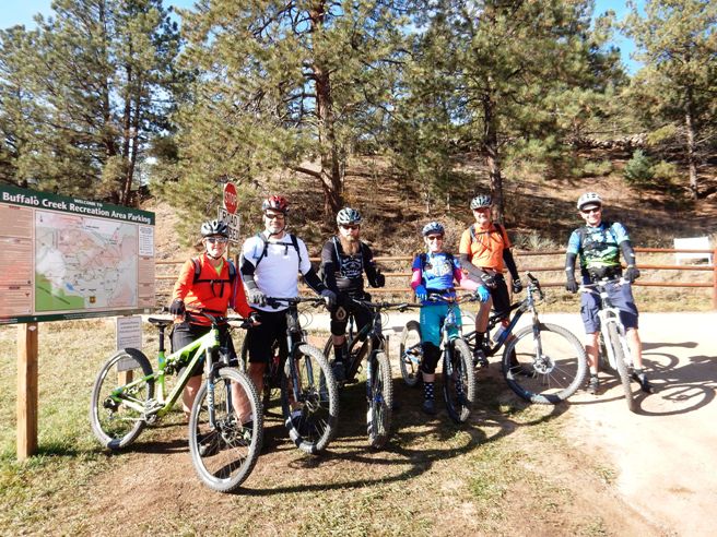
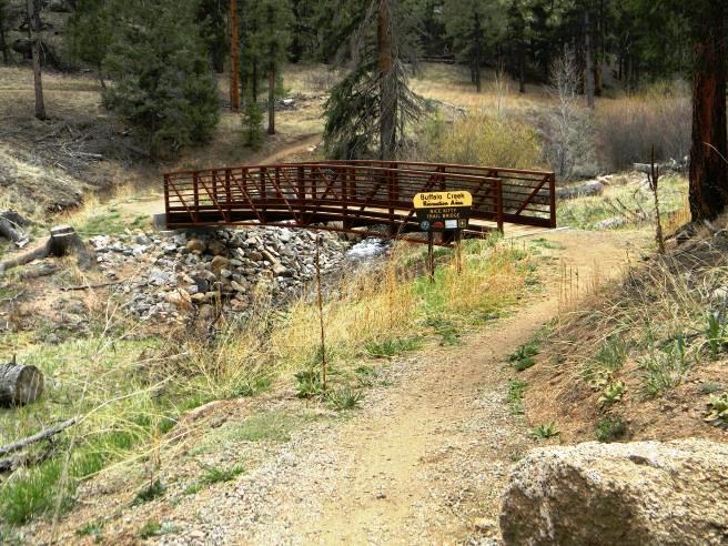
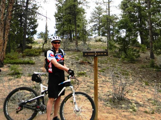
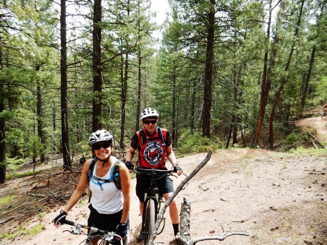
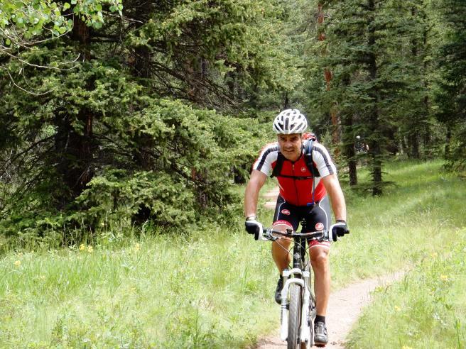
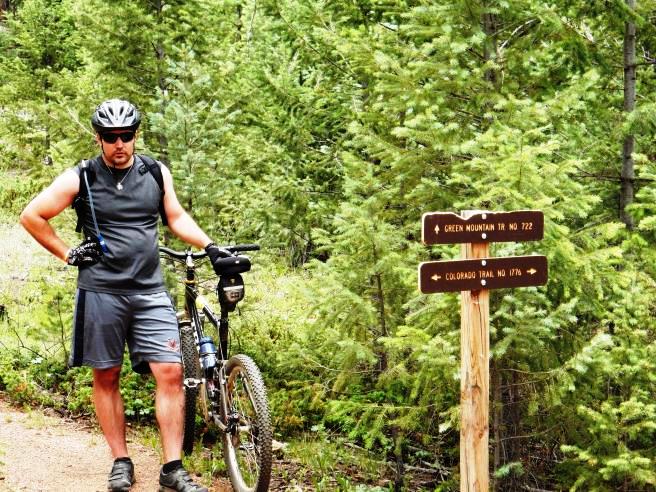
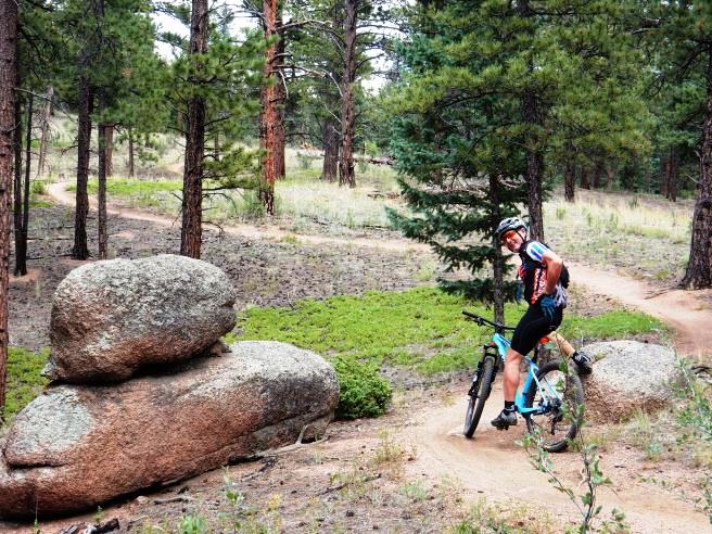
Mountain Biking In Colorado The following is descriptions and photos of the trails Bruce has ridden in Colorado. These trails were ridden over several years between 2014 and 2016. Scroll down for a complete list of rides and summaries, and use the links in the in the summaries to go to descriptions and photos for the specific trails and rides. Boulder, CO - Betasso Trail System: On May 4, 2014, Bruce rode the Betasso Preserve Trail west of Boulder. He rode it again on August 17, 2014. Betasso is a fun trail, giving a good workout without being technical. Castle Rock, CO - Ridgeline Trail: On June 13, 2015, Bruce rode the Ridgeline Trail with the Not-Over-The-Hill-Yet group from Denver. He had driven out for a couple of weeks work at the airport and brought his bike along. Colorado Springs, CO - Rampart Reservoir: On September 13, 2014, Bruce rode the Rampart Reservoir Trail with some of the folks from the Not-Over-The-Hill-Yet group from Denver. Colorado Springs, CO - Red Rocks Open Space: On October 26, 2014, Bruce rode the Red Rocks Open Space Trail Colorado Springs, Colorado with his friend and coach, Zoe Nance. Evergreen, CO - Aldefer/Three Sisters Trail System: Alderfer/Three Sisters is a typical JeffCo trail system. It is located in the foothills west of Denver and near the town of Evergreen. Bruce has ridden this system twice: once on June 8, 2014, and again on July 5, 2014. Evergreen, CO - Elk Meadow Trail System: On July 13, 2014, Bruce rode the Elk Meadow Trail north of Evergreen. he rode it again on October 25, 2014 and made a video of the descent down "Too Long" on that ride. The name for this park is very deceptive. While the park has a meadow where Elk graze, but the trail is a steep, rocky and rooty climbs in many places followed by an awesome steep, rocky and rooty down-hill. Frisco, CO - Peaks Trail: On July 12, 2014, Bruce rode the Peaks Trail from Frisco to near Breckenridge. He rode this trail with the Not-Over-The-Hill-Yet Group. This is a favorite for the summer because it is above 10,000' for the most part, and tends to be cool, even in July and August. Fruita, CO - Edge, Chutes & Ladders & PBR, 18 Road Trail System: Bruce did The Edge Loop, Chutes & Ladders and Pumps, Berms and Rollers (PBR) during both the May and August trips in 2014. Fruita, CO - Prime Cut & Joe's Ridge, 18 Road Trail System: Bruce rode Prime Cut and Joe's Ridge during both the May and August trips in 2014. Joe's Ridge is an interesting ride in that it combines some of the ridge riding of Zippity with the pumps, berms and rollers of PBR. Joe's parallels both Kessel and Zippity, lying between the two. Fruita, CO - Prime Cut & Kessel Run, 18 Road Trail System: Bruce rode Prime Cut and the Kessel Run on both the May and August trips in 2014. The Kessel Run comes from the scene in Star Wars where Luke and Obiwan are looking for a ship to get to Alderan. “You’ve never heard of the Millennium Falcon? It’s the ship that made the Kessel run in less than 12 parsecs.” This trail is reached by riding up Prime Cut and then blasting down about 3 miles of super fast, flowy single-track. Fruita, CO - Pumps, Berms & Rollers, 18 Road Trail System: Fruita, CO - Zippity Do Da, 18 Road Trail System: Like many of the other trails, Zippity Do Da was ridden during both the May and August visits. Both times it was done as a shuttle ride since it is the finale and usually the last ride of the trip. Zippity is the most exciting of all the rides at the 18 Road Trail System. It has a long run down a ridge, awesome drops, nice climbs and some really fast, long downhill runs. Fruita, CO - Kokopelli Trail System: On August 30, 2014, Bruce and Bobby rode the Kokopelli Trail System southwest of Fruita. The ride consisted of Mary's, Horse Thief, Steve's and back via a gravel road. Nearly half of the route followed the Colorado River. This is the most scenic of all the systems at Fruita. Golden, CO - North Table Mt. Trail System: The trailhead for North Table Mt. is located about a block from the Golden office, and due to its proximity, gets ridden often, including at lunch occasionally. Golden, CO - White Ranch Trail System: On May 18, 2014, Bruce rode the White Ranch trail system. This park is part of the Jefferson County, Colorado Open Space program. The trail is located just west of North Table Mountain in foothills of the Rockies. The system offers several trails and some of the most intense climbing in the area. The down-hill is also awesome. Idaho Springs, CO - Centennial Cone: Bruce has ridden Centennial Cone twice so far: first on May 24, 2014 and then again on July 6, 2014. The Centennial Cone Trail is located in the foothills or Front Range of the Rockies 9 miles west of Golden. This is one of the finest mountain bike trails in the area, with outstanding trail design and magnificent vistas. Jefferson, CO - Colorado Trail, Kenosha Pass to Georgia Pass: On September 27, 2014, Bruce rode a section of the Colorado Trail between Kenosha Pass and Georgia Pass. This trail is located west of Denver near Breckenridge, well into the Colorado Rockies. The trail was high, fairly long, very technical is spots and had a lot of climbing. This trail is rated as intermediate to advanced by Colorado standards, and has a black diamond rating. Littleton, CO - Deer Creek Trail: On June 29, 2014, Bruce rode the Deer Creek Canyon Trail west of Littleton. The Deer Creek Trail is located in the Deer Creek Canyon Park and is a short, steep, rocky climb best left to those that really have something to prove. Lyons, CO - Hall Ranch Trail System: On July 19, 2014, Bruce rode the Hall Ranch trails. These trails are located just west of Lyons and Northwest of Boulder. It has several trails with a wide range of skill-levels needed to ride them. The most common ride starts with the Bitterbrush Trail at the parking lot on SR-7. This trial starts with a smooth climb then transitions to a challenging, technical rock garden that only fit, expert riders can clear all the way up. However, it is quite an experience for intermediate riders on the way down. Morrison, CO - Bear Creek: 3/30/2014 Local, Urban trail in Morrison near the Front Range. Check back later for the link to the page for that ride. Morrison, CO - Dakota Ridge & Red Rocks: Bruce rode the Dakota Ridge and Red Rocks Trails as a loop from the Matthew-Winters Open Space Park on August 3, 2014. It was a double black diamond trail, but since it was rated as one of the top trails on the Front Range, it was on his list to ride Morrison, CO - Green Mountain: On June 22, 2014, Bruce rode the Green Mountain Trail in Lakewood. This is a local, urban trail near the Front Range. Check back later for the link to the page for that ride. Morrison, CO - Lair O' The Bear Trail System: On June 28, 2014, Bruce rode the Lair of the Bear trail with the Not-Over-The-Hill-Yet mountain biking group. This was an out-and-back ride in the foothills west of Denver from the main trailhead to Pence Park. Nederland, CO - Sourdough Trail: On August 8 2014, Bruce rode the Sourdough Trail north of Nederland with the Not-Over-The-Hill-Yet mountain biking group out of Denver. This was a "high altitude" ride, which is what a lot of folks in Colorado like to do in the summer. Pike National Forest, CO - Indian Creek 800 Trail: On August 16, 2014, Bruce rode the Indian Creek 800 Trail. The ride was deep into the wilderness, making it one of the prettiest trails he has ridden in Colorado. He shared this experience with his friend, Anne Taylor. Pine, CO - Buffalo Creek Trail System: Buffalo Creek is an IMBA EPIC trail located in the foothills about an hour's drive south-west of Denver. Bruce rode BC, as it is called locally, on May 3, June 21, July 4 and September 21, 2014. The IMBA ranks the trail as #4 in Colorado and #11 world-wide. Boulder, CO - Betasso Trail System On May 4th, 2014, and again on August 17, Bruce rode the Betasso Preserve Trail outside of Boulder with the Not-Over-The-Hill-Yet mountain biking group. This is a mixed-gender social riding group made up of mostly 45+ aged mountain bikers that ride trails that are not highly technical.
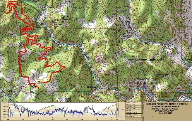
The statistics for the Betasso Trail ride are provided below along
with a map showing the track and profile and statistics. The track
and profile is for the clockwise direction. Reverse it for a
counter-clockwise ride.
Right click on the GPX link above to download a GPX file for this ride. The GPX file may want to save as an XML file, so if it does, change the extension to gpx before you save it. The file is a high-resolution track with points are every 10' created on the Delorme PN-60W GPS. You can right-click on the image below and use the "Save Target As" option to down-load a 1MB 11x17" PDF version of the map that can be printed. You can also click on the image to open it in a new window and zoom up to 200% for a detailed view.
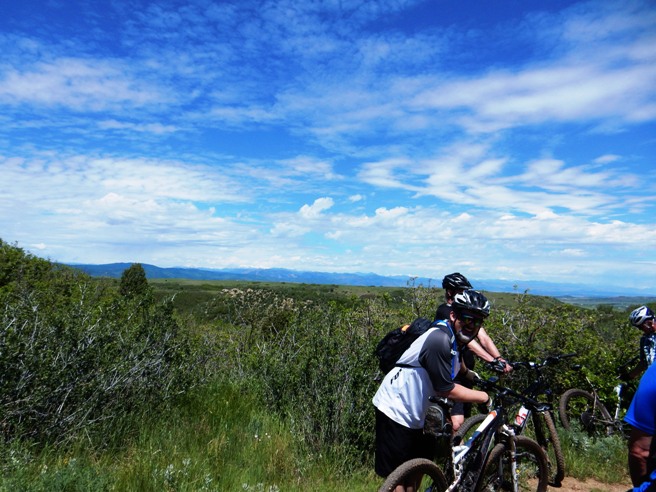
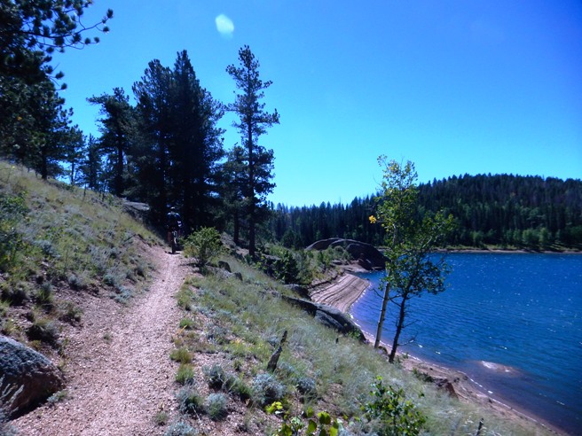
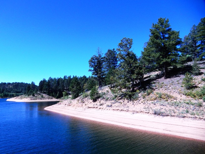
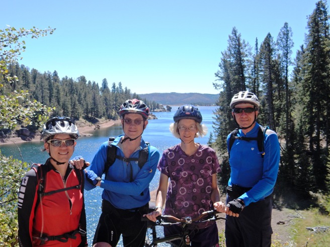
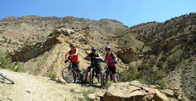
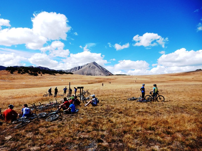
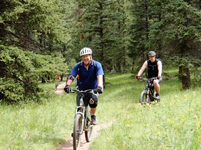
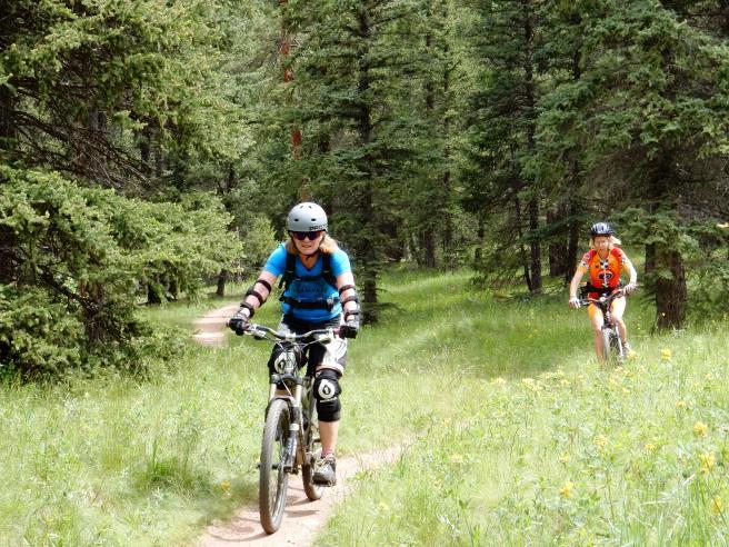
The climbing was 2,034 feet and was spread out across the entire ride. The maximum elevation was 7,883' AMSL, so breathing is not too difficult. This is the kind of trail on which you will use most of your lower gears. The grades are manageable for the most part and there are few technical sections. This makes the trail very popular with the women. Glen, Pat, Scott, Dianne & Linda at the beginning of the ride.
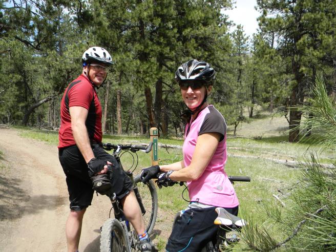
Glen and Dianne at the first junction and stop.
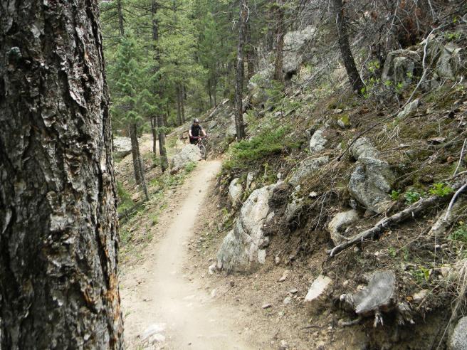
An unidentified rider coming up the trail.
Linda coming up the trail near the end of the ride.
Linda showing off her "merit badge".
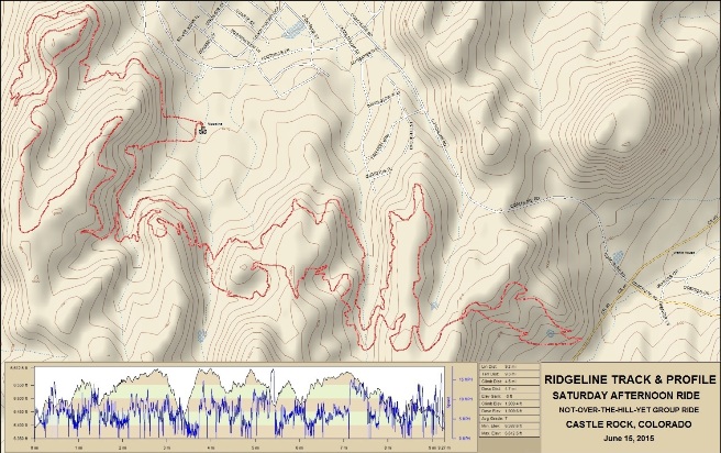
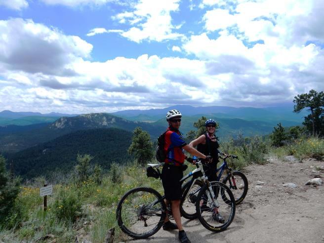
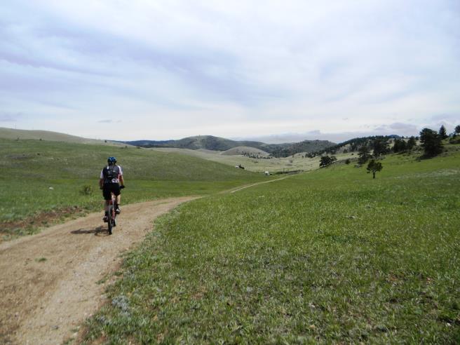
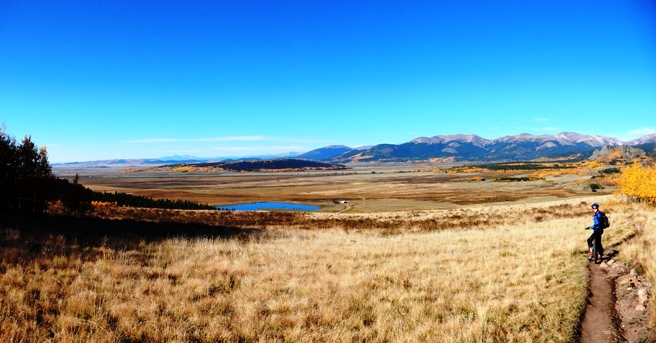
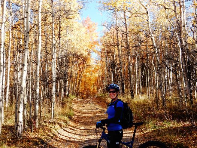
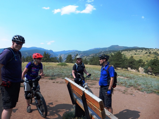
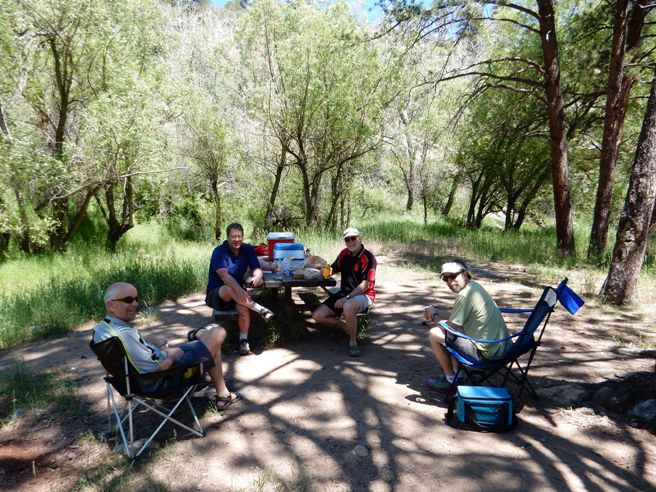
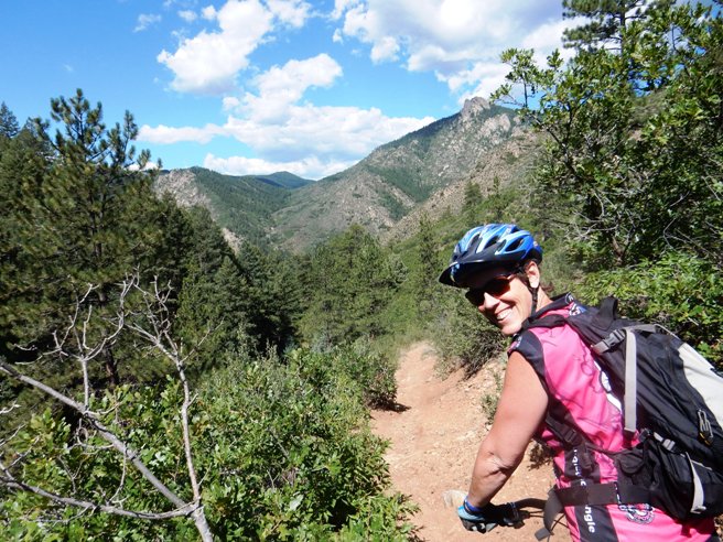
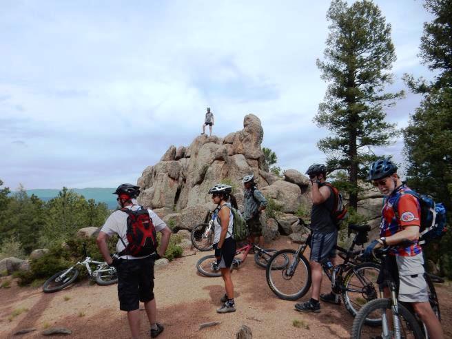
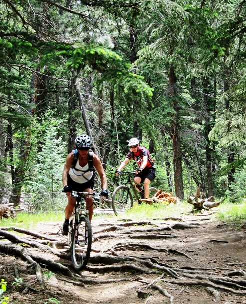
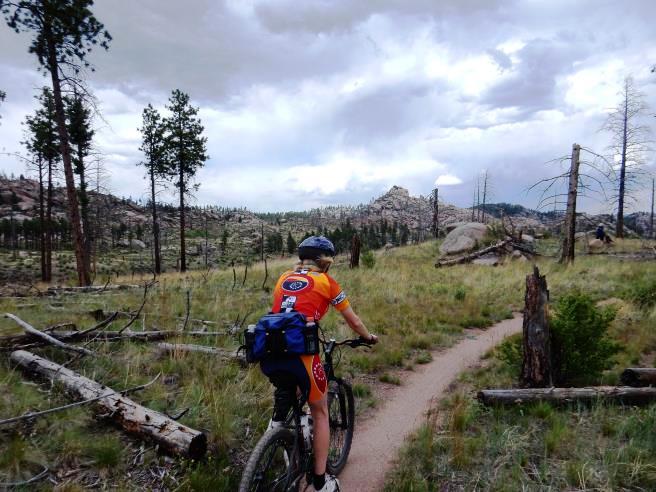
Betasso is always a good social ride and usually ends with a picnic. Castle Rock, CO - Ridgeline Trail System On June 13th, 2015, Bruce rode the Ridgeline Trail just west of Castle Rock, Colorado with the Not-Over-The-Hill-Yet mountain biking group of Denver.
The statistics for the Ridgeline Trail ride are provided below along
with a map showing the track and profile and statistics. The track
and profile is for the clockwise direction. Reverse it for a
counter-clockwise ride.
Right click on the GPX link above to download a GPX file for this ride. The GPX file may want to save as an XML file, so if it does, change the extension to gpx before you save it. The file is a high-resolution track with points are every 10' created on the Delorme PN-60W GPS. Below is a map showing the track, profile and statistics for the Ridgeline Trail ride in the clockwise direction. Reverse it for a counter-clockwise ride. You can right-click on the image below and use the "Save Target As" option to down-load a 1MB 11x17" PDF version of the map. You can also click on the image and zoom up to 200% for a detailed view in a separate window.
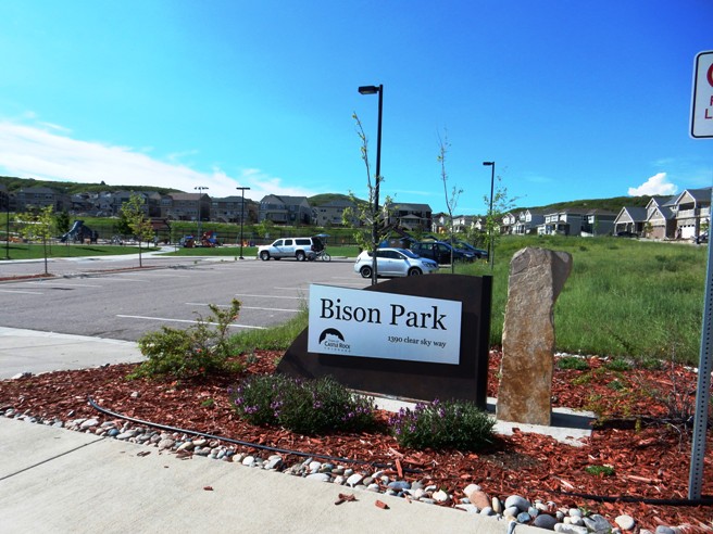
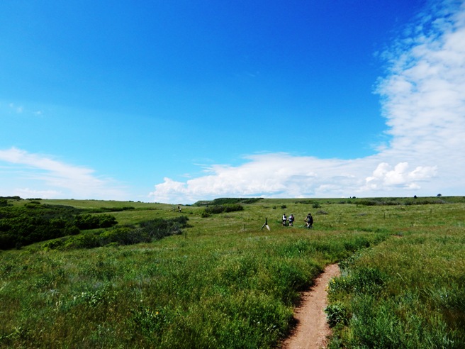
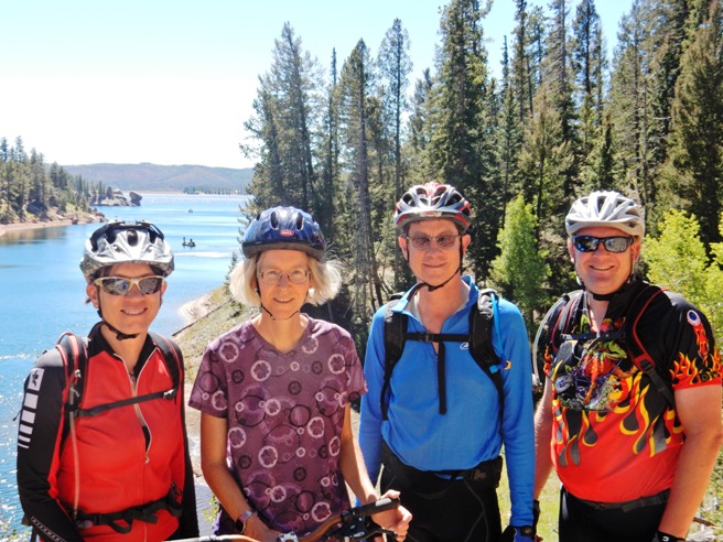
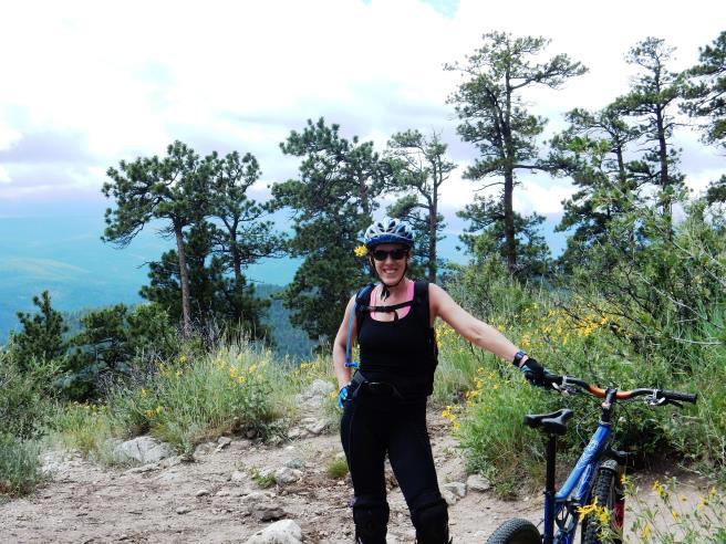
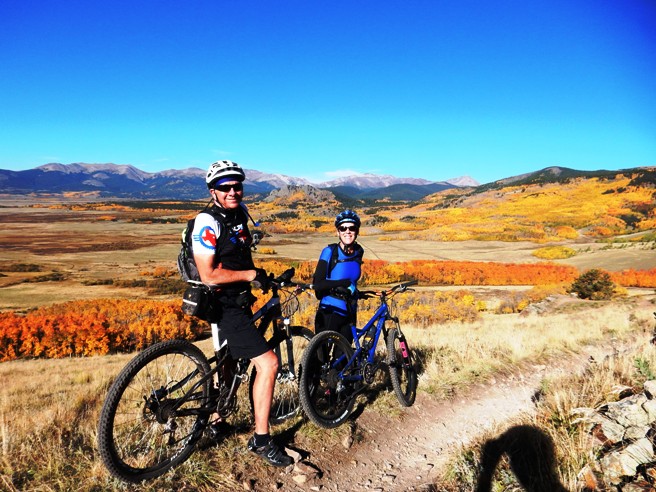
This is the kind of trail on which you will use most of your lower gears. The grades are manageable for the most part and there are few technical sections. There is a lot of trail passing through some beautiful meadows up on top of the ridge. The most popular trail head is near Bison Park. Here there is plenty of parking and restrooms too. Once out on the trail, the group stopped for the customary group photo.
After an initial climb, they were up on top riding through a series of beautiful meadows.
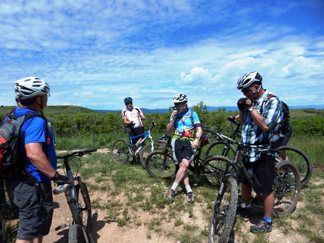
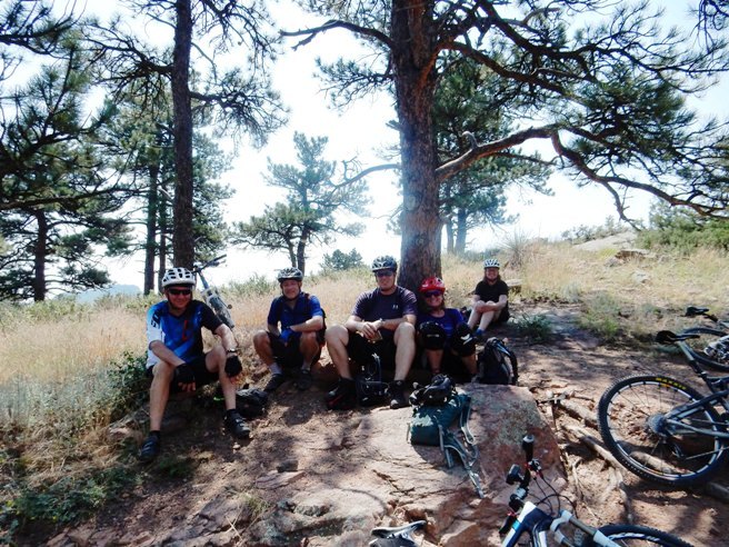
The Not-Over-The-Hill-Yet group rides for the fun of it. Below is the group taking a short break about half-way through the ride.
Another stop along the way.
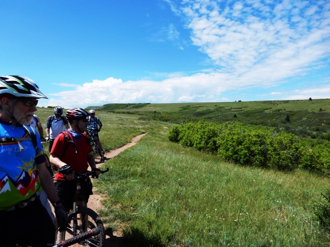
And one final stop.
There were a couple of streams to cross on the way down, and Suzie is showing the results.
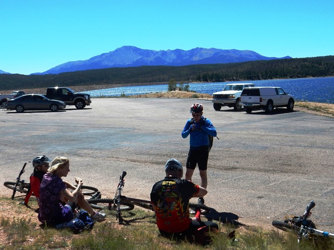
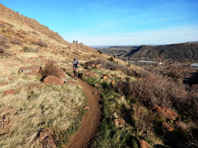
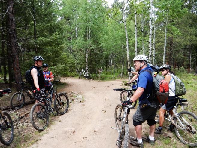
Colorado Springs, CO - Rampart Reservoir Trail System On September 13th, 2014, Bruce rode the Rampart Reservoir Trail near Woodlands, Colorado, just west of Colorado Springs with the Not-Over-The-Hill-Yet mountain biking group of Denver. This was a beautiful trail and a joy to ride. Since it circumnavigates the reservoir, the elevation changes are minimal. However, the trail is at 9,000' above sea level, so since the trail doesn't give you much of a work-out, the altitude does.
The statistics for the Rampart Reservoir Trail ride are provided below along
with a map showing the track and profile and statistics. The track
and profile is for the clockwise direction. Reverse it for a
counter-clockwise ride.
Right click on the GPX link above to download a GPX file for this ride. The GPX file may want to save as an XML file, so if it does, change the extension to gpx before you save it. The file is a high-resolution track with points are every 10' created on the Delorme PN-60W GPS. Below is a map showing the track, profile and statistics for the Rampart Reservoir Trail ride in the clockwise direction. Reverse it for a counter-clockwise ride. You can right-click on the image below and use the "Save Target As" option to down-load a 1MB 11x17" PDF version of the map. You can also click on the image and zoom up to 200% for a detailed view in a separate window.
The 2,462' of climbing was spread out across the entire 14.2 mile ride. The average grade was 6% and the maximum elevation was 9,278' AMSL. The elevation was more of a consideration than the grades. This is the kind of trail on which you will use most of your gears, and spend a lot of time in the middle ring. The grades are not impossibly steep, and don't go on for any long distances. The photo below is the customary group photo at the trail head with Wayne, Sarah and Nan.
The next photo is one of Sarah negotiating an under-water section of the trail. Nan rode it and Bruce followed her through. It was 6" to 10" deep in spots with exposed and submerged logs laying across it.
From the photo below, you can see how the trail follows the bank of the reservoir for the most part. Many sections are gravel, and a few sections of gravel are pretty deep.
Sarah and Nan coming up the trail. You have to look carefully to see them between the trees.
. . . and Wayne said: "I am going to ride the rock". Judging from the trail to the base, this appears to be a common practice.
. . . and ride it he did!
Below is a group photo at one of the fingers with Nan, Wayne, Sarah and Bruce. At this point Wayne's friend (also named Wayne) caught up and made the photo.
Same group but with the other Wayne in the photo and Bruce behind the camera.
Wayne (#1) and Sarah walking a rocky switch-back descent. Wayne (#2) and Nan are in the foreground.
A rare "trock gate" on the trail. This is an inside poke at my DORBA friends in Dallas that seem to have problems with tree gates and comment about my narrow bars.
Below is Nan at one of the technical areas. There were a few sections we had to dismount.
Lunch at the dam with Pike's Peak as the backdrop. Many of the rides in Colorado were long and you needed to bring lunch.
Near the end of the ride, Nan came across what was left of an Elk along the trail.
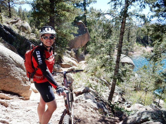
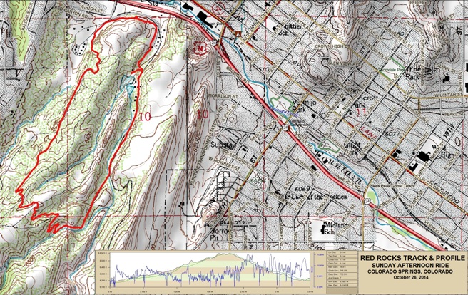
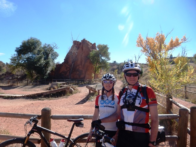
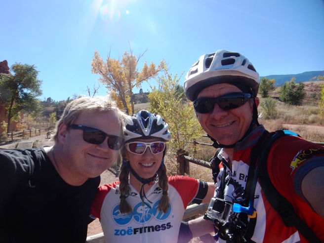
Rampart was a very enjoyable ride. The weather was perfect although a bit cool as you can see from the long-sleeved jerseys. Colorado Springs, CO - Red Rocks Open Space On October 26th, 2014, Bruce rode the Red Rocks Open Space Trail in Colorado Springs, Colorado with his friend and coach, Zoe Nance. They rode up the Red Rocks Canyon Trail to the Roundup Trail, and then took the Sand Canyon and Red Rock Canyon Trails back to the trail head. Bruce first made Zoe's acquaintance when doing long duration rides in Nevada and Utah. She has a training and coaching business and provided advice on fueling for long duration events. Check her out at ZoeFitness.com.
The statistics for the Red Rocks Open Space Trail ride are provided below along
with a map showing the track and profile and statistics. The track
and profile is for the clockwise direction. Reverse it for a
counter-clockwise ride.
Right click on the GPX link above to download a GPX file for this ride. The GPX file may want to save as an XML file, so if it does, change the extension to gpx before you save it. The file is a high-resolution track with points are every 10' created on the Delorme PN-60W GPS. You can right-click on the image below and use the "Save Target As" option to down-load a 1MB 11x17" PDF version of the map that can be printed. You can also click on the image to open it in a new window and zoom up to 200% for a detailed view.
This is the kind of trail on which you will use most of your gears. The grades are not impossibly steep, but a few go on for some distance, making it necessary to slow down to a sustainable climbing pace. The photo below shows Zoe and Bruce at the trail head at the start of the ride.
Zoe's friend Jon, was supposed to join the ride, but wasn't able to, so it was just Zoe and Bruce.
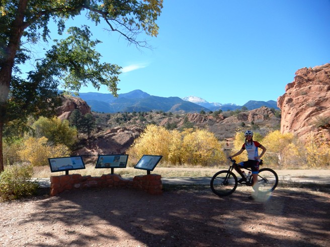
Not far from the trail head, there was a gorgeous view of Red Rocks with Pike's Peak snow capped in the distance. Zoe posed for the photo below.
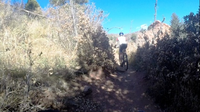
All in all, the trail was fairly ordinary. Below is a typical section of the Roundup Trail.
There weren't very many technical sections on the trail. The photo below shows the most technical section encountered on the ride. Needless to say, both Zoe and Bruce walked this one.
While not particularly technical, parts of the trail were rather scenic. Below is one of the views along the Sand Canyon Trail.
There was one other technical section, a drop near the end of the ride. This was a fairly routine drop and easily handled by an experienced, intermediate-level rider.
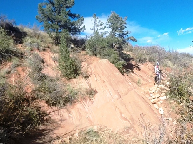
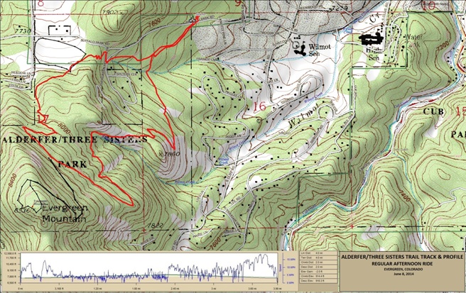
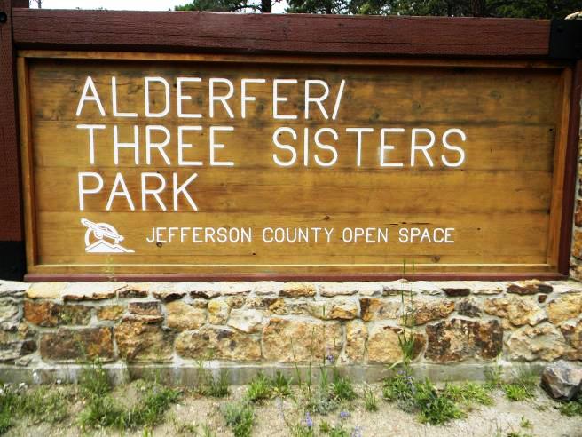
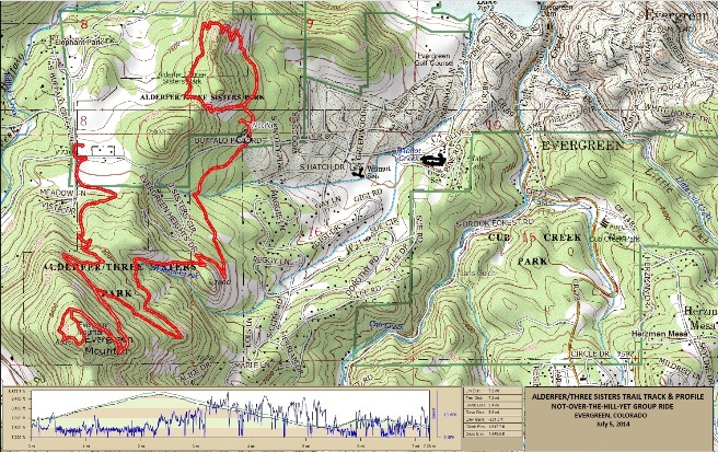
Red Rocks is a scenic and fun trail, and perfect for a second trail ride in one day. Evergreen, CO - Alderfer/3 Sisters Trail System Alderfer/Three Sisters is a typical JeffCo trail system. It is located in the foothills west of Denver Alderfer/Three Sisters Park is part of the Jefferson County Open Space System. Bruce has ridden this trail twice so far. The first time was June 8, 2014 where he did the south side in a clockwise direction. The next time was July 5, 2014 where he did the south side in the counter-clockwise direction and then did the north side. Buffalo Park Rd. divides the trail system into two parts: the North Side and the South Side. The south side has a lot of moderated climbs and descents on the Evergreen and Ranch View Loops, and includes a "lollipop" spur up to the top of Evergreen Mt. where you hit 8530' in elevation. The north side has a decidedly different character with several very rugged rock climbs and descents. All but the best expert riders can ride the entire north side, so expect to hike-a-bike in a few places. June 8, 2014 Ride
The statistics for the Alderfer Trail ride on June 8, 2014 are
provided below along with a map showing the track and profile and
statistics. The track and profile is for the clockwise direction.
Reverse it for a counter-clockwise ride.
Right click on the GPX link above to download a GPX file for this ride. The GPX file may want to save as an XML file, so if it does, change the extension to gpx before you save it. The file is a high-resolution track with points are every 10' created on the Delorme PN-60W GPS. You can right-click on the image below and use the "Save Target As" option to down-load a 1MB 11x17" PDF version of the map that can be printed. You can also click on the image to open it in a new window and zoom up to 200% for a detailed view.
This is the kind of trail on which you will use all your gears, and spend a lot of time in 1-1. The grades are not impossibly steep, but go on for some distance, making it necessary to slow down to a sustainable climbing pace. The black track is the Summit Loop which Bruce did not ride due to a thunder storm that was moving in. There are two parking lots at Alderfer. The one shows is the is the sign for the first trail head parking lot you come to leaving Evergreen. There is a second lot about a mile further out Buffalo Park Rd.
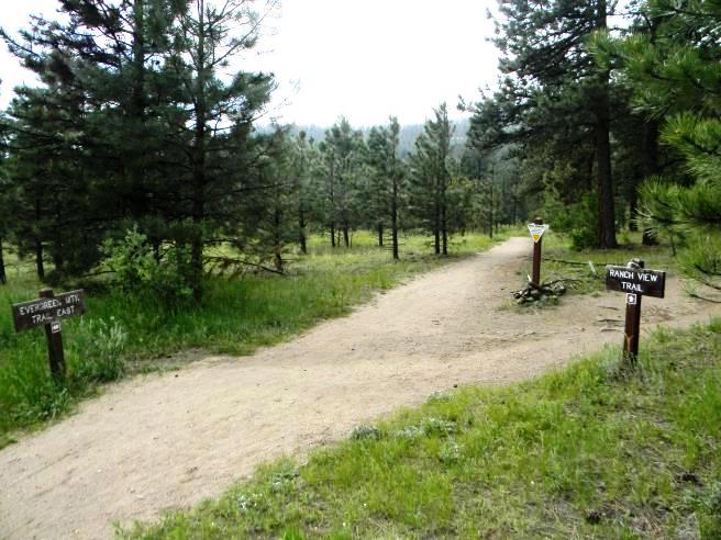
The first intersection you come to is the Evergreen/Ranch View split. To ride clockwise, take the left fork for the Evergreen Trail. The right fork is the Ranch View Trail and has you doing it counter-clockwise. Either way, you end up back at this intersection.
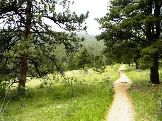
On this ride, Bruce went left to ride Evergreen. The trail starts out as a smooth climb.
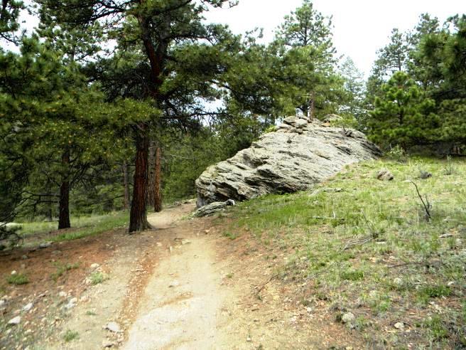
A little further up, the grade increases and it gets rockier.
As you go up, the roots, rocks and water bars become more frequent.
There are a few level spots before reaching the Summit Loop, but not too many. This one starts to climb again just around the bend.
There are a few technical spots, but nothing a rider with solid intermediate skills can't handle.
Bruce was about to start up the Summit Loop when a thunder storm moved in. Not wanting to be on the mountain during a thunderstorm, he high-tailed it off the mountain.
July 5, 2014 Ride The second ride was with the Not-Over-The-Hill-Yet mountain biking group of Denver on July 5, 2014. The statistics are provided below along with a map showing the track and profile and statistics.
The statistics for the (Trail Name) ride are provided below along
with a map showing the track and profile and statistics. The track
and profile is for the clockwise direction. Reverse it for a
counter-clockwise ride.
Right click on the GPX link above to download a GPX file for this ride. The GPX file may want to save as an XML file, so if it does, change the extension to gpx before you save it. The file is a high-resolution track with points are every 10' created on the Delorme PN-60W GPS. You can right-click on the image below and use the "Save Target As" option to down-load a 1MB 11x17" PDF version of the map that can be printed. You can also click on the image to open it in a new window and zoom up to 200% for a detailed view.
Below is a shot of Janet checking some deer in the woods.
This time the weather was much better and he was able to ride the Summit Loop. Here is a photo of Denise at the summit. She pointed out her house down in the valley below.
Over on the north side, it was time to ride in the rocks. Below is Bud clearing a rocky climb with a few water bars along the way.
Next up the climb was Josh.
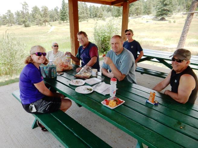
After the ride, it was time for a picnic lunch in one of the dining shelters. That's Janet, Joe, Pat, Monte and Bud at the main table and Phillip in the background.
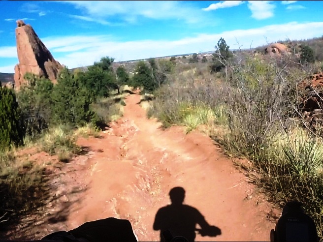
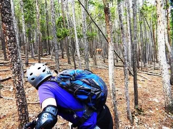
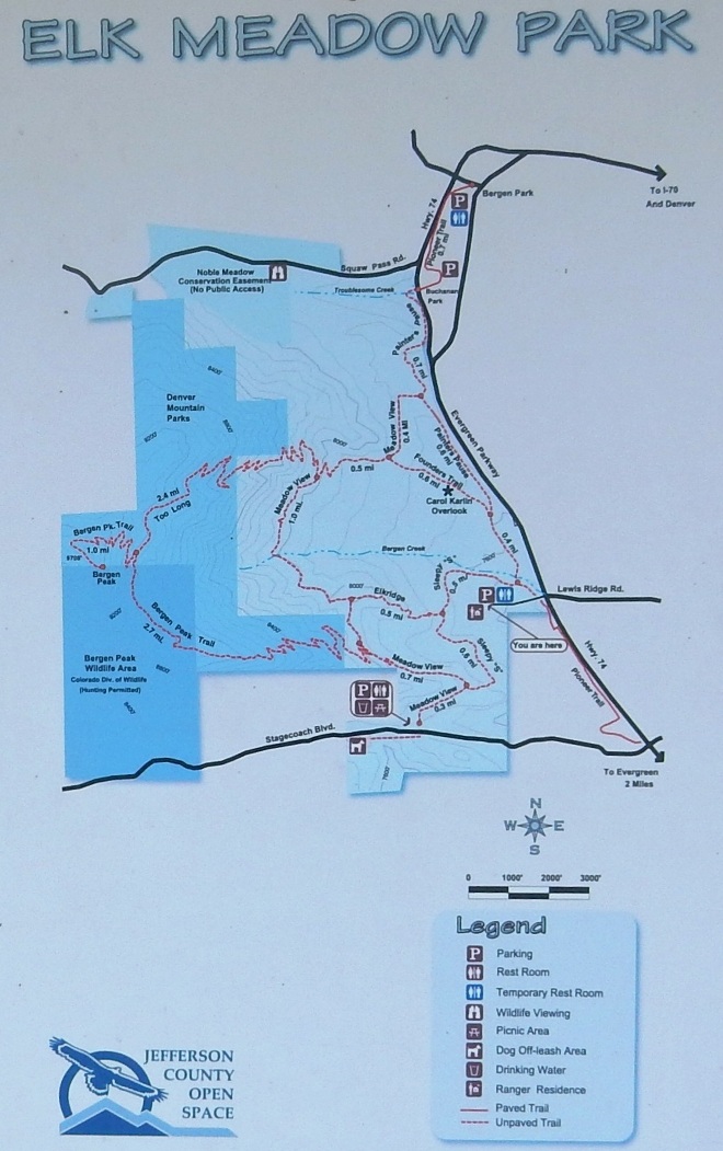
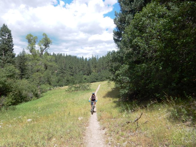
Evergreen, CO - Elk Meadow Trail System On July 13th, 2014, Bruce rode the Elk Meadow Trail with Anne and Jim, friends from Dallas now living in Colorado. This was supposed to be a "recovery ride" after having rode The Peaks Trail from Frisco to Breckenridge the day before. Bruce thought Elk Meadow would be a short, relaxing ride. As he has done in the past, he picked a trail for recovery that was more difficult than the ride he was trying to recover from. Bruce rode it again on October 25th, 2014 just for "fun".
The statistics for the Elk Meadow Trail ride on October 25th are
provided below along with a map showing the track and profile and
statistics. The track and profile is for the clockwise direction.
Reverse it for a counter-clockwise ride.
Right click on the GPX link above to download a GPX file for this ride. The GPX file may want to save as an XML file, so if it does, change the extension to gpx before you save it. The file is a high-resolution track with points are every 10' created on the Delorme PN-60W GPS. You can right-click on the image below and use the "Save Target As" option to down-load a 1MB 11x17" PDF version of the map that can be printed. You can also click on the image to open it in a new window and zoom up to 200% for a detailed view.
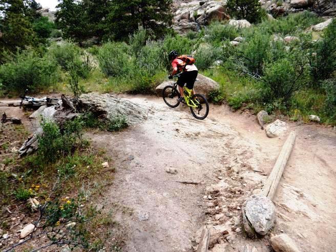
This is the kind of trail on which you will use all your gears, and spend a lot of time in 1-1 on the way up. The grades are steep and technical, and really give the legs a work-out on the way up. Use this link to see a video of the run down the "Too Long" trail. The trail map. Our ride included the big loop to the west WITHOUT the climb to the summit. The way up on the Bergen Trail was brutal in spots. The way down on Too Long was full of rocky, switch-back descents.
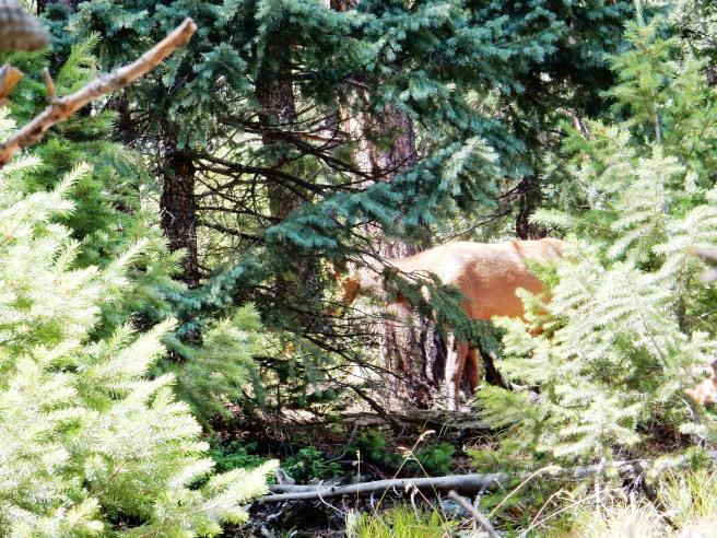
A female elk spotted grazing on our way up during the July ride.
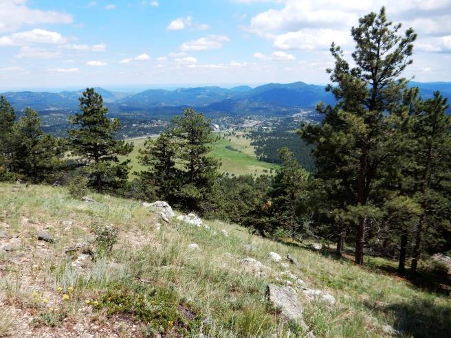
Bruce and Anne at one of the first scenic overlooks in July. That is Evergreen in the distance.
Anne showing off on the July ride by clearing a rocky ascent.
Another overlook shot with Bruce and Anne during the July ride.
Anne getting "feminine" with some wildflowers in July.
Jim attempting a switch-back and rocky ascent in July. There were far too many of these on the climb up to suite Bruce.
Bruce, Anne and Jim at another scenic overlook during the July ride.
More rocky, rooty ascent. Walked most of this. Way too much hike-a-bike on the way up.
It only got worse as you went up. Below is a photo from the October 2014 ride.
Below is yet another photo from the October, 2014 ride. This trail shows no mercy.
And just when you thought it couldn't get worse, you encounter this!
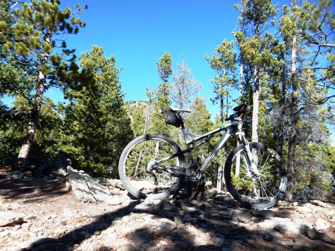
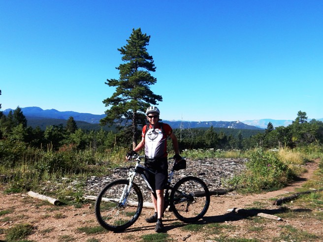
You finally reach the top, and get a view of the summit. Below is a photo of the bike with Bergen Peak in the background. The bike is at 9,250' AMSL. Bergen Peak is at 9,708' AMSL.
Here is a link to a video of the ride down "Too Long" from the photo spot above. On the way down, got a good look at our destination.
Bruce and Anne finishing the the last technical descent before reentering the meadow.
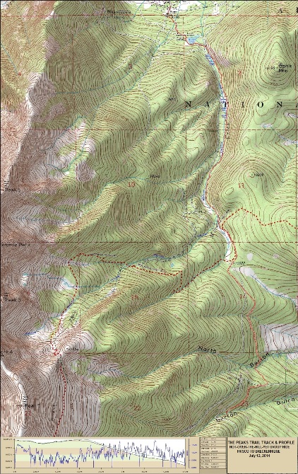
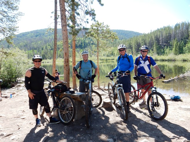
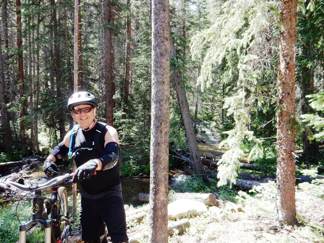
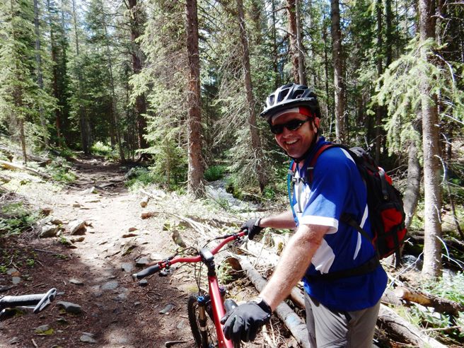
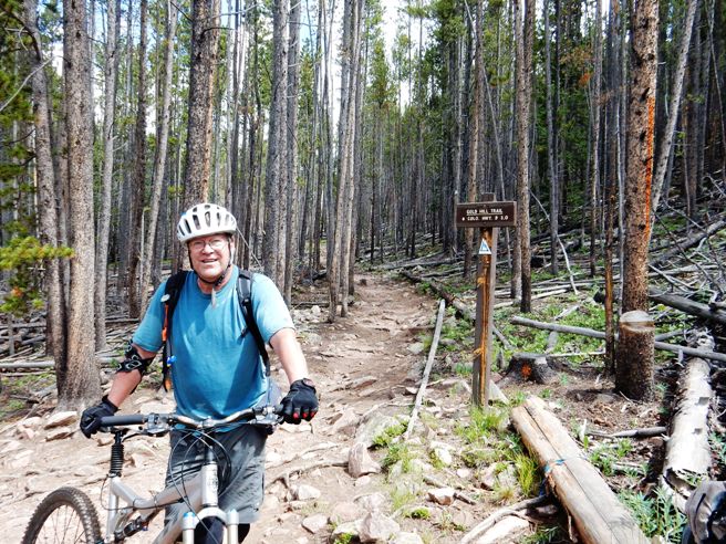
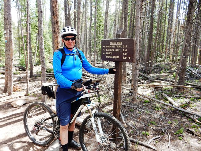
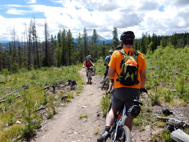
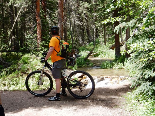
The name of the trail is deceiving. Elk Meadow suggests something gentle and scenic. This is only true for a small amount of trail at the bottom. The Sleepy S, Meadow View and Founder's Trails are pleasant, but the Bergen Peak and Too Long trails, which make up the majority of the ride, are down-right demanding. On July 12th, 2014, Bruce rode the Peaks Trail from Frisco to near Breckenridge with the Not-Over-The-Hill-Yet Group out of Denver. The trail runs from Frisco to Breckenridge. This is a local favorite in the summer because it is above 10,000' for the most part, and tends to be cool, even in July and August. The trail starts out at 9,100 feet and climbs to just over 10,000 feet. It follows the Tenmile Range, a ridge of 13,000 foot peaks to the west. It also follows the Continental Divide for a while.
The statistics for the The Peaks Trail ride are provided below along
with a map showing the track and profile and statistics. The track
and profile is for the direction from Breckenridge back to Frisco.
Right click on the GPX link above to download a GPX file for this ride. The GPX file may want to save as an XML file, so if it does, change the extension to gpx before you save it. The file is a high-resolution track with points are every 10' created on the Delorme PN-60W GPS. You can right-click on the image below and use the "Save Target As" option to down-load a 1MB 11x17" PDF version of the map that can be printed. You can also click on the image to open it in a new window and zoom up to 200% for a detailed view.
This is the kind of trail on which you will use all your gears, and spend a lot of time in 1-1 at the beginning. The grades are not impossibly steep, but go on for some distance, making it necessary to slow down to a sustainable climbing pace. Once up on top, the climbing moderates to a typical undulating pattern.
After a short initial climb, you arrive at Rainbow Lake. Below is
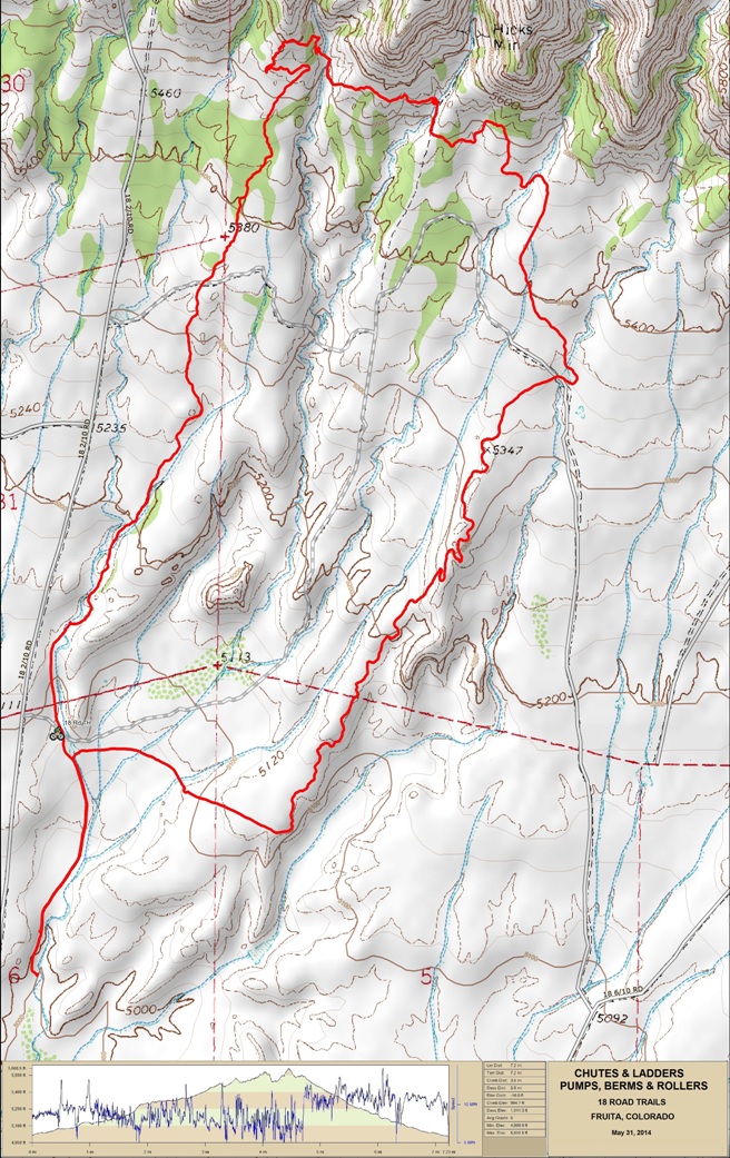
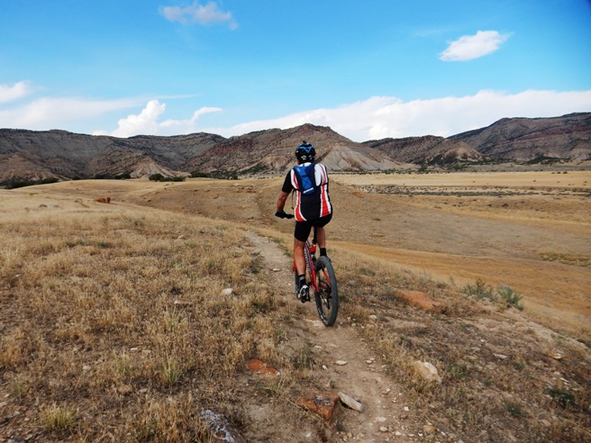
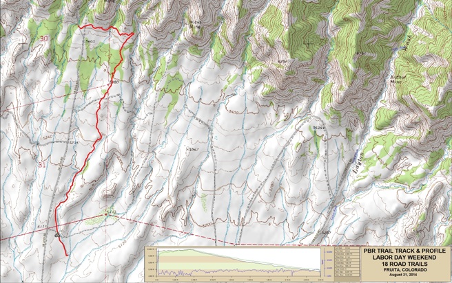
Bud, Pat, Bruce and Aaron at the lake. Fruita, CO - Edge, Chutes & Ladders & PBR, 18 Road Trail System Bruce rode The Edge Loop, Chutes & Ladders and Pumps, Berms and Rollers (PBR) during both the May and August trips in 2014. In May, he followed Jim, Anne and Rob out the Edge trail to Down Uppity, to Vegetarian, to Chutes and down PBR (Pumps, Berms & Rollers). He did the same ride with Bobby Duncan during the Labor Day trip in 2014 where he made a video of the run down PBR.
The statistics for this ride are provided below along with a map
showing the track and profile and statistics. The track and profile
is for the clockwise direction. Reverse it for a counter-clockwise
ride.
Right click on the GPX link above to download a GPX file for this ride. The GPX file may want to save as an XML file, so if it does, change the extension to gpx before you save it. The file is a high-resolution track with points are every 10' created on the Delorme PN-60W GPS. You can right-click on the image below and use the "Save Target As" option to down-load a 1MB 11x17" PDF version of the map that can be printed. You can also click on the image to open it in a new window and zoom up to 200% for a detailed view.
This is the kind of trail on which you will use all your gears, and spend a lot of time in 1-1. The grades are not impossibly steep, but go on for some distance, making it necessary to slow down to a sustainable climbing pace. The down-hill on PBR is awesome! Below is Bobby starting out on the Edge Loop.
The photo below is of Jim and Rob during the May trip.
Next we have a panoramic photo of Anne on Chutes & Ladders during the May trip.
Bobby on his way up during the August trip.
Looking back on a climb on Chutes & Ladders during the May trip.
Looking back on the climb, but this time with Bobby in the photo.
Below is a photo of Bruce near the top of Chutes & Ladders during the May trip.
Rob, Jim and Anne near the top of Chutes & Ladders during the May trip.
Bobby near the top during the August trip.
Below is a panoramic view looking towards the south and PBR from up near the west end of Chutes & Ladders during the May trip.
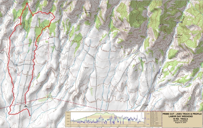
The way back was via PBR, but since this is a fast down-hill run, and Bruce didn't have the GoPro for this ride, so that is all you will see. They did PBR two days later, and this time there was video. Fruita, CO - Prime Cut & Joe's Ridge, 18 Road Trail System Joe's Ridge is an interesting ride in that it combines some of the ridge riding of Zippity with the pumps, berms and rollers of PBR. Joe's parallels both Kessel and Zippity, lying between the two.
The statistics for the Prime Cut & Joe's Ridge ride are provided
below along with a map showing the track and profile and statistics.
Since Joe's Ridge is a down-hill run, the loop is only ridden
counter-clockwise.
Right click on the GPX link above to download a GPX file for this ride. The GPX file may want to save as an XML file, so if it does, change the extension to gpx before you save it. The file is a high-resolution track with points are every 10' created on the Delorme PN-60W GPS. You can right-click on the image below and use the "Save Target As" option to down-load a 1MB 11x17" PDF version of the map that can be printed. You can also click on the image to open it in a new window and zoom up to 200% for a detailed view.
This is the kind of trail on which you will use all your gears. The way up is in the lower gears, and the way down is in the higher gears. The grades are not impossibly steep, but go on for some distance. the climbs up are not difficult, and the down-hill on Joe's is over the top. The ride started by climbing Prime Cut (again). Below is a photo of Bobby on his way up.
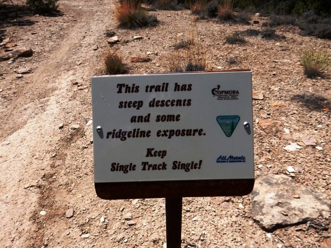
Soon after turning onto Joe's, you encounter a "warning sign". Anyone that knows Fruita knows to expect this kind of stuff on Joe's and Zippity.
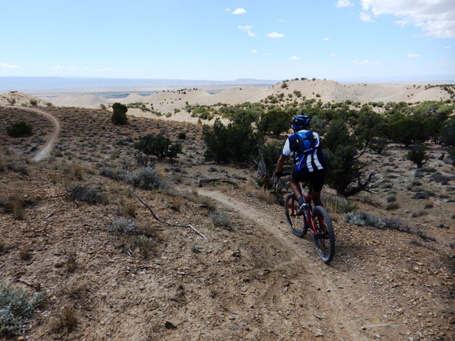
Next, you start out on the ridge. Below is a shot of Bobby getting started.
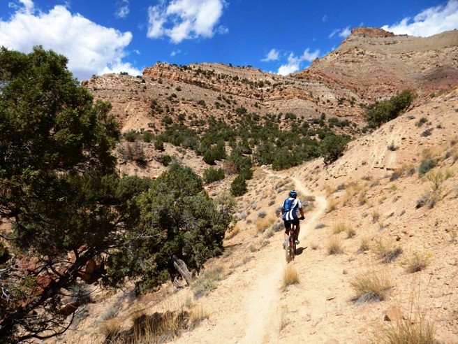
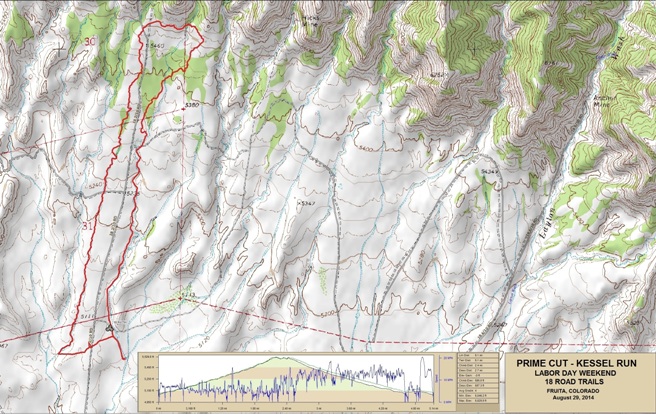
At this point, the still camera was put away and the GoPro was switched on. Use this link to view the Joe's Ridge video. Fruita, CO - Prime Cut & Kessel Run, 18 Road Trail System Bruce did Prime Cut and the Kessel Run on both the May and August trips in 2014. The Kessel Run comes from the scene in Star Wars where Luke and Obi-Wan are looking for a ship to get to Alderaan. “You’ve never heard of the Millennium Falcon? It’s the ship that made the Kessel run in less than 12 parsecs.” The Kessel Run Trail is reached by riding up Prime Cut and then blasting down the trail, about 3 miles of super fast, flowy single-track. During the Labor Day trip, Bruce had a GoPro and made a video of Bobby descending the Run. The link to the video as at the end of this article.
The statistics for the Kessel Run Trail ride are provided below along
with a map showing the track and profile and statistics. The trail
is ridded in the counter-clockwise direction since you want to go up
Prime cut to get to the entrance to the Kessel Run.
Right click on the GPX link above to download a GPX file for this ride. The GPX file may want to save as an XML file, so if it does, change the extension to gpx before you save it. The file is a high-resolution track with points are every 10' created on the Delorme PN-60W GPS. You can right-click on the image below and use the "Save Target As" option to down-load a 1MB 11x17" PDF version of the map that can be printed. You can also click on the image to open it in a new window and zoom up to 200% for a detailed view.
This is the kind of trail on which you will use all your gears. The way up is in the lower gears, and the way down is in the higher gears. The grades are not difficult, but go on for some distance. The down-hill on the Kessel Run is over the top. The photo below shows Bobby on Prime Cut on the way up.
The photo below shows Bobby and Bruce at the top of Prime Cut getting ready to head over to the Kessel Run.
Bruce made a video of ride down the Kessel Run segment of this ride. Use this link for the Kessel Run video. Fruita, CO - Pumps, Berms & Rollers, 18 Road Trail System Introduction to the trail and ride including any other riders or group with you.
The statistics for the (Trail Name) ride are provided below along
with a map showing the track and profile and statistics. The track
and profile is for the clockwise direction. Reverse it for a
counter-clockwise ride.
Right click on the GPX link above to download a GPX file for this ride. The GPX file may want to save as an XML file, so if it does, change the extension to gpx before you save it. The file is a high-resolution track with points are every 10' created on the Delorme PN-60W GPS. You can right-click on the image below and use the "Save Target As" option to down-load a 1MB 11x17" PDF version of the map that can be printed. You can also click on the image to open it in a new window and zoom up to 200% for a detailed view.
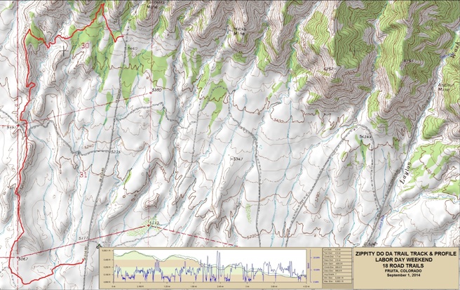
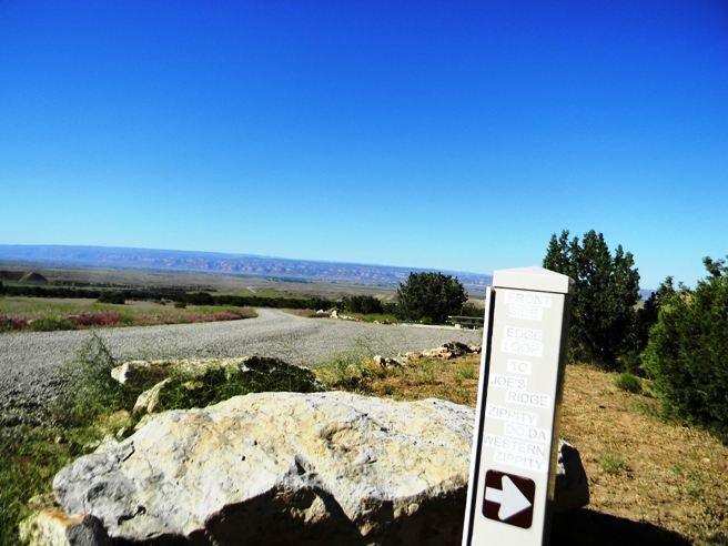
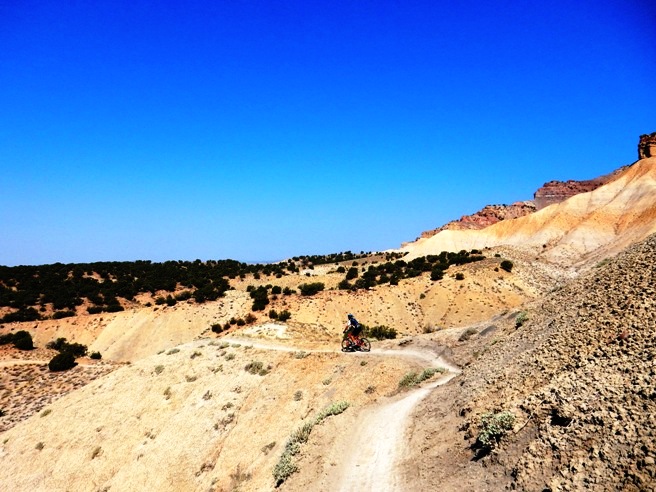
This is the kind of trail on which you will use all your gears, and spend a lot of time in 1-1. The grades are not impossibly steep, but go on for some distance, making it necessary to slow down to a sustainable climbing pace. The photo below shows (description). (Place-holder for photo) Description of following photo. (Place-holder for photo) While Kessel is mostly a swooping, flowing down-hill run, PBR has a lot of pumps and rollers, and is decidedly more three-dimensional than Kessel. Use this link to view the PBR video. Fruita, CO - Zippity Do Da, 18 Road Trail System Like many of the other trails, Zippity Do Da was ridden during both the May and August visits. Both times it was done as a shuttle ride since it is the finale and usually the last ride of the trip. Zippity is the most exciting of all the rides at the 18 Road Trail System. It has a long run down a ridge, awesome drops, nice climbs and some really fast, long downhill runs.
The statistics for the Zippity ride are provided below along with a
map showing the track and profile and statistics. Since Zippity is a
down-hill run, the loop is only ridden counter-clockwise.
Right click on the GPX link above to download a GPX file for this ride. The GPX file may want to save as an XML file, so if it does, change the extension to gpx before you save it. The file is a high-resolution track with points are every 10' created on the Delorme PN-60W GPS. You can right-click on the image below and use the "Save Target As" option to down-load a 1MB 11x17" PDF version of the map that can be printed. You can also click on the image to open it in a new window and zoom up to 200% for a detailed view.
This is the kind of trail on which you will use all your gears. The way up is climbing in the lower gears, and the way down is in the higher gears. A mile of the ride was on Front Range trail from Prime Cut to start of Zippity. The trail dropped about 600' in 3.3 miles with an overall descent of 996 feet. You can either shuttle up to the parking lot or ride the Edge Loop up from the camping area. Either way, you take Front Range out to the start of Zippity.
Below is a photo of Rob on Front Range during the May 2014 trip.
Another photo of Rob further out on Front Range.
Below is a photo of Bruce at the same spot on the August 2014 ride.
Next is Bobby heading out Front Range towards the Zippity Trail Head.
The following photo from the May 2014 ride gives a wider view of the approach to Zippity.
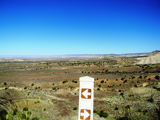
The trail marker says you have arrived!
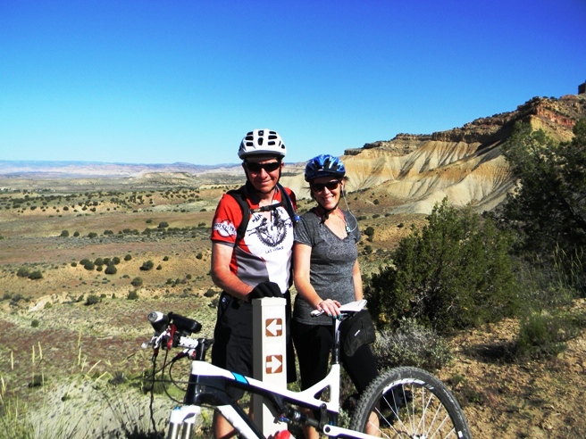
Below is a photo of Bruce and Anne at the start of Zippity during the May 2014 ride.
Below is Bobby at the Zippity Trail Head during the August 2014 ride.
The next photo from the August 2014 ride shows Bruce just past the trail marker and gives a nice view of the first ridge.
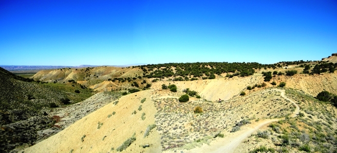
At the end of the first ridge, there is a bench-cut in the top of the hill. The photo below shows just how high up you are at this point.
As if the photo above wasn't enough, the one below shows Bobby on the bench-cut during the August 2014 ride. Bobby is the large black speck just to the left of the peak.
The photo below gives a long view of the bench-cut and and descending trails.
Further down, Bruce, Anne and Rob came to a steep drop in May. It was loose, so not having ridden it before, they elected to walk down. Even walking was a chore. In August, Bruce rode down it, and this is in the video for this trail.
The photo shows Bobby happy to have made it down one of the several steep drops on Zippity.
And finally, a photo looking back on the first section of Zippity.
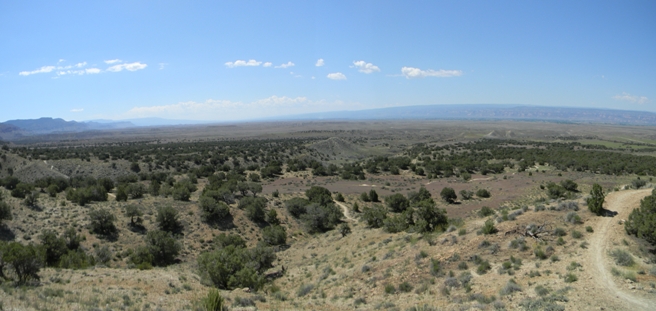
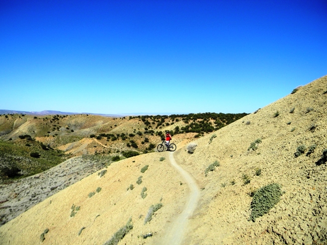
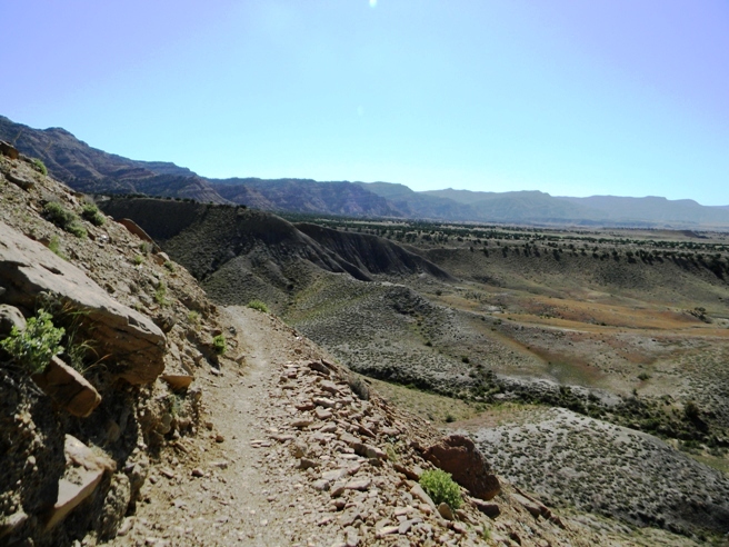
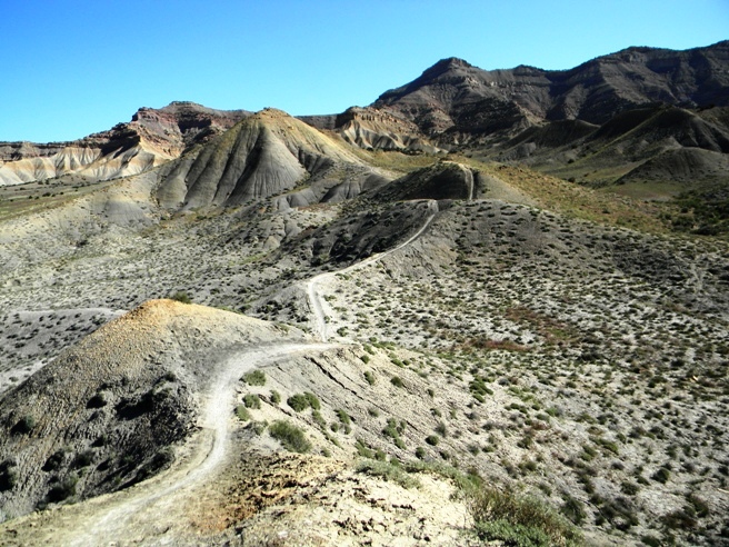
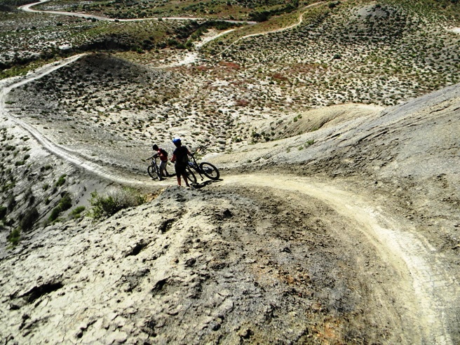
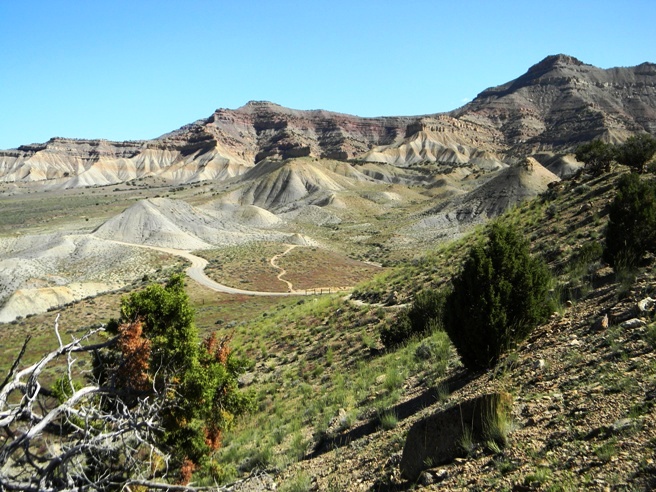
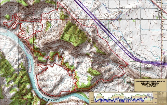
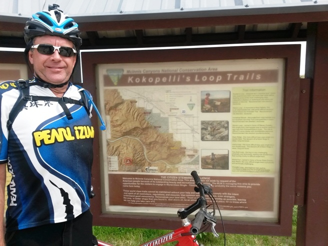
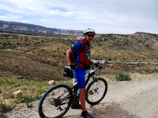
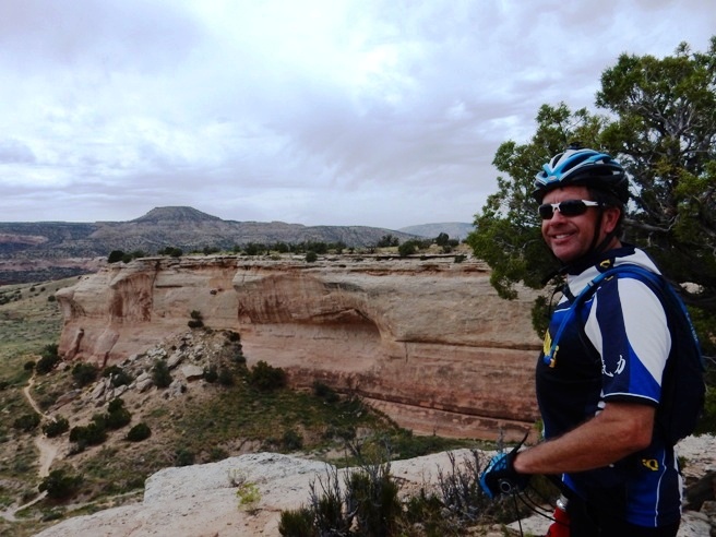
A video was made of most of the run down Zippity. The climbing sections have been edited out since they are not nearly as exciting as the other sections. Use this link to view the video. Fruita, CO - Kokopelli Trail System On August 30, 2014, Bruce and Bobby rode the Kokopelli Trail System southwest of Fruita. The ride consisted of Mary's, Horse Thief, Steve's and back via a gravel road. Nearly half of the route followed the Colorado River. This is the most scenic of all the systems at Fruita.
The statistics for the Kokopelli Trail System ride are provided below along
with a map showing the track and profile and statistics. The track
and profile is for the clockwise direction. Reverse it for a
counter-clockwise ride.
Right click on the GPX link above to download a GPX file for this ride. The GPX file may want to save as an XML file, so if it does, change the extension to gpx before you save it. The file is a high-resolution track with points are every 10' created on the Delorme PN-60W GPS. You can right-click on the image below and use the "Save Target As" option to down-load a 1MB 11x17" PDF version of the map that can be printed. You can also click on the image to open it in a new window and zoom up to 200% for a detailed view.
This is the kind of trail on which you will use all your gears. The terrain is quite varied with rocky climbs and descents and lots of smooth single-track. Below is a photo of Bobby at the Kokopelli trail head.
After a short climb up a gravel road, the trail system and Colorado River came into view.
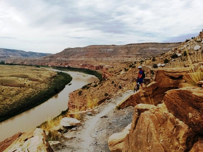
They started out on Mary's which followed the bluffs along the north side of the Colorado River. Below is a photo of Bruce on the bluffs on the way out.
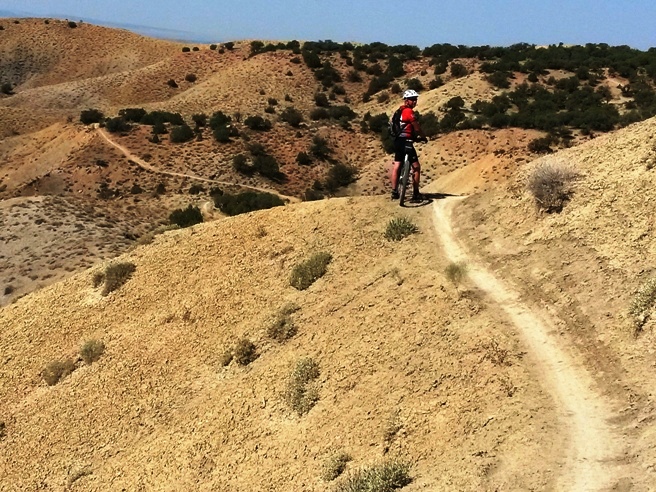
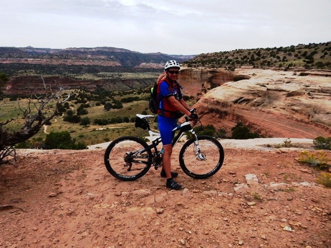
The vistas were magnificent! Below is a panorama of Bruce further down the trail
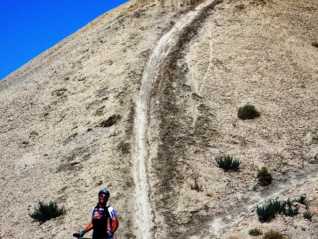
About half-way out Mary's, the Horse Thief Bench Loop branches off. The way down is what Bruce considers to be a triple black diamond descent. Most riders walked it, although a few rode about half-way down and then walked.
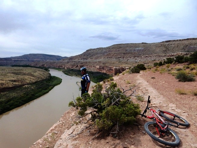
Once down, you see the bluffs from an entirely different perspective.
Along the way, there were some interesting rock formations carved out by the river in the past.
After completing Horse Thief, it was time to hike the bike back to the top of the bluff.
Back up top, the vistas continued. To say the trail provided sensory overload would be an understatement.
As you can see from the photo below, the trail continued along the bluffs and the Colorado River for quite a distance.
Below is Bobby in a state of total fascination with the experience.
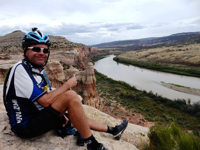
Part way out, it was time for a little nourishment. They picked a nice spot and refueled. The objects in the river are the rafts of a large group of folks drifting down the Colorado.
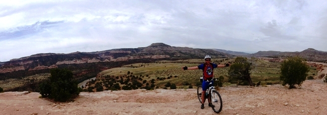
Next, it was out on Steve's Loop. This was the most spectacular part of the entire ride. The trail continued to follow the bluffs, and got to within a few feet of the edge in places.
The sensory overload extended around every bend. At this point, the trail went in and out with the washes.
Below is a photo on one of the many washes as seen from on high. Notice how trail follows the edge.
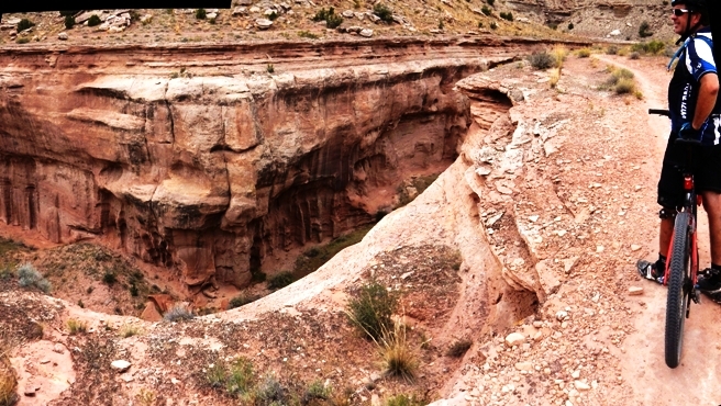
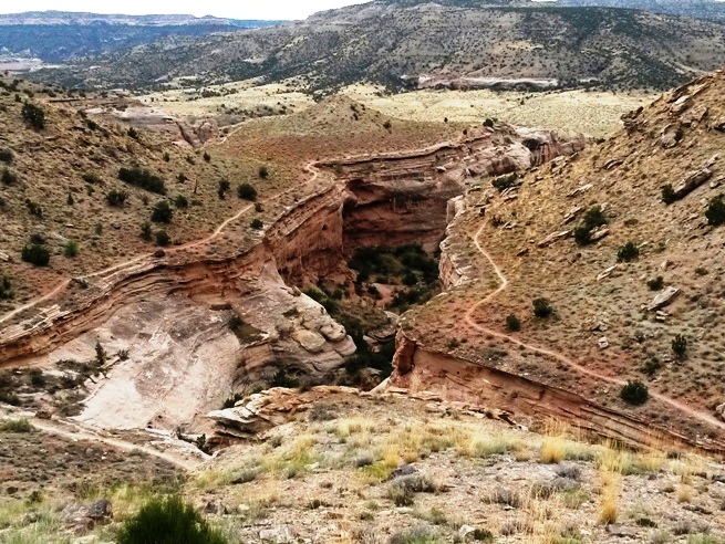
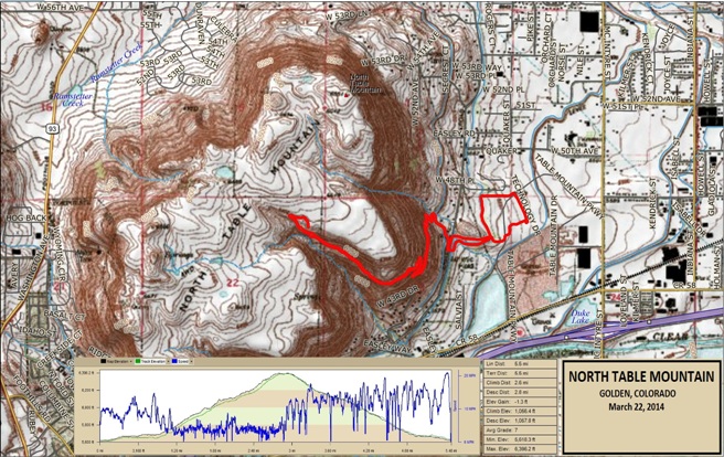
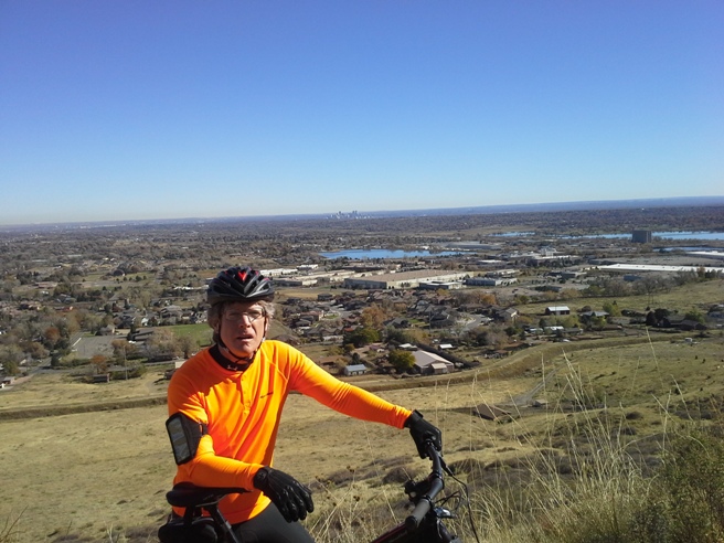
Golden, CO - North Table Mt. Trail System In January of 2014, Bruce was doing some work for a company in Golden, Colorado. About a block from the office was the trailhead for the North Table Mt. trail system. The first ride Bruce took was from the office for lunch on March 21st. He and another engineer rode up to the vista on the top of the canyon near the middle of the mountain. This eventually become a weekly lunch ride. More information on all the trails here can be found at the IMBA Mountain Bike Project page for North Table Mountain.
The statistics for the N. Table Mountain Trail ride are provided below along
with a map showing the track and profile and statistics. The track
and profile is for the clockwise direction. Reverse it for a
counter-clockwise ride.
Right click on the GPX link above to download a GPX file for this ride. The GPX file may want to save as an XML file, so if it does, change the extension to gpx before you save it. The file is a high-resolution track with points are every 10' created on the Delorme PN-60W GPS. A map with the ride profile and statistics is provided below. Right-click on the image below and use the "Save Target As " option to down-load a 1 MB 11x17" PDF version of the map. You can also click on the image and zoom up to 200% for a detailed view in a separate window. You can right-click on the image below and use the "Save Target As" option to down-load a 1MB 11x17" PDF version of the map that can be printed. You can also click on the image to open it in a new window and zoom up to 200% for a detailed view.
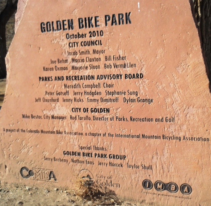
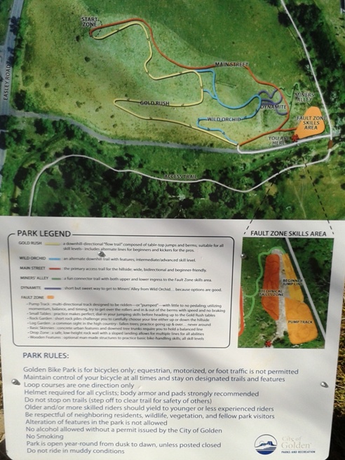
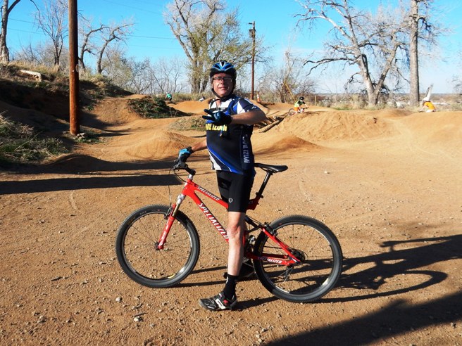
The distance ridden this day was 5.5 miles. The ride time was about 45 min. up and down. Climbing was 1,056 feet and occurred in about 1.5 miles of the trail. This is the kind of trail on which you will use all your gears, and spend a lot of time in 1-1. The grades are not impossibly steep, but go on for some distance, making it necessary to slow down to a sustainable climbing pace. The distance ridden this day was 5.5 miles. The ride time was about 45 min. up and down. Climbing was 1,056 feet and occurred in about 1.5 miles of the trail. Bruce rode this trail once or twice a week after work on Mondays and Friday's. A friend from Dallas, Bobby Duncan was out that way and stopped by for a Friday afternoon ride prior to a skiing on Saturday and Sunday. Across from the trail head is the Golden Bike Park. This is skills and pump-track area.
The skills area is on top of a hill, and the pump track is down near the entrance to the park.
Below is a photo of Bobby at the skills area during his visit in April of 2014.
After checking out the skills park, Bobby and Bruce headed up Table Mountain. Below is Bobby about half way up. The trails are not too technical, but the climbs and switchback are brutal.
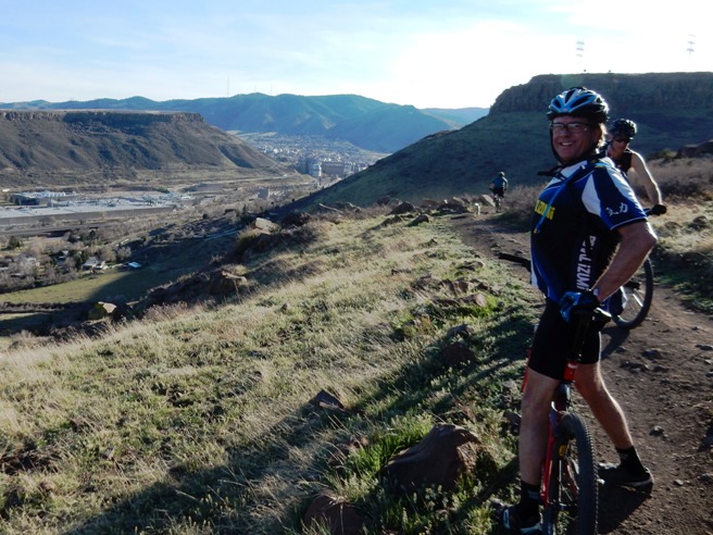
Once rounding the south face, they could see the Coors Brewery and the town of Golden.
Further up the trail, they came to the split between the North Table Mt. loop and the Cottonwood trail. The North Table Mt. loop goes on around the mountain and the Cottonwood trail goes up to the top.
The photo below shows Bobby coming up the Cottonwood Trail.
Further up the trail looking back. CO_20160130_161155_N_Table_Mt_Golden
Near the top are several switch-back turns. The first switch-back.
The second switch-back turn.
Next is a set of stairs.
The third switch-back turn.
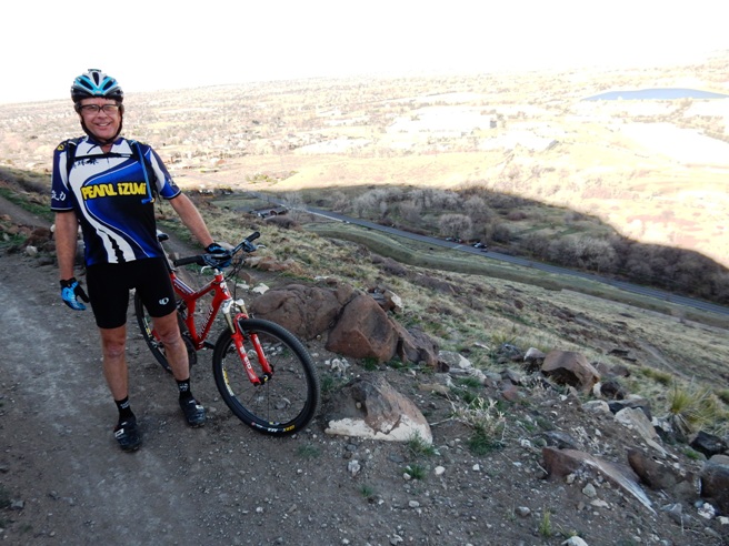
After the third switch-back turn, the grade decreases, you cross a rock garden and arrive at the overlook. Below is Bruce on the overlook with the outskirts of Golden in the distance.
Bobby also had his photo made from this vantage point.
From the overlook, it was up a short climb to top of N. Table Mountain.
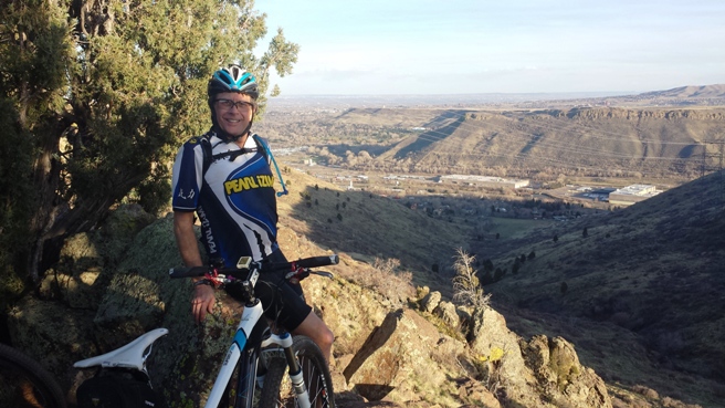
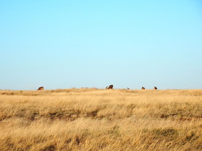
Up on top they saw a heard of Mule Deer.
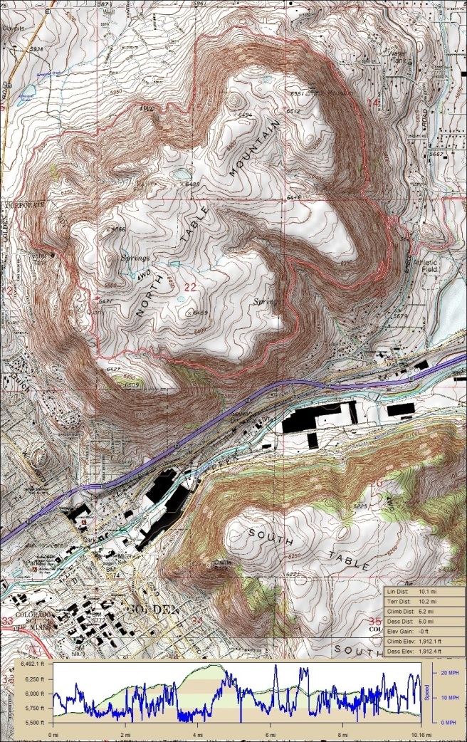
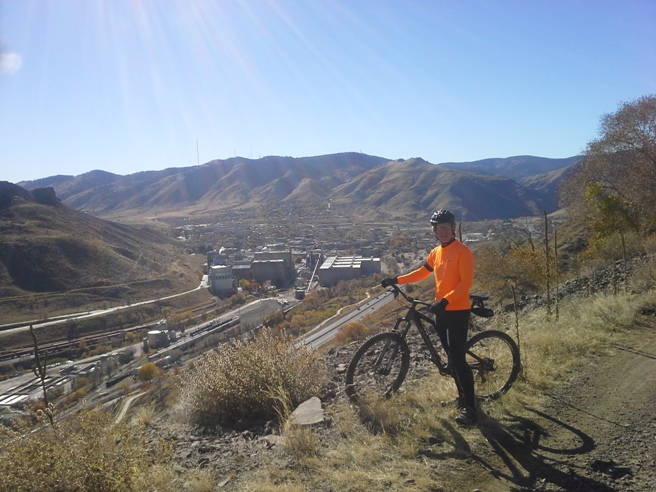
After taking in the view, they enjoyed a descent of over 1,100 feet. The initial ride described above covered only a portion of the trail. The main trail circumnavigates the mountain as seen in the track and profile map below. Since Bruce was working at Denver International Airport for a company in Golden, he rode the circular loop many times in 2014, 2015 and January of 2016.
The statistics for the N. Table Mountain Trail loop are provided below along
with a map showing the track and profile and statistics. The track
and profile is for the clockwise direction. Reverse it for a
counter-clockwise ride.
Right click on the GPX link above to download a GPX file for this ride. The GPX file may want to save as an XML file, so if it does, change the extension to gpx before you save it. The file is a high-resolution track with points are every 10' created on the Delorme PN-60W GPS. A map with the ride profile and statistics is provided below. Right-click on the image below and use the "Save Target As " option to down-load a 1 MB 11x17" PDF version of the map. You can also click on the image and zoom up to 200% for a detailed view in a separate window. You can right-click on the image below and use the "Save Target As" option to down-load a 1MB 11x17" PDF version of the map that can be printed. You can also click on the image to open it in a new window and zoom up to 200% for a detailed view.
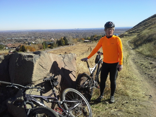
The photo below shows Pat on the on the north-east side of the loop. The city of Denver can be seen in the distance. Bruce and Pat rode the the loop in the counter-clockwise direction.
The photo below shows Pat with the Golden Technology Park below.
Looking down Cottonwood Canyon near the end of the ride.
The photo below shows Pat further around on the South East side the loop. The Coors Brewery and City of Golden are in the background.
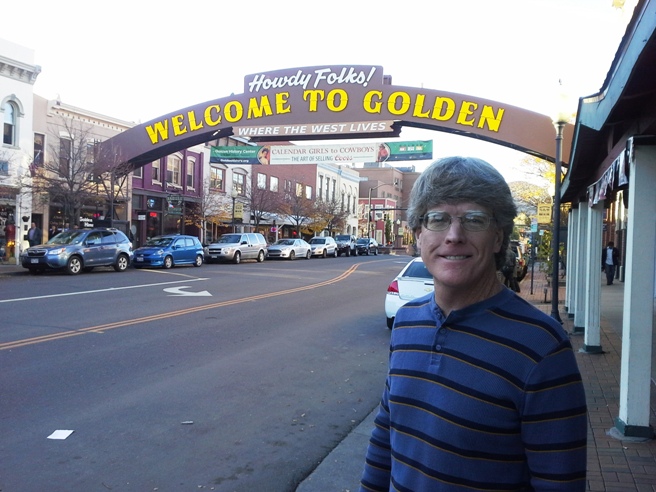
After the ride, Bruce and Pat headed into Golden for a little and sight seeing and dinner.
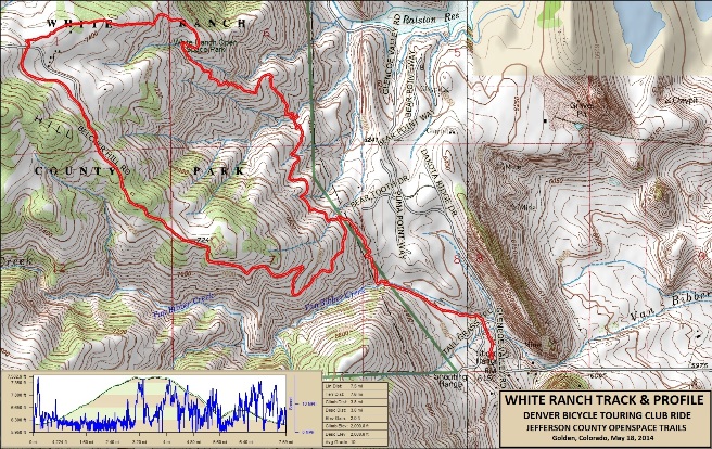
Golden, CO - White Ranch Trail System On May 18, 2014, Bruce rode the White Ranch trail system. This park is part of the Jefferson County, Colorado Open Space program. The trail is located just west of North Table Mountain in foothills of the Rockies. The system offers several trails and some of the most intense climbing in the area. The down-hill is also awesome.
The statistics for the White Ranch Trail System ride are provided below along
with a map showing the track and profile and statistics. The track
and profile is for the clockwise direction. Reverse it for a
counter-clockwise ride.
Right click on the GPX link above to download a GPX file for this ride. The GPX file may want to save as an XML file, so if it does, change the extension to gpx before you save it. The file is a high-resolution track with points are every 10' created on the Delorme PN-60W GPS. You can right-click on the image below and use the "Save Target As" option to down-load a 1MB 11x17" PDF version of the map that can be printed. You can also click on the image to open it in a new window and zoom up to 200% for a detailed view.
This is the kind of trail on which you will use all your gears, and spend a lot of time in 1-1. The initial climb is long and steep, making it necessary to slow down to a sustainable climbing pace. The run down at the end is fun, especially when it comes to jumping the water bars. Below is a photo of Bruce on the Metcalf Trail about half-way up to the "Upper" parking lot.
Part of the group at the upper lot. Bruce, Fred and Darrell.
Below is the long descent down from the parking lot. They got to jump lots of water diversion logs while screaming down the trail. Once at the bottom, it was "hike-a-bike" back out.
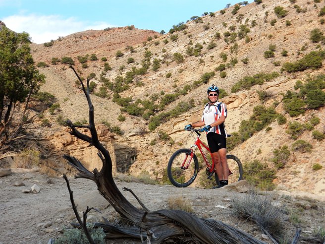
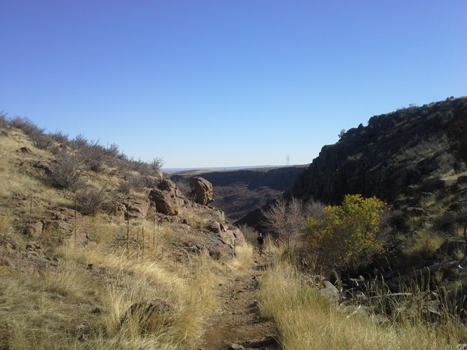
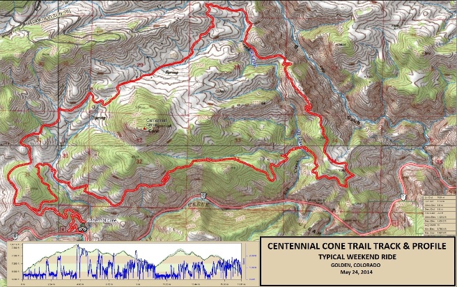
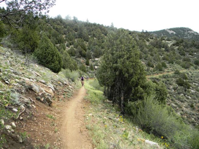
Idaho Springs, CO - Centennial Cone Bruce has ridden Centennial Cone twice so far: first on May 24, 2014 and then again on July 6, 2014. The Centennial Cone Trail is located in the foothills or Front Range of the Rockies 9 miles west of Golden. This is one of the finest mountain bike trails in the area, with outstanding trail design and magnificent vistas.
The statistics for the Centennial Cone Trail ride are provided below along
with a map showing the track and profile and statistics. The track
and profile is for the clockwise direction. Reverse it for a
counter-clockwise ride.
Right click on the GPX link above to download a GPX file for this ride. The GPX file may want to save as an XML file, so if it does, change the extension to gpx before you save it. The file is a high-resolution track with points are every 10' created on the Delorme PN-60W GPS. You can right-click on the image below and use the "Save Target As" option to down-load a 1MB 11x17" PDF version of the map that can be printed. You can also click on the image to open it in a new window and zoom up to 200% for a detailed view.
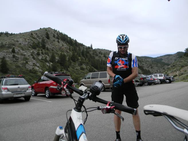
This is the kind of trail on which you will use all your gears, and spend a lot of time in 1-1. The grades are moderately steep and go on for some distance, making it necessary to slow down to a sustainable climbing pace. The photo below shows Bobby getting ready. You begin to realize the beauty of this place just standing in the parking lot.
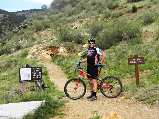
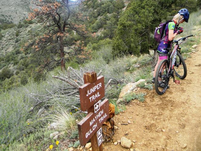
The first trail in the system is Mayhem Gulch. The trailhead is at the west end of the parking lot and is hard to miss. It is important to note that this is an "alternate use" trail on weekends. Mountain bikers have it on even-numbered days and hikers on odd-numbered days. The climb up Mayhem Gulch is 600 feet vertical in 2 miles.
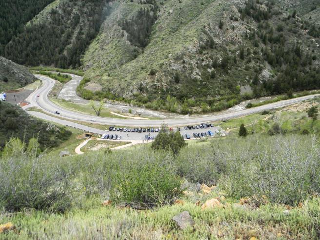
Part way up the trail, you get a bird's eye view of the parking lot and trailhead.
Below is a shot of Bobby "grinding up the gulch". The climb up Mayhem is 2 miles long with grades ranging from 3 to 30. There are a few short down-hill sections, but darn few.
At the top, you reach the intersection with the Juniper trail.
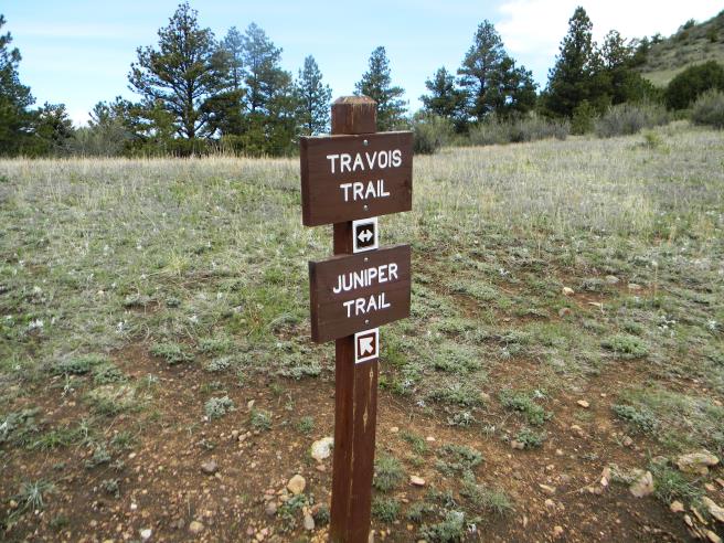
Centennial Cone can be ridden clockwise or counter-clockwise from this point. On this day they went clockwise. The counter-clockwise direction has more climbing at the beginning of the ride. After a mile or so, the Juniper intersects the Travois Trail. At this point you have gone about 2.5 miles and climbed nearly 1,000 feet.
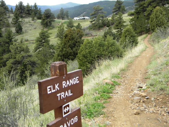
Down the Travois you come to the Elk Range Trail. At this point, the climbing starts to ease up.
As you travel down the Elk Range Trail, you ride through a beautiful meadow, past a split rail fence. If you look back, you get a gorgeous view to the west.
Once around the bend, it was through a cattle gate and down a fast, smooth section of double-track. The photo below shows Bobby on his way down. Bruce was right behind him and hit his highest speed during the ride here at 29.7 MPH.
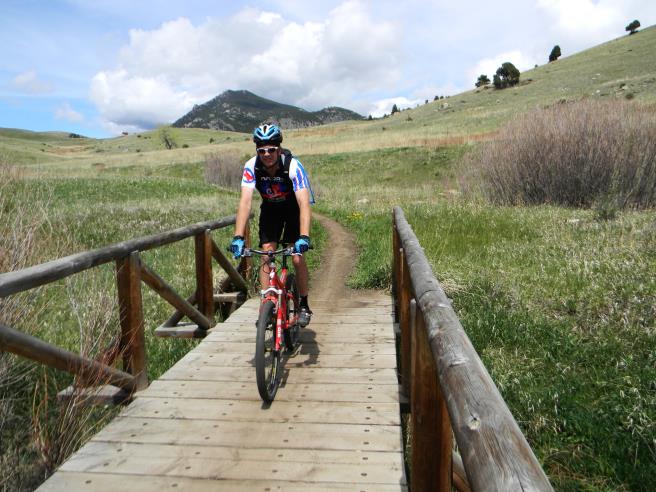
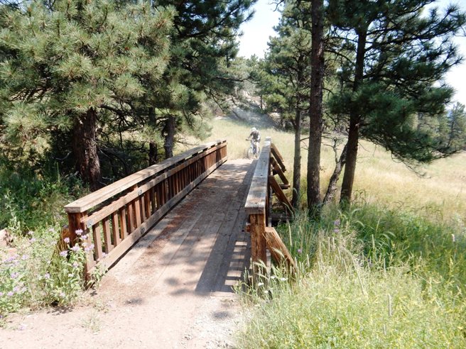
Just past the third parking area and trail head, they crossed their first long bridge.
After another "moderate" climb up some more awesome single-track, they came around the bend to even more spectacular scenery.
Marvelous vistas behind them, marvelous vistas in front of them!
Around the bend was another fantastic photo op at a pinnacle Bobby dubbed Lovers Leap!
Not all the scenery was in the distance. It was spring time, and the trails were lined with wildflowers.
As they rounded every bend, it seems there was another spectacular view. Here is another. Bobby and Bruce never got tired of the scenery.
Jefferson County has done a great job on this park. Not only are the trails some of the best around, the bridges are first class too. Here is Bobby coming across one.
The bridges are nice, but it usually means there is more climbing ahead. Here is Bobby topping a 2 mile climb up out of the river valley.
After the climb, it was time for a rest. At this point, they had done nearly 4,000' of climbing, and the legs were starting to wear down.
Just beyond the rest stop was a rock pile. Bruce decided to see if his legs had enough in them to make it. They didn't. He made two of the six steps up.
After more climbing, it was time to go down a ways. Here is Bobby stopping for a photo op on one of the descending switch-backs. The trailhead is down by the creek and road seen to the right and below Bobby in the distance.
After a bit more climbing and some down-hills, they were at the Mayhem Trail and ready to make their final descent to the trailhead and parking lot.
About half-way down the Mayhem, they stopped for another photo op showing the end of the descent.
Past the switch-back and toward the bottom of the descent, Bruce took a photo of a local rider on the trail.
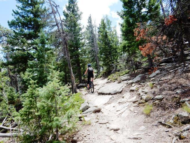
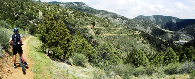
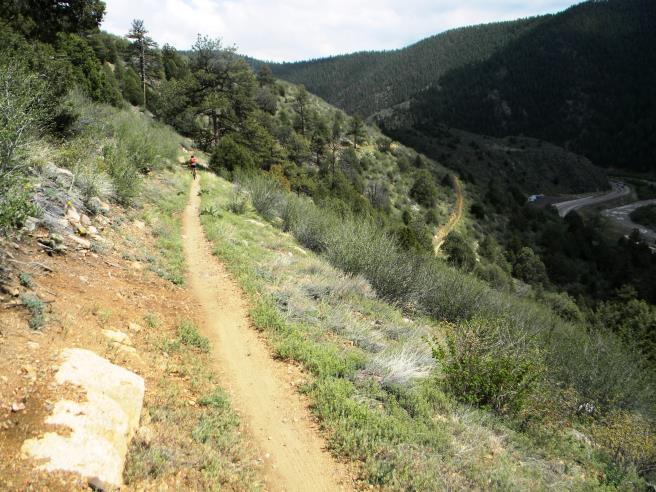
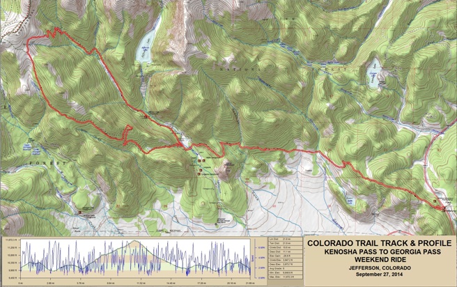
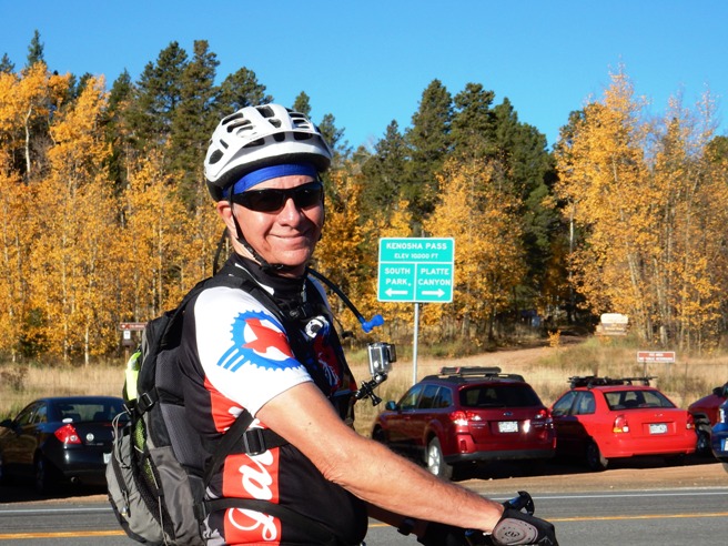
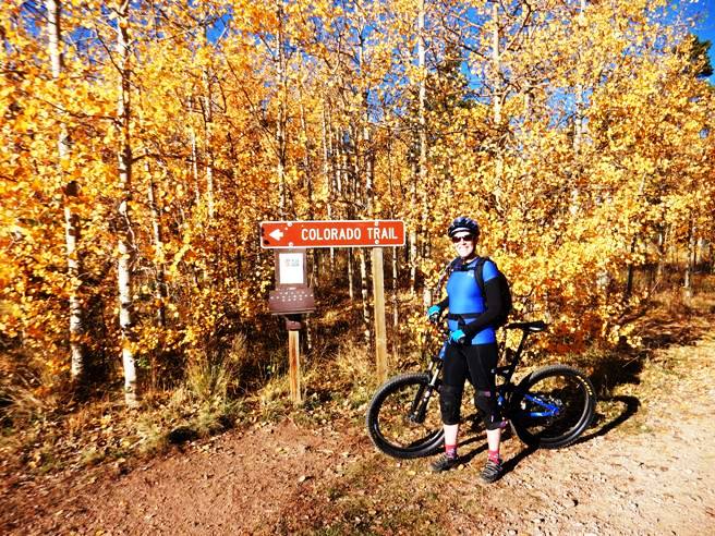
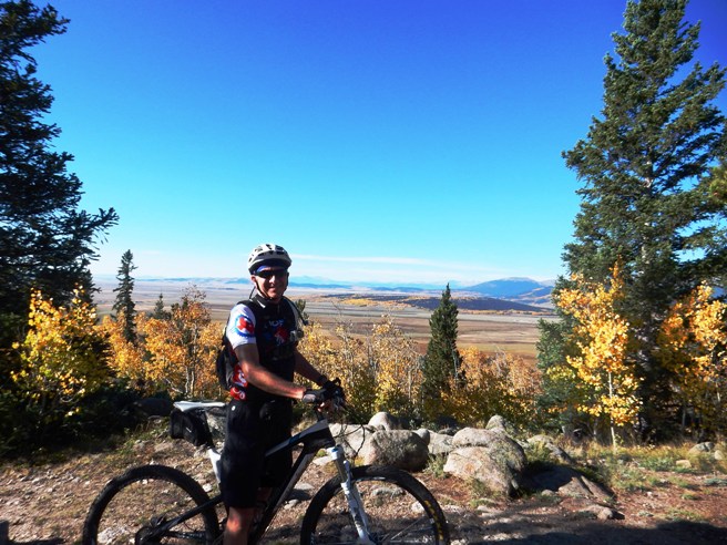
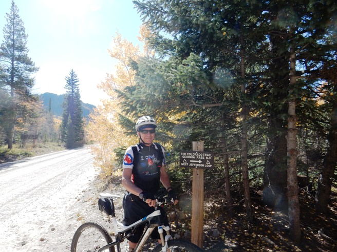
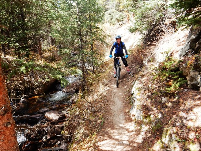
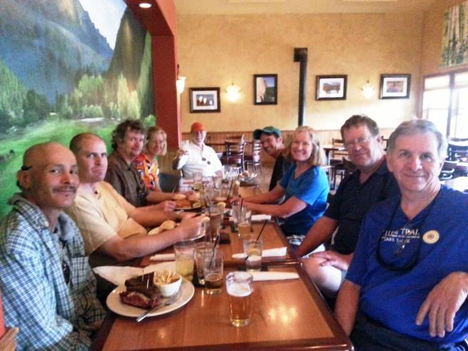
It was a fantastic ride. From there, they cleaned up and headed back into Golden for drinks and dinner with friends. Jefferson, CO - Colorado Trail, Kenosha Pass to Georgia Pass On September 27th, 2014, Bruce rode a section of the Colorado Trail between Kenosha Pass and Georgia Pass. This trail is located west of Denver near Breckenridge, well into the Colorado Rockies. The trail was high, fairly long, very technical is spots and had a lot of climbing. The trail is rated as intermediate to advanced by Colorado standards, and has a black diamond rating.
The statistics for the Colorado Trail ride between Kenosha Pass and
Georgia Pass are provided below along
with a map showing the track and profile and statistics. The track
and profile is for the clockwise direction around the loop at the
end. Reverse it for a
counter-clockwise ride.
Right click on the GPX link above to download a GPX file for this ride. The GPX file may want to save as an XML file, so if it does, change the extension to gpx before you save it. The file is a high-resolution track with points are every 10' created on the Delorme PN-60W GPS. Bruce and Anne rode up the Colorado Trail to Georgia Pass and back down the West Jefferson Trail. Below is a map showing the track, profile and statistics for the Colorado Trail ride between Kenosha Pass and Georgia Pass. This track and profile is for the out-and-back the clockwise direction around the west end. Reverse it for a counter-clockwise ride. There seems to be no consensus on the preferred direction to ride it, although most of the traffic seemed to be taking the loop in the clockwise direction. You can right-click on the image below and use the "Save Target As" option to down-load a 1MB 11x17" PDF version of the map that can be printed. You can also click on the image to open it in a new window and zoom up to 200% for a detailed view.
This is the kind of trail on which you will use all your gears, and spend a lot of time in 1-1. The grades are not impossibly steep, but some are technical and others go on for some distance, making it necessary to slow down to a sustainable climbing pace. The distance ridden was 22.6 miles and the ride time was over 8 hours. Ninety percent of the ride was above 10,000', and made for a very strenuous and demanding ride. The long ride time was due in part to the altitude, and in part by stopping for photos. Most of the climbing was concentrated at the west end of the ride. There was also a good bit of climbing spread out across the entire ride. Anne and Bruce preparing at the Kenosha Pass trail head.
Below is Bruce ready to ride. Notice the elevation on the sign in the background. They started at 10,000'.
Anne just across the street at the entrance to the Colorado Trail. The Aspens were perfect.
Below is Bruce at one of the first over-looks after the initial climb.
A little further down, they came to a gorgeous view of the valley and the Heckendorf Ranch.
Another view of the valley further down. Lots of color here.
Below is Anne at one of the Forest Service roads you cross along the way.
At points, the trail looked like the Yellow Brick Road. Bruce found himself playing "Follow the Yellow Brick Road" in his mind as we rode along.
Below is Bruce at CR-37. At this point the Colorado Trail begins its long, technical climb to 11,672'.
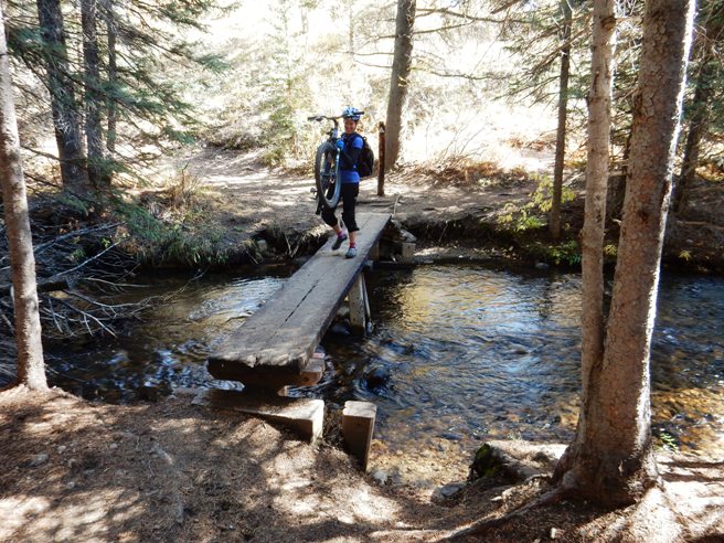
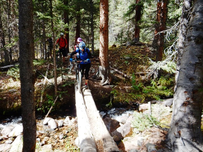
Below is Anne on one of the creek crossings. This was one of many creek crossings past CR-37. The approaches to the bridge were eroded, making it impossible to ride unless you could bunny hop up 24" while making a hard right turn.
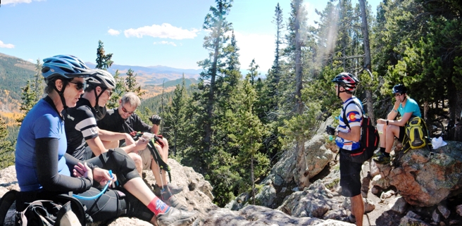
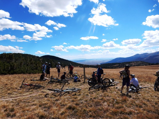
About half-way up the Colorado Trail side of the loop made by the Jefferson and Colorado Trails, they came to "Lunch Rocks". As you can see, the locals stop there for lunch on this ride.
Finally at the top and at the tree-line. Elevation was 11,672'. That didn't seem to faze the locals. You can see a steady stream of riders coming up in the distance.
The Colorado Trail continues out and the West Jefferson turns right. The riders in the distance are on the Colorado Trail. Anne and a rider they met from Boulder are on the West Jefferson at the right of the photo below.
After a stop and some conversation at the trail intersection, it was back down the mountain on the West Jefferson Trail. Below is Anne and another rider on the upper end of the West Jefferson Trail. The trail was tricky to ride. It was off-camber and had no discernable "line". It reminded Bruce of a trail he would ride in the Vegas area named the "Twilight Zone". The trail made them feel like they were in another dimension.
A little further down, Anne stopped for a photo op. They were still near 11,000' at this point. The mountains and valley in the distance show just how high up they were. The valley in the distance is at nearly 10,000'. This is REAL mountain biking.
On the way back down the West Jefferson Trail, they had numerous creek crossings. Here is one where they had carry the bikes across a creek while balancing on a single log.
At the next creek, the bridge was rotted out and they had to walk across.
At the next creek crossing, they had the luxury of two logs to use. Below is Anne doing a balancing act while walking her bike across.
About half way down, the West Jefferson Trail followed the creek towards the bottom of the trail.
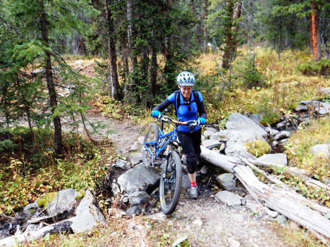
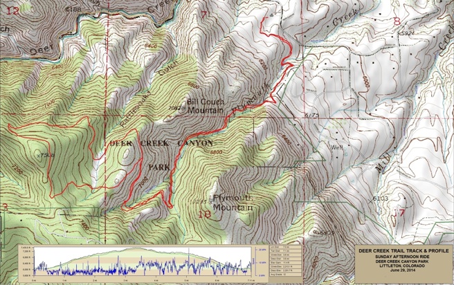
This ride is definitely one to make if you are in the area. The trail and altitude are going to tax your skills and endurance. It is not recommended you attempt this trail unless you are an advanced intermediate or expert rider. Littleton, CO - Deer Creek Trail On June 29, 2014, Bruce rode the Deer Creek Canyon Trail west of Littleton. The Deer Creek Trail is located in the Deer Creek Canyon Park and is a short, steep, rocky, technical climb best left to those that really have something to prove.
The statistics for the Deer Creek Trail ride are provided below along
with a map showing the track and profile and statistics. The track
and profile is for the clockwise direction. Reverse it for a
counter-clockwise ride.
Right click on the GPX link above to download a GPX file for this ride. The GPX file may want to save as an XML file, so if it does, change the extension to gpx before you save it. The file is a high-resolution track with points are every 10' created on the Delorme PN-60W GPS. You can right-click on the image below and use the "Save Target As" option to down-load a 1MB 11x17" PDF version of the map that can be printed. You can also click on the image to open it in a new window and zoom up to 200% for a detailed view.
This is the kind of trail on which you will use all your gears, and spend a lot of time in 1-1. The grades are rocky and brutal, making it difficult to a sustainable climbing pace. Coming down, you will be glad you have a dropping seat post.
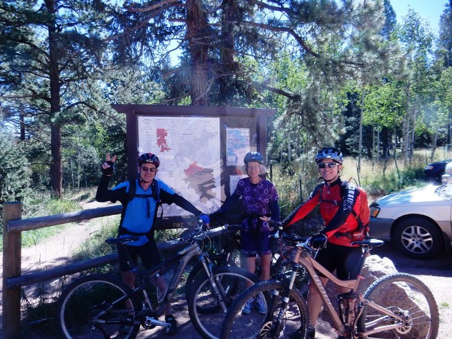
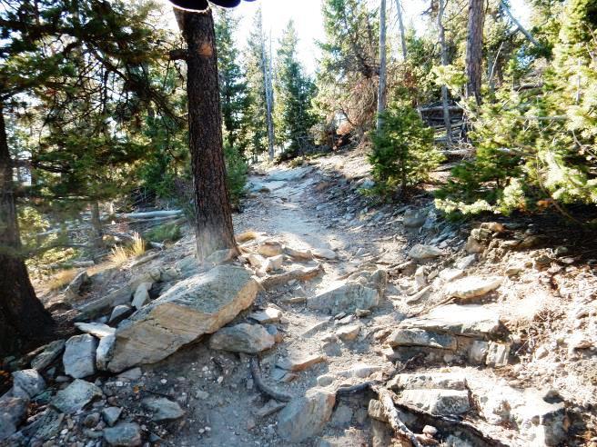
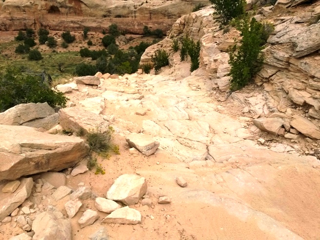
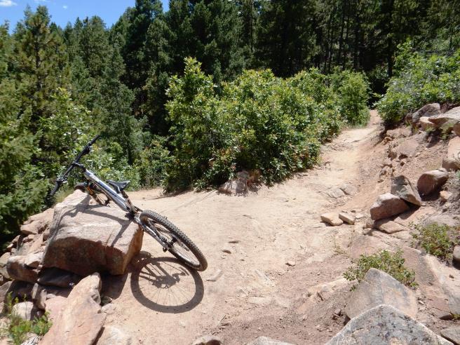
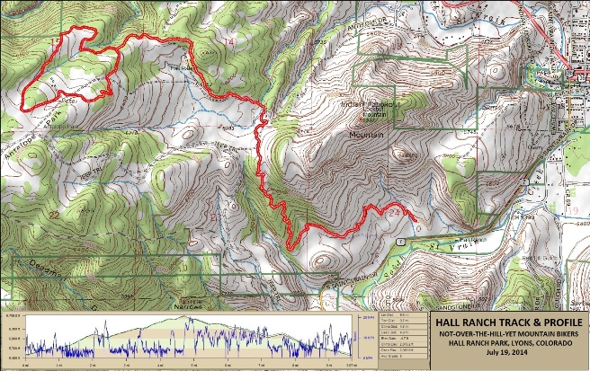
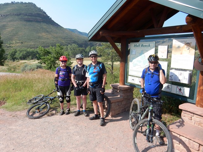
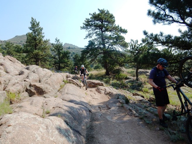
The second climb. Strewn with rocks as you can see. Lyons, CO - Hall Ranch Trail System On July 19, 2014, Bruce rode the Hall Ranch trails. These trails are located just west of Lyons and Northwest of Boulder. This system consists of several trails with a wide range of skill-levels needed to ride them. The group rode the lower and upper sections of Bitterbush, and the Nelson Loop. The most common ride starts with the Bitterbrush Trail at the parking lot on SR-7. This trail begins with a smooth climb then transitions to a challenging, technical rock garden that only fit, expert riders can clear all the way up. However, it is quite an experience for intermediate riders on the way down.
The statistics for the Hall Ranch Trail ride are provided below
along with a map showing the track and profile and statistics. The
track and profile is for the clockwise direction around the loop at
the end, which is the way most folks ride it.
Right click on the GPX link above to download a GPX file for this ride. The GPX file may want to save as an XML file, so if it does, change the extension to gpx before you save it. The file is a high-resolution track with points are every 10' created on the Delorme PN-60W GPS. You can right-click on the image below and use the "Save Target As" option to down-load a 1MB 11x17" PDF version of the map that can be printed. You can also click on the image to open it in a new window and zoom up to 200% for a detailed view.
This is the kind of trail on which you will use all your gears, and spend a lot of time in 1-1. The grades are not impossibly steep, but the amount and size of the rocks on them making walking the bike a reality in many spots. The photo below Janet, Sandy, Bruce and Jon. Monti is behind the camera and can be seen in later photos in a purple jersey.
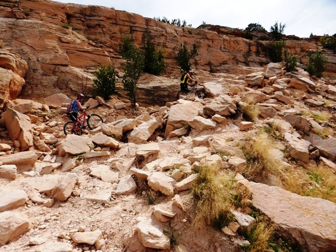
The photo below shows Sandy clearing one of the many rocky climbs on the way up. This trail gives you a good impression of why they call these the Rocky Mountains.
Right behind Sandy on the climb was Janet. Most of the photos are of Janet and Sandy since Monti was usually the first one up, and Bruce, who had the camera was usually second.
Here is the group taking a break mid-way up Bitterbush near the junction with the Antelope Trail.
At the end of Bitterbush, the group took a "nutrition break" before riding the Nelson Loop.
The Nelson Loop was far more "civilized" than Bitterbush. Below is Sandy about to cross the only bridge on the trail. Shortly after crossing the bridge, Bruce heard screams. It seems Sandy saw and rode by a small snake beside the trail.
After riding the Nelson Loop, it was time to head back down. Below is a photo of Janet clearing one of the many rock gardens on Bitterbush.
Right behind Janet was Sandy. Both of these women "rocked" the trail.
This was a fun trail, and Bruce will do it again if he gets the opportunity. 3/30/2014 Local, Urban trail in Morrison near the Front Range. Check back later for the link to the page for that ride.
The statistics for the (Trail Name) ride are provided below along
with a map showing the track and profile and statistics. The track
and profile is for the clockwise direction. Reverse it for a
counter-clockwise ride.
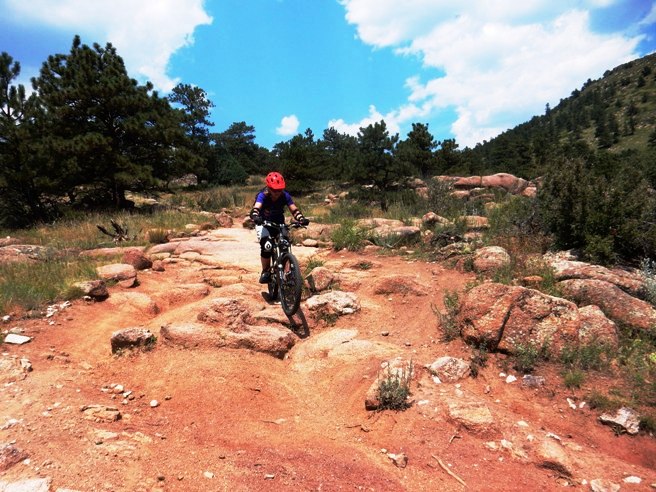
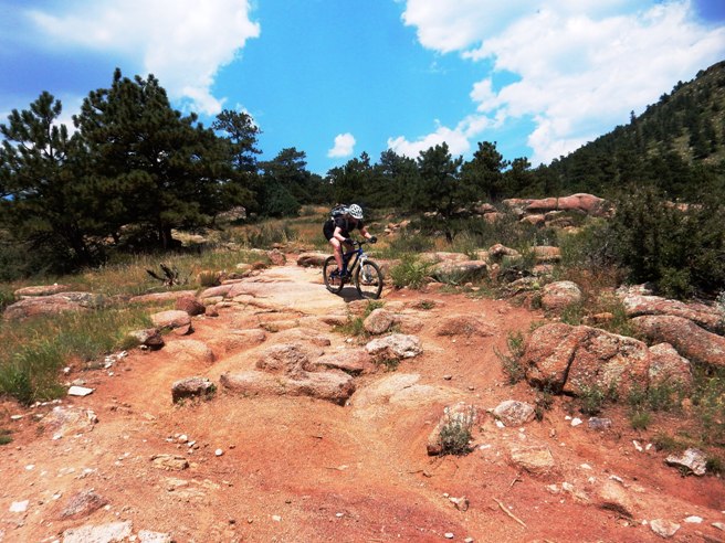
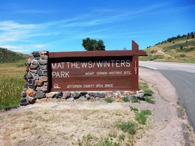
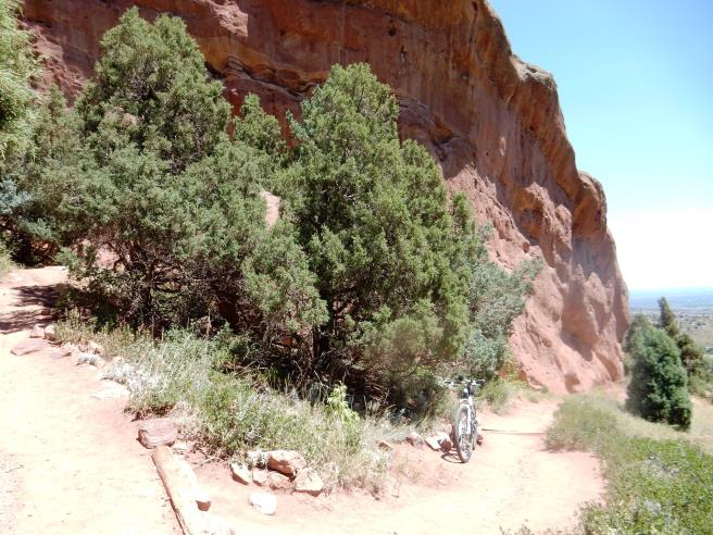
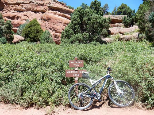
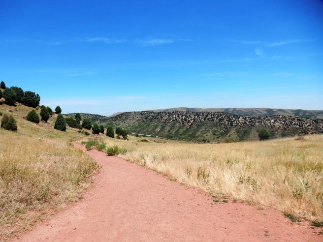
Right click on the GPX link above to download a GPX file for this ride. The GPX file may want to save as an XML file, so if it does, change the extension to gpx before you save it. The file is a high-resolution track with points are every 10' created on the Delorme PN-60W GPS. You can right-click on the image below and use the "Save Target As" option to down-load a 1MB 11x17" PDF version of the map that can be printed. You can also click on the image to open it in a new window and zoom up to 200% for a detailed view. (Insert Track-Profile map with link to tabloid-sized PDF) This is the kind of trail on which you will use all your gears, and spend a lot of time in 1-1. The grades are not impossibly steep, but go on for some distance, making it necessary to slow down to a sustainable climbing pace. The photo below shows (description). (Place-holder for photo) Description of following photo. (Place-holder for photo) Wrap up Morrison, CO - Dakota Ridge & Red Rocks Bruce rode the Dakota Ridge and Red Rocks Trails as a loop from the Matthew-Winters Open Space Park on August 3, 2014. It was a double black diamond trail, but since it was rated as one of the top trails on the Front Range, it was on his list to ride.
The statistics for the Dakota Ridge ride are provided below along
with a map showing the track and profile and statistics. The track
and profile is for the clockwise direction. Reverse it for a
counter-clockwise ride.
Right click on the GPX link above to download a GPX file for this ride. The GPX file may want to save as an XML file, so if it does, change the extension to gpx before you save it. The file is a high-resolution track with points are every 10' created on the Delorme PN-60W GPS. Below is a map showing the track, profile and statistics for the Dakota Ridge ride. It was actually two trails: Dakota Ridge going out and Red Rocks coming back. This track and profile is for the clockwise direction. Reverse it for a counter-clockwise ride. You can right-click on the image below and use the "Save Target As" option to down-load a 1MB 11x17" PDF version of the map that can be printed. You can also click on the image to open it in a new window and zoom up to 200% for a detailed view in a separate window.
This is the kind of trail on which you will use all your gears, and spend a lot of time in 1-1. The grades are not impossibly steep, but go on for some distance, making it necessary to slow down to a sustainable climbing pace. The ride started at the Matthews/Winters parking lot, crossed CO-93 and went up the climb seen to the right of the top of the sign.
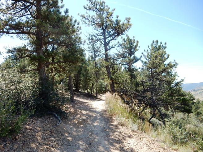
The initial climb was about 250' vertical, and once up top, looked pretty nice.
It didn't stay nice for long. Very soon you came to some log ramps leading up to a technical rocky section.
There was no lack of rock on the Dakota Ridge section of the trail. Below is a photo of a typical rocky climb. There were many climbs and descents like this.
Beyond the rocky climb above, you come to another rocky climb and more log ramps.
As you turn the corner to the right in the photo above, you are greeted with four more ramps.
The rock is relentless. The photo below shows another of the many rocky sections.
Near the high point on the trail, you get a nice view of Red Rocks in the distance. Ultimately, the trail goes through that area.
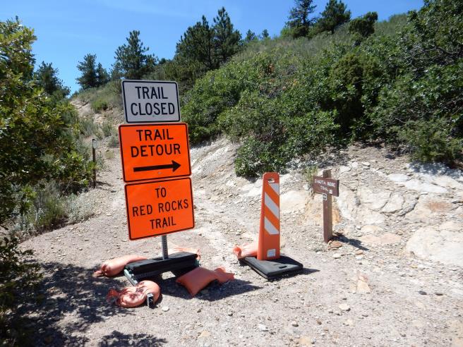
For some reason, part of the Dakota Ridge Trail was closed. Bruce had never seen such elaborate trail closure signage before, but took the detour even though it meant riding pavement to get around the closed section of trail.
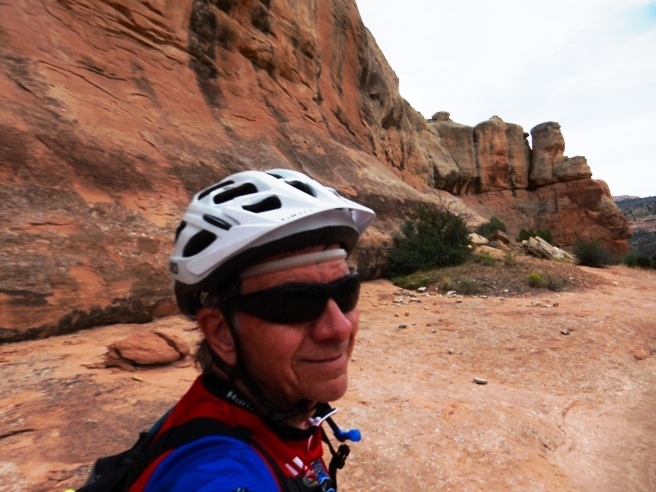
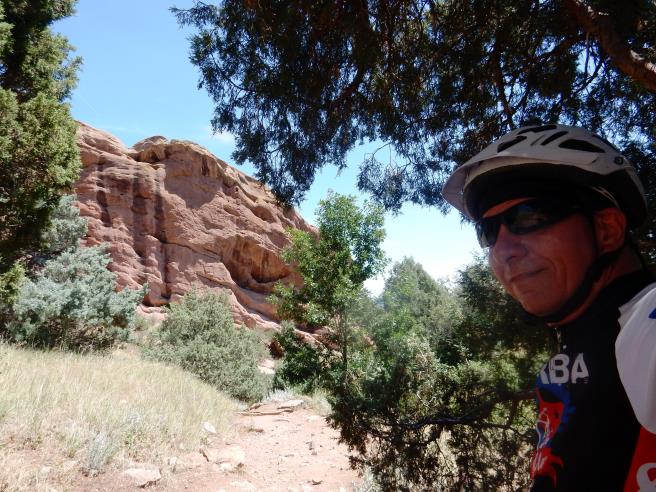
The detour dumped him onto the Red Rocks Trail. Below is a "selfie" he took at the beginning of the Red Rocks trail.
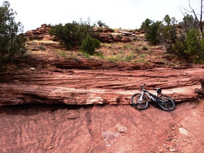
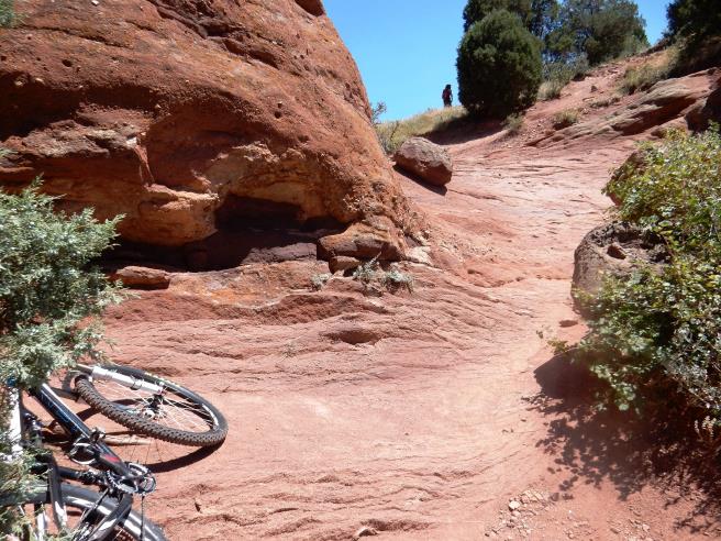
The rock formations along the Red Rocks trail were spectacular. Below is one of his bike along the way.
About a third of the way along Red Rocks, he reached the junction of the Morrison Slide Trail.
Just beyond the junction, there was a spectacular climb on rock.
Once up at the top of the climb, he finally encountered some smooth single track going down.
The trail followed the contour of the land, going back into the canyons and valleys. Below is a photo of one of them with a small stream in it.
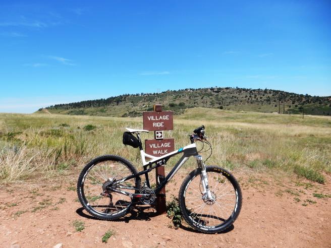
Red Rocks Trail ended at the Village Trail. This trail has two parts: Walking and Riding. Bikers go right and walkers go left.
He has to admit that this trail is one of the toughest little trails he has ever ridden, due in large part to all the technical, rocky sections up on the ridge in the distance. That section of trail is rated double black diamond, and certainly deserves that rating. On June 22, 2014, Bruce rode the Green Mountain Trail in Lakewood. This is a local, urban trail near the Front Range. Check back later for the link to the page for that ride.
The statistics for the (Trail Name) ride are provided below along
with a map showing the track and profile and statistics. The track
and profile is for the clockwise direction. Reverse it for a
counter-clockwise ride.
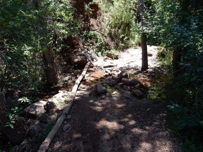
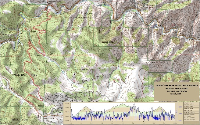
Right click on the GPX link above to download a GPX file for this ride. The GPX file may want to save as an XML file, so if it does, change the extension to gpx before you save it. The file is a high-resolution track with points are every 10' created on the Delorme PN-60W GPS. You can right-click on the image below and use the "Save Target As" option to down-load a 1MB 11x17" PDF version of the map that can be printed. You can also click on the image to open it in a new window and zoom up to 200% for a detailed view. (Insert Track-Profile map with link to tabloid-sized PDF) This is the kind of trail on which you will use all your gears, and spend a lot of time in 1-1. The grades are not impossibly steep, but go on for some distance, making it necessary to slow down to a sustainable climbing pace. The photo below shows (description). (Place-holder for photo) Description of following photo. (Place-holder for photo) Wrap up Morrison, CO - Lair O' The Bear Trail System On June 28th, 2014, Bruce rode the Lair of the Bear trail with the Not-Over-The-Hill-Yet mountain biking group. This was an out-and-back ride in the foothills west of Denver from the main trailhead to Pence Park.
The statistics for the Lair O' The Bear Trail ride are provided below along
with a map showing the track and profile and statistics. The track
and profile is for the out-and-back ride.
Right click on the GPX link above to download a GPX file for this ride. The GPX file may want to save as an XML file, so if it does, change the extension to gpx before you save it. The file is a high-resolution track with points are every 10' created on the Delorme PN-60W GPS. You can right-click on the image below and use the "Save Target As" option to down-load a 1MB 11x17" PDF version of the map that can be printed. You can also click on the image to open it in a new window and zoom up to 200% for a detailed view.
This is the kind of trail on which you will use all your gears, spending time in 1-1 on the climbs and 3-9 on the open down hill runs. The grades are not impossibly steep, but go on for some distance, making it necessary to use the lower gears to maintain a sustainable climbing pace. The photo below shows "Diesel" and Pat on the Panorama Point Trail.
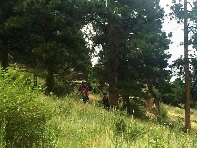
Below is a photo of one of the riders coming out of the trees on one of the nice down hill runs.
Below is a photo of another rider coming out of the trees on one of the nice down hill runs.
A photo of one of the technical descents ridden on the way out. It was now a technical climb.
Below is a photo of the traditional after ride picnic at a park near the trail head.
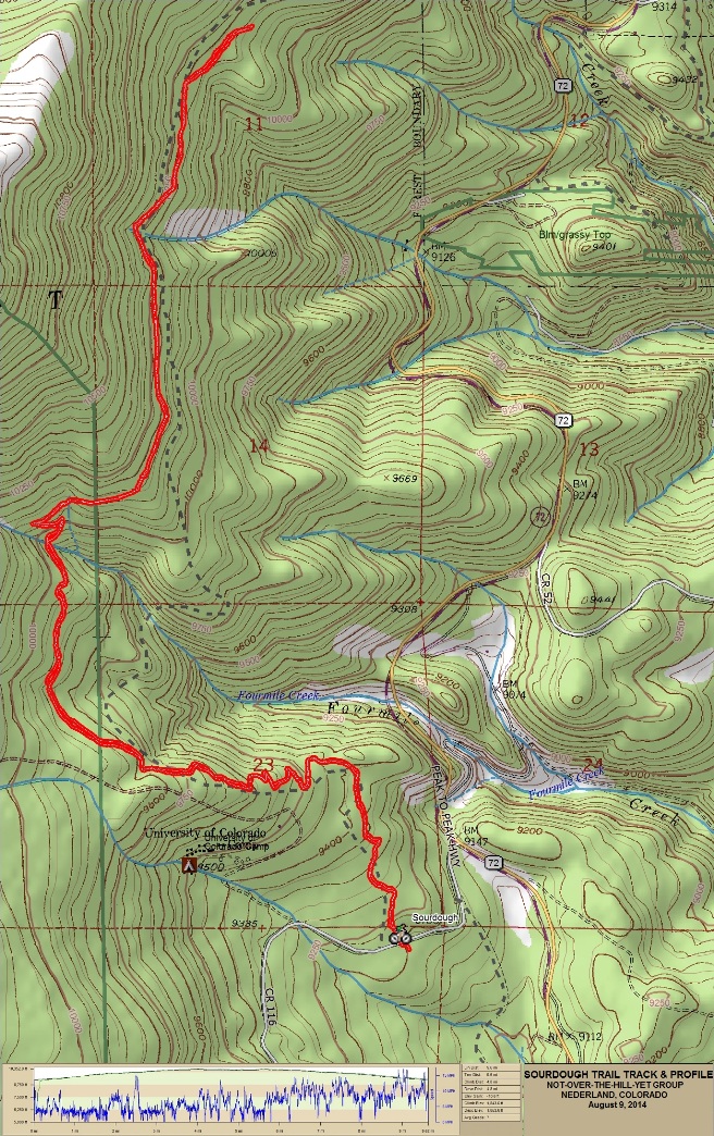
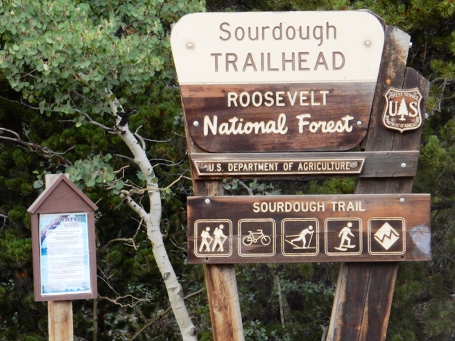
The photo includes Joe, Pat, Diesel and Josh. Nederland, CO - Sourdough Trail On August 8 2014, Bruce rode the Sourdough Trail north of Nederland with the Not-Over-The-Hill-Yet mountain biking group out of Denver. This was a "high altitude" ride, which is what a lot of folks in Colorado like to do in the summer.
The statistics for the Sourdough Trail ride are provided below along
with a map showing the track and profile and statistics. The track
and profile is for the out-and-back ride.
Right click on the GPX link above to download a GPX file for this ride. The GPX file may want to save as an XML file, so if it does, change the extension to gpx before you save it. The file is a high-resolution track with points are every 10' created on the Delorme PN-60W GPS. You can right-click on the image below and use the "Save Target As" option to down-load a 1MB 11x17" PDF version of the map that can be printed. You can also click on the image to open it in a new window and zoom up to 200% for a detailed view.
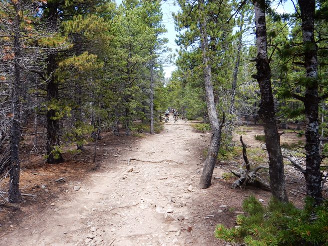
This is the kind of trail on which you will use all your gears, and spend a lot of time in your small chain ring. The grades are not impossibly steep, but go on for some distance, making it necessary to slow down to a sustainable climbing pace. Sourdough is on County Rd. 116 off CO-75 about 5 miles north of Nederland. There is a nice parking lot on the south side of 116 and the trail head is on the north side. It is a multi-use trail as seen from the signage below. It is rough, so I do not know how anyone skis or snow shoes it unless there is a good bit of snow on it.
The trail starts out climbing and the climbing goes on for 3-4 miles with very little flat ground on the way up. The initial ascent is 1,000' in 3 mi.
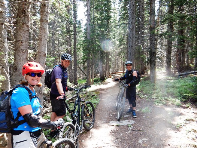
The trail does level out once you get up on top at about 10,300'. Below is Janet, Monte and Bud.
There are a few log piles along the trail. Below is Monte crossing one of them.
Here is Monte crossing another log pile.
Once back down, it was time for a short rest before heading to a cafe for dinner. Yes, a couple of us needed jackets. The temperatures during the ride ranged from 60F to 64F.
Here is Aaron and Bruce "chillin" in their jackets on August 8th.
After chillin, it was off to the Sunset cafe. The table had a wonderful view of the mountains, but you can't see it for the back-lighting. At the table are Bruce, Janet, Monte behind Bruce, Michele, Bud and Matt.
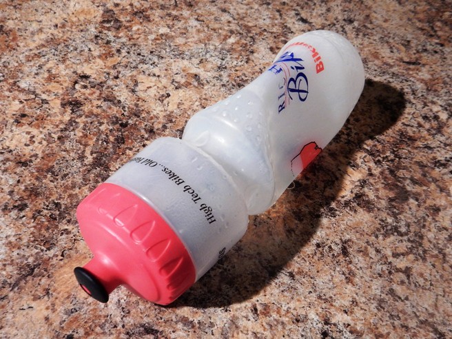
Back at the apartment in Denver, Bruce unpacked a water bottle used on the mountain. Notice how it collapsed even at Denver's elevation. The difference in altitude was about 5,000'.
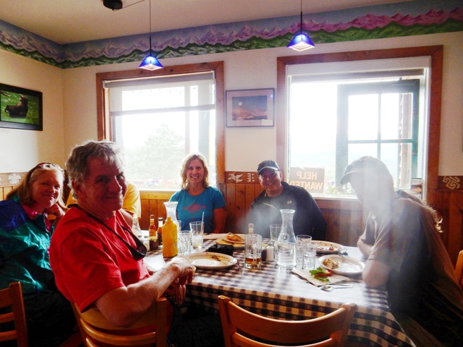
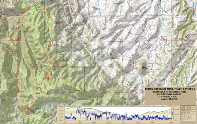
Sourdough was a fun trail, but one you want save for later on your list. There are lots of better rides. The group did this one because it was high and in the cooler temperatures. The folks in Colorado don't like to ride when the temperatures hit 80F or above. Pike National Forest, CO - Indian Creek 800 Trail On August 16, 2014, Bruce rode the Indian Creek 800 Trail. The ride was deep into the wilderness, making it one of the prettiest trails he has ridden in Colorado. He shared this experience with his friend, Anne Taylor.
The statistics for the Indian Creek 800 Trail ride are provided below along
with a map showing the track and profile and statistics. The track
and profile is for the counter-clockwise direction. Reverse it for a clockwise ride.
Right click on the GPX link above to download a GPX file for this ride. The GPX file may want to save as an XML file, so if it does, change the extension to gpx before you save it. The file is a high-resolution track with points are every 10' created on the Delorme PN-60W GPS. You can right-click on the image below and use the "Save Target As" option to down-load a 1MB 11x17" PDF version of the map that can be printed. You can also click on the image to open it in a new window and zoom up to 200% for a detailed view.
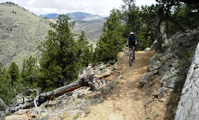
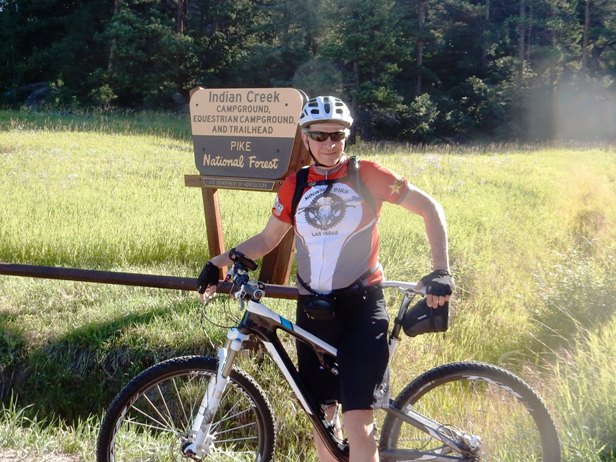
This is the kind of trail on which you will use all your gears, and spend a lot of time in 1-1. Most of the grades are not impossibly steep, but go on for some distance, making it necessary to slow down to a sustainable climbing pace. Others are incredibly steep and mere mortals will end up pushing their bike up them. The steepest grades were near the end of the ride when traveling in counter-clockwise direction. Bruce recommends riding this trail in the clockwise direction. The photo below shows Bruce at the entrance to Indian Creek.
Below is Anne pointing out one of the trail hazards.
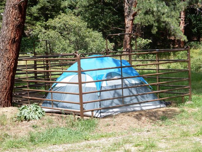
Down in the campground, some equestrian campers showed how to "bear proof" a tent.
After an initial switch-back climb, the trail became quite enjoyable as shown by Anne below.
After a bit more climbing, they were in a clearing on top and rewarded with a beautiful view.
Anne and Bruce took turns with the camera. At this point the trail became a double-track Jeep road.
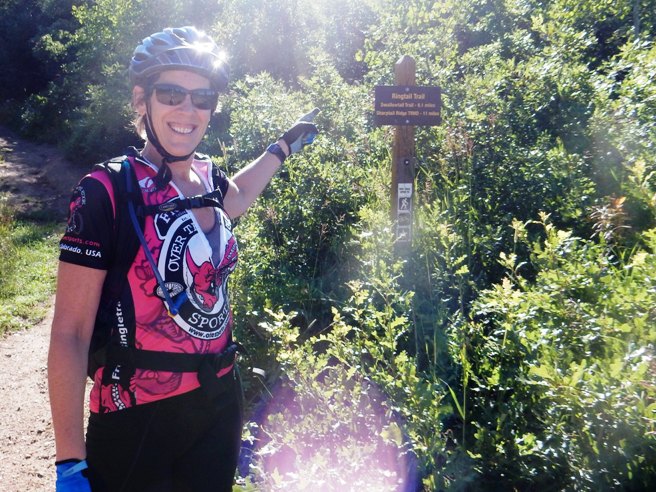
Further down the 800 Trail, they came to the intersection with the Ringtail trail. This trail is quite famous in the Denver area.
A little further down, Anne and Bruce came to an 800 Trail marker. Some local runners offered to take the photo of Bruce and Anne together.
The ride down the double-track was breath taking. Bruce stopped to take a photo as Anne peddled on.
The view off to their left was quite impressive. Here is a photo of Bruce along the way.
They swapped the camera and Bruce got a shot of Anne at the same location.
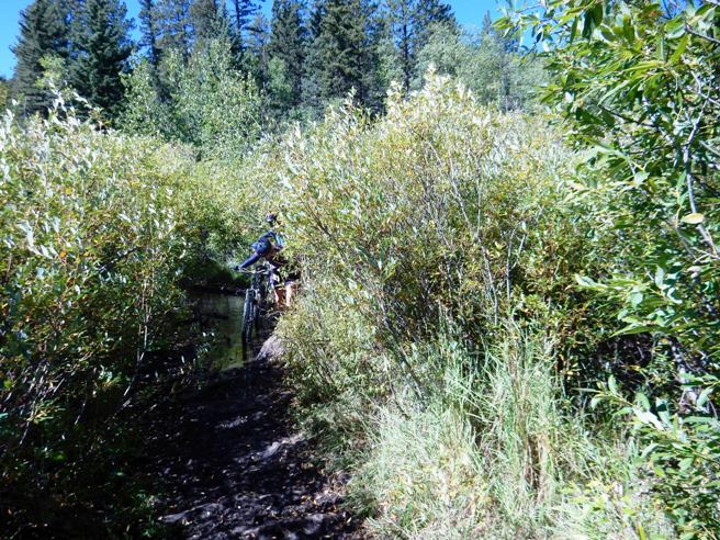
They followed the double-track to a power line, at which point the trail turned back into single track through lush under-brush.
Further down, the trail opened up into a beautiful meadow.
From this point, the trail traveled in and out of forest and meadows.
Even some of the climbs up the valleys were in long, narrow meadows.
At this point, they missed their turn and started down to the 1776 Colorado Trail. Anne really liked that down-hill. However, since they made a wrong turn, they had to climb back up to get back on track. That wouldn't have been too bad except for the 25% to 30% grades that lay ahead.
A few more meadows to ride before the hard part.
There were several streams and creeks along the way. Below is Anne crossing one of them.
Then came the killer climbs. They ended up walking a number of the 25% to 30% grades, but were rewarded on top.
There were also some rather technical sections on top. They wouldn't have been too bad except they had been riding for almost 4 hours at this point.
They survived! Even though the ride took four and a half hours, and they were quite happy, albeit, very tired. Next time, they will ride the loop clockwise to get the steep climbs and technical sections out of the way at the beginning of the ride. Pine, CO - Buffalo Creek Trail System Bruce rode Buffalo Creek five times in 2014: May 3rd, June 21st, July 4th, September 21st and October 18th. The trail is in the foothills of the Rocky Mountains west of the Denver suburb of Morrison. In May it was with friends from Dallas, Anne Taylor and Jim Able. In June and September it was with the Not-Over-The-Hill-Yet mountain biking group of Denver. On the 4th of July it was with Phillip Bird while helping him train for the Telluride 100 race. Buffalo Creek, or BC as the locals call it, is an IMBA EPIC Trail ranked #4 in Colorado and #11 world-wide by the International Mountain Biking Association. This trail is a joy to ride because it combines just about every type of trail feature you could ever expect to experience in one ride, and it does so without being overly technical. Intermediate level riders have an opportunity to "clear" just about everything on this trail. It is quite beautiful too. Part of the ride includes the famous Colorado Trail. However, the trail is at 8,000' above sea level, so the altitude will give you as much of a workout as the trail does. The trail located in the foothills on the east side of the Rockies about an hour's drive south-west of Denver.
The statistics for the Buffalo Creek IMBA EPIC trail ride are provided below along
with a map showing the track and profile and statistics. The track
and profile is for the clockwise direction. Reverse it for a
counter-clockwise ride.
Right click on the GPX link above to download a GPX file for this ride. The GPX file may want to save as an XML file, so if it does, change the extension to gpx before you save it. The file is a high-resolution track with points are every 10' created on the Delorme PN-60W GPS. The file may want to save as an XML file, so if it does, change the extension to gpx before you save it. The file is a high-resolution track created on the Delorme PN-60W GPS. The map below shows the track, profile and statistics for the Buffalo Creek Trail ride on September 21, 2014. As you can see from the shaded relief map, this is truly mountain biking. This track and profile is for the clockwise direction which the way it is most commonly ridden. You can right-click on the image below and use the "Save Target As" option to down-load a 1MB 11x17" PDF version of the map. You can also click on the image and zoom up to 200% for a detailed view in a separate window.
This is the kind of trail on which you will use all your gears, and spend a bit of time in 1-1. The grades are not impossibly steep, but go on for some distance, making it necessary to slow down to a sustainable climbing pace. The ride ends using your big ring for 7 miles of sweet down-hill single track. The main trail head is in the community of Buffalo Creek, Colorado on CR-126. This is one of the most popular trail systems in the Denver area, so the parking lot can fill up early.
There is another trail head a few miles further out CR-126 named Little Scraggy. It cuts out about 6 miles and 1,000 feet of climbing, but you need to leave a shuttle vehicle at the main trail head to be able to get back to Little Scraggy. Here is the Not-Over-The-Hill-Yet group at Little Scraggy for the September 21, 2014 ride. Diesel (far left), Greg (third in from the left in the back) and Bruce (not pictured) did the 6-mile climb from the main trail head that day.
The main trail head has a nice map. Here is a photo of Phillip at the map during the July 4, 2014 ride. The area is expansive and has a lot of trails. Most are marked, but not all are. Bruce has tracks from previous rides and MTBProject GPX files loaded into his GPS for navigation.
Phillip had registered for the Telluride 100 and needed to train at higher altitudes than were available in Dallas, so Bruce developed a ride plan that had him starting at 8,000 feet and working up to over 10,000 feet. During the 4th of July weekend they rode Buffalo Creek, Alderfer and Centennial Cone. During the three days, they rode 52 miles and climbed over 10,620 feet. Below is a photo of Pamela, Bela, Jim, Anne, Sheldon and Bruce at the trailhead for the October 18th ride.
On leaving the main trail head and heading to Nice Kitty on a "Jeep road", you are reminded you are in the the Pike National Forest.
Further down the "Jeep road", you come to the entrance to the Nice Kitty Trail. The drop to the bridge is one of very few descents you have for the next 5 miles. The rest is nearly all climbing.
The trail is mostly dirt although there are sections with granite slabs. The photo below shows one first granite slabs you come to.
After 5-miles of riding and 1,000 feet of climbing, you reach the top of Nice Kitty. The photo below shows Anne at the top of Nice Kitty at the intersection with the Buffalo Burn Loop on the May 3, 2014 ride. The cleared landscape provides a great view of the mountains.
Below is Diesel and Greg at the top of Nice Kitty during the climb up to meet the main group at Little Scraggy on the September 21, 2014 ride. The clouds and mountains give a good indication of the elevation at this point of the ride.
The Buffalo Burn Trail intersects Section 1776 of the Colorado Trail. The photo below shows Bruce on the Colorado Trail for the first time during the May 3, 2104 ride with Anne and Jim.
The section of the Colorado Trail you follow for this ride is quite picturesque and easy to ride.
Below is a photo of Bruce on the Colorado Trail during the September 21, 2014 ride. The air temperature was 56F at the time, hence the need to wear the arm-warmers.
Occasionally, you do encounter obstacles on the trail. Below is Anne at a downed tree during the May 3, 2014 ride.
For the most part, the section of the Colorado Trail at Buffalo Creek is an easy ride. Below is a photo of Karen and Bruce during the June 21, 2014 ride with the Not-Over-The-Hill-Yet group.
There are interesting rock piles along the way. Here the Not-Over-The-Hill-Yet group stopped for a "photo-op". That is Robert on top of the rock pile.
Once Robert came down off the rocks, everyone assembled for a group photo. Karen is behind he camera, so she is not in it. However, she is in the center of the above photo.
Further down, the trail breaks into a meadow. Below is Ricky enjoying the experience.
Next is Jon coming through the meadow.
Below is Pat, the group organizer followed by Monte.
Next, it is Janet and Sarah.
Occasionally you encounter some technical sections. Here is Karen followed by Bruce descending some roots.
About half-way through the ride, it is decision time. Below, the group is discussing who wants to ride up and over Green Mt. and who want to go around. Bruce and about half the group went left over the mountain during the June 21, 2014 ride. They bypassed it on the September 21, 2014 ride.
Below is a close-up of the trail marker at the intersection of the Colorado Trail and Green Mt. Loop.
Even with "local knowledge", you can get lost. Here is Aaron checking the map after making a wrong turn coming down off Green Mt. Ricky is checking out a rocky hill.
Most of the trail is picturesque, and some parts are exceptional. Below is a photo of Phillip during the July 4, 2014 ride.
Below is another photo of Phillip during the July 4, 2014 ride, next to one of the interesting rock formations along the trail.
Exiting the Redskin Trail, you pass through another burn area. Below is Sarah on the June 21, 2014 ride. From here is 7 miles of some of the sweetest, down-hill single-track you could ever imagine.
Below is another photo on the single-track during the June 21, 2014 ride.
The rides with the Not-Over-The-Hill-Yet group in Denver usually end with lunch at a local restaurant. The photo below is one taken after the June 21st ride when the group gathered at Zoka's in Pine, Colorado for lunch.
The Buffalo Creek trail system is a fine place to ride, especially with the Not-Over-The-Hill-Yet Mountain Bikers.
|
|
Version 0.2, December 27, 2015 |