|
|
|
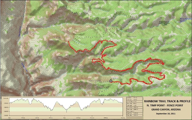
Mountain Biking In Arizona To date, Bruce has ridden two locations in Arizona: The Timp to Parrissawampits trail along the north rim of the Grand Canyon and Sedona. Rainbow Trail - North Rim, Grand Canyon: dates and summary Little Horse Trail - Sedona: dates and summary Trail 3 name: dates and summary Trail 4 name: dates and summary Rainbow Trail - North Rim, Grand Canyon While working on the Nevada Shared Radio System from Las Vegas, Bruce and some friends dashed over to the North Rim of the Grand Canyon for what turned out to be the adventure of a lifetime. He stayed with Steve and Jenn in St. George Friday evening and then everyone headed out first thing Saturday morning. Since a weather front was predicted to come through later in the day, the plan was to start riding from the N. Timp trail location instead of at Timp Point and get as close to Parissawampitts Point as possible. The map below shows the area, track profile and ride stats.
The statistics for the Timp to Parrissawampits ride are provided
below along with a map showing the track and profile and statistics.
Right click on the GPX link above to download a GPX file for this ride. The GPX file may want to save as an XML file, so if it does, change the extension to gpx before you save it. The file is a high-resolution track with points are every 10' created on the Delorme PN-60W GPS. You can right-click on the image below and use the "Save Target As" option to down-load a 1MB 11x17" PDF version of the map that can be printed. You can also click on the image to open it in a new window and zoom up to 200% for a detailed view.
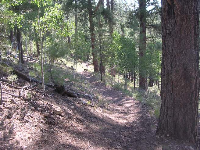
The elevation profile shows the amount of climbing and descending involved. This is the kind of trail on which you will use all your gears, and spend a lot of time climbing in 1-1. The grades are not impossibly steep, but go on for some distance, making it necessary to slow down to a sustainable climbing pace. The trail descends into the side canyons and climbs back out to the points. The photo below shows the forest and climb in Locust Canyon on the way to Locust Point.
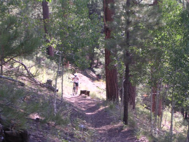
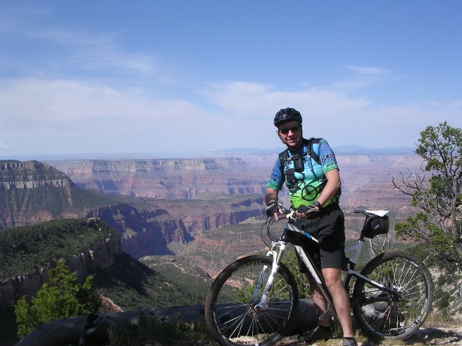
The first climb was a killer. The photo above shows the last 20% of the climb with Steve just barely visible in the distance. The photo below is a telephoto shot of Steve pedaling the end of the climb to the first point.
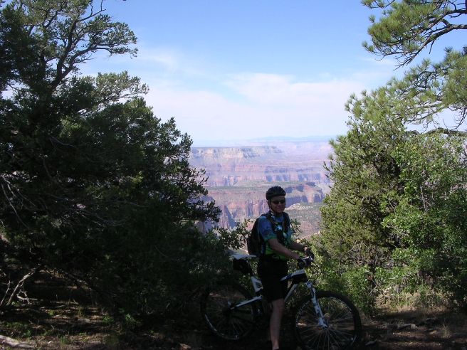
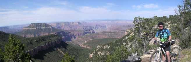
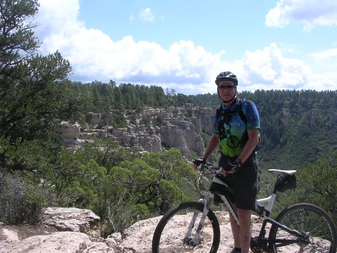
Once up on the point, you start to get a glimpse of what this ride is all about.
From here it was on out a little further to the first vista on Locust Point. This vista was jaw dropping to say the least.
And below is a closer shot showing the canyon in more detail.
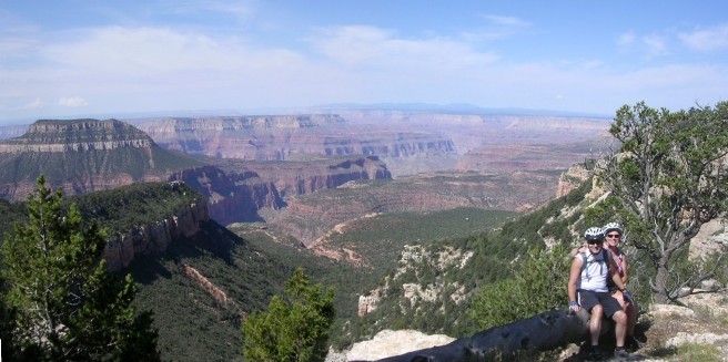
Below is Steve and Jenn at the first vista on Locust Point.
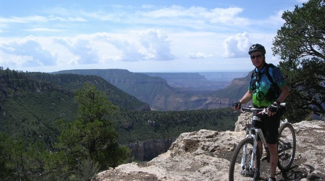
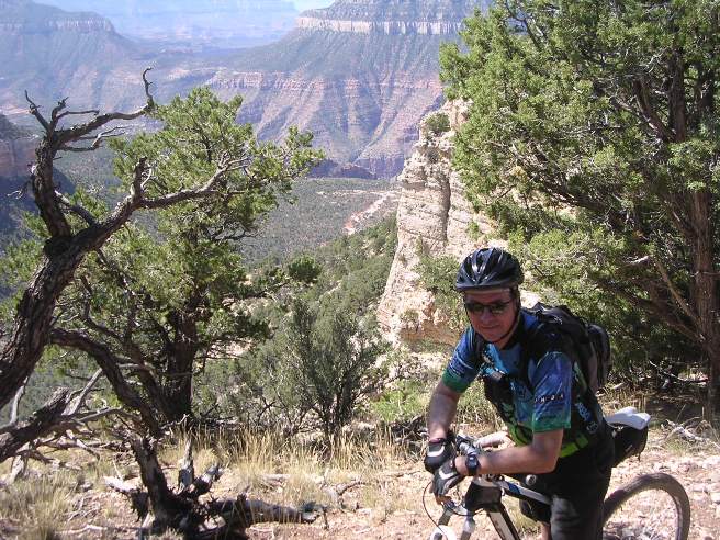
Next is a photo taken from another vista further out Locust Point.
The shot below is looking back towards the first vista in the distance on top of the rocky area.
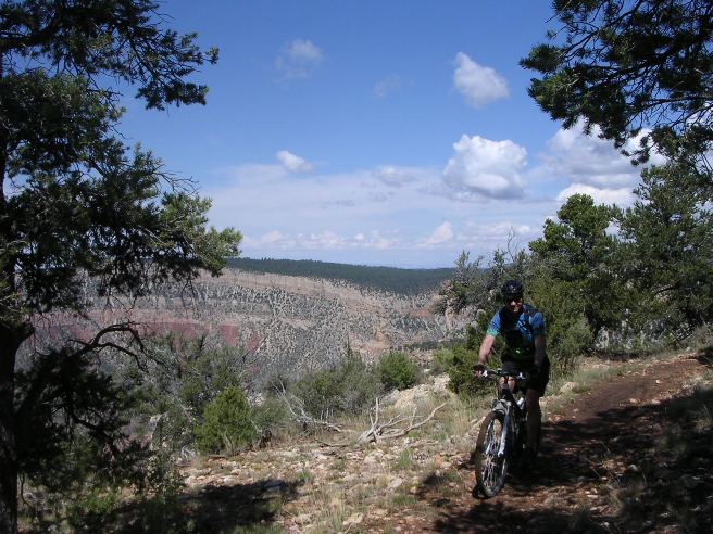
The next photo is yet another view of the canyon from the trail.
And yet another view from the trail.
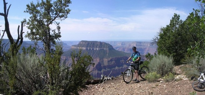
With the weather threatening, it was time to head back. Parissawampitts Point can be seen in the background.
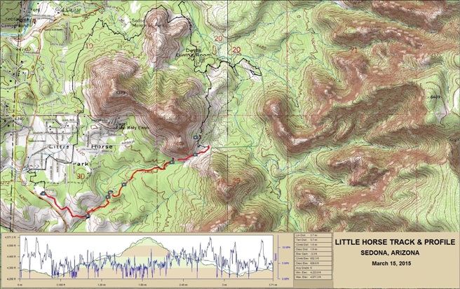
The out and back ride was 18.7 miles overall with 2,630' of total ascent. The total trail length is 18 miles one way, so he only was able to ride half of it. On March 15th, 2015, Bruce drove out to Las Vegas to attend the International Wireless Communications Expo. On the way, he stopped by Sedona for a "quick" ride. The statistics for the Little Horse ride are provided below along with a map showing the track and profile and statistics. The track and profile is for the clockwise direction. Reverse it for a counter-clockwise ride.
Right click on the GPX link above to download a GPX file for this ride. The GPX file may want to save as an XML file, so if it does, change the extension to gpx before you save it. The file is a high-resolution track with points are every 10' created on the Delorme PN-60W GPS. You can right-click on the image below and use the "Save Target As" option to down-load a 1MB 11x17" PDF version of the map that can be printed. You can also click on the image to open it in a new window and zoom up to 200% for a detailed view. The photo locations are shown on the map and correspond to numbers associated with the photos below.
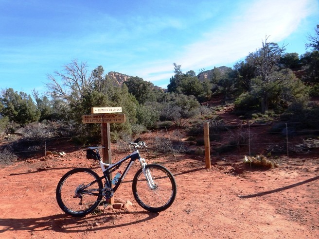
This is the kind of trail on which you will use all your gears, and experience a few short, tough climbs. The grades are not impossibly steep, but go on for some distance, making it necessary to slow down to a sustainable climbing pace. The photo below shows Cathedral Rocks in the distance from the parking lot at the Little Horse trail head.
Photo Location 03 below shows the beginning of the trail. From here you can go straight to the Bell Rock Pathway or the Little Horse Trail, or turn right to Mystic via the sidewalk.
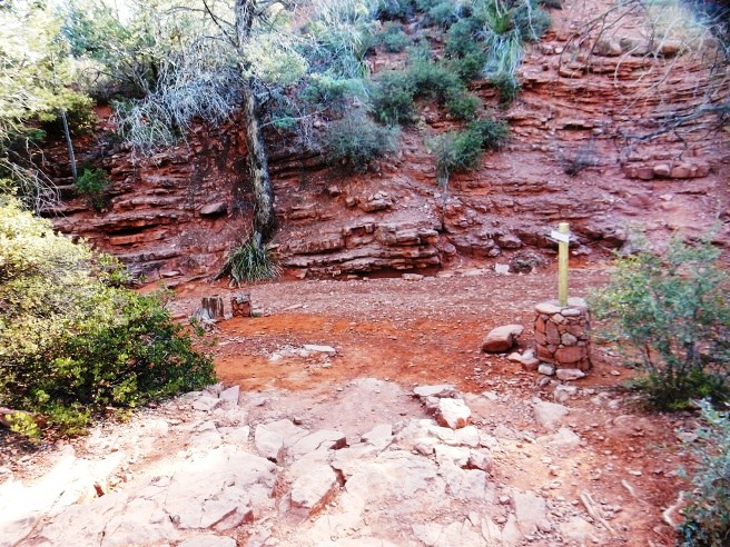
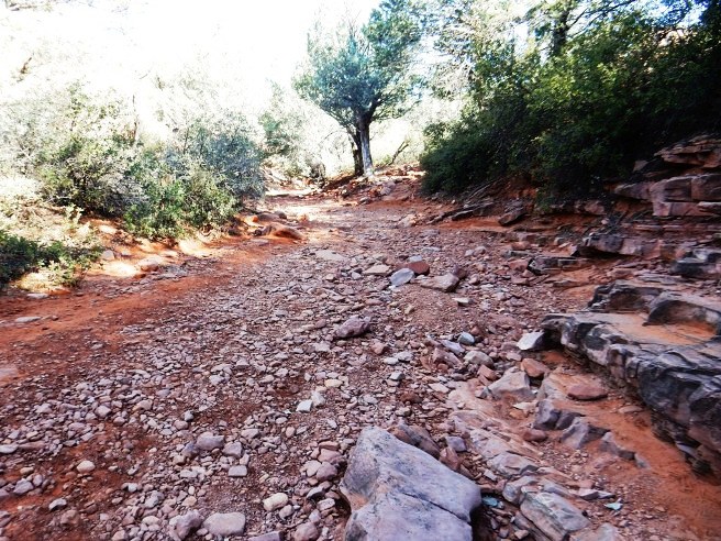
A short way down the trail, you come to a canyon and dry wash shown at photo location 05 below. The trail turns left and heads up the wash.
The second photo made near Location 05 shows the trail following the wash for a short distance before climbing out of the wash to the right of the tree in the distance.
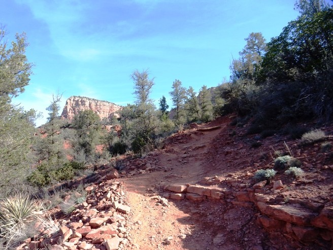
There are quite a few climbs along the way. The photo at Location 06 below shows one of these with part of Twin Buttes in the distance.
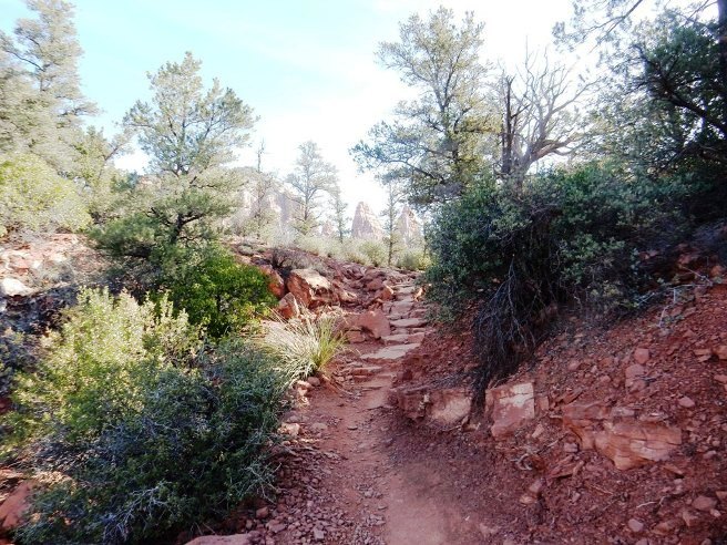
Below is another photo, this one at Location 07 showing the next climb a little further down on the Little Horse Trail on the way out to Twin Buttes.
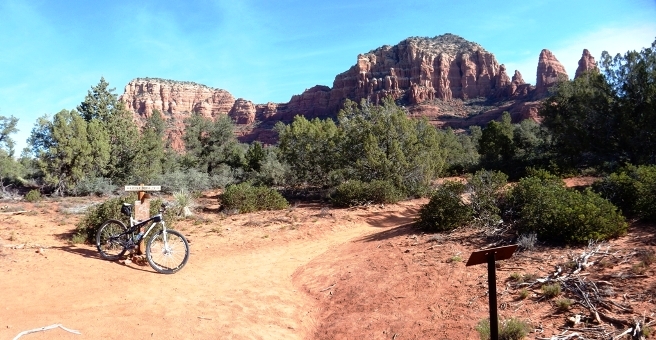
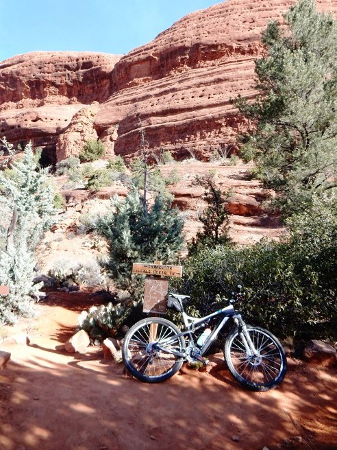
Twin Buttes are shown in the photo below along with the Superfly resting against a sign post at the junction of the Little Horse and Llama trails.
Another photo of the Superfly leaning against a sign post below, this time at the junction of the Little Horse and Chapel Trails, Location 08.
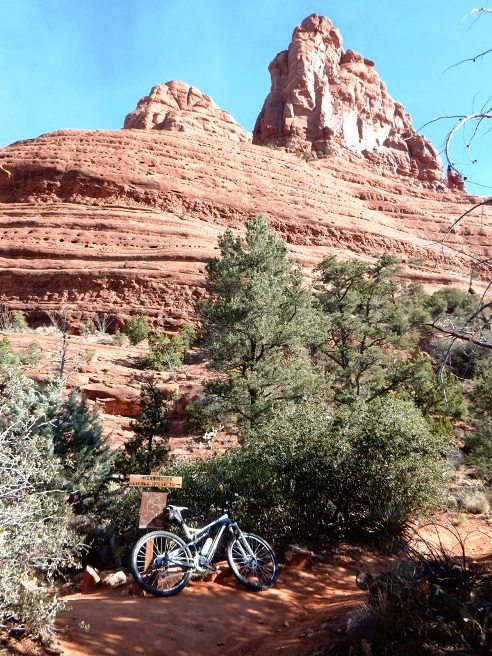
Below is a photo of the Superfly leaning against a sign post at the junction of the Little Horse and Chapel Trails, Location 09.
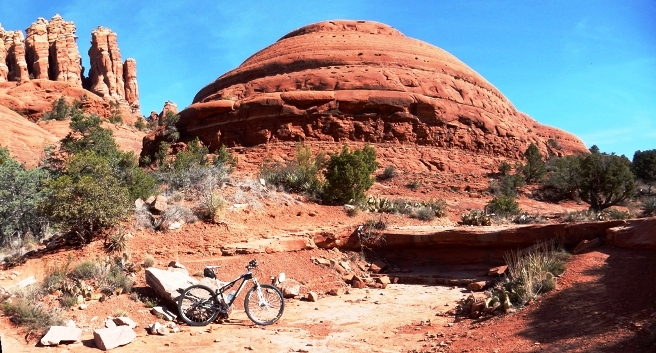
A ledge and the rocks out at Chicken Point are shown in Photo 11 below. The trail follows the edge of the wash behind the bike. This is near the junction with the Broken Arrow Trail.
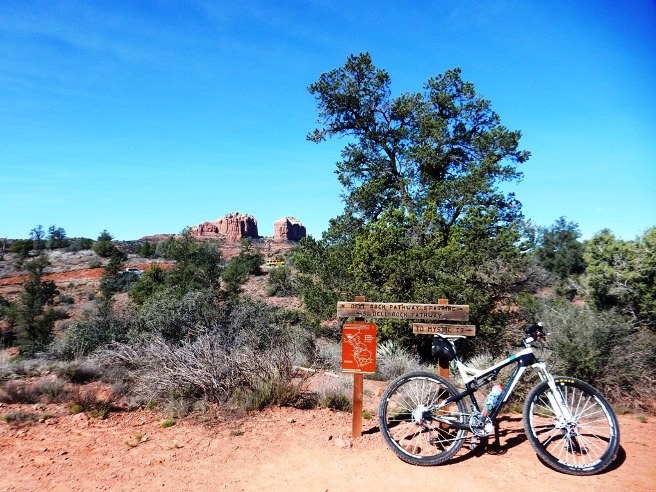
One final photo was made on the way back from this ride, and this was at the junction of the Little Horse and Bell Rock Pathway. Cathedral Rocks can be seen in the distance.
This was a great little ride, but it was time to head to Vegas. If you plan to do ride in Sedona, allow at least 3 days of riding time. Introduction to the trail and ride including any other riders or group with you.
The statistics for the (Trail Name) ride are provided below along
with a map showing the track and profile and statistics. The track
and profile is for the clockwise direction. Reverse it for a
counter-clockwise ride.
Right click on the GPX link above to download a GPX file for this ride. The GPX file may want to save as an XML file, so if it does, change the extension to gpx before you save it. The file is a high-resolution track with points are every 10' created on the Delorme PN-60W GPS. You can right-click on the image below and use the "Save Target As" option to down-load a 1MB 11x17" PDF version of the map that can be printed. You can also click on the image to open it in a new window and zoom up to 200% for a detailed view. (Insert Track-Profile map with link to tabloid-sized PDF) This is the kind of trail on which you will use all your gears, and spend a lot of time in 1-1. The grades are not impossibly steep, but go on for some distance, making it necessary to slow down to a sustainable climbing pace. The photo below shows (description). (Place-holder for photo) Description of following photo. (Place-holder for photo) Wrap up Introduction to the trail and ride including any other riders or group with you.
The statistics for the (Trail Name) ride are provided below along
with a map showing the track and profile and statistics. The track
and profile is for the clockwise direction. Reverse it for a
counter-clockwise ride.
Right click on the GPX link above to download a GPX file for this ride. The GPX file may want to save as an XML file, so if it does, change the extension to gpx before you save it. The file is a high-resolution track with points are every 10' created on the Delorme PN-60W GPS. You can right-click on the image below and use the "Save Target As" option to down-load a 1MB 11x17" PDF version of the map that can be printed. You can also click on the image to open it in a new window and zoom up to 200% for a detailed view. (Insert Track-Profile map with link to tabloid-sized PDF) This is the kind of trail on which you will use all your gears, and spend a lot of time in 1-1. The grades are not impossibly steep, but go on for some distance, making it necessary to slow down to a sustainable climbing pace. The photo below shows (description). (Place-holder for photo) Description of following photo. (Place-holder for photo) Wrap up
|
|
Version 0.1, October 27, 2015 |